
Wildfires and poor air quality continue for the Pacific Northwest, Rockies and extended into the Plains. Severe thunderstorms possible for the northern Plains and upper Midwest on Monday along a frontal boundary. Another boundary will focus showers and thunderstorms for the eastern seaboard with localized heavy rainfall possible. For Alaska, a strong Bering Sea storm will bring winds and rainfall. Read More >
Last Map Update: Sun, Aug 2, 2026 at 2:32:31 pm MDT


 Social Media
 Radar
Radar Satellite
 Surface Weather Maps
 Tabular Forecasts
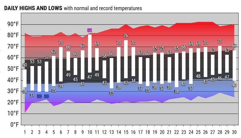 Month Charts
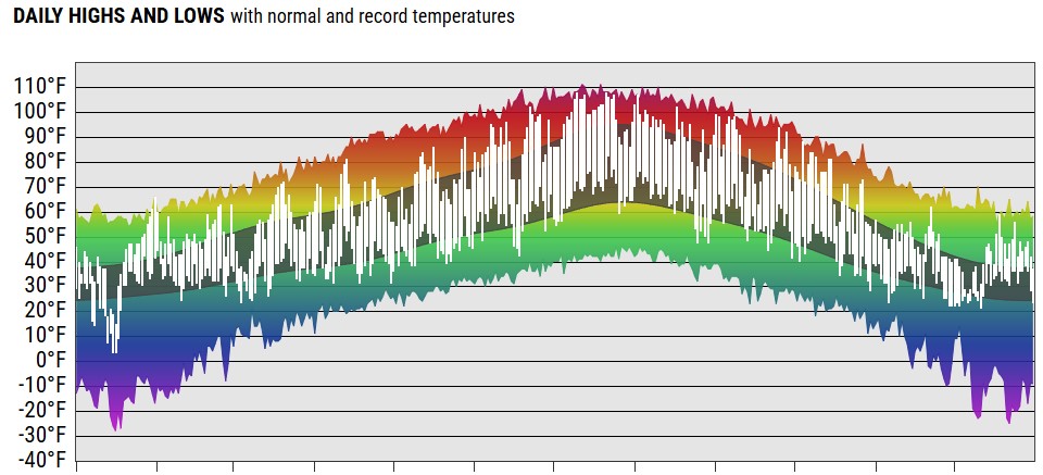 Year Charts
 Web Cameras
 Area Forecast Discussion
 Probabilistic Snow Information
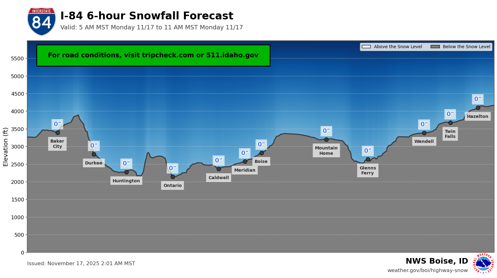 Highway Snow Profiles
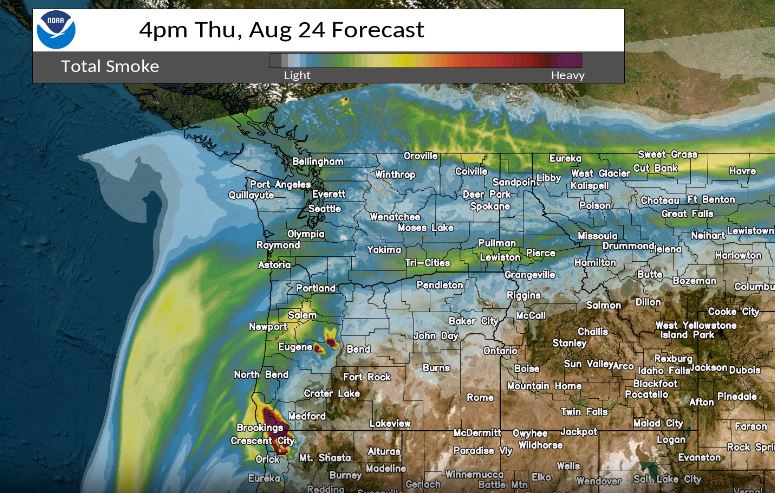 Experimental Smoke Forecast
 Aurora 30min Forecast
 Submit Reports