
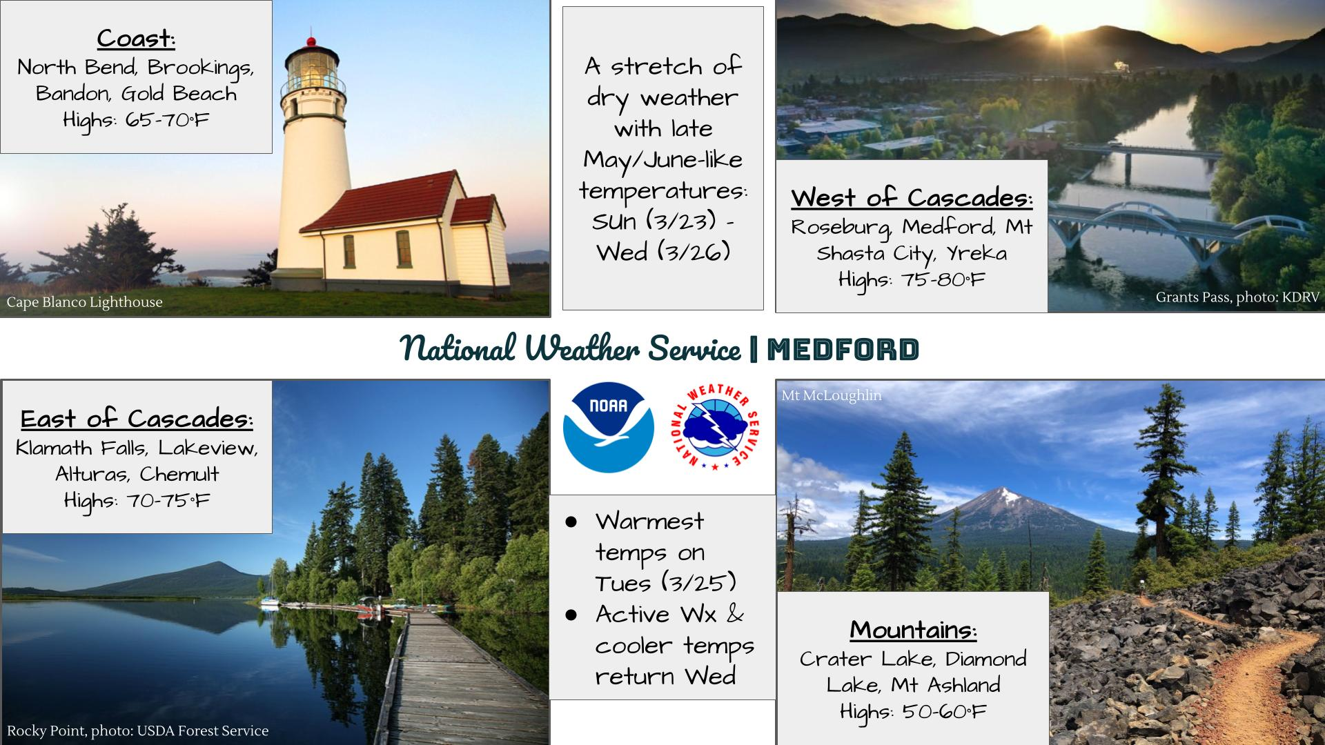
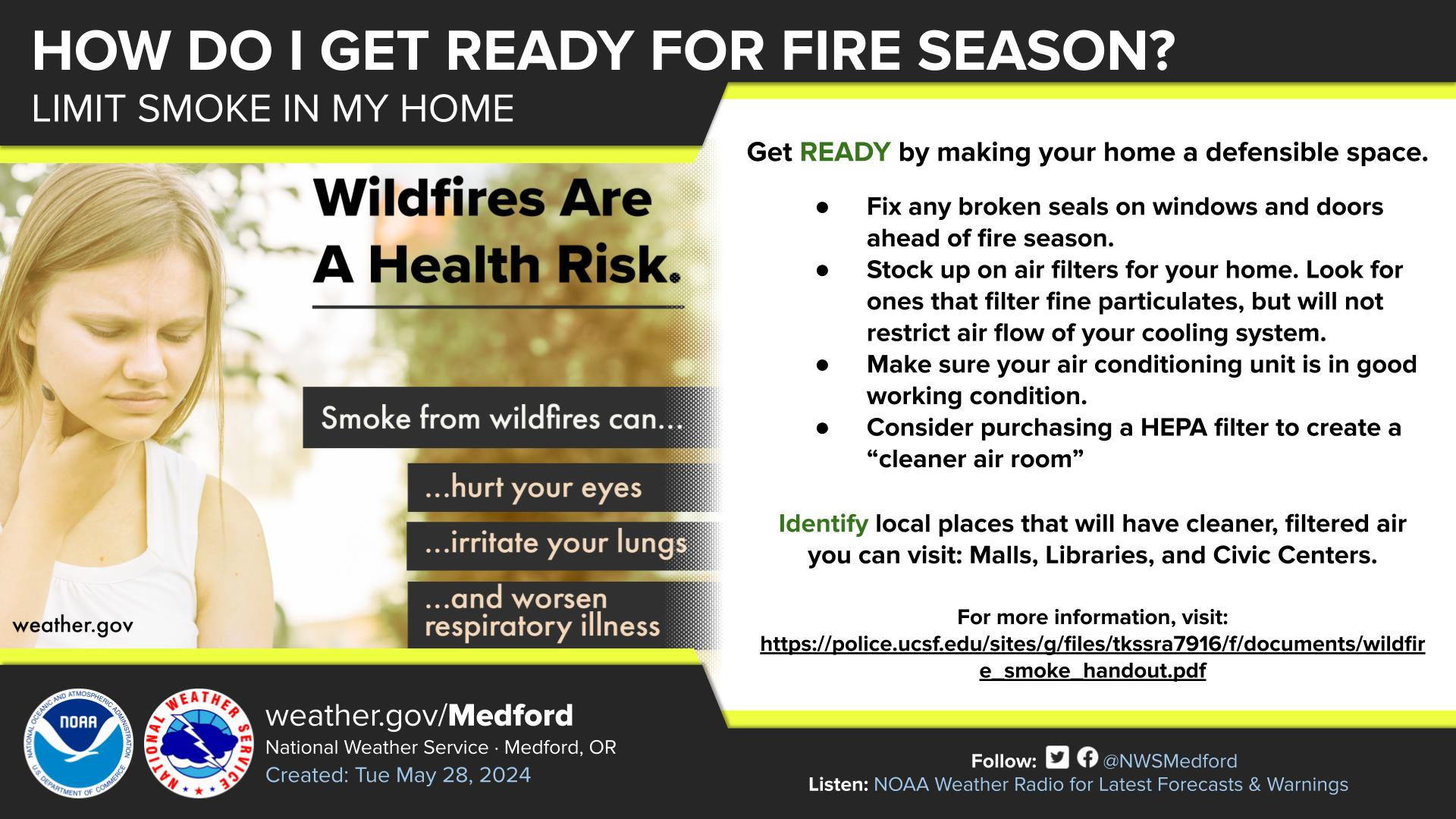
Wildfires and poor air quality continue for the Pacific Northwest, Rockies and extended into the Plains. Severe thunderstorms possible for the northern Plains and upper Midwest on Monday along a frontal boundary. Another boundary will focus showers and thunderstorms for the eastern seaboard with localized heavy rainfall possible. For Alaska, a strong Bering Sea storm will bring winds and rainfall. Read More >
Last Map Update: Sun, Aug 2, 2026 at 1:30:17 pm PDT

|
Text Product Selector (Selected product opens in current window)
|
|


 Precipitation Tracker
 Graphical Hazards Outlook
 RADAR and Satellite
 Forecast Discussion
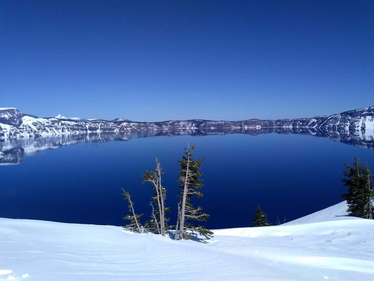 Snowfall and Depth With Crater Lake Details
 Avalanche Guidance
 NESDIS Geocolor
 Weather Map
 Marine
 GOES 18 Water Vapor Imagery
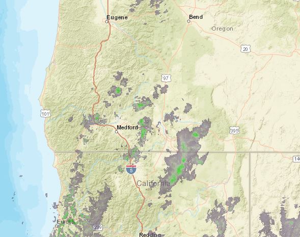 Pan/Zoom Radar
 Local Climate Data
 Alternate Point Forecast
 Weather Stats
 Year Charts
 Fire Weather
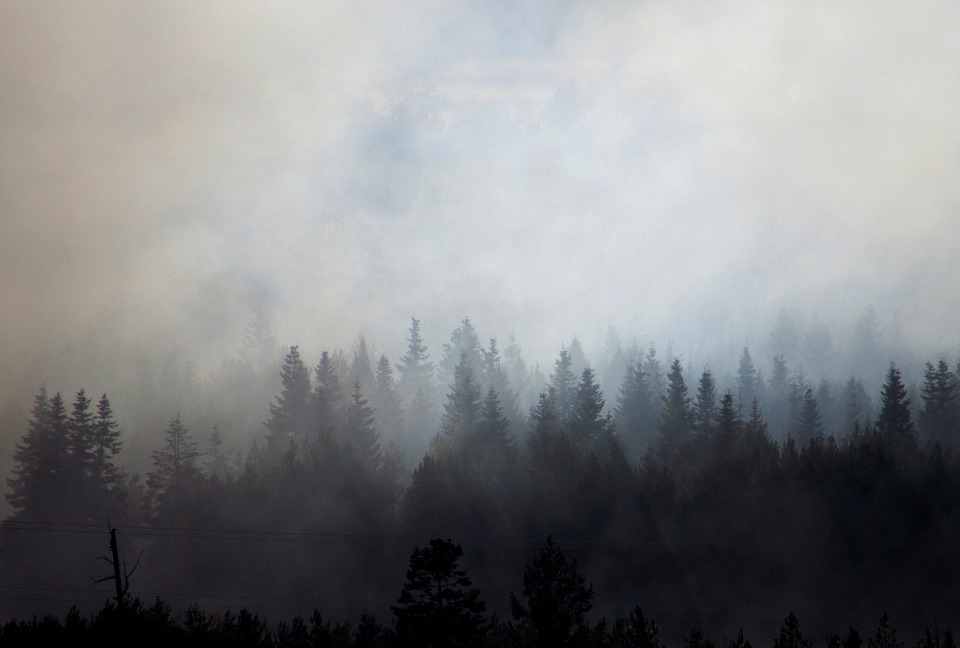 Smoke Forecast