
Wildfires and poor air quality continue for the Pacific Northwest, Rockies and extended into the Plains. Severe thunderstorms possible for the northern Plains and upper Midwest on Monday along a frontal boundary. Another boundary will focus showers and thunderstorms for the eastern seaboard with localized heavy rainfall possible. For Alaska, a strong Bering Sea storm will bring winds and rainfall. Read More >
Last Map Update: Sun, Aug 2, 2026 at 7:06:32 pm PDT
|
Text Product Selector (Selected product opens in current window)
|
|


 Social Media Feeds
 Sacramento Radar
 Beale Radar
 Satellite
 Graphical Forecasts - Local
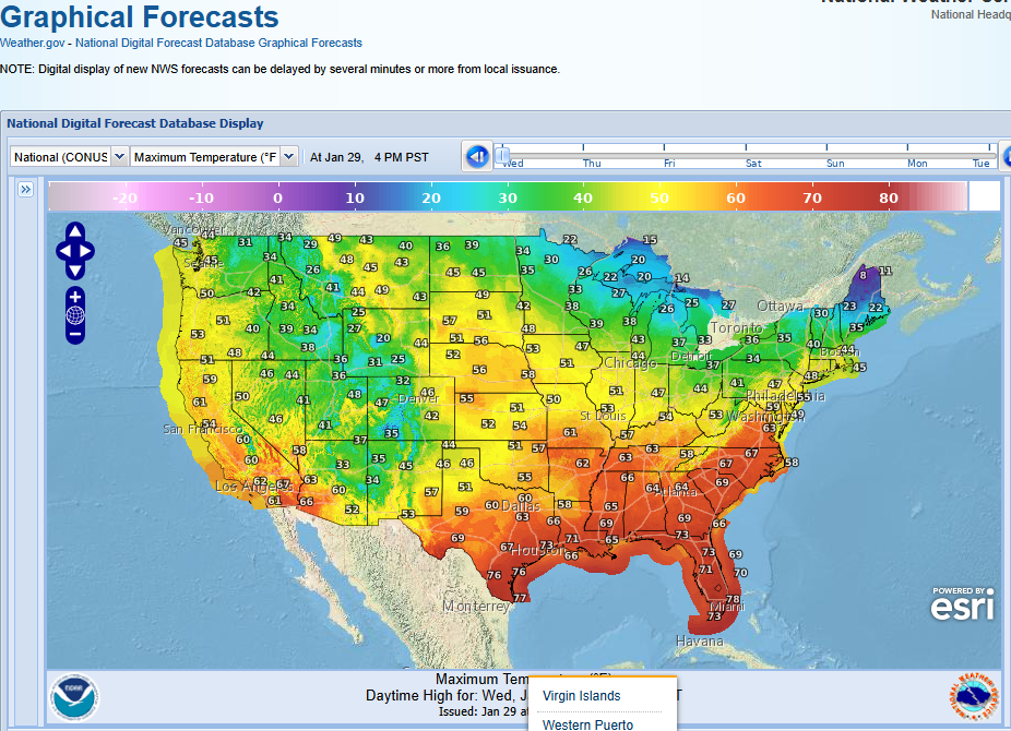 Graphical Forecasts - U.S.
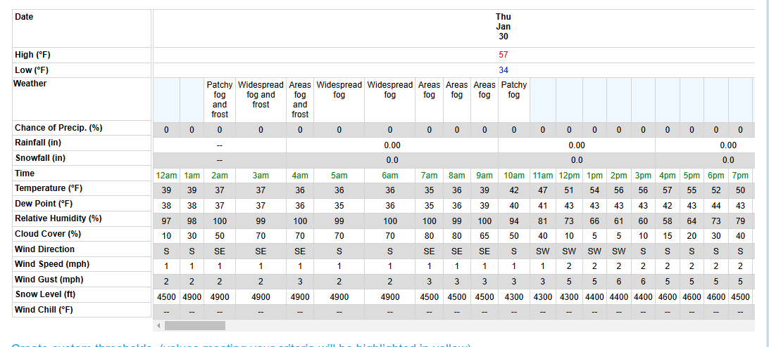 Forecast Weather Tables
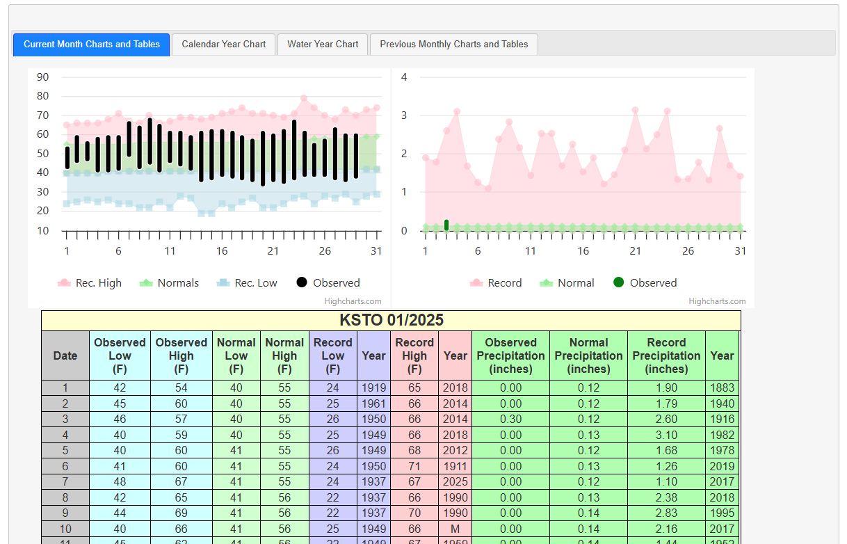 Recent STO Temperatures
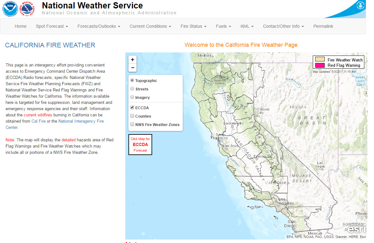 California Fire Weather Page
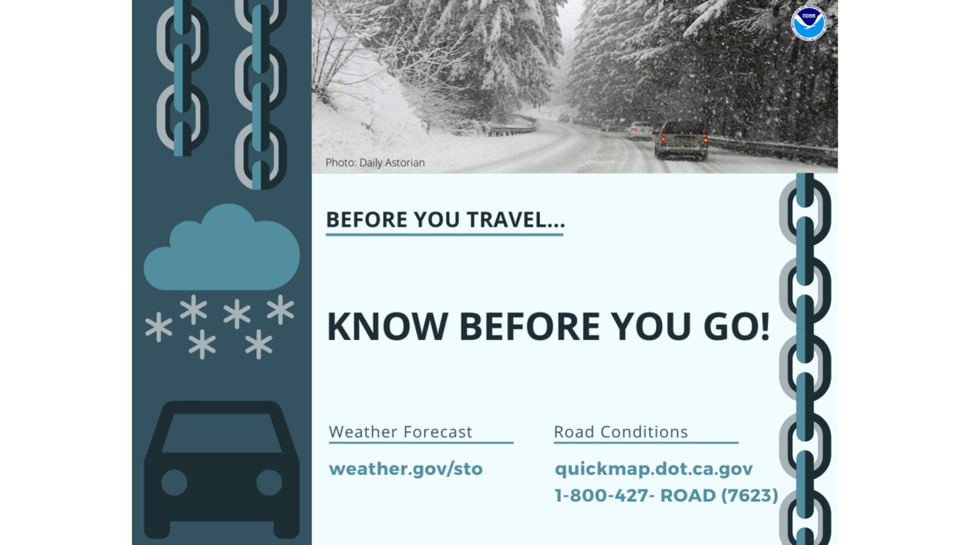
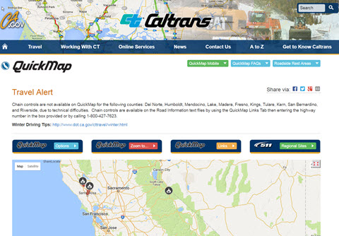 Caltrans QuickMap
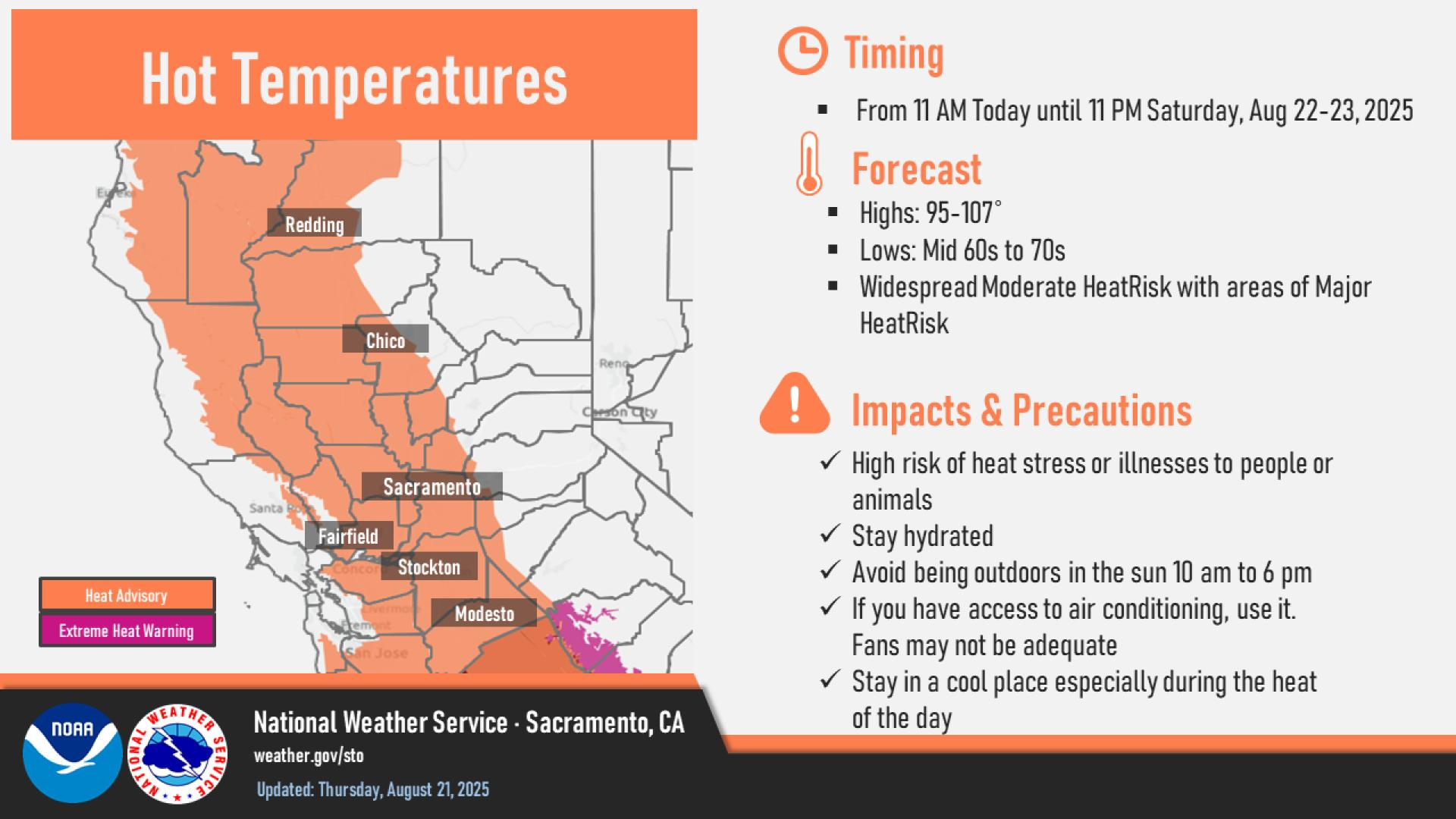
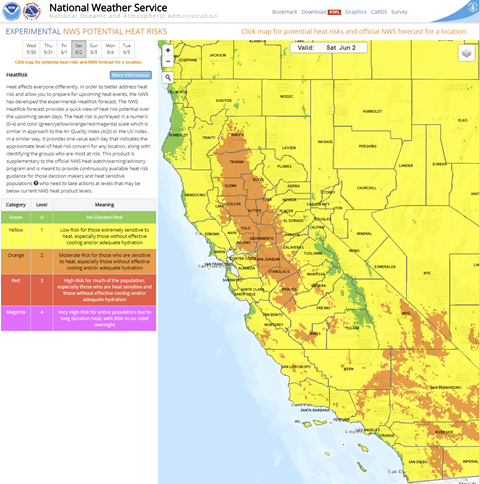 Heat Risk Link
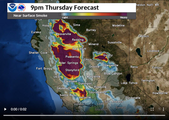 Experimental Smoke Forecast
 Weather Stats