
Wildfires and poor air quality continue for the Pacific Northwest, Rockies and extended into the Plains. Severe thunderstorms possible for the northern Plains and upper Midwest on Monday along a frontal boundary. Another boundary will focus showers and thunderstorms for the eastern seaboard with localized heavy rainfall possible. For Alaska, a strong Bering Sea storm will bring winds and rainfall. Read More >
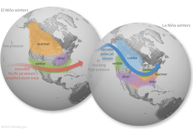
El Niño: A warming of the ocean surface, or above-average sea surface temperatures (SST), in the central and eastern tropical Pacific Ocean. Over Indonesia, rainfall tends to become reduced while rainfall increases over the tropical Pacific Ocean. The low-level surface winds, which normally blow from east to west along the equator (“easterly winds”), instead weaken or, in some cases, start blowing the other direction (from west to east or “westerly winds”).
 ​
​https://psl.noaa.gov/map/clim/sst.anom.anim.year.htm
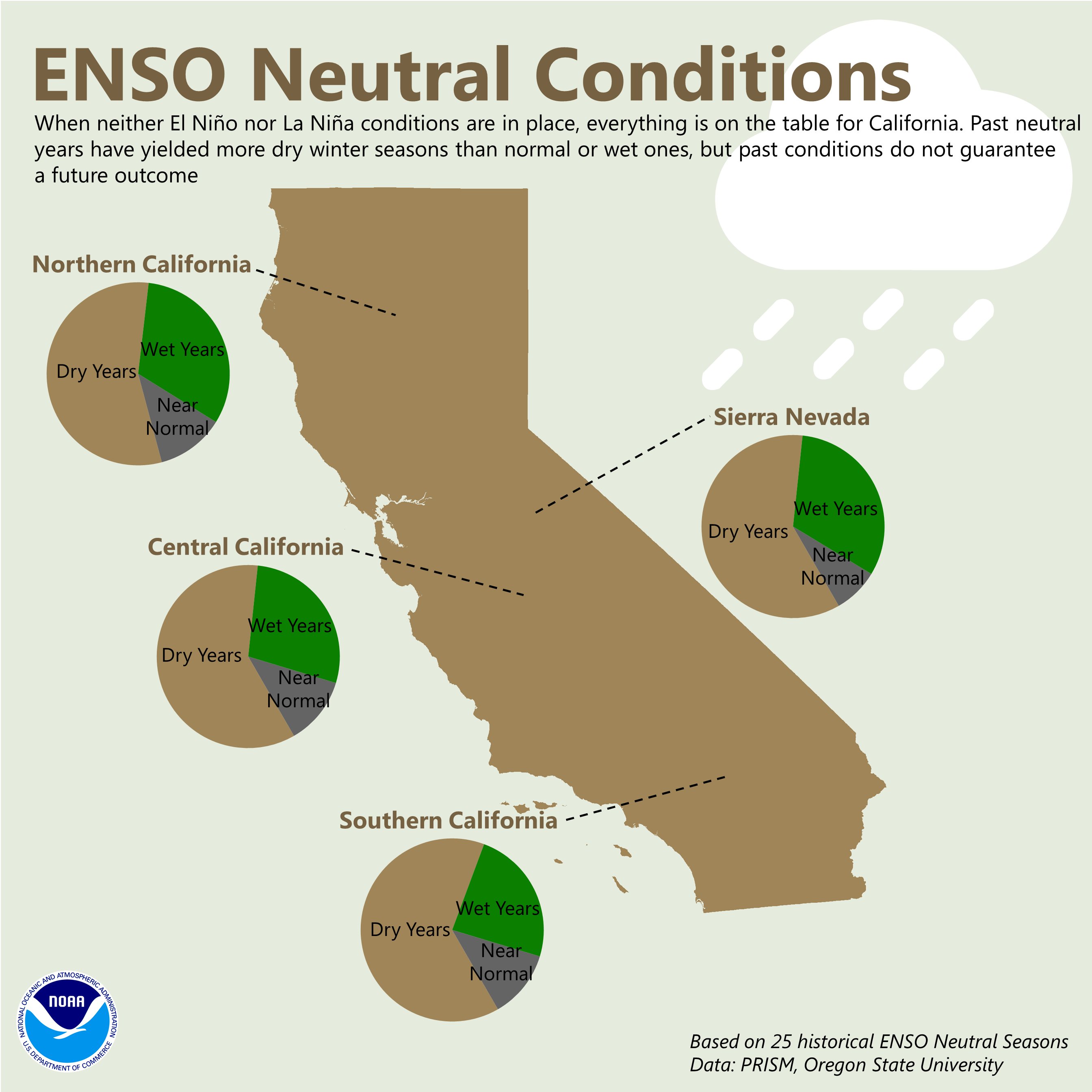
Northern Sierra Precipitation (8-station Index in Sacramento Basin)
Central Sierra Precipitation (5-station Index in San Joaquin Basin)
Southern Sierra Precipitation (6-station Index in Tulare Basin)
Maps
El Niño 2015/16: A Historical Perspective (NCEI)
U.S. Risk of Seasonal Extremes During ENSO (ESRL)
ENSO across NOAA
El Niño/Southern Oscillation (NCEI)
ENSO Research and Monitoring (ESRL)
Societal & ecosystem impacts

