
Widely scattered severe thunderstorms may produce damaging winds, hail, and flash flooding from the southern Plains into the lower Great Lakes. Elevated to locally critical fire weather conditions will persist across portions of the Southwest and Southern High Plains due to gusty winds and dry conditions. An early-season heatwave will challenge temperature records across the eastern U.S.. Read More >
| Snow Amount
Potential
Experimental - Leave feedback
|
|
| Expected
Snowfall - Official NWS Forecast
What's this? |
High End Amount 1 in 10 Chance (10%) of Higher Snowfall What's this? |
| Low End
Amount 9 in 10 Chance (90%) of Higher Snowfall What's this? |
|
| Percent Chance That Snow
Amounts Will Be Greater Than...
Experimental - Leave feedback
What's
this?
|
||||||||||||||||
|
||||||||||||||||
| Snowfall Totals by Location
Experimental - Leave feedback
What's
this?
|
|
|
| Ice Accumulation
Potential
Experimental - Leave feedback
|
|
| Expected
Ice Accumulation - Official NWS Forecast
What's this? This is the elevated flat surface ice accumulation. It is not radial/line ice. Radial/line ice is typically 39% of the elevated flat surface ice. For more information on this, see this module. |
High End Amount 1 in 10 Chance (10%) of Higher Ice Accumulation What's this? |
| Low End
Amount 9 in 10 Chance (90%) of Higher Ice Accumulation What's this? |
|
| Percent Chance That Ice
Accumulation Will Be Greater Than...
Experimental - Leave feedback
What's
this?
|
||||||||||||||||
|
||||||||||||||||
| Ice Accumulation by
Location
Experimental - Leave feedback
What's
this?
|
|
|
| Precipitation Onset/End Timing | ||
| Onset of Wintry Precipitation | End Timing of Wintry Precipitation | |
|---|---|---|
 |
 |
|
| What's this? | What's this? | |
| Winter Storm Severity Index (WSSI) | Winter Storm Outlook (WSO) |
|---|---|
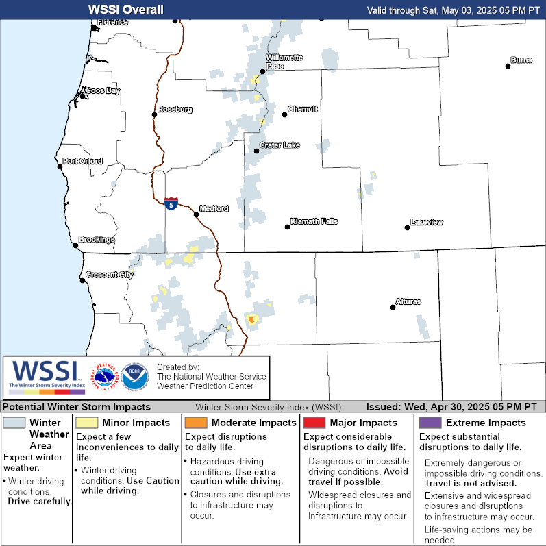
|

|
| Local Snow Reports | National Snowfall Analysis |
|---|---|
 |
 |
| Days 4-7 Winter Weather Outlook | |
| Day 4 Winter Weather Outlook | Day 5 Winter Weather Outlook |

|

|
| Day 6 Winter Weather Outlook | Day 7 Winter Weather Outlook |

|

|
|
|
|
| CPC Week-2 Experimental Heavy Snow Risk | |
 |
|
| CPC Temperature & Precipitation Maps | |
|
Days 6-10 |
|
| Temperature | Precipitation |
 |
 |
|
Days 8-14 |
|
| TEMPERATURE | PRECIPITATION |
 |
 |
|
Week 3-4 |
|
|
TEMPERATURE |
PRECIPITATION |
 |
 |


 Precipitation Tracker
 Graphical Hazards Outlook
 RADAR and Satellite
 Forecast Discussion
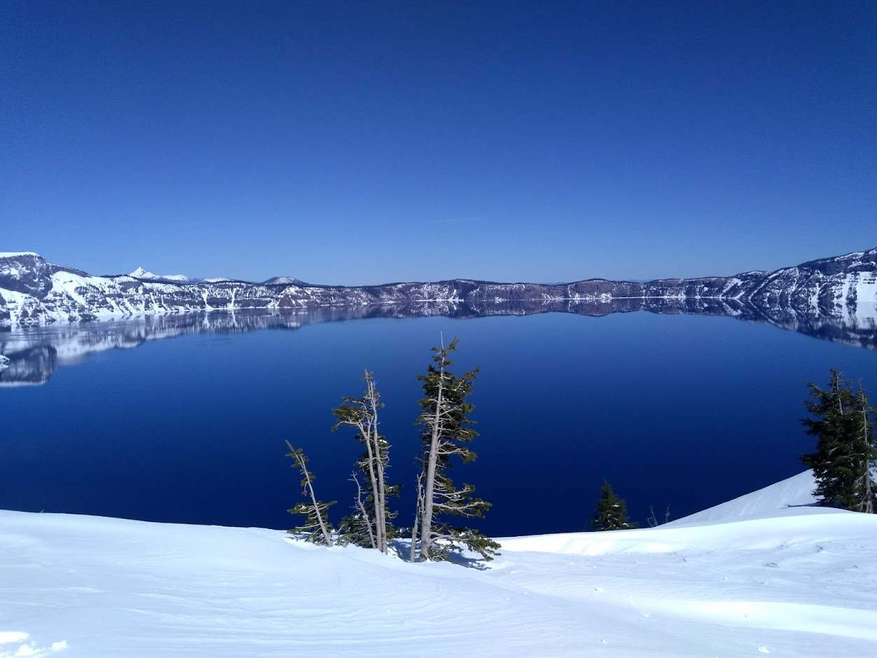 Snowfall and Depth With Crater Lake Details
 Avalanche Guidance
 NESDIS Geocolor
 Weather Map
 Marine
 Fire Weather
 GOES 18 Water Vapor Imagery
 Mountain Pass Forecasts
 Local Climate Data
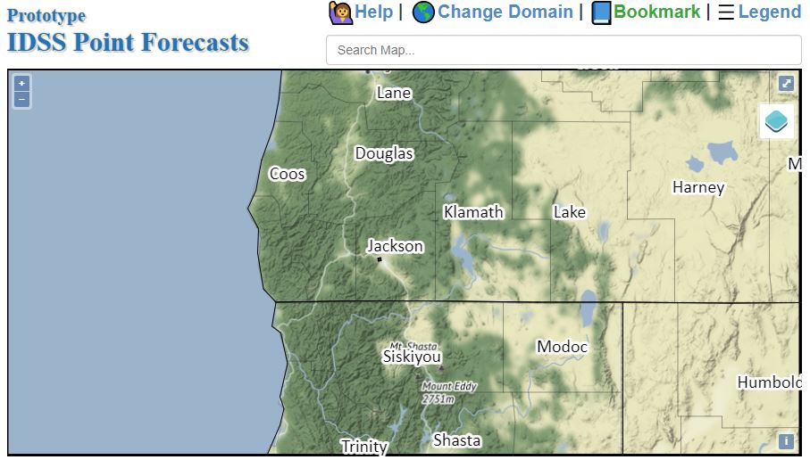 Alternate Point Forecast
 Weather Stats
 Year Charts
 Fire Weather