
An active pattern remains in place across the center of the country with additional threats from severe thunderstorms and heavy rainfall. These concerns will remain in place through most of the weekend. An approaching storm across the Pacific Northwest is expected to bring heavy rainfall and strong winds late this weekend. The heat risk and fire weather concerns will increase across the Southwest. Read More >
| ZTL Airspace Summary / KCLT TAF For ATC Planning Purposes Only | |||
|---|---|---|---|
|
|
CLT METAR:
|
||
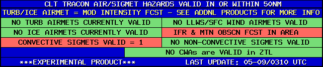
| CLT TRACON HAZARDS | |
|---|---|
|
| CLT Convection Gates |
 |
| Forecast Surface Map Loop / Collaborative Convective Forecast Product / Vertical Wind Profile | ||
|---|---|---|
 |
 |
|
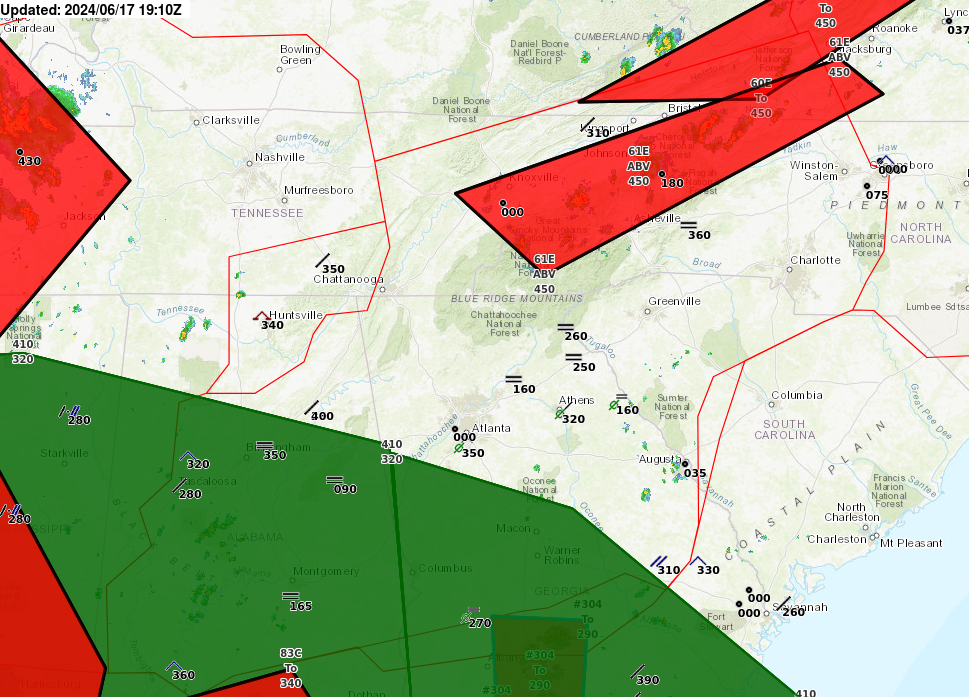
| AIRMETs & SIGMETS/ Southeast Radar loop / Satellite Image (click on image to enlarge) | ||
|---|---|---|
 |
 |
|


