
Scattered strong to severe thunderstorms capable of producing damaging winds, hail and heavy rainfall will be possible this afternoon over the Upper Mississippi Valley and Central Plains. A low pressure system in the Western Gulf of Mexico will bring heavy to excessive rainfall for much of South Texas. A dangerous heat wave will impact much of the Midwest to the Northeast through this week. Read More >
Atlanta
Center Weather Service Unit
| ZTL Airspace Summary / KAVL TAF For ATC Planning Purposes Only | |||
|---|---|---|---|
|
Updated:
|
AVL METAR:
|
||
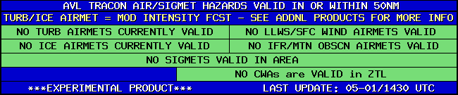
| AVL TRACON HAZARDS | |
|---|---|
|
| Forecast Surface Map Loop / Collaborative Convective Forecast Product / Vertical Wind Profile | ||
|---|---|---|
 |
 |
|
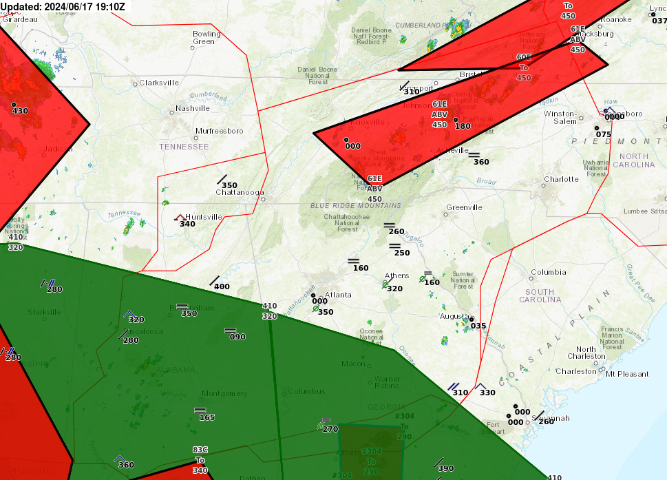
| AIRMETs & SIGMETS/ Southeast Radar loop / Satellite Image (click on image to enlarge) | ||
|---|---|---|
 |
 |
|
US Dept of Commerce
National Oceanic and Atmospheric Administration
National Weather Service
Atlanta
299 Woolsey Road
Hampton, GA 30228
770.210.7693
Comments? Questions? Please Contact Us.


