
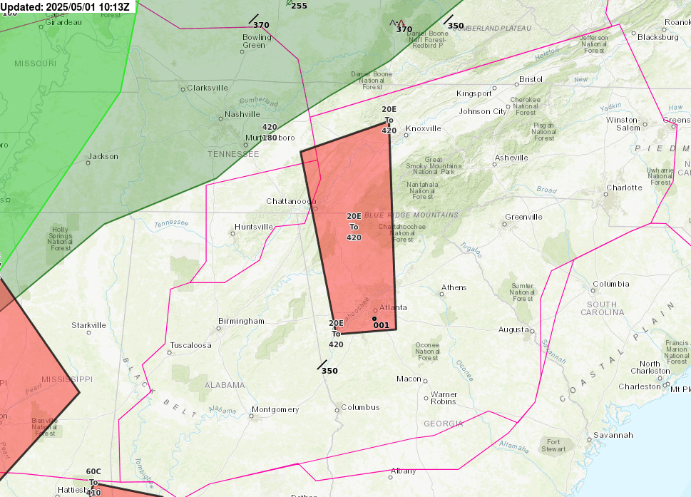
Tropical Depression Two is expected to gradually strengthen and could bring tropical storm conditions to the Florida Panhandle beginning late Monday. Areas of flash flooding will be possible through Thursday along the eastern and central Gulf Coast. Severe thunderstorms will develop and move along a cold front crossing the Upper Midwest Monday, and through the Ohio Valley/Mid-Atlantic on Tuesday. Read More >
Atlanta
Center Weather Service Unit
| Hover over or click station to get METAR and TAF (if available). | VFR MVFR IFR LIFR |
 |
 |
 |
 |
 |
 |
|
|
|
|
|
|
|
US Dept of Commerce
National Oceanic and Atmospheric Administration
National Weather Service
Atlanta
299 Woolsey Road
Hampton, GA 30228
770.210.7693
Comments? Questions? Please Contact Us.


 PreDuty Weather Briefing
 Pirep TDA
 Daily Weather Briefing
 Convective Forecast
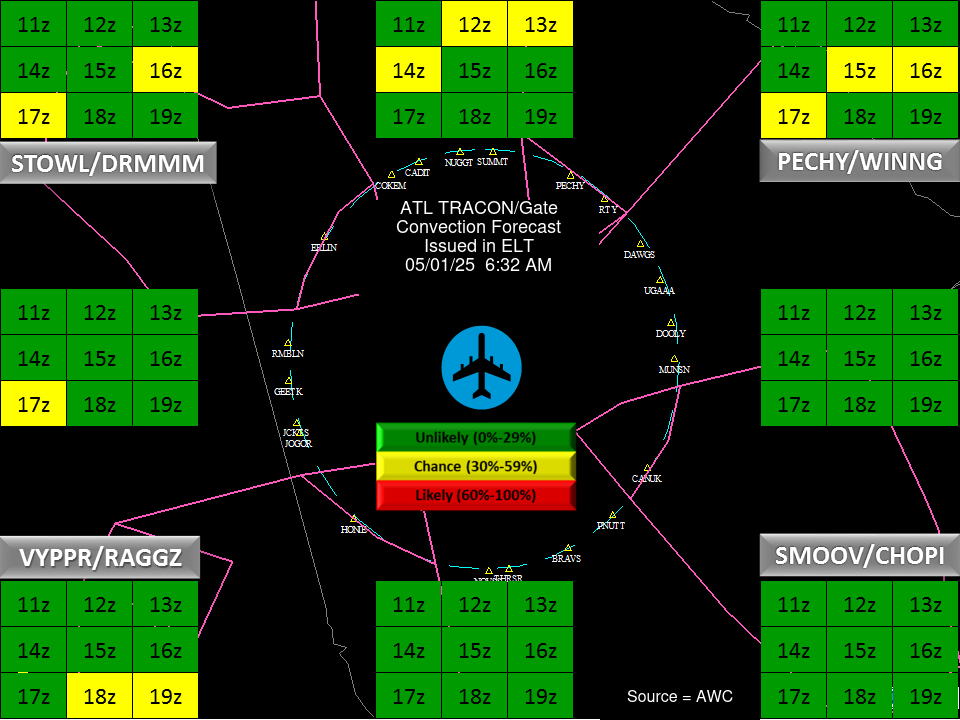
 ATL TRACON Briefing
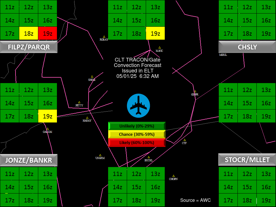
 CLT TRACON Briefing