
Scattered severe thunderstorms are expected to develop across portions of the central and northern High Plains Sunday afternoon and linger into Sunday evening. Severe winds, large to very large hail and heavy rain will be possible. A late season atmospheric river event will kick-off Sunday across the Pacific Northwest bringing strong winds and moderate to heavy rain through early next week. Read More >
| ZTL Airspace Summary / KCSG TAF For ATC Planning Purposes Only | |||
|---|---|---|---|
|
Updated:
|
CSG METAR:
|
||
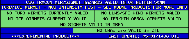
| CSG TRACON HAZARDS | |
|---|---|
|
| Forecast Surface Map Loop / Collaborative Convective Forecast Product / Vertical Wind Profile | ||
|---|---|---|
 |
 |
|
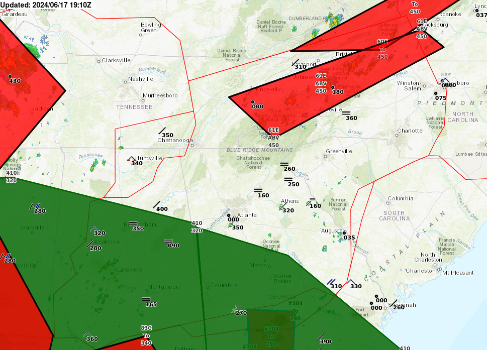
| AIRMETs & SIGMETS/ Southeast Radar loop / Satellite Image (click on image to enlarge) | ||
|---|---|---|
 |
 |
|
2


