National Weather Service United States Department of Commerce

Strong to Severe Thunderstorms from the Southern Plains to the Ohio Valley; Heavy Rain and Flooding in the Southern Plains

Severe thunderstorms are expected from central Texas to middle Tennessee and Kentucky this afternoon into tonight. Large hail and damaging winds are the main threats. Heavy to excessive rainfall may produce areas of flooding today and tonight from central Texas into the lower Mississippi Valley. Read More >

Click a location below for detailed forecast.

Last Map Update: Fri, May 2, 2025 at 6:44:18 am CDT

A disturbance will move through South Texas late this afternoon and into tonight bringing scattered to numerous short-lived/persistent intense storms. Greatest threat will be damaging winds and isolated areas of damaging hail. Have many ways to receive alerts and prepare for this evening.
Accompanying the severe weather risks with tonight's storms will be the threat of excessive rainfall, capable of producing localized flooding in the strongest/slow-moving storms. Remember, Turn Around, Don't Drown if roadways are flooded!
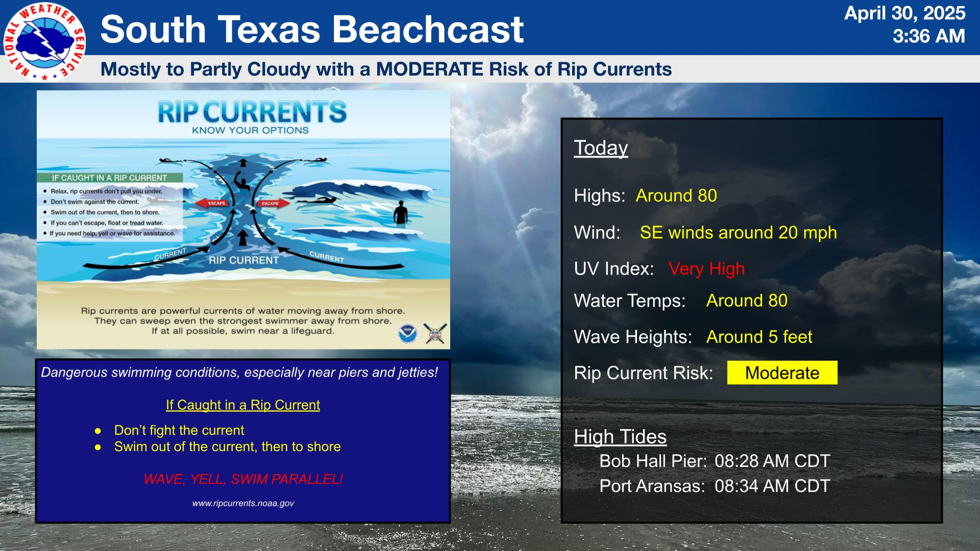
There is a LOW risk of rip currents today, accompanied by mostly cloudy skies this afternoon with highs around 80 degrees, and SE winds at 15-20 mph. Inland storms will move toward the coast resulting in gusty conditions in one. Dangerous swimming conditions may be present, especially near piers and jetties. Please be very cautious if entering the waters.
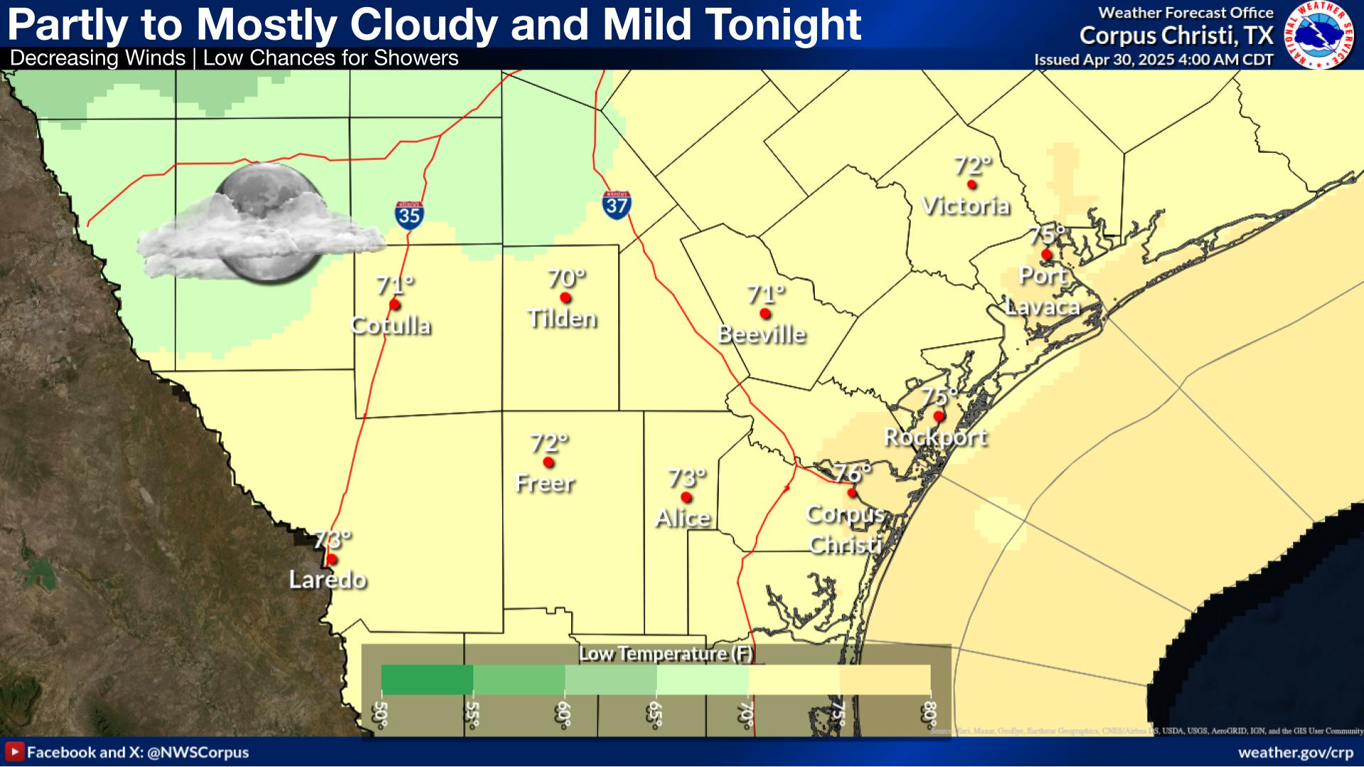
Mostly cloud skies this morning will lead to partial clearing by the afternoon. Today will be a muggy day ahead of storms developing late this afternoon and pushing through South Texas throughout the evening. Make sure to have multiple ways to receive alerts and check the weather before heading out.
A rainy weekend will ease slightly on Sunday before picking up Monday evening and continuing through mid-week. Highs through Monday will generally be in the 80s, but will trend warmer by mid-week.

 
Hourly Weather Roundup ( )
Location Sky/Weather Temp Dewpt RH Wind Baro Remarks
Alice
N/A
N/A
N/A
N/A
N/A
N/A
N/A
Beeville
N/A
N/A
N/A
N/A
N/A
N/A
N/A
Corpus Christi
N/A
N/A
N/A
N/A
N/A
N/A
N/A
Corpus Christi NAS
N/A
N/A
N/A
N/A
N/A
N/A
N/A
Cotulla
N/A
N/A
N/A
N/A
N/A
N/A
N/A
Kingsville NAS
N/A
N/A
N/A
N/A
N/A
N/A
N/A
Laredo
N/A
N/A
N/A
N/A
N/A
N/A
N/A
Port Lavaca
N/A
N/A
N/A
N/A
N/A
N/A
N/A
Rockport
N/A
N/A
N/A
N/A
N/A
N/A
N/A
Victoria
N/A
N/A
N/A
N/A
N/A
N/A
N/A
Note: "N/A" or "MISG" will be displayed if values are not available. In the LOCATION column, click on links for a list of recent observations at sites of interest. In the WIND column, VRB is "variable" and G is "gust". Wind speeds are in MPH. In the BARO (pressure) column, values are in inches. In the REMARKS column, HX is "heat index", WCI is "wind chill index", and VSB is "visibility" (if shown).
 
Text Product Selector
Video Briefing Weather Outlook Fcst Discussion Tropical Marine Tides
Rivers and Lakes Daily Rainfall Drought Fire Observations Satellite

Hourly Wx Graph Graphical Fcst Aviation Climate Past Events Hurricane Guide