
Click on the products in the table below for the latest information.
| Hazardous Weather Product Links | |
| Last Issued | |
| Outlooks and Discussions | |
| Drought Information Statement | No recent issuance |
| Area Forecast Discussion | 2025-11-07 04:24 |
| Tornado or Severe Thunderstorm Watch | |
| Tornado or Severe Thunderstorm Watch for the Albuquerque Forecast Area | No recent issuance |
| Severe Weather Products | |
| Severe Weather Statement | 2025-10-25 00:46 |
| Tornado Warning | No recent issuance |
| Special Weather Statement | 2025-10-24 23:43 |
| Severe Thunderstorm Warning | 2025-10-25 00:15 |
| Flash Flood Products | |
| Flood Watch | No recent issuance |
| Flash Flood Warning | No recent issuance |
| Flash Flood Statement | No recent issuance |
| River/Arroyo/Small Stream Flood Products | |
| Flood Warning | No recent issuance |
| Urban or Arroyo and Small Stream Flood Advisory | 2025-10-24 17:54 |
| Other Hazardous Weather Products | |
| Non-Precipitation Advisory (e.g. wind,freeze) |
2025-10-30 08:48 |
| Winter Weather Message | No recent issuance |
| Fire Weather Watch or Red Flag Warning | No recent issuance |
| Overview of Potential or Expected Impacts for the Next Six Days | ||
| Forecast Products from the Storm Prediction Center | ||
 |
 |
 |
| Day 1 Outlook | Day 2 Outlook | Day 3 Outlook |
 |
 |
 |
| Mesoscale Discussions | Current Watches | Day 4-8 Outlook |
|
Other Products from the Storm Prediction Center
|
||
 |
 |
Other Links:
|
| Current Watch, Warning and Advisory Display | Today's Nationwide Storm Reports | |
| Latest Radar Images | ||
 |
 |
 |
| Albuquerque | Cannon AFB | Holloman AFB |
| Latest Satellite Images | ||
 |
 |
|
| Visible | Infrared | Water Vapor |
| Quantitative Precipitation Forecasts from Weather Prediction Center | ||
 |
 |
 |
| Day 1 QPF | Day 2 QPF | Day 3 QPF |
 |
 |
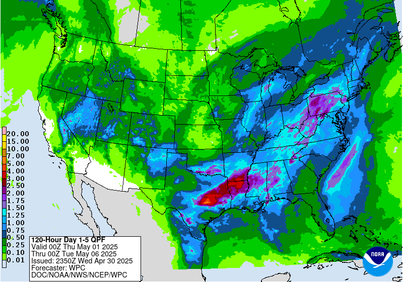 |
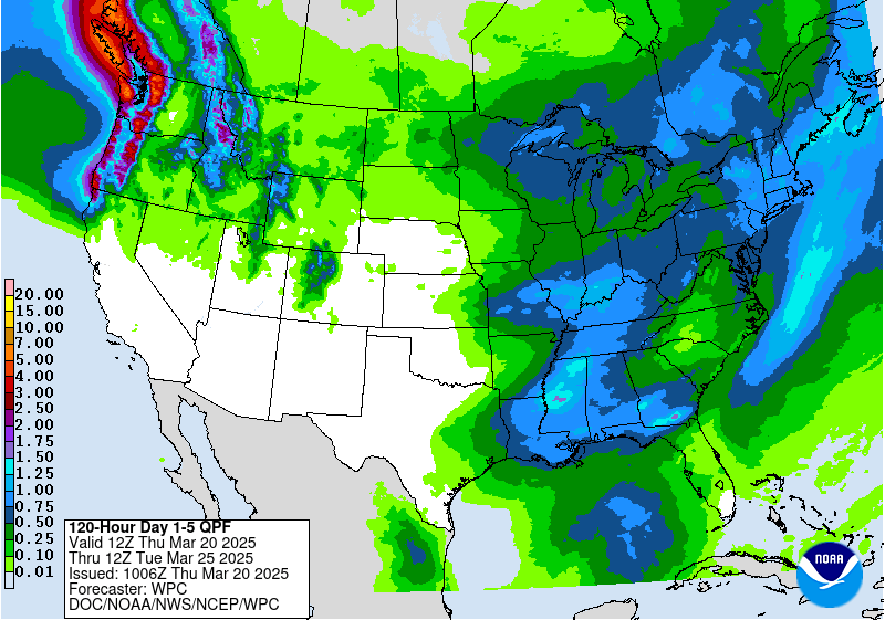
| Day 1-3 QPF | 5 Day Total - Valid 12z | 5 Day Total - Valid 00z |
| Winter Weather Products from the Weather Prediction Center | |||
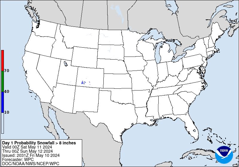
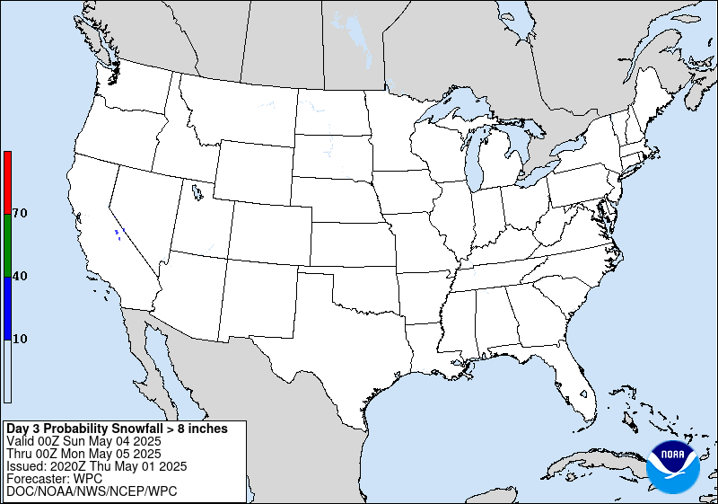
| The following table depicts the probability of snowfall accumulating greater than 4, 8 and 12 inches. Please note: Images will be old during non-winter seasons. | |||
| >=4 inches | >=8 inches | >=12 inches | |
| Day 1 |  |
 |
 |
| Day 2 |  |
 |
 |
| Day 3 |  |
 |
 |
| More WPC products can be found here. | |||
| Road Conditions | ||
| New Mexico | 511 | NM Roads |
| Arizona | 888-411-7623 | AZ Roads |
| Colorado | 303-639-1111 | CO Roads |
| Texas | 800-452-9292 | TX Roads |
| Utah | 866-511-8824 | UT Roads |
| Oklahoma | 888-425-2385 | OK Roads |


