
A prolonged period of moderate snow affects the region from Friday night through early Sunday morning, potentially resulting in hazardous road conditions. Portions of northeast Iowa into southwest Wisconsin could see snowfall amounts of 9-12+". Colder air arrives for Sunday through Tuesday with overnight wind chills in the single digits to teens below zero. Read More >
Overview
|
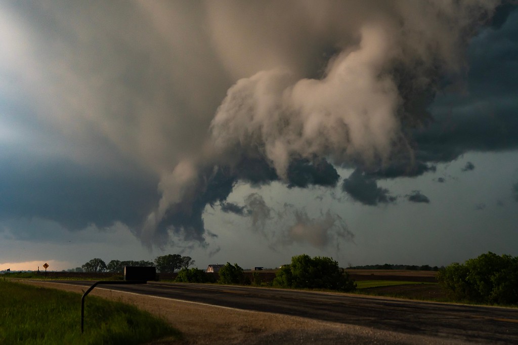
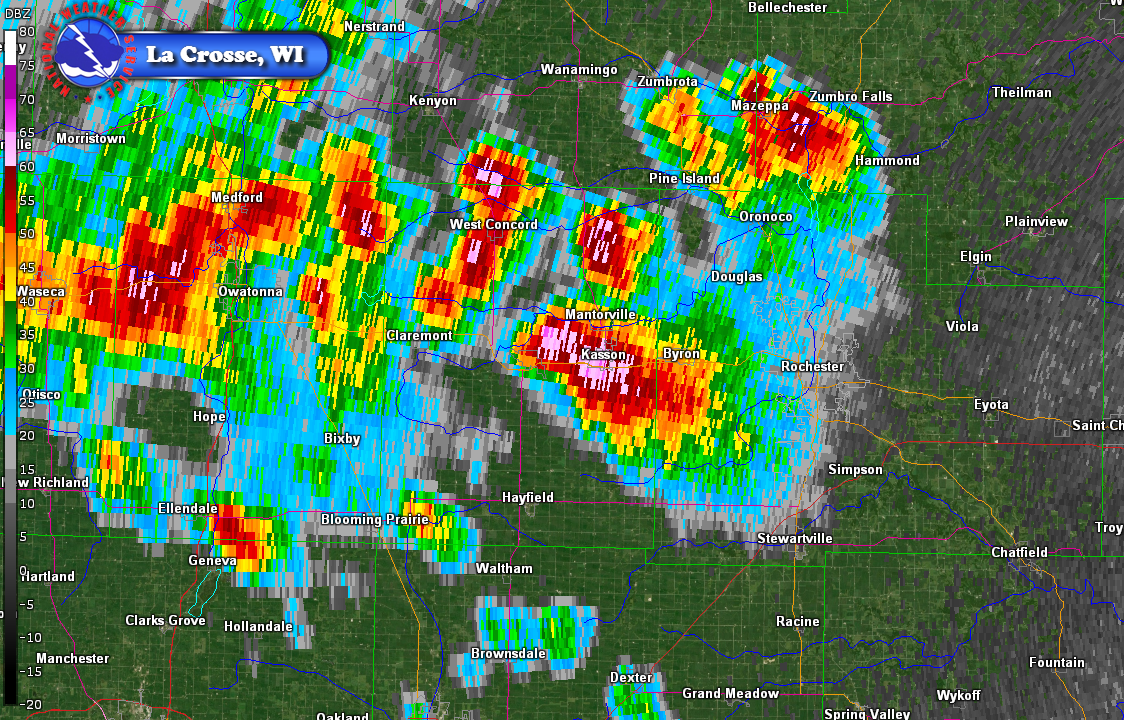
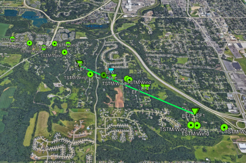
Clusters of thunderstorms across central Minnesota turned into a line of storms that moved through southeast Minnesota and into neighboring parts of Iowa and Wisconsin during the late afternoon and evening hours of Tuesday, June 4th. Hardest hit was parts of Dodge and Olmsted Counties in southeast Minnesota where large hail (up to baseball size), a brief tornado, and damaging winds occurred. An EF-1 tornado heavily damaged trees and at least one home in southwest Rochester. Winds hit near 70 mph at the Rochester International Airport and other areas in southwest Rochester. In addition, low clouds and turbulence with the clouds led to numerous reports of funnel clouds and rotation. |
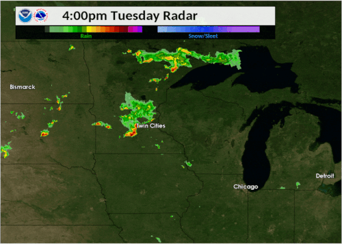 Radar loop from June 4 2019 |
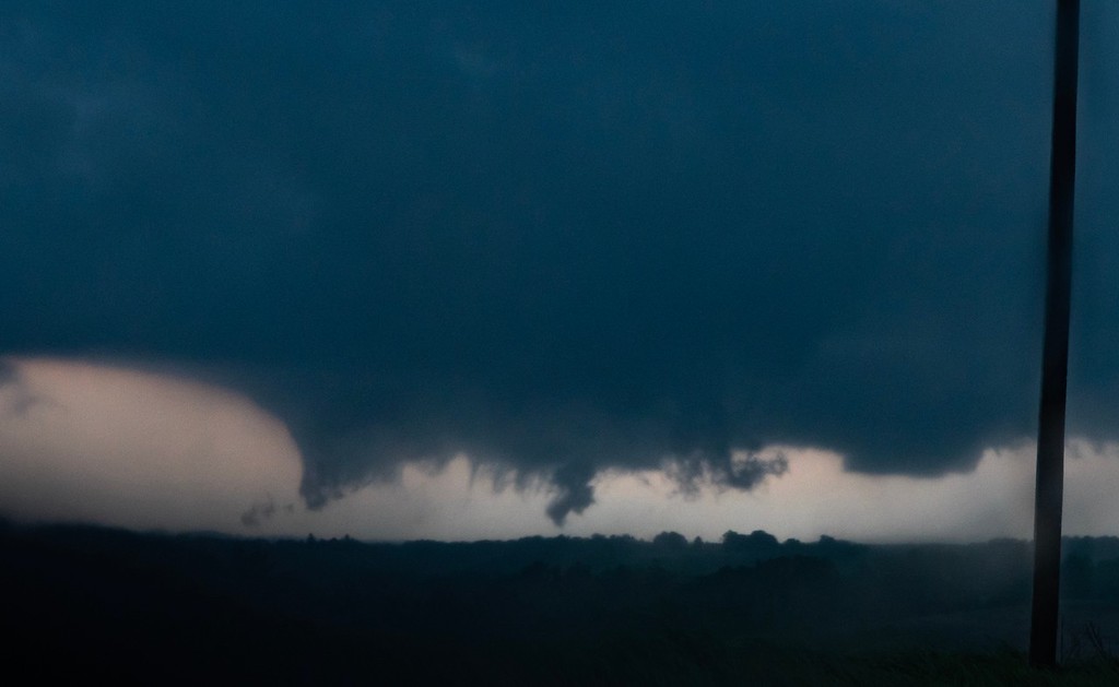
Tornado:
|
Tornado - SW Rochester, MN
|
||||||||||||||||
The Enhanced Fujita (EF) Scale classifies tornadoes into the following categories:
| EF0 Weak 65-85 mph |
EF1 Moderate 86-110 mph |
EF2 Significant 111-135 mph |
EF3 Severe 136-165 mph |
EF4 Extreme 166-200 mph |
EF5 Catastrophic 200+ mph |
 |
|||||
Photos:
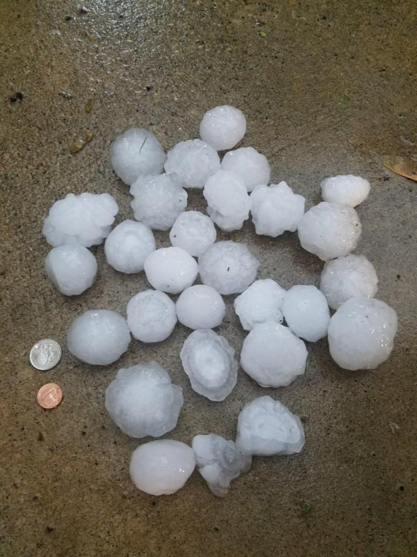
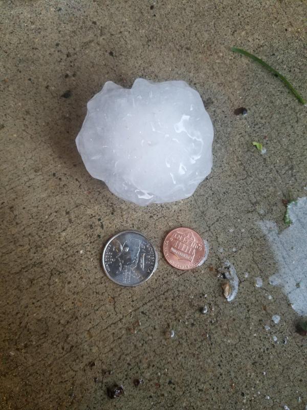
Dodge Co. Large Hail
 |
 |
 |
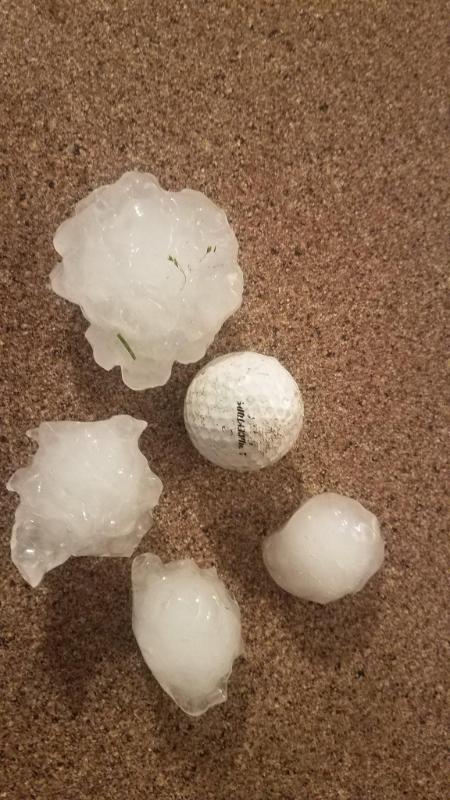 |
| Large hail in Kasson, MN (Photo by Dan Giesen) |
Large hail in Kasson, MN (Photo by Ethan Barnum) |
Large hail in Kasson, MN (Photo by Ethan Barnum) |
Large hail between Kasson & Dodge Center, MN (Photo by Joel Olson) |
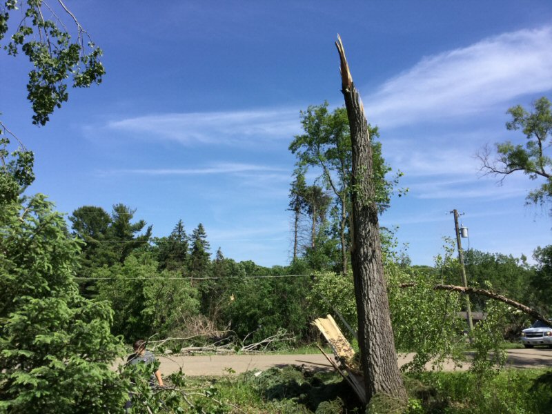
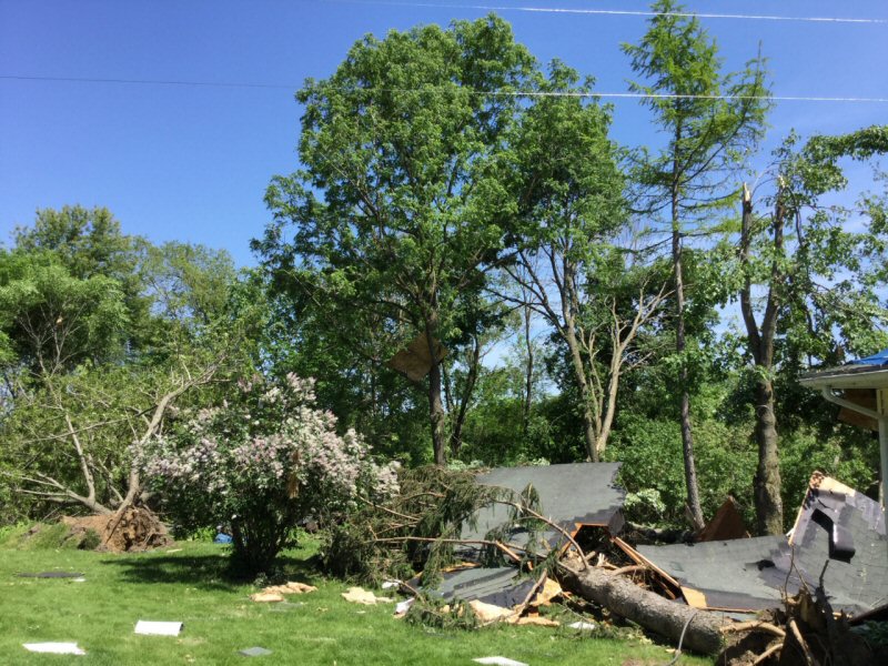
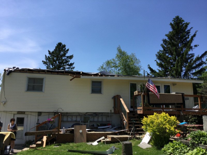
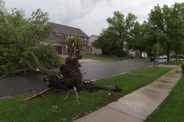
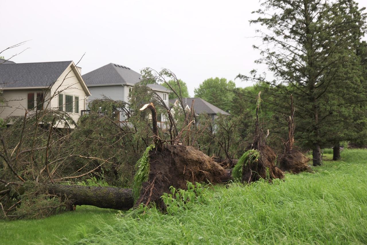
EF-1 Tornado Damage in Southwest Rochester, MN
 |
 |
 |
|
| Hardwood tree snapped from EF-1 tornado in SW Rochester (Photo by NWS Survey Team) |
EF-1 tornado damage in SW Rochester (Photo by NWS Survey Team) |
Home that sustained significant roof damage in SW Rochester (Photo by NWS Survey Team) |
EF-1 tornado damage in SW Rochester (Photo by NWS Survey Team) |
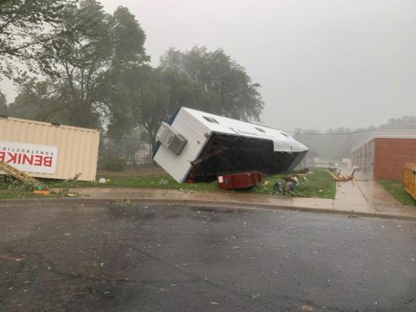
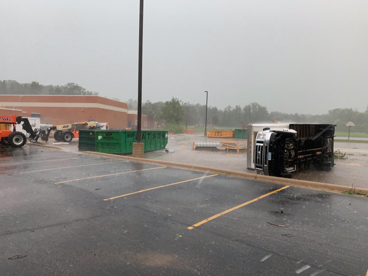
Olmsted Co. Wind Damage
 |
 |
 |
 |
| Wind damage at Bamber Valley Elem. School/SW Rochester (Photo by Leo Evans) |
Wind damage at Bamber Valley Elem. School/SW Rochester (Photo by Leo Evans) |
Wind damage in southwest Rochester (Photo by Leo Evans) |
Wind damage in southwest Rochester (Photo by Leo Evans) |
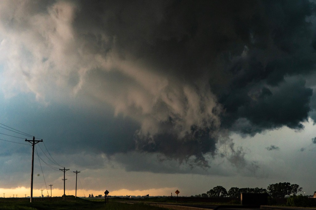
Scud /Shelf Cloud Photos
 |
 |
 |
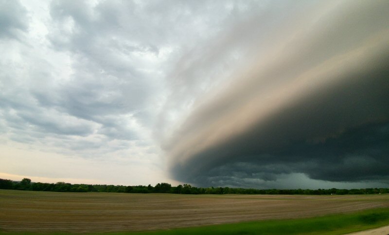 |
| Scud clouds near Hokah, MN (Photo by Dan Mckenzie) |
Scud clouds near Hokah, MN (Photo by Dan Mckenzie) |
Scud clouds near Hokah, MN (Photo by Dan Mckenzie) |
Shelf cloud near Eleva, WI (Photo by Jacob Tepsa) |
Radar:
 |
 |
 |
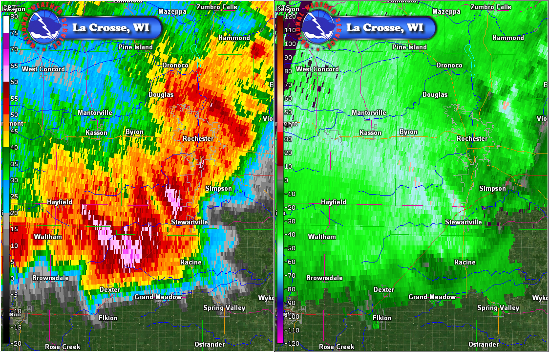 |
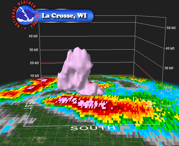
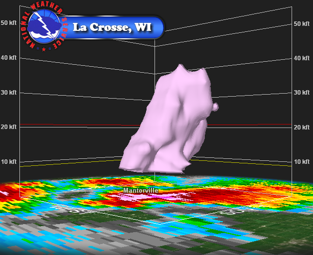
| Reflectivity image when biggest hail was occurring in Dodge Co., MN | 3-D image of hail core over Dodge Co., MN | 3-D image of hail core over Dodge Co., MN | Reflectivity and velocity images when wind damage occurred in southwest Rochester. |
Storm Reports
PRELIMINARY LOCAL STORM REPORT...SUMMARY
NATIONAL WEATHER SERVICE LA CROSSE WI
922 PM CDT TUE JUN 4 2019

..TIME...   ...EVENT...      ...CITY LOCATION...     ...LAT.LON...
..DATE...   ....MAG....      ..COUNTY LOCATION..ST.. ...SOURCE....
            ..REMARKS..

0430 PM     HAIL             DODGE CENTER            44.03N 92.85W
06/04/2019  E0.88 INCH       DODGE              MN   PUBLIC

            .

0434 PM     TSTM WND GST     DODGE CENTER            44.03N 92.85W
06/04/2019  M46 MPH          DODGE              MN   AWOS


0438 PM     HAIL             KASSON                  44.03N 92.75W
06/04/2019  E0.25 INCH       DODGE              MN   PUBLIC


0440 PM     HAIL             2 W KASSON              44.02N 92.79W
06/04/2019  E0.25 INCH       DODGE              MN   PUBLIC

            REPORTED PEA TO SMALLER THAN DIME SIZE.

0455 PM     HAIL             DODGE CENTER            44.03N 92.85W
06/04/2019  M2.00 INCH       DODGE              MN   PUBLIC

            .

0456 PM     HAIL             DODGE CENTER            44.02N 92.84W
06/04/2019  E1.00 INCH       DODGE              MN   PUBLIC

            QUARTER-SIZE HAIL. RELAYED VIA SOCIAL MEDIA.

0500 PM     HAIL             1 S KASSON              44.02N 92.75W
06/04/2019  E1.00 INCH       DODGE              MN   PUBLIC

            0.5 TO 1 INCH HAIL.

0502 PM     HAIL             DODGE CENTER            44.03N 92.85W
06/04/2019  M2.00 INCH       DODGE              MN   PUBLIC


0502 PM     HAIL             DODGE CENTER            44.03N 92.85W
06/04/2019  M2.50 INCH       DODGE              MN   PUBLIC

            .

0504 PM     HAIL             KASSON                  44.03N 92.75W
06/04/2019  E2.75 INCH       DODGE              MN   EMERGENCY MNGR


0505 PM     HAIL             DODGE CENTER            44.03N 92.85W
06/04/2019  M2.50 INCH       DODGE              MN   BROADCAST MEDIA


0507 PM     HAIL             KASSON                  44.03N 92.75W
06/04/2019  E1.50 INCH       DODGE              MN   PUBLIC

            PING PONG BALL SIZE HAIL.

0507 PM     HAIL             KASSON                  44.03N 92.75W
06/04/2019  E1.00 INCH       DODGE              MN   PUBLIC

            CORRECTS PREVIOUS HAIL REPORT OF PING PONG
            SIZE FROM KASSON.

0515 PM     HAIL             1 NE BYRON              44.04N 92.64W
06/04/2019  E0.88 INCH       OLMSTED            MN   PUBLIC

            NICKEL SIZE HAIL NEAR SOMERBY GOLF COURSE.

0516 PM     HAIL             1 E KASSON              44.03N 92.73W
06/04/2019  M1.25 INCH       DODGE              MN   BROADCAST MEDIA


0516 PM     HAIL             KASSON                  44.03N 92.75W
06/04/2019  M1.75 INCH       DODGE              MN   PUBLIC

            .

0525 PM     HAIL             2 W KASSON              44.03N 92.79W
06/04/2019  E0.50 INCH       DODGE              MN   TRAINED SPOTTER


0535 PM     TSTM WND GST     DODGE CENTER            44.03N 92.85W
06/04/2019  M69 MPH          DODGE              MN   AWOS


0555 PM     TSTM WND GST     4 SW ROCHESTER          43.97N 92.53W
06/04/2019  E54 MPH          OLMSTED            MN   TRAINED SPOTTER


0555 PM     TSTM WND GST     2 SSW ROCHESTER         43.99N 92.48W
06/04/2019  M54 MPH          OLMSTED            MN   TRAINED SPOTTER

            .

0555 PM     TSTM WND GST     2 NW ROCHESTER          44.03N 92.50W
06/04/2019  M56 MPH          OLMSTED            MN   TRAINED SPOTTER

            .

0556 PM     TSTM WND GST     2 S ORONOCO             44.13N 92.54W
06/04/2019  E60 MPH          OLMSTED            MN   TRAINED SPOTTER


0557 PM     TSTM WND GST     ROCHESTER               44.01N 92.48W
06/04/2019  E60 MPH          OLMSTED            MN   EMERGENCY MNGR

            AT APACHE MALL.

0559 PM     TSTM WND GST     ROCHESTER AIRPORT       43.91N 92.50W
06/04/2019  M60 MPH          OLMSTED            MN   ASOS


0601 PM     TSTM WND GST     ROCHESTER AIRPORT       43.91N 92.50W
06/04/2019  M64 MPH          OLMSTED            MN   ASOS


0617 PM     HEAVY RAIN       MANTORVILLE             44.07N 92.76W
06/04/2019  M1.85 INCH       DODGE              MN   PUBLIC

            .

0627 PM     TSTM WND GST     4 W CHATFIELD           43.84N 92.27W
06/04/2019  E70 MPH          FILLMORE           MN   TRAINED SPOTTER

            TRAINED SPOTTERS ESTIMATED WIND GUST OF 70
            MILES PER HOUR FOUR MILES WEST OF CHATFIELD.

0630 PM     HEAVY RAIN       2 ESE MANTORVILLE       44.06N 92.72W
06/04/2019  M1.81 INCH       DODGE              MN   COCORAHS

            FELL IN 70 MINUTES. ALSO HAD QUARTER SIZE
            HAIL.

0647 PM     TSTM WND GST     1 S HARMONY             43.54N 92.01W
06/04/2019  M58 MPH          FILLMORE           MN   FIRE DEPT/RESCUE

            .

0731 PM     TSTM WND GST     LA CROSSE AIRPORT       43.87N 91.26W
06/04/2019  M46 MPH          LA CROSSE          WI   ASOS


0747 PM     TSTM WND GST     4 NNE STODDARD          43.71N 91.19W
06/04/2019  E40 MPH          VERNON             WI   NWS EMPLOYEE


0755 PM     TSTM WND GST     1 WSW WEST SALEM        43.90N 91.10W
06/04/2019  E50 MPH          LA CROSSE          WI   NWS EMPLOYEE

            ESTIMATED 40-50 MPH WIND GUSTS.

0801 PM     TSTM WND DMG     1 NE SPARTA             43.95N 90.80W
06/04/2019                   MONROE             WI   TRAINED SPOTTER

            SEVERAL TREES REPORTED DOWN. TIME ESTIMATED
            FROM RADAR.


&&
Services
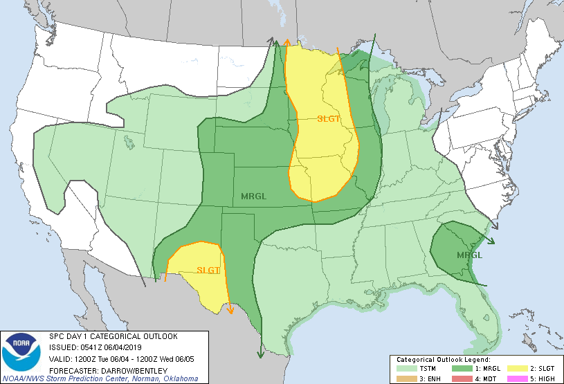
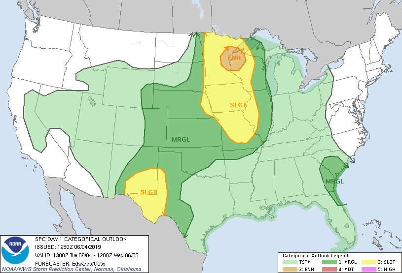
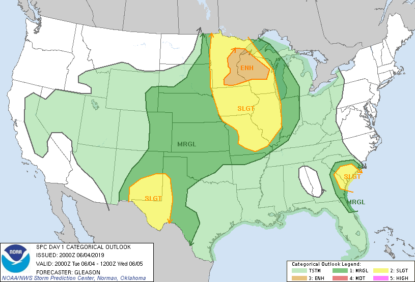
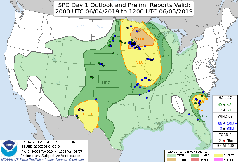
Day 1 Severe Weather Outlooks for June 4 2019 / Severe Thunderstorm Watch #328
 |
 |
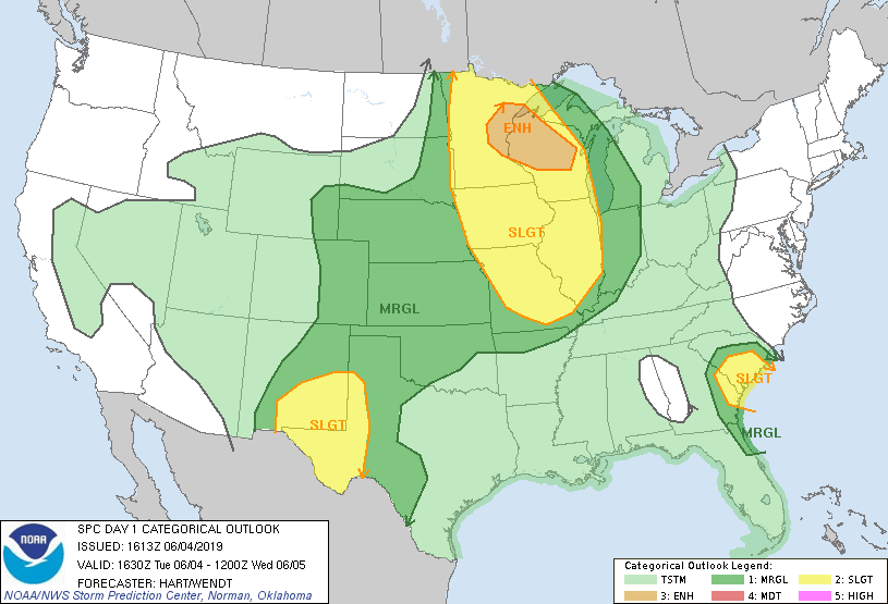 |
| Initial Day 1 Outlook | Early morning update | Late morning update |
 |
 |
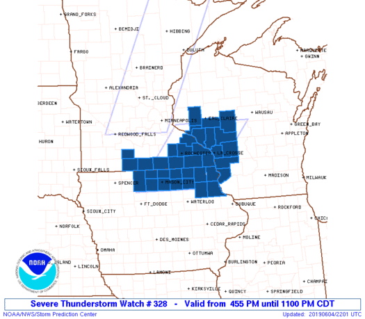 |
| Mid afternoon Day 1 Update | Verification for Day 1 Outlook | Severe Thunderstorm Watch #328 |
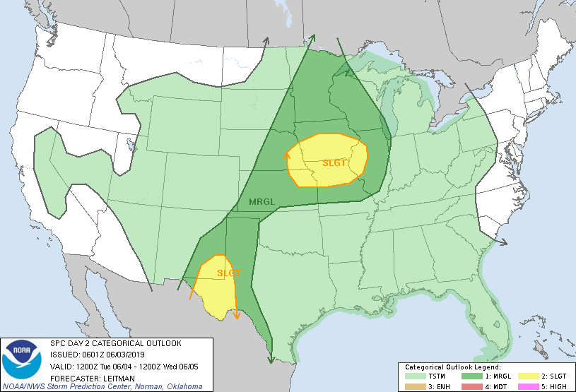
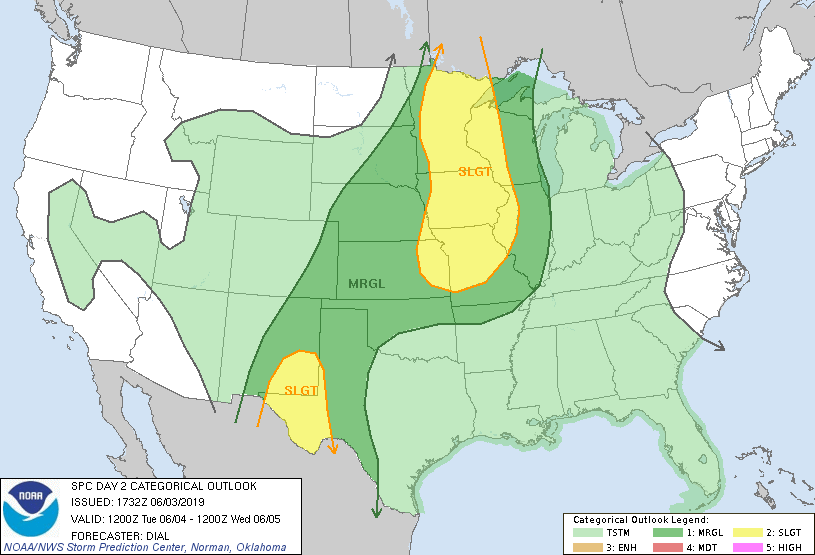
Day 2 and Day 3 Severe Weather Outlooks
 |
 |
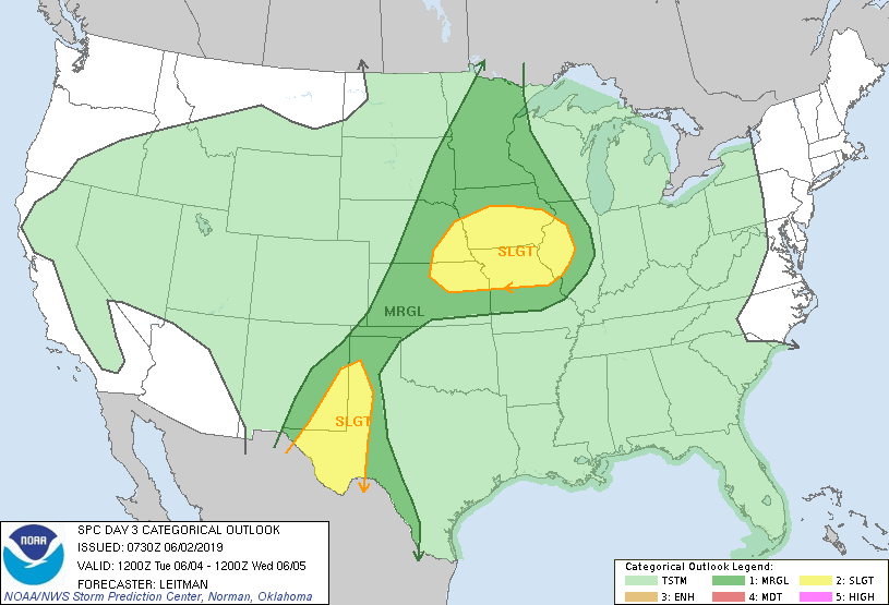 |
| Day 2 Outlook (Issued June 3rd) | Day 2 Outlook Update (Issued June 3rd) | Day 3 Outlook (Issued June 2nd) |
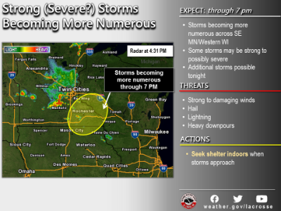
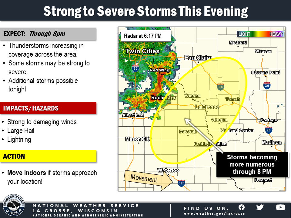
NWS Graphics
 |
 |
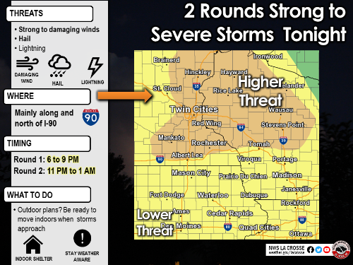 |
| Graphicast Image | Graphicast Image | Weather Story graphic update |
 |
Media use of NWS Web News Stories is encouraged! Please acknowledge the NWS as the source of any news information accessed from this site. |
|


 Weather Story
 Weather Map
 Local Radar