Overview
|
A small, but intense Supercell formed along a warm front that was stretched across southern Minnesota and northern Iowa on Friday afternoon, June 11, 2004. It initially developed near Charles City, IA and then tracked northeast into Howard County, Iowa. From that point on it began to produce a series of tornadoes as it moved north toward the state line. No other damage could be found as the storm tracked north until it approached the Riceville, IA area where it dropped another brief touchdown. A few sheds and buildings on the east side of Riceville were damaged, with mainly tin blown off roofs and siding torn off. This damage was rated F0 and the approximate time was 5:35 p.m. A much more significant tornado formed around 5:50 p.m. about 4 miles north of Riceville or 4 miles southwest of Le Roy, Minnesota, just east of the Mitchell-Howard County line. The tornado formed in open fields near County Road A23 just east of Addison Avenue, which is the Mitchell-Howard County line. It hit several homes and farms (F2 damage) as it tracked straight north toward the Minnesota-Iowa state line, only feet from the county line. One home lost the roof and all outbuildings, while another home right on the state line was completely destroyed. The tornado was approx. 150 yards wide at times and apparently reached low end F3 damage intensity right on the state line around 6:00 p.m. The tornado then started to weaken but did heavy damage to a grain company (Koch Industries)(F2 damage) about 2 miles west of Le Roy and continued north crossing Highway 56 just before 6:15 p.m.. The tornado lifted approximately 4 miles northwest of Le Roy in open fields. There were also brief tornado touch downs (all rated F0) near Dexter and Le Roy, Minnesota, as well as areas along the Mower-Fillmore County line west of Spring Valley. |
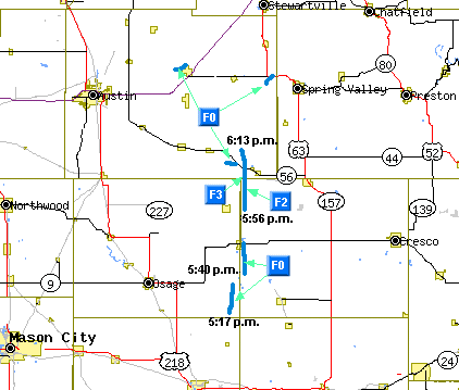 Tornado map from June 11, 2004 |
 |
 |
 |
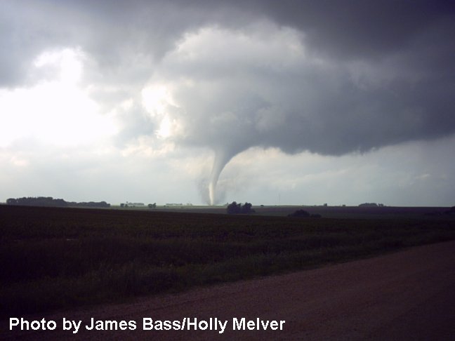
| Tornado in extreme northwest Howard County, IA. (Photo by James and Holly Bass) |
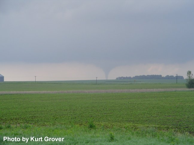
Tornado southwest of Le Roy, MN. (Photo by Kurt Grover) |
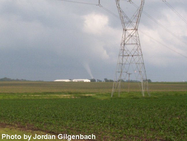
Another shot of tornado. (Photo by Jordan Gilgenbach and Lindsay Viker) |
Tornadoes:
|
Tornado - New Haven, IA
Track Map  |
||||||||||||||||
|
Tornado - Riceville, IA
Track Map |
||||||||||||||||
|
Tornado - LeRoy, MN
Track Map |
||||||||||||||||
|
Tornado - LeRoy, MN
Track Map |
||||||||||||||||
|
Tornado - 2 miles NE of Dexter, MN
Track Map |
||||||||||||||||
The Enhanced Fujita (EF) Scale classifies tornadoes into the following categories:
| EF0 Weak 65-85 mph |
EF1 Moderate 86-110 mph |
EF2 Significant 111-135 mph |
EF3 Severe 136-165 mph |
EF4 Extreme 166-200 mph |
EF5 Catastrophic 200+ mph |
 |
|||||
Timetable:
Photos:
 |
 |
 |
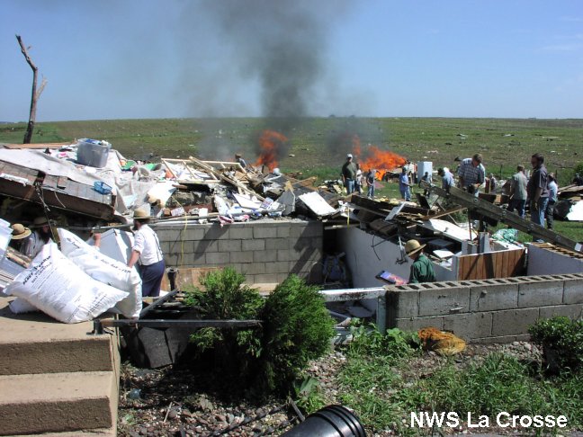 |
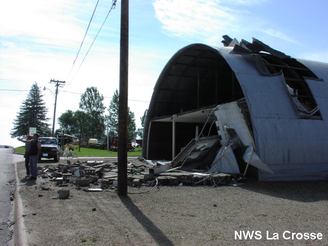
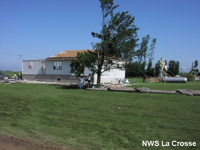
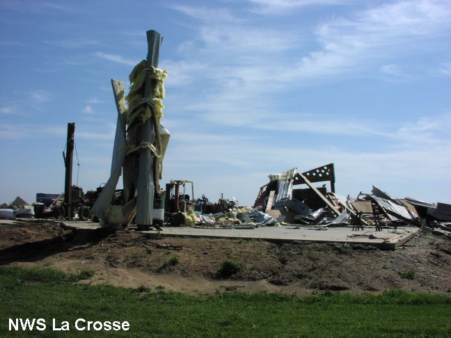
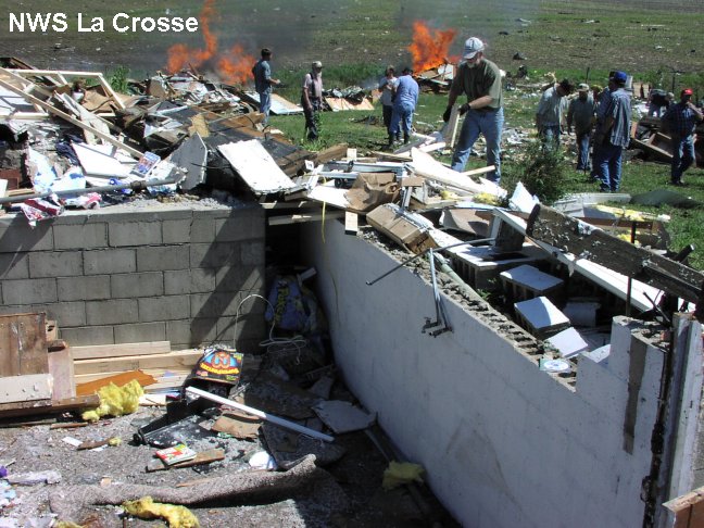
| Damage in Riceville, IA. | Home damage about 4 miles southwest of Le Roy, MN in extreme northwest Howard County. | Garage damage. Cars were also thrown. | Home demolished near the Minnesota-Iowa state line. |
 |
 |
 |
 |
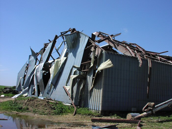
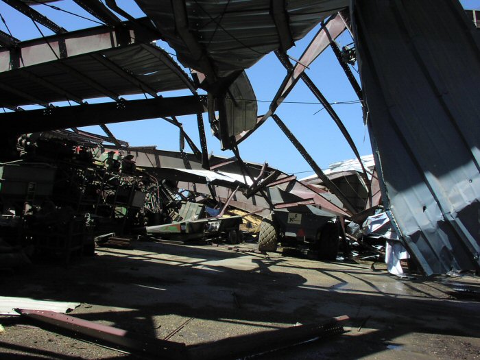
| Heavy damage to same home near the state line. They hid in the basement and survived. | Sheds damaged west of Le Roy. | More damage west of Le Roy to sheds. | Track of the tornado in Howard County, looking south. The ground was scoured. |
 |
|||
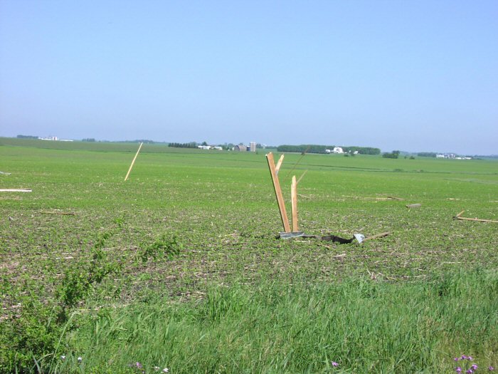
| Projectiles thrown into Mitchell County Iowa. |
Radar:
Header
 |
 |
 |
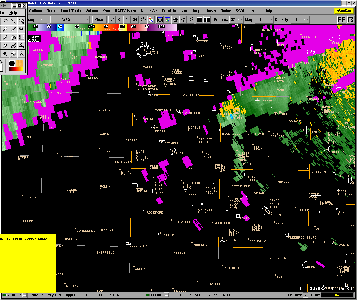 |
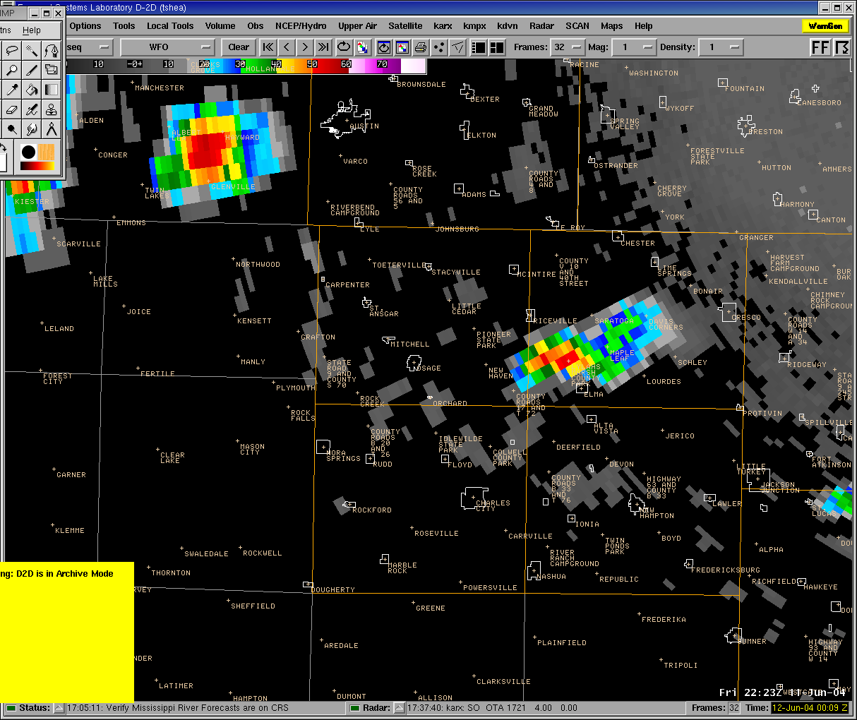
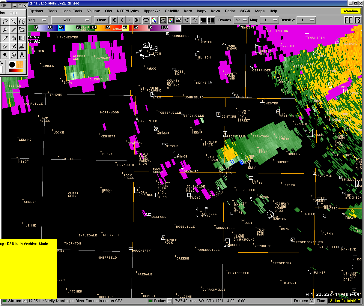
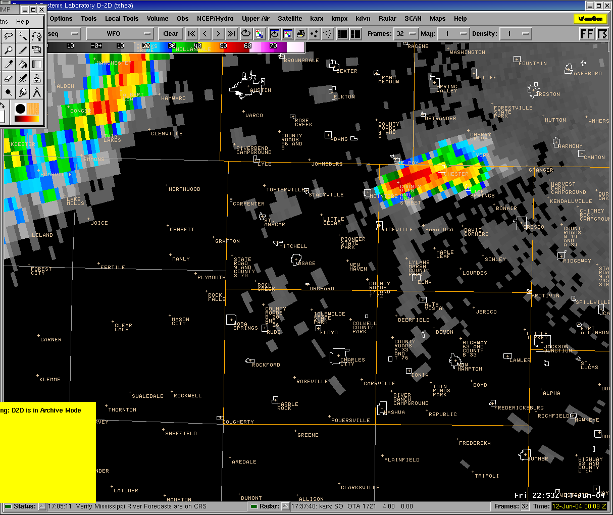
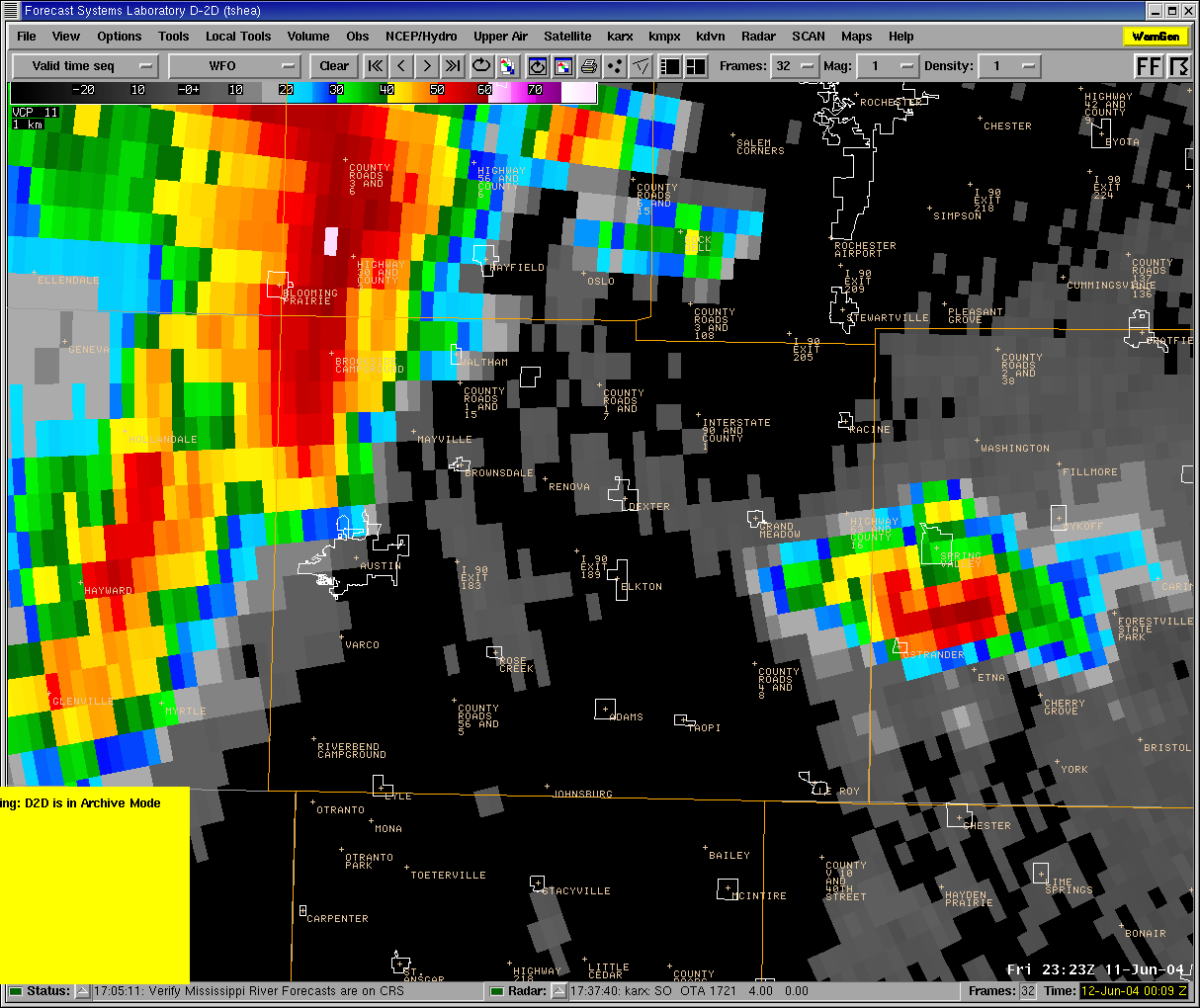
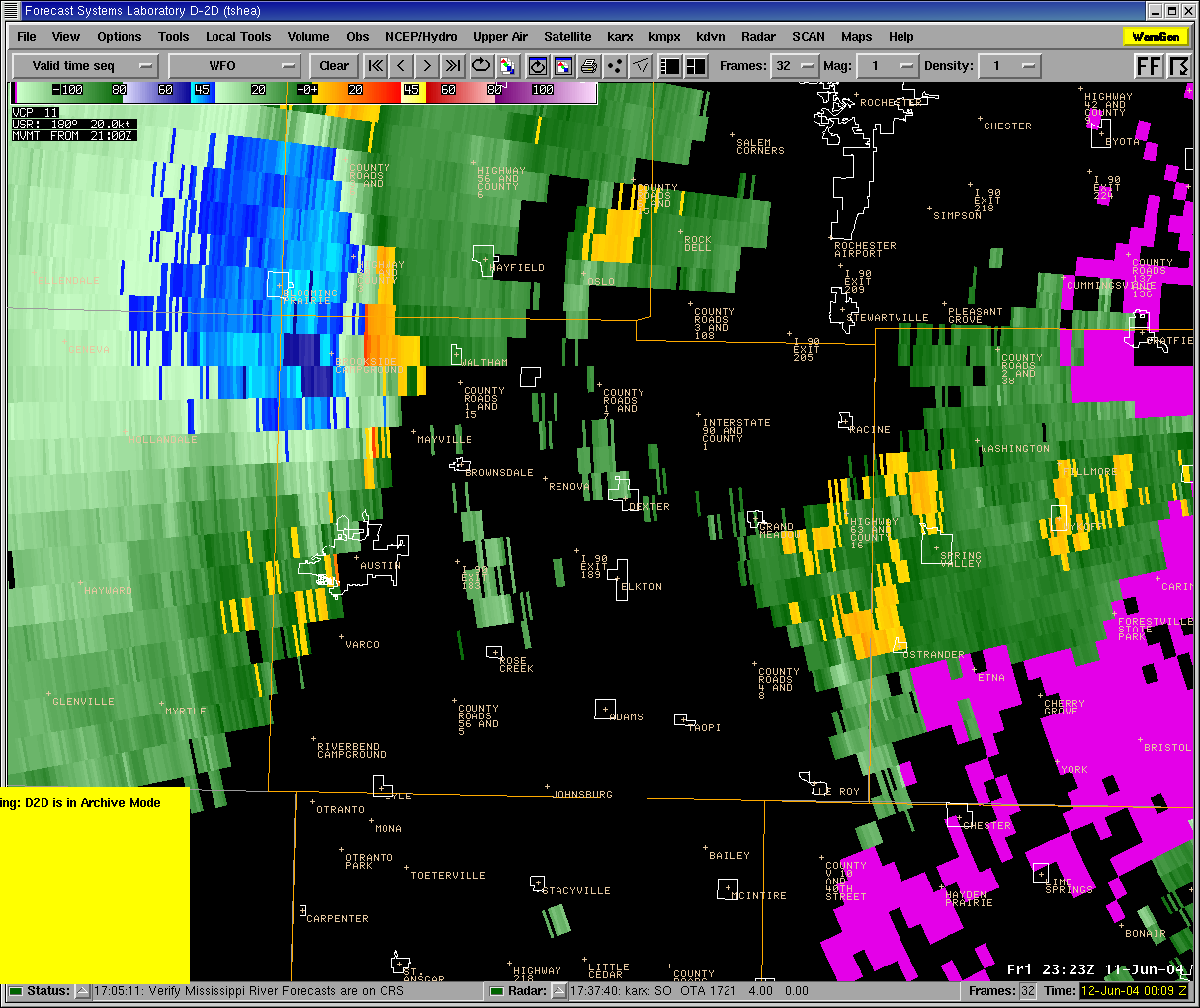
| 0.5 degree base reflectivity at 523 p.m. CDT around the first brief tornado touchdown. | 0.5 degree storm-relative velocity at 523 p.m. CDT around the first brief tornado touchdown. | 0.5 degree Base reflectivity at 553 p.m. CDT near Riceville and LeRoy. | 0.5 degree storm-relative velocity at 553 p.m. CDT near Riceville and LeRoy. |
 |
 |
||
| 0.5 degree Base reflectivity at 623 p.m. CDT near Ostrander. | 0.5 degree storm-relative velocity at 623 p.m. CDT near Ostrander. |
 |
Media use of NWS Web News Stories is encouraged! Please acknowledge the NWS as the source of any news information accessed from this site. |
|


 Follow us on YouTube