Five Points Tornado - Cleburne County
August 25th, 2008
|
Rating:
(Click for EF Scale) |
EF-2
|
|
Estimated Maximum Wind:
|
110 - 120 MPH
|
|
Injuries/Fatalities:
|
None
|
|
Damage Path Length:
|
0.36 of a Mile
|
|
Maximum Path Width:
|
400 Yards
|
|
Approximate Start Point:
|
33.58/-85.68 at 12:06 PM
|
|
Approximate End Point:
|
33.59/-85.68 at 12:07 PM
|
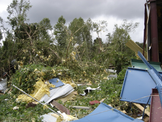
A National Weather Service damage assessment team surveyed the storm damage in Cleburne County. It was determined that the damage was the result of a tornado. The tornado was rated an EF-2 on the Enhanced Fujita scale. Damage estimates were consistent with winds between 110 and 120 MPH. The total tornado damage path was 0.36 of a mile long and was 400 yards wide at its widest point.
The tornado touched down on US Highway 431 about a half mile south of the intersection with State Highway 281. The tornado then moved northwestward, along and just east of US Highway 431. The tornado lifted just before reaching State Highway 281. One gas station/convenience store and one auto body shop were significantly damaged. Approximately 100 to 200 trees were snapped off or were uprooted along the damage path.
Damage Photos
|
||||||||||||


 Follow us on YouTube