On April 3, 2017 an upper level trough over northern Texas lifted into the Midwest. A series of upper level disturbances embedded in the trough moved over the Southeast during the afternoon and evening. The associated surface low developed across Missouri/Illinois with a trailing cold front which moved eastward from Mississippi to South Carolina through the day. The main area of thunderstorms developed ahead of the cold front in a quickly advancing line with some discrete supercells developing in southeastern Georgia. The main and most significant band of convection, enhanced by a strong low level jet and moisture transport off of the Gulf of Mexico, pushed quickly across the Midlands and Central Savannah River Area (CSRA) during the afternoon and early evening. The combination of moderate atmospheric instability and very strong vertical wind shear set the stage for a severe weather outbreak. This severe weather outbreak led to 3 confirmed tornadoes (an EF-2, EF-1 and EF-0 on the Enhanced Fujita Scale), strong straight-line winds and a few hail reports across the Midlands and CSRA.
Environmental conditions favored widespread damaging winds and supported tornado development on April 3. Onshore (SE) surface flow in the wake of a northward moving warm front led to warm, moist advection across the CWA. This combined with an approaching mid-level trough created moderate instability, large helicity values and strong vertical wind shear.
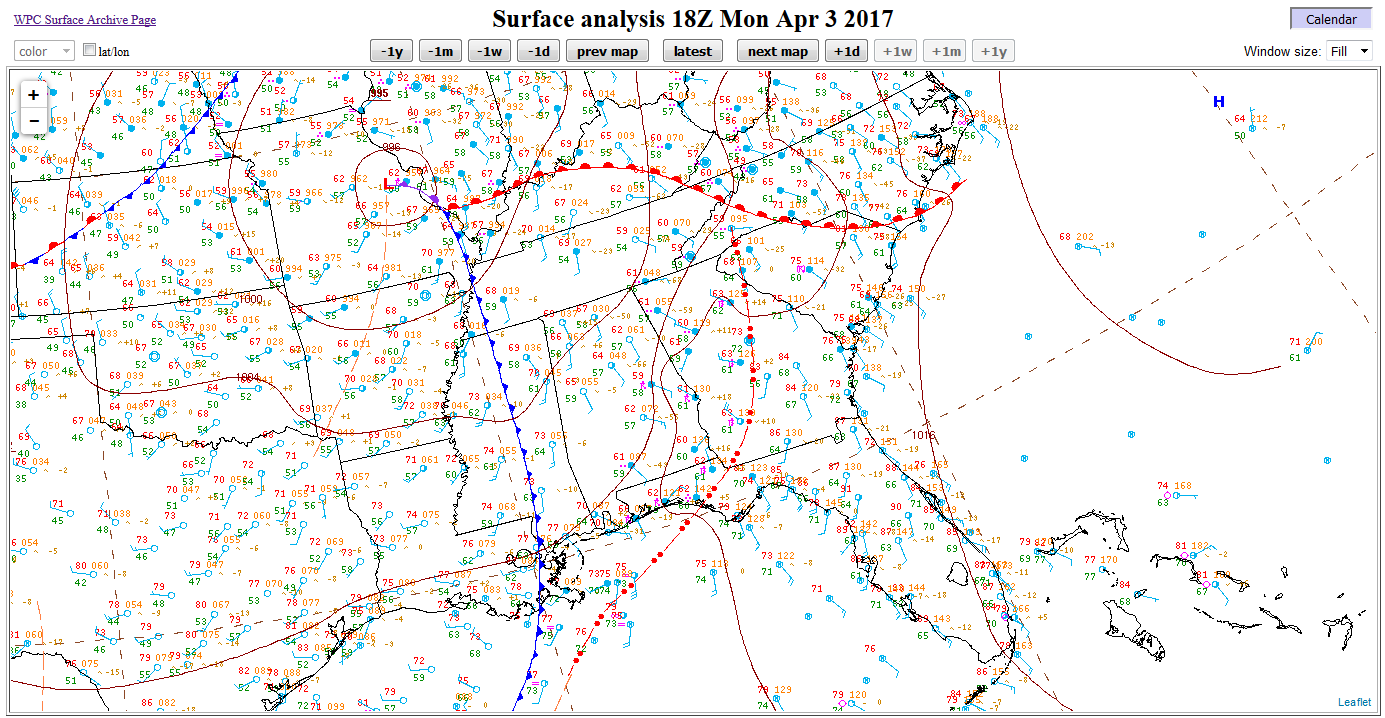
April 3, 2017, 2 PM EDT surface observations (Mesoanalysis from Storm Prediction Center)
Surface-based Convective Available Potential Energy (CAPE) values at 3 PM ranged from 500 to 1000 J/kg with highest values over the CSRA. Effective-layer Storm Relative Helicity (SRH) values ranged from 300 to 500 m2/s2 at 4 pm indicating an increased threat for tornado development.

April 3, 2017, 3 PM EDT surface based Convective Available Potential Energy (J/kg) (Mesoanalysis from Storm Prediction Center)
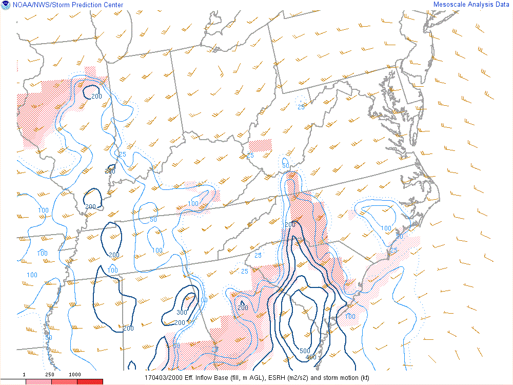
April 3, 2017, 4 PM EDT effective layer Storm Relative Helicity (m2/s2) and storm motion wind barbs (Mesoanalysis from Storm Prediction Center)
Effective bulk shear values were around 55 kts in the central Midlands and CSRA which indicated the ability for storms to develop rotating updrafts.
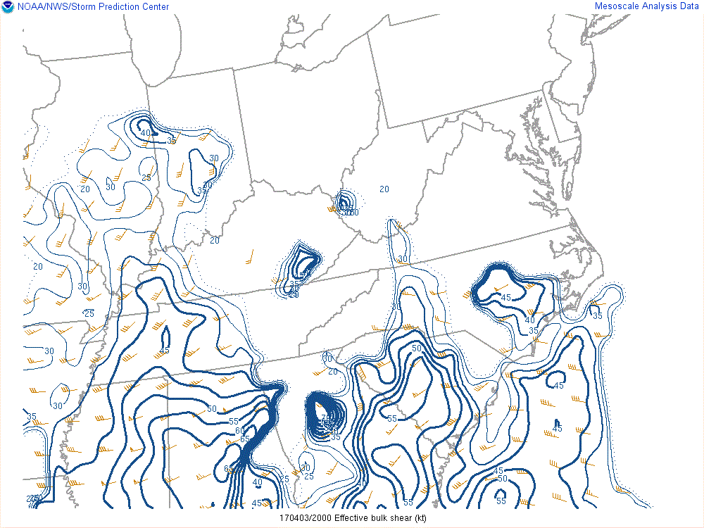
April 3, 2017, 4 PM EDT Effective Bulk Shear (knots) (Mesoanalysis from Storm Prediction Center)
The radar loop of the event (below) shows the Quasi-Linear Convective System (QLCS) moving into the CSRA around 3 PM and out of the eastern Midlands by 6 PM. The majority of the damage and all of the confirmed tornadoes occurred with the QLCS.
April 3, 2017 8 AM to 8 PM MRMS Composite Reflectivity Loop
The strongest tornado touched down just east of Highway 601 near the Calhoun County and Orangeburg County line. During the event, the radar indicated a strong velocity couplet as well as a Tornadic Debris Signature (TDS) in the Correlation Coefficient (CC) product.
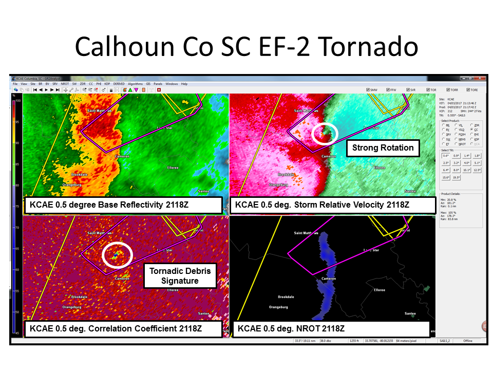
April 3, 2017 5:18 PM Radar Data (top left reflectivity, top right SRV, bottom left CC, bottom right NROT)
A closer look at the Storm Relative Velocity (SRV) product shows that there was 43 knots of rotational shear about 2000 feet above radar level, indicating a tornado was likely on the ground.
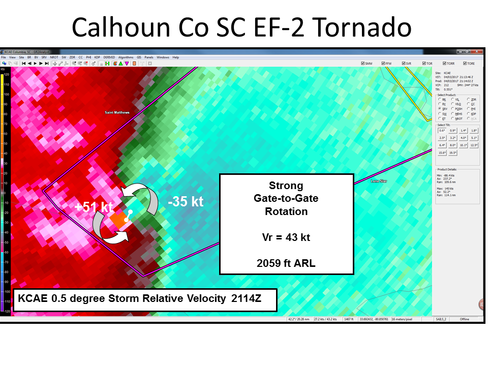
April 3, 2017 5:14 PM Storm Relative Velocity
The confirmed EF-2 tornado traveled a distance of approximately 6.5 miles with wind speeds up to 118 mph. It caused damage to several structures and snapped utility poles.
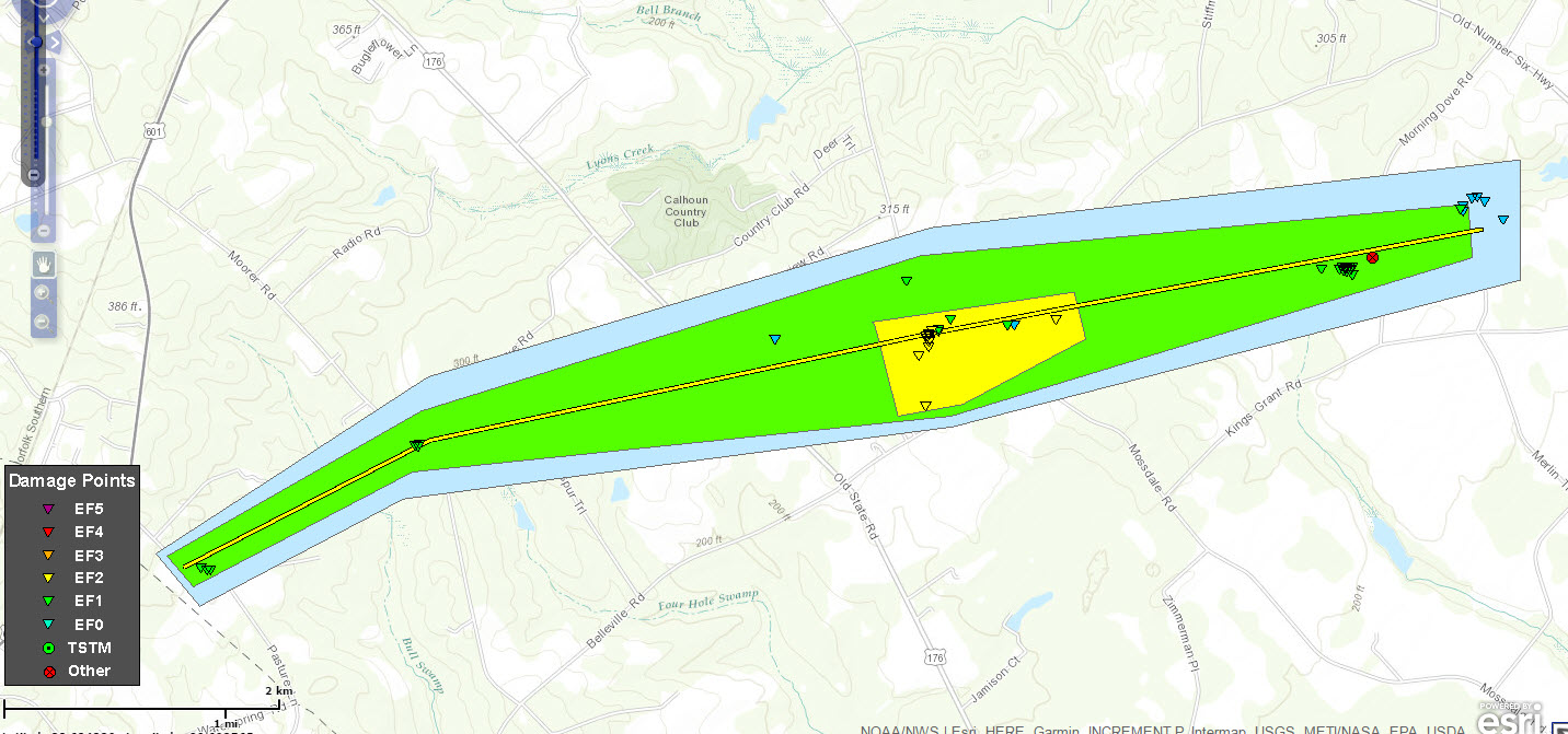
April 3, 2017 Tornado path from Calhoun County EF-2. Triangles indicate points of damage that were surveyed. Yellow polygon/triangles indicates areas/points of EF-2 damage, similarly green indicates EF-1 and blue EF-0. The center yellow line shows approximate tornado path.
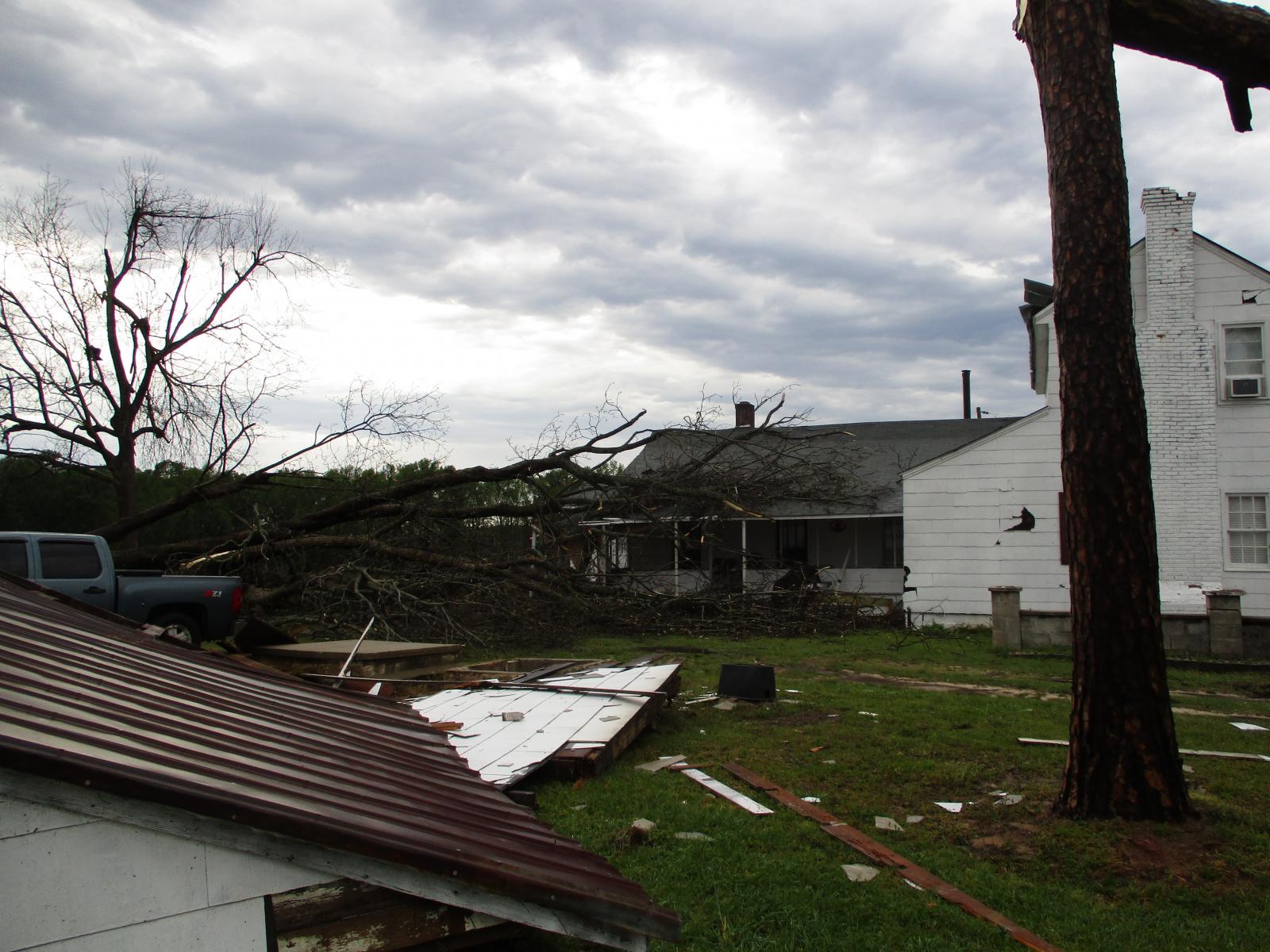
Calhoun County, SC. Tree trunks snapped, damage to home, shed and barn (not pictured) on April 3, 2017

Calhoun County, SC. Power poles snapped on Sikes Road on April 3, 2017
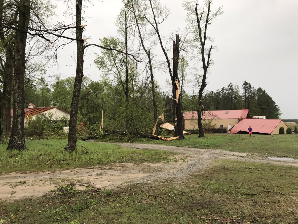
Calhoun County, SC. Tree trunks snapped and metal building damaged on April 3, 2017
There were two other tornadoes that occurred in the Columbia, SC County Warning Area (CWA) on April 3, 2017. One EF-1 in northern Aiken County, south of Monetta, and a brief EF-0 tornado which occurred near the town of Aiken, SC. In total, there were 18 reports of wind damage, one large hail report (=>1”) and 1 flash flooding report in the Columbia, SC CWA.
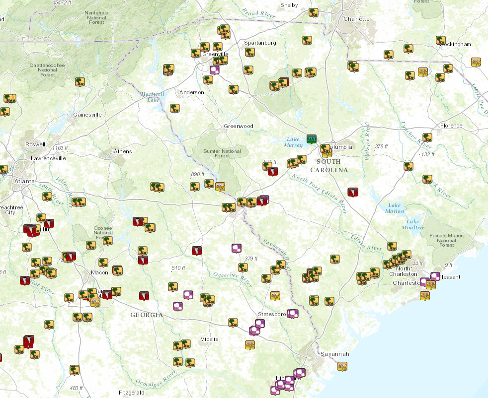
April 3, 2017 Storm reports map (tree icons represents wind damage, pink icons represent hail, red icons represent tornadoes)


 Follow us on YouTube