With a mean upper trough axis to our west, a lead impulse moved through our region in a SW flow aloft Wednesday. At the surface, a stationary front was stretched across the central SC/GA, with a cold front to our west, that came through late Wednesday night. Upper energy, diurnal heating, strong low to mid level jets, and the surface front, contributed to moderate to strong instabilities, along with strong shear. This produced severe thunderstorm activity, including two tornadoes, along with numerous reports of strong damaging straight-line wind gusts and large hail. In addition, training cells in a moisture-rich environment, contributed to locally heavy rainfall and flash flooding in a few locations.
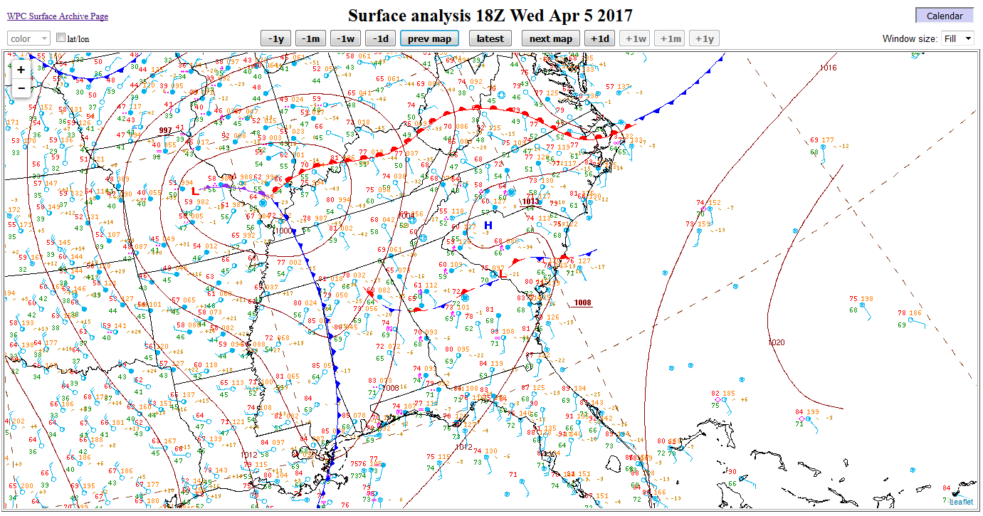
April 5, 2017, 2 PM EDT surface analysis and observations (from Weather Prediction Center)
Surface based Lifted Index values up to -7 and most unstable Convective Available Potential Energy values from 1000 to 2000 J/kg indicated moderate instability across the southern portion of the forecast area. Effective layer bulk shear values from 50 to 70 knots show a strongly sheared environment and suggest an elevated threat for rotating updrafts and tornadoes.
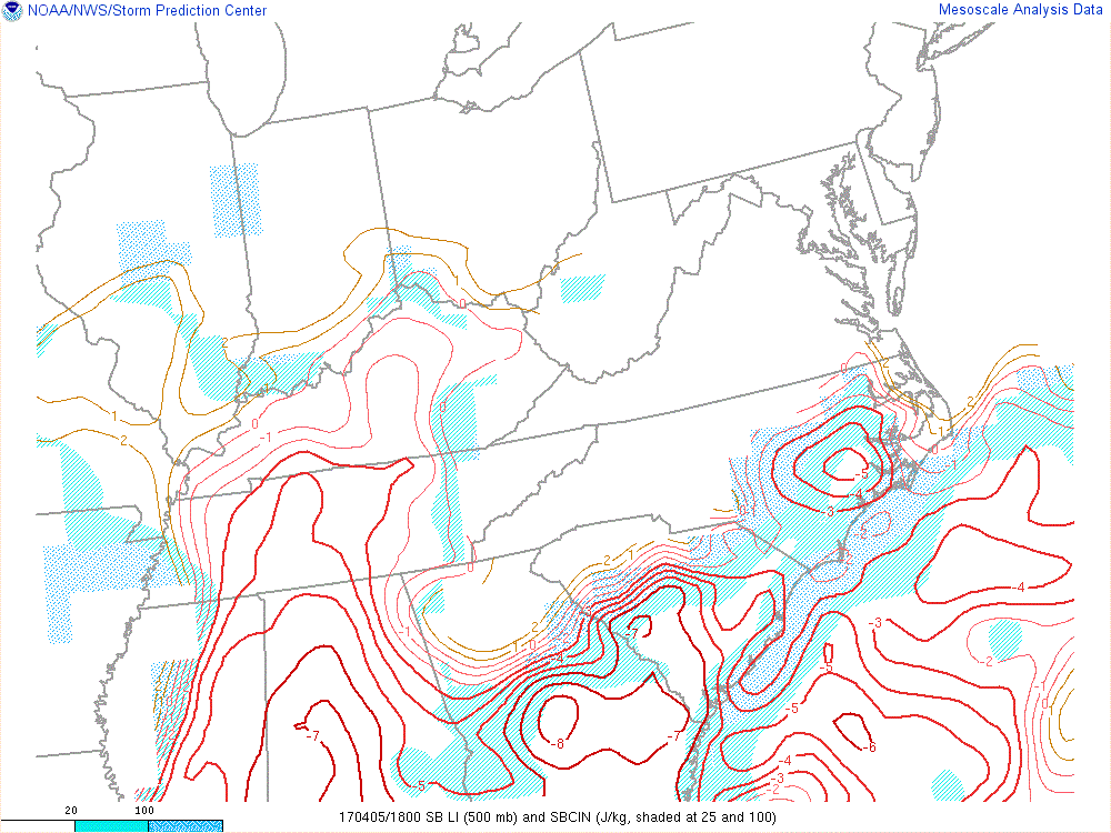
April 5, 2017, 2 PM EDT surface-based Lifted Index and SBCIN (from Weather Prediction Center)
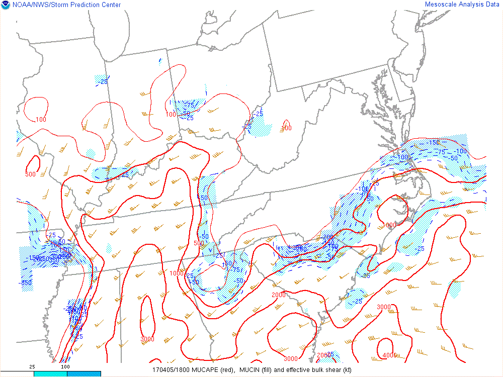
April 5, 2017, 2 PM EDT most unstable Convective Available Potential Energy (J/kg) and effective layer Bulk Shear (knots) (Mesoanalysis from Storm Prediction Center)
The radar loop of the event (below) shows strong cells moving into Lincoln County, GA and McCormick County, SC around 12:30pm and accelerated across the Midlands. This storm produced an EF-2 tornado which traveled for just over 7 miles in Edgefield and Saluda counties. Large hail and heavy rain fell across the central Midlands. Areas in downtown Columbia experienced flash flooding closing down several streets and stranding multiple cars.
April 5, 2017 8 AM to 8 PM MRMS Composite Reflectivity Loop
A closer look at the radar reflectivity and Storm Relative Velocity (SRM) product shows the hook structure and strong rotational couplet, indicators that a tornado is likely on the ground near Johnston, SC. These features continue to track eastward and move over the town of Ward, SC at approximately 1:24 PM (17:24 UTC).
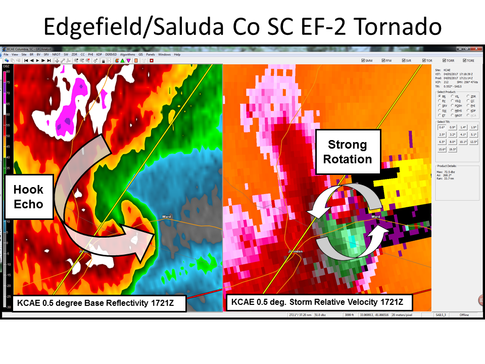
April 5, 2017 1:21 PM Radar Data (left reflectivity, right Storm Relative Velocity (SRM))
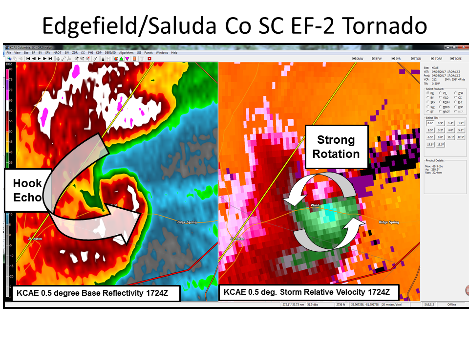
April 5, 2017 1:24 PM Radar Data (left reflectivity, right Storm Relative Velocity (SRM))
The confirmed EF-2 tornado traveled a distance of approximately 7.3 miles with wind speeds up to 115 mph. It caused damage to several structures and uprooted or snapped numerous trees.
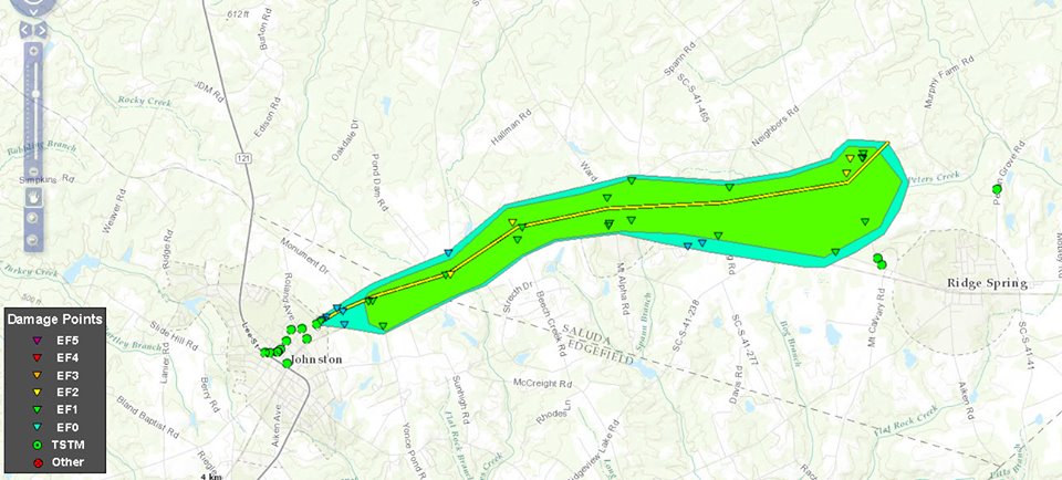
April 5, 2017 Tornado path from Johnston/Ward EF-2. Triangles indicate points of damage that were surveyed. Yellow polygon/triangles indicates areas/points of EF-2 damage, similarly green indicates EF-1 and blue EF-0. The center yellow line shows approximate tornado path.
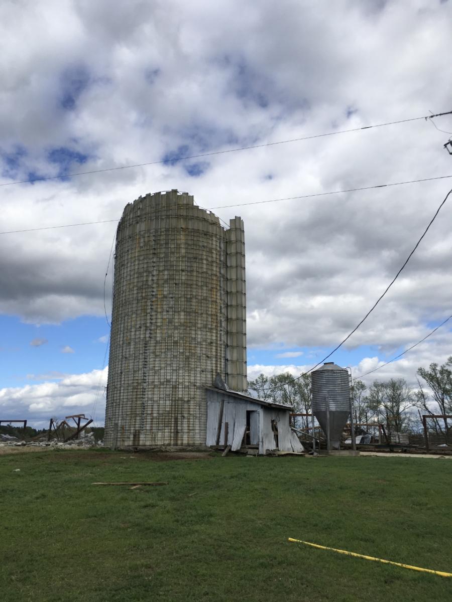
Damage to silo near Johnston, SC on April 5, 2017
Damage to building in Johnston, SC on April 5, 2017

Tree damage to car near Ridge Spring, SC on April 5, 2017
The thunderstorm which produced the EF-2 tornado near Johnston, SC continued east and moved over Columbia, SC causing flash flooding. Many low-lying areas in the city were submerged, stranding cars. USGS stream gauges show rapid increases in stream levels at Rocky Branch and Smith Branch.
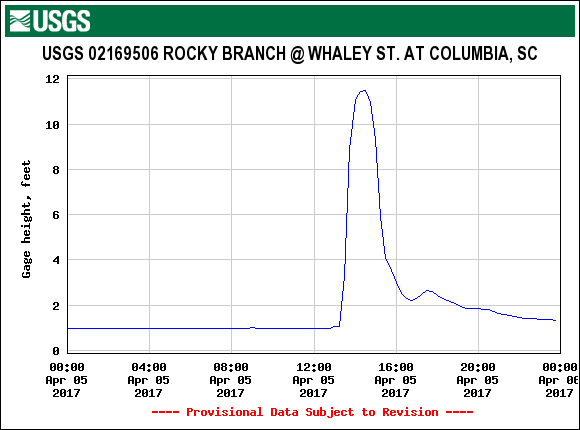
Stream height data from Rocky Branch in Columbia, SC on April 5, 2017
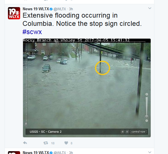
Columbia, SC flooding seen from webcam at Whaley Street on April 5, 2017 (Image from WLTX Twitter Page)
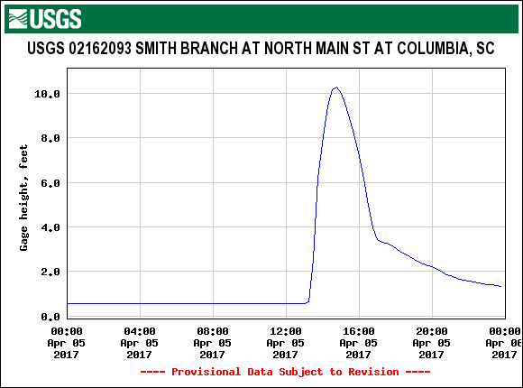
Stream height data from Smith Branch in Columbia, SC on April 5, 2017
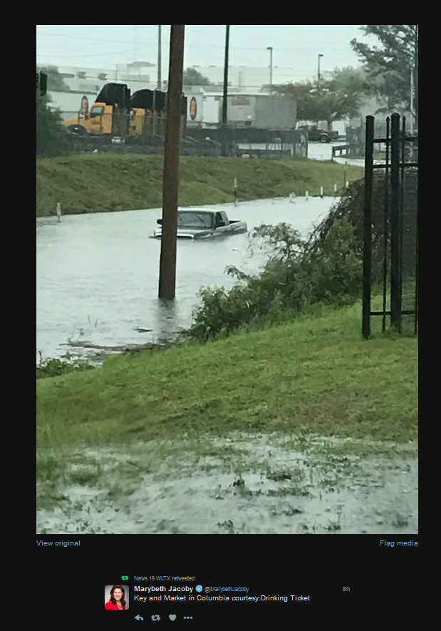
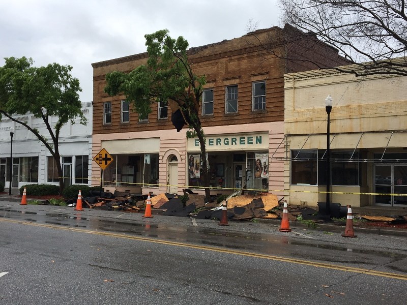
Columbia, SC flooding at Market Street on April 5, 2017
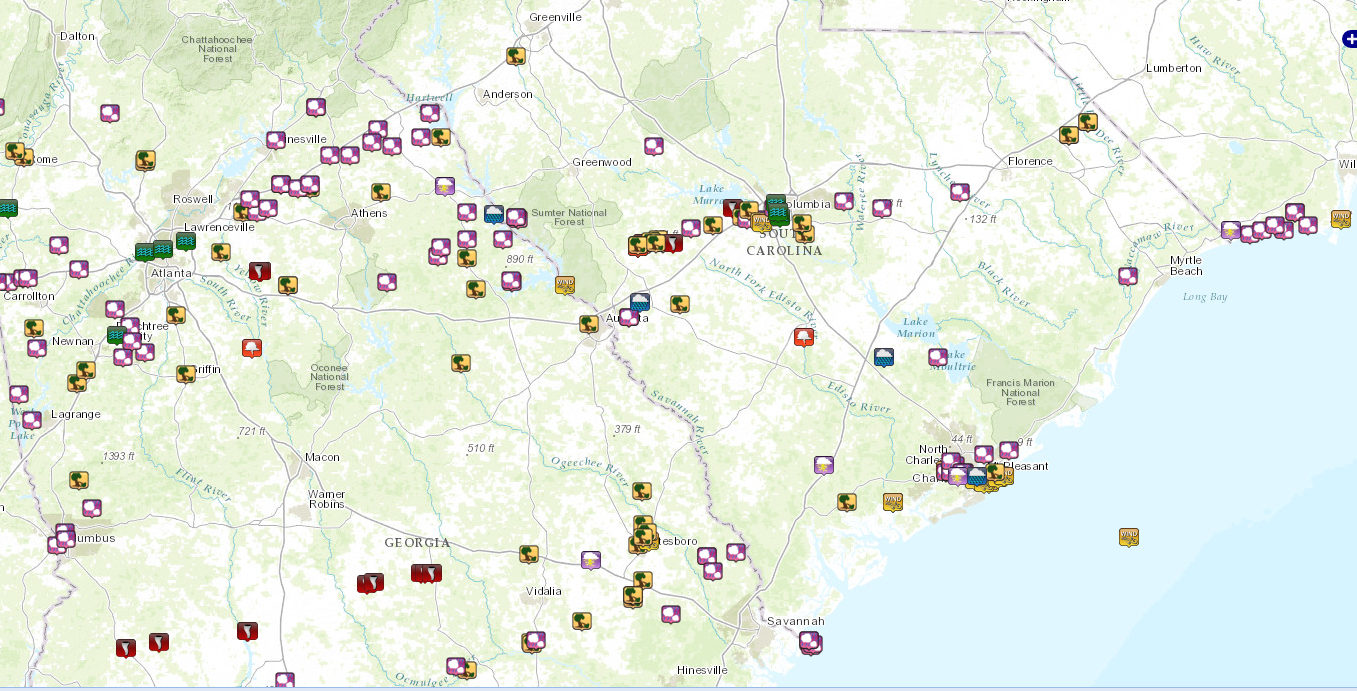
April 5, 2017 Storm reports map (tree icons represents wind damage, pink icons represent hail, red icons represent tornadoes)


 Follow us on YouTube