Detroit/Pontiac, MI
Weather Forecast Office
| Overview | Radar | SPC Products |
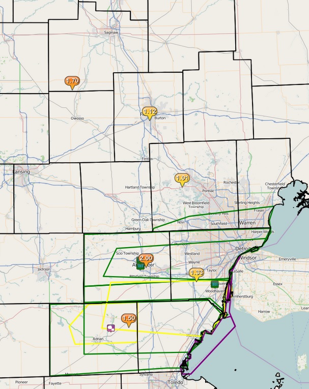
Southern locations of Southeast Michigan saw heavy rainfall over the past couple of days and this day was no different. Along with heavy rain that resulted in flooding, the warm front sparked off some strong thunderstorms that rolled across Lenawee, Monroe, Wastenaw, and Wayne counties. Penny size hail accomanyied the initial severe thunderstorm warning with reports of flooding preceding the rest of the event.
Back to top
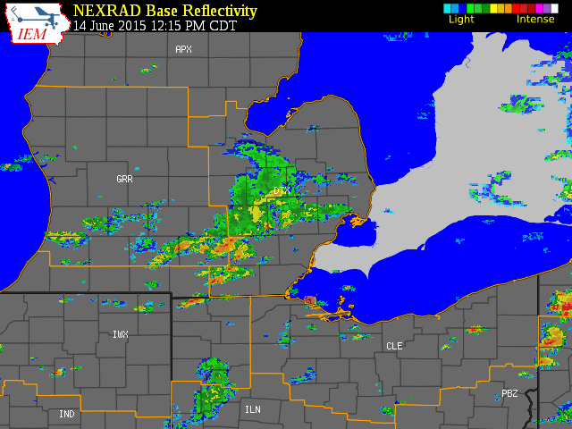 |
| Radar loop courtesy of Iowa Environmental Mesonet (IEM). Larger yellow box is a severe weather watch, smaller yellow boxes are severe thunderstorm warnings, and blue boxes are special marine warnings. |
|
|
| Image courtesy of Iowa Environmental Mesonet (IEM). Yellow boxes are severe thunderstorm warnings, red box is a tornado warning, and purple boxes are special marine warnings. Local Storm Reports (LSR) are also shown plotted on the map. |
|
|
Back to top
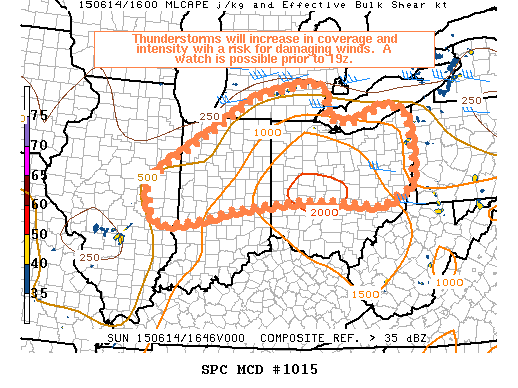
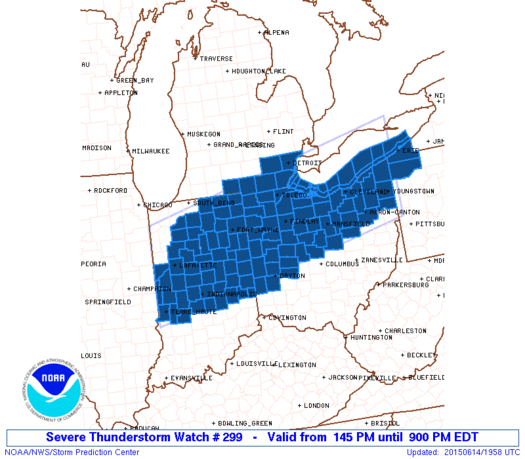
SPC Products (More details can be found by clicking on the images)
Weather Forecasts
Fire Weather
Snowfall Forecast
Marine Forecast
Beach Forecast
Aviation
Digital Forecast Graphics
Current Weather Conditions
Local Observations
Today's Weather History
Observed Snowfall
Regional Radar Mosaic
Past Weather Records
Climate records by month
Additional Daily Climate Data
Top 20 Lists
Breakdown by Decade
Largest Snowstorms
Season Snowfall Maps
Year To Date Plots
Severe Weather
Daily Plots
Annual Plots
Event Summaries
US Dept of Commerce
National Oceanic and Atmospheric Administration
National Weather Service
Detroit/Pontiac, MI
9200 White Lake Road
White Lake, MI 48386
248-620-9804
Comments? Questions? Please Contact Us.