Detroit/Pontiac, MI
Weather Forecast Office
| Overview | Radar | SPC Products |
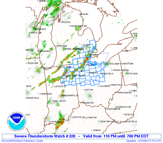
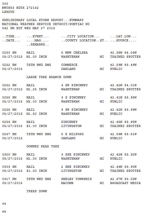
Severe weather broke out along and ahead of a cold front early Wednesday afternoon. A Severe Thunderstorm Watch was issued at 1pm with Severe Thunderstorm Warnings being issued across Monroe and Wayne Counties early in the afternoon. Severe Thunderstorm Warnings were also issued across Southern Livingston, Oakland, Macomb, and St. Clair Counties. Damage consisted of 1-2 inch diameter hail across Livingston County with several trees downed across Oakland and Macomb Counties.
Back to top
|
|
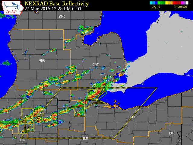
| Radar loop courtesy of Iowa Environmental Mesonet (IEM). Larger yellow boxes are severe thunderstorm watches, smaller yellow boxes are severe thunderstorm warnings, and green boxes are special marine warnings. |
|
|
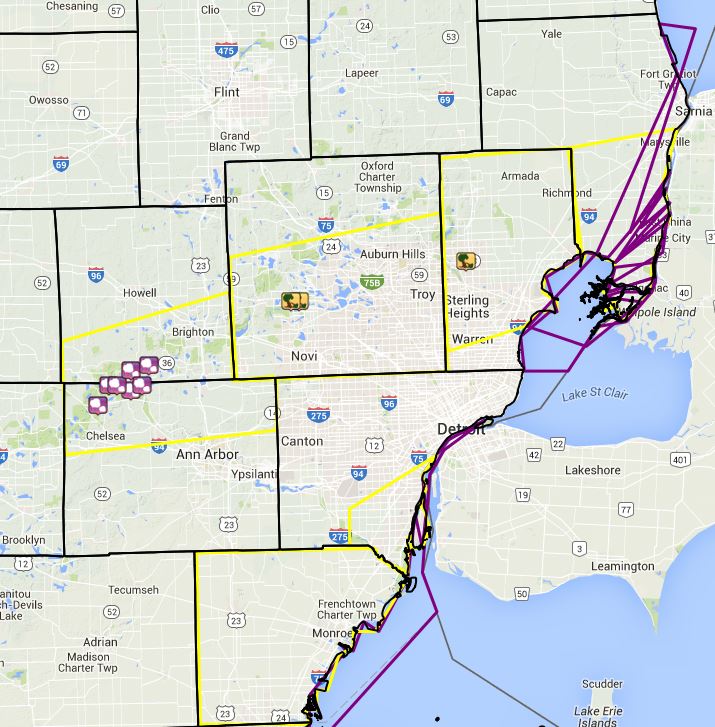
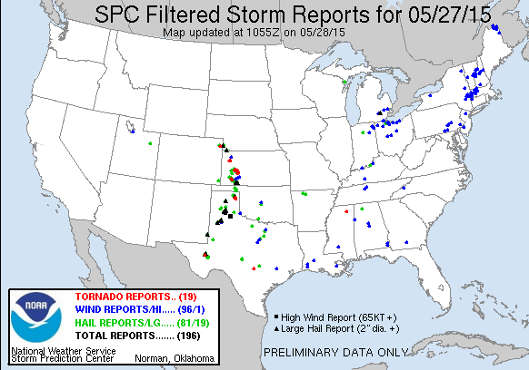
| Image courtesy of Iowa Environmental Mesonet (IEM). Yellow boxes are severe thunderstorm warnings and purple boxes are special marine warnings. Local Storm Reports (LSR) are also shown plotted on the map. |
|
|
Back to top
SPC Products (More details can be found by clicking on the images)
Weather Forecasts
Fire Weather
Snowfall Forecast
Marine Forecast
Beach Forecast
Aviation
Digital Forecast Graphics
Current Weather Conditions
Local Observations
Today's Weather History
Observed Snowfall
Regional Radar Mosaic
Past Weather Records
Climate records by month
Additional Daily Climate Data
Top 20 Lists
Breakdown by Decade
Largest Snowstorms
Season Snowfall Maps
Year To Date Plots
Severe Weather
Daily Plots
Annual Plots
Event Summaries
US Dept of Commerce
National Oceanic and Atmospheric Administration
National Weather Service
Detroit/Pontiac, MI
9200 White Lake Road
White Lake, MI 48386
248-620-9804
Comments? Questions? Please Contact Us.