| Overview | Radar | Damage Surveys |
A sharp cold front interacted with a record warm airmass over Southeast Michigan during the morning of November 6. A narrow line of showers developed along the front and raced across the region between 5 and 8 am. Some of the particularly intense showers were able to pull down strong winds located just above the surface, resulting in several reports of wind damage. The strongest wind gusts were located around the Tri-Cities and Thumb regions. There was one particularly strong swath of downburst winds just south and east of Bad Axe, estimated at up to 85 mph. The Huron County Memorial Airport just south of Bad Axe recorded a wind gust of 73 mph.
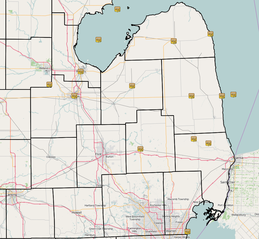
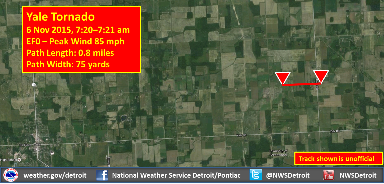
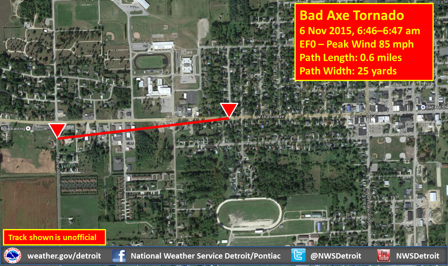
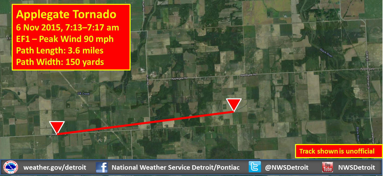
Along the line of showers, a few surges of stronger winds develop, which allowed three brief tornadoes to spin up. Two of the tornadoes that occurred near Bad Axe and Yale were rated EF-0 with peak winds of 85 mph, and one near Applegate was rated EF-1 with peak winds of 90 mph. These three tornadoes doubled the previous number of November tornadoes in Southeast Michigan from 3 to 6 (since 1950). Two of the tornadoes occurred between 7 and 8 am, making these the first tornadoes to occur during this hour on record. Please see the "Damage Surveys" section below for more information on the tornadoes.
.gif)
| Radar loop courtesy of Iowa Environmental Mesonet (IEM). |
|
|
| Image courtesy of Iowa Environmental Mesonet (IEM). Local Storm Reports (LSR) are also shown plotted on the map. |
|
|
Text Summary of Local Storm Reports
Text Listing of Peak Recorded Wind Gusts
Back to top
Bad Axe EF0 and downburst winds and Applegate EF1
Tornado Tracks:
 |
 |
|
| Bad Axe EF0 | Applegate EF1 | Yale EF0 |
Back to top