Detroit/Pontiac, MI
Weather Forecast Office
Overview
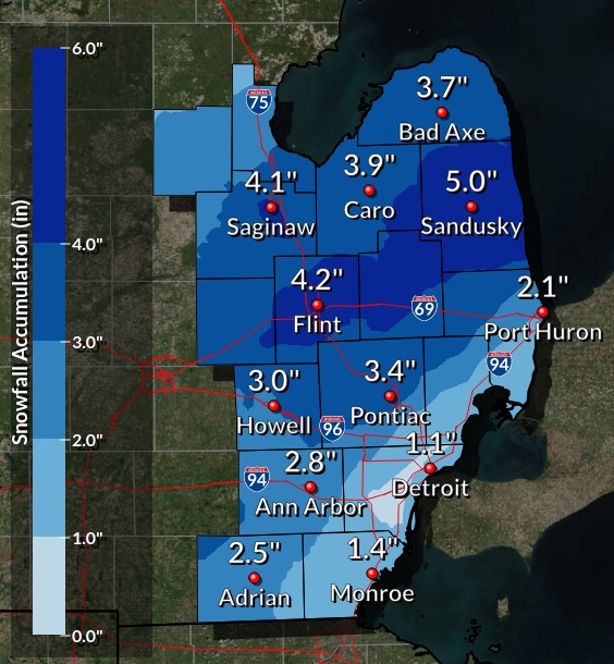
A strong low pressure system brought all kinds of weather to Southeast Michigan to round out the work week. Southerly flow out ahead of the system on Thursday allowed temperatures to soar into the upper 50s melting much of the snow from earlier in the week! This warmth was short-lived as cold, arctic air came back in with a vengeance early Friday morning. Northwesterly flow behind the frontal boundary plummeted temperatures back into the 20s as it moved southeast across the area. Rain overnight on Thursday and into early Friday, changed over to freezing rain for a short time before changing over to all snow. A Winter Weather Advisory was issued on Friday for freezing rain and heavy snow that made the morning commute a challenge. Snow amounts across Southeast Michigan ranged from 1 to 5 inches. The snow finally ended by Friday afternoon, leaving behind snow-covered ground and cold temps once again.Snowfall Map
 |
Radar:
Header
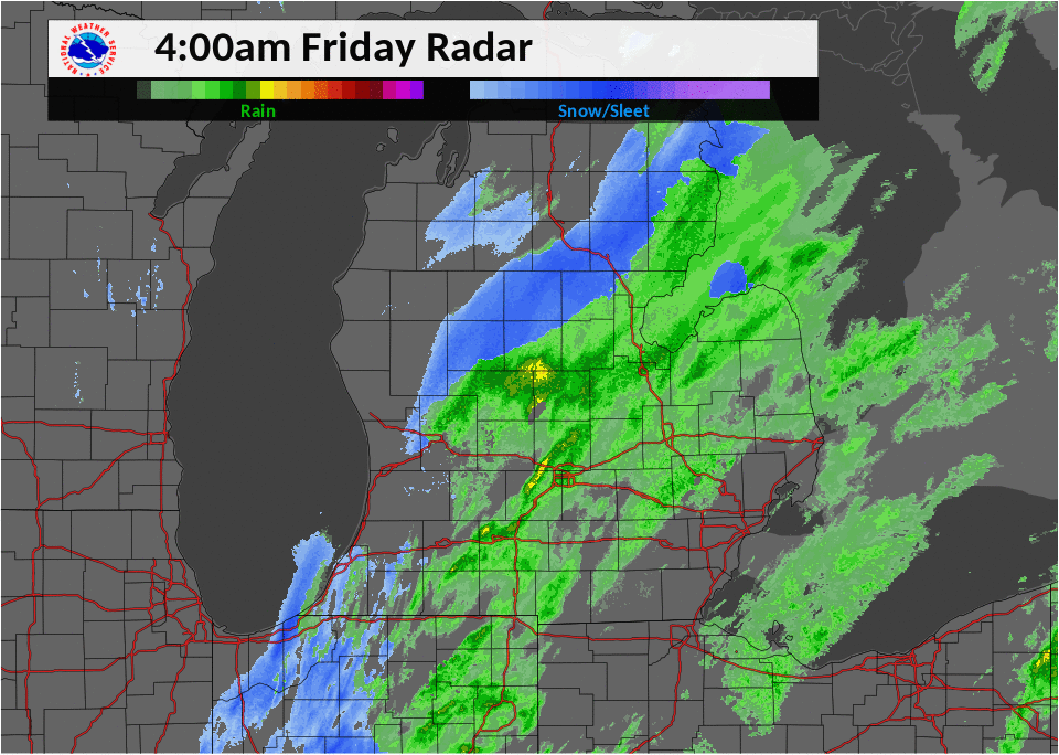 |
| Radar loop as rain changed from freezing rain/sleet to snow Friday morning. |
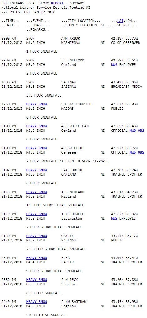
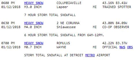
Storm Reports
 |
Media use of NWS Web News Stories is encouraged! Please acknowledge the NWS as the source of any news information accessed from this site. |
|
Weather Forecasts
Fire Weather
Snowfall Forecast
Marine Forecast
Beach Forecast
Aviation
Digital Forecast Graphics
Current Weather Conditions
Local Observations
Today's Weather History
Observed Snowfall
Regional Radar Mosaic
Past Weather Records
Climate records by month
Additional Daily Climate Data
Top 20 Lists
Breakdown by Decade
Largest Snowstorms
Season Snowfall Maps
Year To Date Plots
Severe Weather
Daily Plots
Annual Plots
Event Summaries
US Dept of Commerce
National Oceanic and Atmospheric Administration
National Weather Service
Detroit/Pontiac, MI
9200 White Lake Road
White Lake, MI 48386
248-620-9804
Comments? Questions? Please Contact Us.

