Summary of the September 16, 2009 El Paso County Hail Storms |
| On September 16, 2009, two large supercell thunderstorms developed over El Paso county. Both of these storms produced golf ball-sized hail. The second of the two storms moved across the heart of El Paso's east side, and then moved to the southeast along Interstate 10. Damage from the storm is estimated at over $150 million. This would make it the costliest hail storm in the history of El Paso. During the morning of Wednesday September 16th, a cold front pushed into the area from the east. This front brought with it slightly cooler temperatures and moist air. But, more importantly, it ushered in some strong easterly winds. In the middle and upper part of the atmosphere, an upper level low was dropping south along the Arizona/New Mexico border. Out ahead of this system were some strong westerly winds. Among the ingredients needed to help develop supercell thunderstorms are winds that turn (or change direction) in the atmosphere. In our case, we had strong southeasterly winds at the surface with strong westerly winds aloft. A perfect environment for the development of supercell thunderstorms. The first supercell developed over southern Otero County in New Mexico, just to the north of El Paso a little after 2 PM. This storm quickly became severe and dropped to the southeast. The storm moved over far east El Paso County which is sparsely populated and produced golf ball-sized hail at the Hueco State Park headquarters just north of Montana. This storm continued to drop to the southeast and weakened as it moved across western Hudspeth County. A little before 4 PM the second supercell developed almost directly over the El Paso International Airport. Like the first storm, it quickly became severe and began to move to the southeast. The storm strengthened and begin dropping golf ball size hail over a large swath of El Paso's east side. The storm continued to move to the southeast, over and alongside Interstate 10, over numerous residential areas and business districts. The storm finally weakened as it moved across southern El Paso County. |
|
|
 |
|
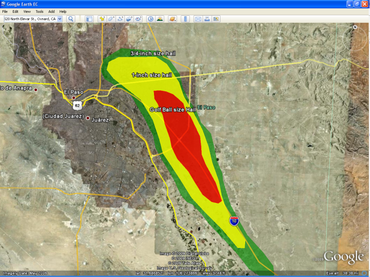
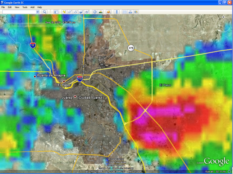
Fig. 1 Approximate hail swaths based on radar data and spotter reports
|
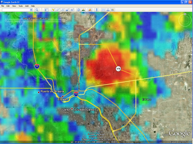 |
| Fig. 2 The supercell develops almost directly on top of the El Paso International Airport. The weather observer at the airport reported one inch diameter hail. |
 |
|
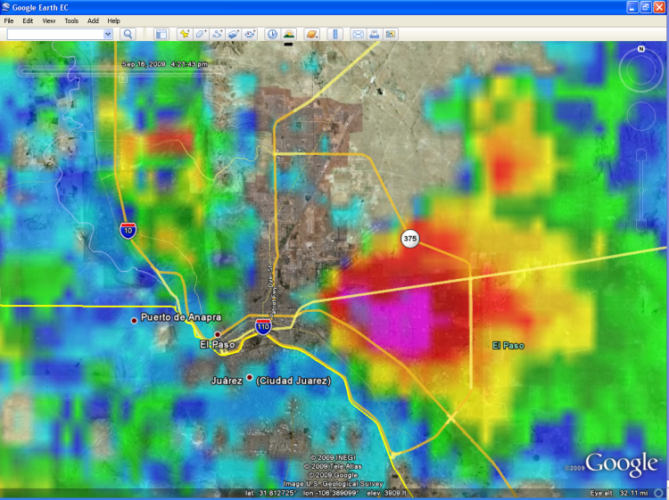
Fig. 3 The supercell began moving southeast. It was shortly after this that the storm began producing golf ball-sized hail.
|
 |
|
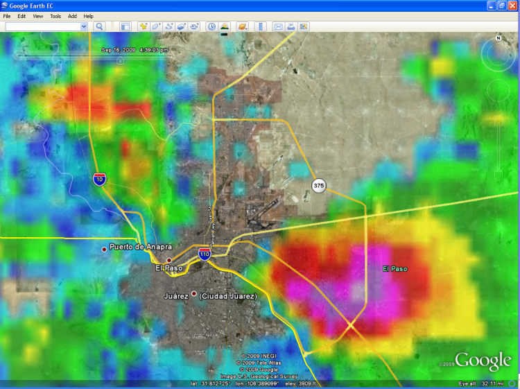
Fig. 4 The supercell continued to move southeast and produced a wide swath of golf ball-sized hail.
|
 |
|
Fig. 5 To make matters worse, the supercell moved right along Interstate 10 during rush hour. It was still producing golf ball-sized hail at this point.
|
 |
|
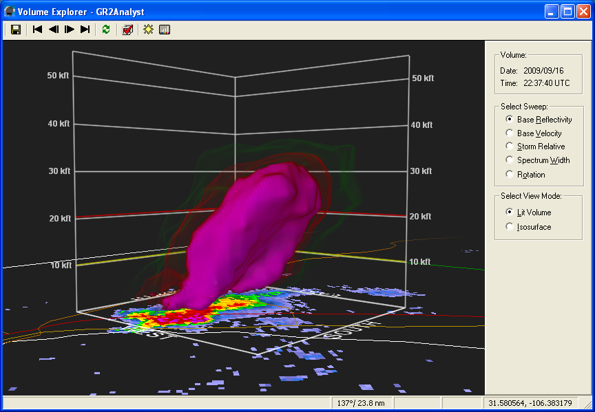
Fig. 6 This is a 3D image of the storm's hail core. As you can see, the hail core extended 30,000 feet above the ground.
|
 |
|
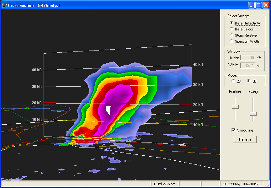
Fig. 7 If you cut the supercell in half, this is what you would see. This image depicts the cross section of the storm
|
  |
|
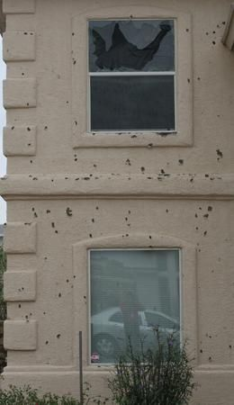
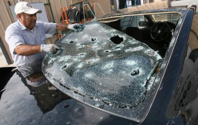
Fig. 8 Home and auto damaged by hail. Photos courtesy the El Paso Times.
|
|
Other storm resources: View the radar loop and hail swaths in Google Earth |

