Atlanta/Peachtree City, GA
Weather Forecast Office
April 3, 2015 Dade County Tornado
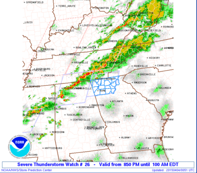
A cold front moved into northwest Georgia Friday night (April 3, 2015) and brought with it a line of showers and thunderstorms. The storms were expected to be strong enough to produce damaging wind and hail and thus a Severe Thunderstorm Watch was in effect for parts of north Georgia Friday night.
During this event, three Severe Thunderstorm Warnings and one Tornado Warning were issued.
Dade County:
The tornado moved across Dade County on April 3, 2015. It uprooted one tree and multiple large tree limbs came down. The tornado touched down just west of I-59, moved across the interstate and ended just east of the interstate.The total path length was approximately 560 ft.
|
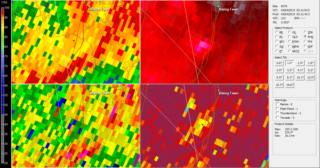 |
| Weak Radar Signature of the Dade County Tornado Reflectivity (Upper Left), Velocity (Upper Right), ZDR (Lower Left) and Correlation Coefficient (Lower Right) |
Current Hazards
Local Storm Reports
Local
Submit Storm Report
Outlooks
Georgia Road Conditions
Nationwide
Forecasts
Graphical
Aviation Weather
Activity Planner
Recreational Forecast
Fire Weather
Forecast Discussion
Incident Support
Tropical Weather
Local
Computer Models
Current Weather
Observations
Maps
Rivers/Lakes
Satellite Images
Radar Imagery
Nationwide
Warner Robins
Peachtree City
Regional Loop
US Dept of Commerce
National Oceanic and Atmospheric Administration
National Weather Service
Atlanta/Peachtree City, GA
4 Falcon Drive
Peachtree City, GA 30269
770.486.1133
Comments? Questions? Please Contact Us.

