|
||||||||||||||||||||
| Complete Tornado Track Map
|
||||||||||||||||||||
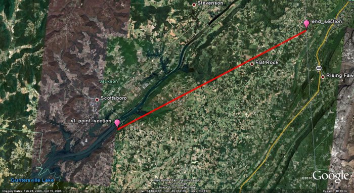
Zoomed in Image of Track From: NE of Section near Highway 35 to Pisgah to Flat Rock |
||||||||||||||||||||
|
|
||||||||||||||||||||
 |
||||||||||||||||||||
|
The image above depicts the southern portion of this tornado track through the Pisgah community and further northeast. |
||||||||||||||||||||
|
|
||||||||||||||||||||
|
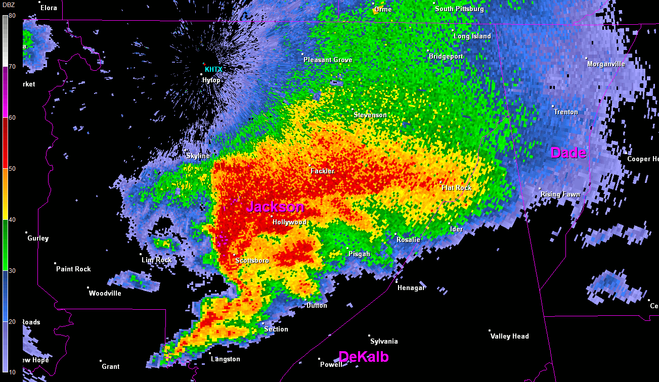
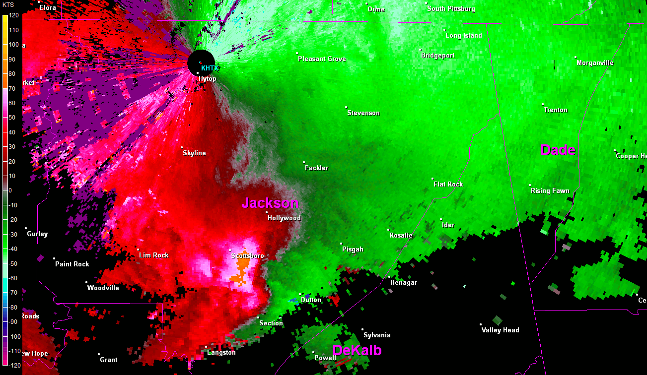
A violent long-track tornado began its life about 3 miles northeast of Section as an EF-0 to EF-1 tornado with peak wind speeds of 70 to 90 mph snapping or uprooting several soft and hardwood trees. The tornado rapidly intensified to high end EF-3 to low end EF-4 strength within a matter of minutes with peak wind speeds of 150 to 170 mph and a path width of 1/2 to 3/4 mile as it roared into areas northeast of Pisgah and north of Rosalie. Residents interviewed remarked that this tornado was multi-vortex with up to three tornadoes merging into one very large tornado. There was some evidence of this in the damage swath, but an aerial survey may prove more telling. This tornado demolished several mobile homes and block foundation homes in its path, and snapped or uprooted thousands of trees. Numerous trees were debarked in the process. The tornado leveled at least two mobile homes and swept their remains hundreds of yards downwind. Three were killed in three separate homes along this first part of the tornado's path. Several vehicles were launched or swept several yards in different directions, in a few cases up to 50 yards away from their initial location. The Friendship Church roof was heavily damaged. Several farms were also affected, with barns and chicken houses heavily damaged or destroyed. As the tornado continued its track, it intensified even further to high-end EF-4 intensity with peak winds of up to 190 mph as it approached the Flat Rock and Higdon communities. The tornado killed another three from the same family at a residence southwest of Flat Rock. The tornado mowed down thousands of trees in a 1/2 to 3/4 mile path width. One well-built block foundation home literally exploded as the tornado struck, lifting and sweeping all its structure and contents downwind, in some cases several hundred yards. However, miraculously, a mother and three children taking refuge in a hallway were completely unharmed. At this farm, all fencing was destroyed and up to 19 cattle were killed. Two chicken barns were completely obliterated and swept away unidentifiably. A propane tank was lifted from the previous location of chicken barns and dropped over 100 yards away in front of the destroyed home. |
||||||||||||||||||||
|
|
||||||||||||||||||||
|
||||||||||||||||||||


 Local Radar
 Weather Map
 Follow us on YouTube