|
||||||||||||||||
|
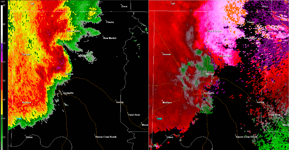
This tornado formed in association with a secondary circulation that developed a few miles south of a pre-existing tornado. The second tornado touched down west of the intersection of Huntsville Brownsferry Road and Neely Road, and moved east-northeast before dissipating near Tanner. This weak/brief tornado primarily uprooted trees and caused damage to signage near Tanner High School. |
||||||||||||||||
Radar Data |
||||||||||||||||
|
||||||||||||||||


 Local Radar
 Weather Map
 Follow us on YouTube