|
||||||||||||||||
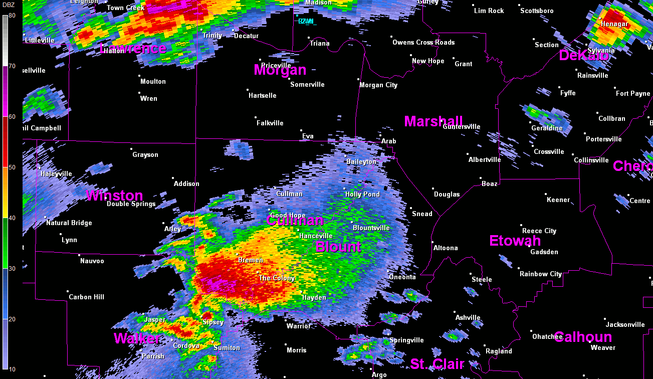
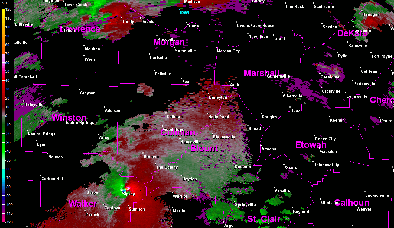
Radar Data
|
||||||||||||||||
|
|
||||||||||||||||
|
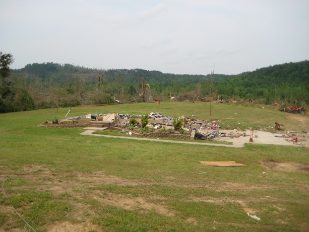
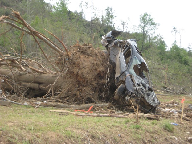
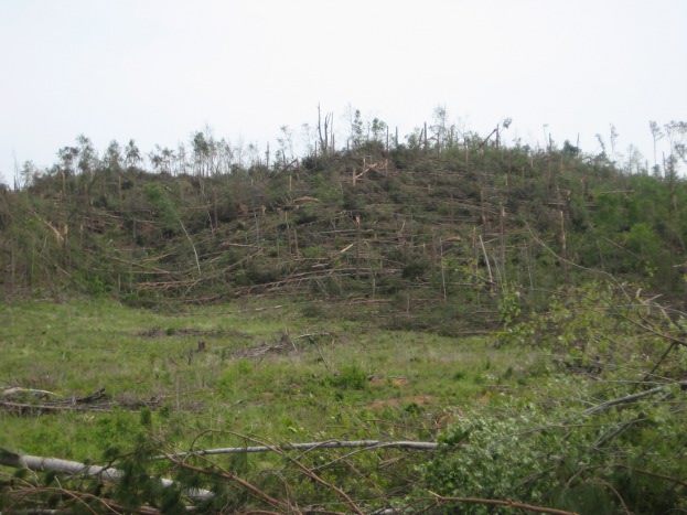
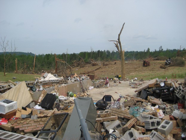
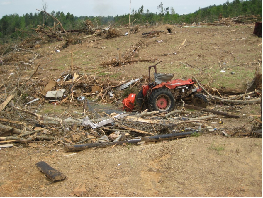
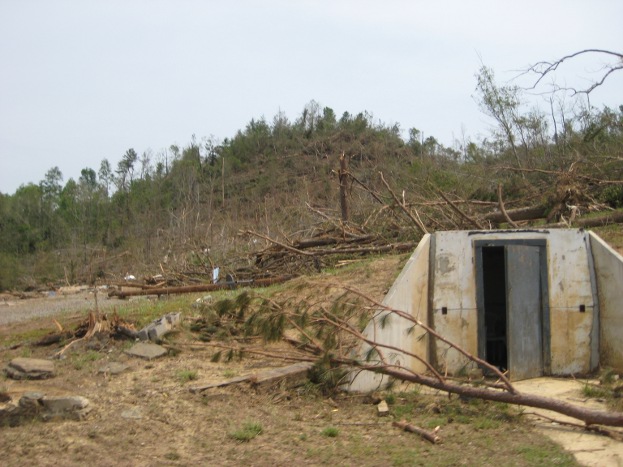
A large long track EF-4 tornado continued its track northeastward itno the Huntsville County Warning Area (CWA) and moved across the very southern tip of Cullman County, from about 3 miles southwest of Arkadelphia to just over 2 miles ESE of Arkadelphia. This tornado then tracked out of the Huntsville CWA into Blount County. In Cullman County, a wide swath of pine and hardwood trees was found snapped at the bases or splintered several feet off the ground, with some debarking of trees. South of Hwy 91 along Washington Loop, several homes were damaged or destroyed. A mobile home was obliterated and the frame was found at least 200 yards to the east up a hill. A cinder block home was wiped out, with the contents landing across the road, while the cars nearby were tossed. A truck landed in a nearby hollow at least 50 yards away while a sedan was smashed as it landed about 130 yards away. Farming equipment in a barn was displaced into the hollow, including a hay baler and a tractor. The storm shelter by the residence was partially lifted and damaged. The person inside received minor injuries. Additional homes and buildings nearby were destroyed and only a few trees were left standing or not debarked. The main damage path was fairly well confined, as a well built home just at the edge of the track only sustained minor roof damage. |
||||||||||||||||
|
Track SW of Arkadelphia and along the Eastern Cullman/Western Blount county line.
|
||||||||||||||||
Tornado Damage Photos
|
||||||||||||||||
|
The tornado continued northeast and crossed between the Blount and Cullman county borders several times decreasing from EF2 strength to EF1 intensity. Below is another imageof the path further northeast as it kept meandering back and forth along the eastern Cullman/western Blount county line. |
||||||||||||||||
|
Continued track along the Eastern Cullman/Western Blount county line.
|
||||||||||||||||
|
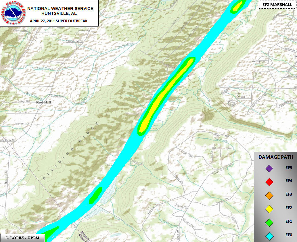
As the tornado crossed into Blount county and a final time and continued to move northeastward, its intensity increased to EF3 criteria as winds reached a range of 130 mph to 160 mph. Below is a zoomed in image of the track across northern Blount county and southern Marshall county. |
||||||||||||||||
|
Track across northern Blount and southwestern Marshall counties.
|
||||||||||||||||
|
Click on the image above to display an experimental contoured map created by Suheiley Lopez (UPRM) dipicting the strength of damage indicators seen along the track during NWS storm surveys.
|
||||||||||||||||
|
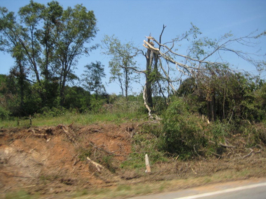
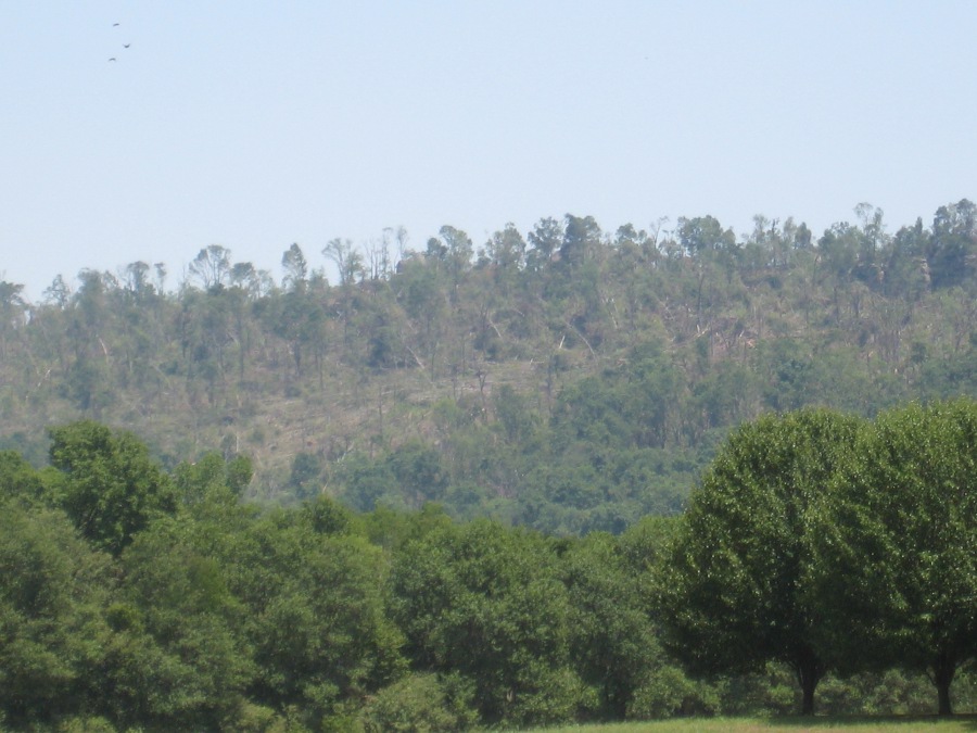
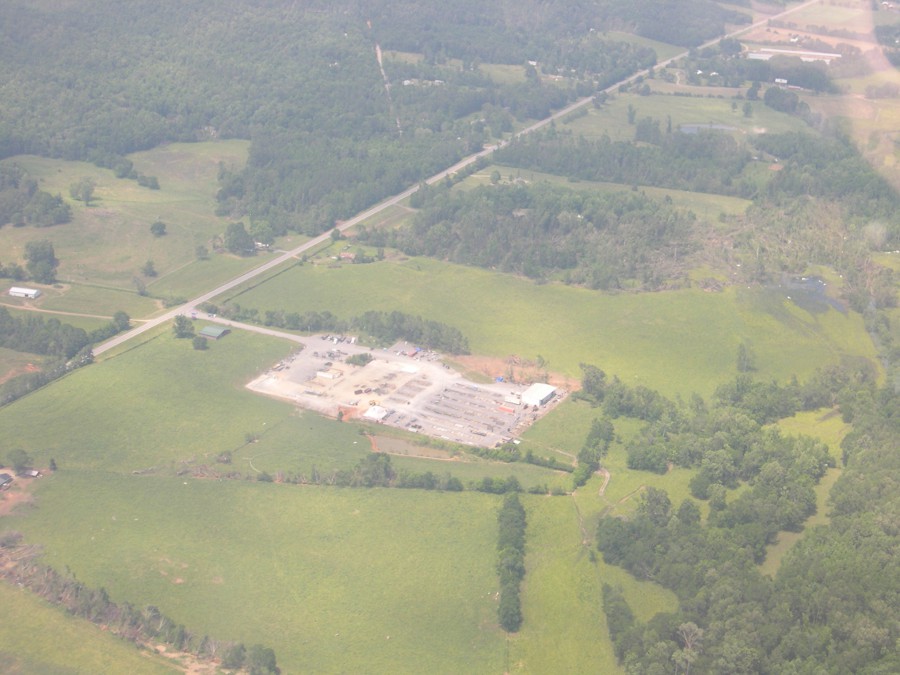
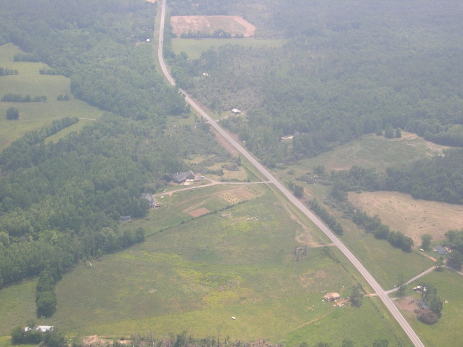
This tornado continued its track across the Blount/Marshall county line along a heavily wooded ridgeline between Highway 79 and Diamond Road. Aerial photography confirms the tornado tracked northeast along this ridgeline doing significant damage to a house just inside the Marshall County line, as well as snapping and uprooting numerous trees. The tornado crossed Highway 79 between mile marker 56 and 57, snapping a few trees and causing damage to the roof of a shed near a residence. Just northeast of this point, the tornado appeared to briefly strengthen (EF-2), completely destroying an industrial plant (Ferguson Industries). The tornado continued northeast moving again over heavily wooded terrain just east of Highway 79. The damage path along this ridgeline can be seen from Highway 79 and aerial pictures confirm this track. |
||||||||||||||||
|
||||||||||||||||
|
Beyond this point several miles south of Highway 431, little additional damage can be confirmed from this tornado. Radar data also suggests that this storm (supercell) was undergoing a transformation period causing the tornado to weaken and eventually lift.
|
||||||||||||||||
| ** Note: this supercell later spawned another tornado that devastated the town of Rainsville (DeKalb County) and moved northeast across the AL/GA state line. This tornado, initially rated an EF-4, was recently upgraded to an EF-5 based on the damage northeast of Rainsville.
https://www.srh.noaa.gov/bmx/?n=event_04272011cordova
|
||||||||||||||||


 Local Radar
 Weather Map
 Follow us on YouTube