 Hurricane Awareness Tour stop #2
Beaumont/Port Arthur, Texas
 |
 |
|
Ever been fascinated by hurricanes or wondered how in the world people fly safely into them? Have a passion for flying and love viewing various aircraft? Check out this 2-minute video about what it's like to be a Hurricane Hunter, then mark your calendar for the 2018 Hurricane Awareness Tour in Nederland, Texas on May 8th!
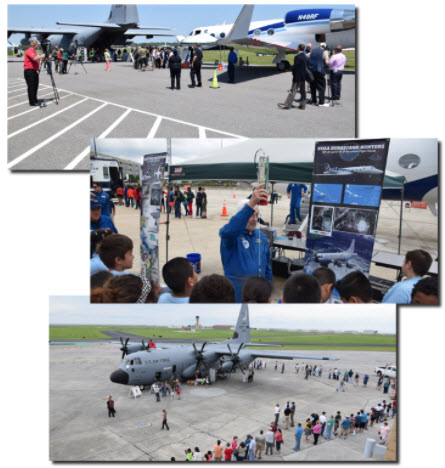
As part of a week-long tour along the Gulf Coast, the NOAA Hurricane Hunters will be making a stop at Jack Brooks Regional Airport. Come tour two of the Hurricane Hunter aircraft, speak with the pilots, and walk through vendor exhibits from various local agencies and organizations. The event is FREE and the public is invited to attend from 2 pm to 5 pm!
|
Event Information
What: 2018 Hurricane Awareness Tour
Where: Jack Brooks Regional Airport
5000 Jerry Ware Dr, Beaumont, TX 77705
When: Tuesday, May 8th, 2 PM to 5 PM
Admission: FREE!
Things To Do:
- Tour Hurricane Hunter aircraft
- Meet the pilots & flight crew
- Speak with hurricane forecasters
- Meet with local National Weather Service meteorologists
- Walk through exhibits from various agencies & organizations
- Learn about weather safety & preparedness
|
 |
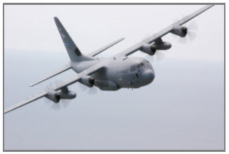 |
WC-130J - "Hercules"
The WC-130J is a high-wing, medium-range aircraft used in weather reconnaissance missions. This plane is configured to penetrate tropical disturbances and storms, hurricanes and winter storms and obtains data on the movement, size and intensity of these systems. The WC-130J is the weather data collection platform for the 53rd Weather Reconnaissance Squadron. It carries a minimal crew of five: pilot, co-pilot, navigator, aerial reconnaissance weather officer and weather reconnaissance loadmaster. The crew collects and reports weather data as often as every minute.
|
|
NOAA Gulfstream IV-SP (G-IV) - "Gonzo"
NOAA’s Gulfstream IV-SP (G-IV) jet is a high-tech, high-flying, and high-speed platform used for hurricane forecasting and research. It is a sophisticated twin-engine jet piloted by NOAA Corps officers and crewed by NOAA civilian engineers and meteorologists. The G-IV flies around and over developing tropical cyclones to create a detailed picture of the surrounding upper atmosphere. It a range of nearly 4,000 nautical miles and a cruising altitude of 45,000 feet.
|
 |
|
|
Directions from Beaumont:
- Take US 69/96/287 south towards Nederland
- Exit at Jerry Ware Dr and turn right
Directions from Orange/Lake CharIes:
- Take Texas 87/Texas 73 south towards Port Arthur
- At the 87/73 split, stay left to remain on Texas 73
- Exit right onto US 69/96/287 north
- Exit at Jerry Ware Dr and turn left
Directions from Port Arthur:
- Take US 69/96/287 north towards Nederland
- Exit at Jerry Ware Dr and turn left
Once on Jerry Ware Dr, head south towards the traffic circle. Parking will be available in the lot on your left as you approach the circle.
|
 |