Killian/I-55/Madisonville, LA Tornado - February 7, 2017
|
Rating:
|
EF-2
|
|
Estimated Maximum Wind:
|
125 mph
|
|
Injuries/Fatalities:
|
3 injuries
|
|
Damage Path Length:
|
23.2 miles
|
|
Maximum Path Width:
|
500 yards
|
|
Approximate Start Point/Time:
|
3 miles S of Killian, LA at 1020 AM CST
|
|
Approximate End Point/Time:
|
2 miles W of Madisonville, LA at 1057 AM CST
|
|
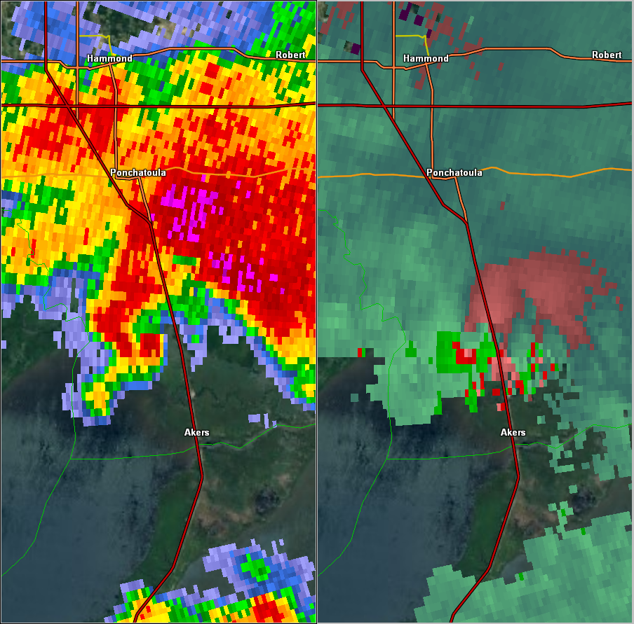
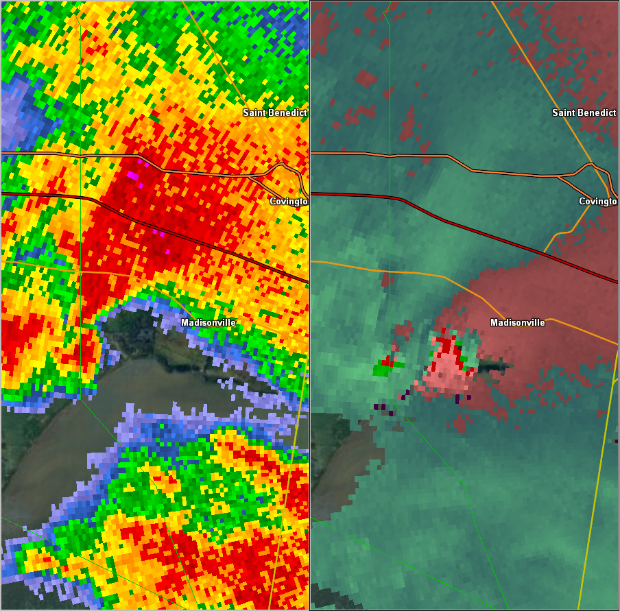
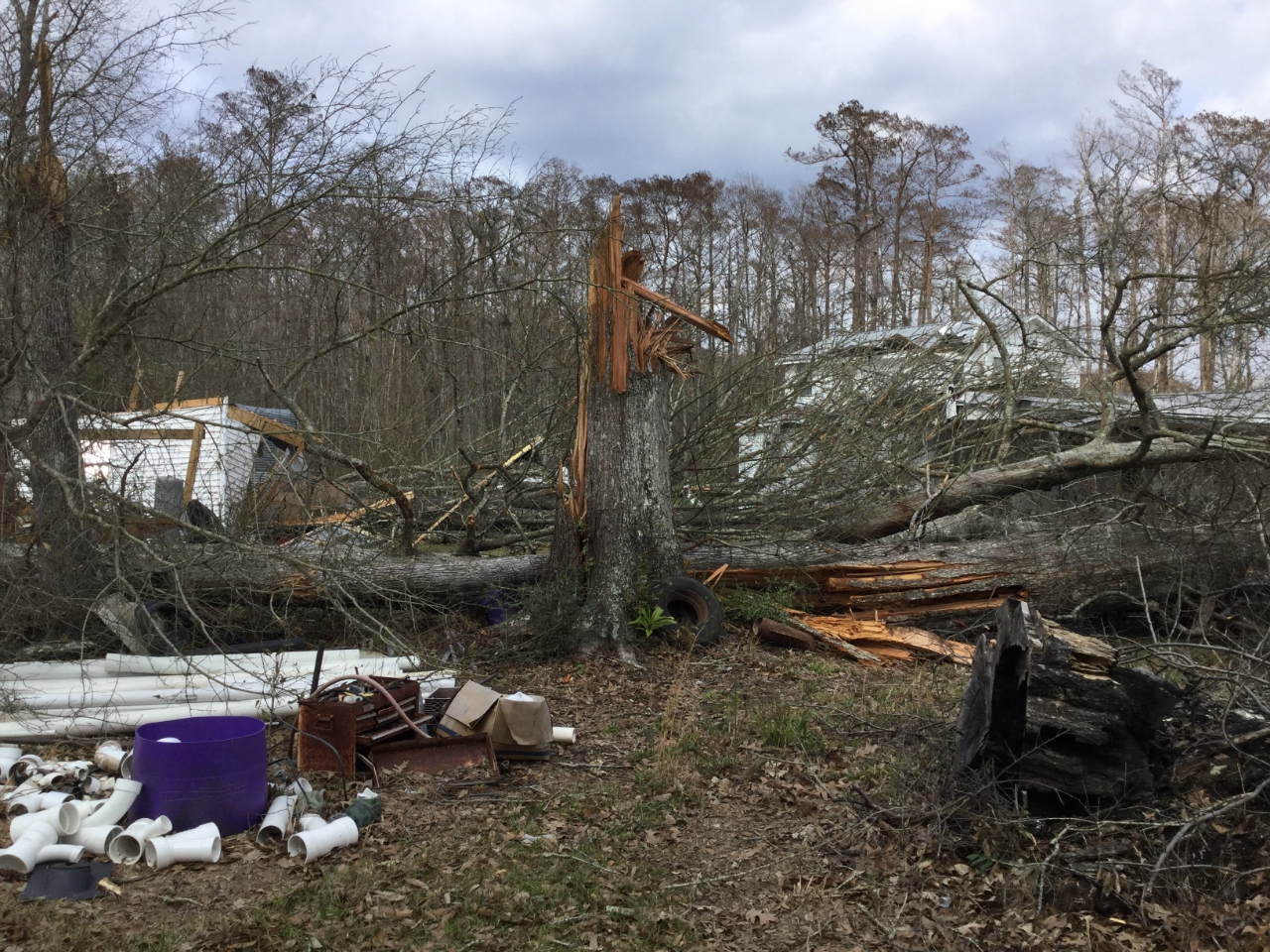
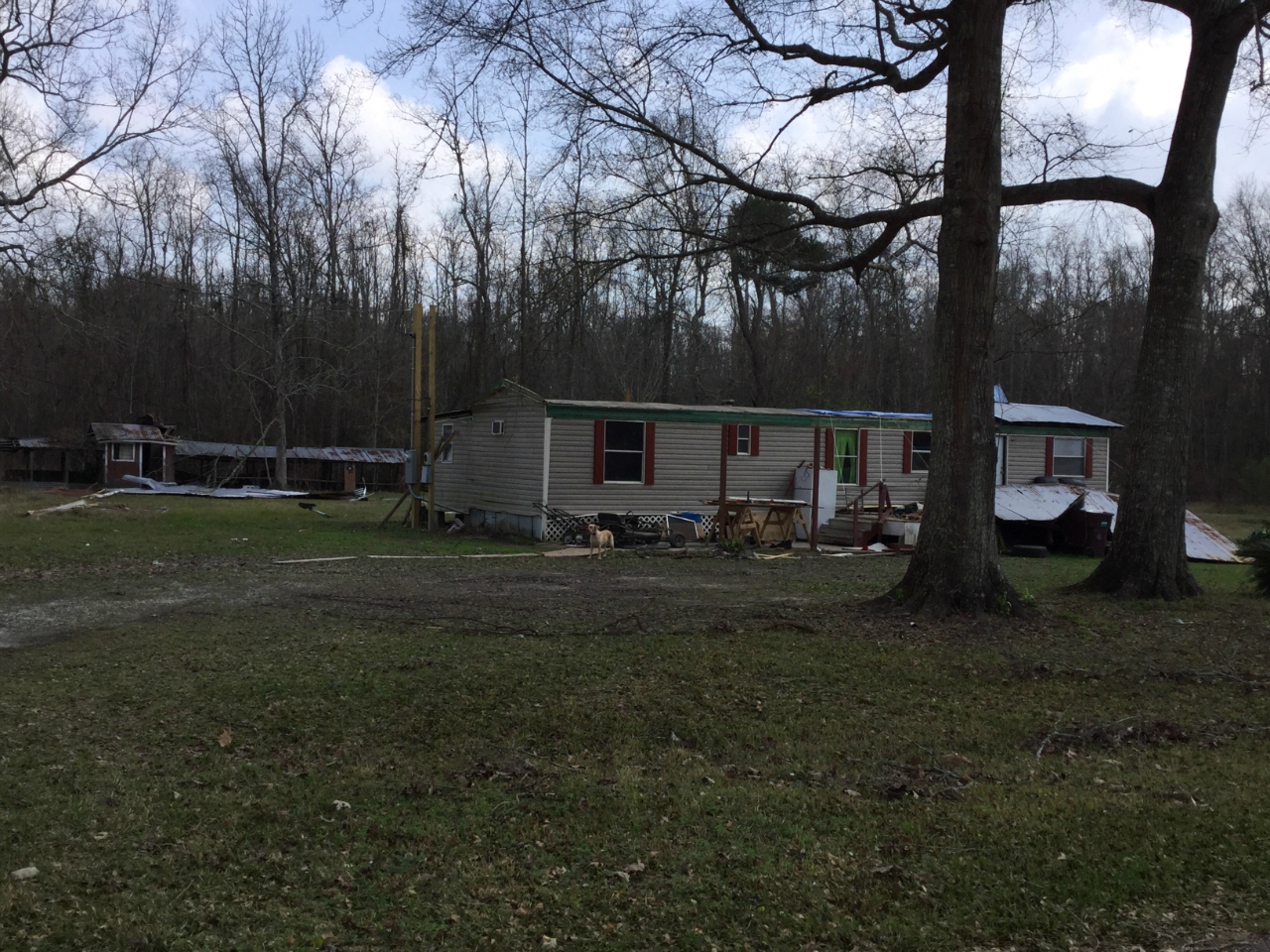
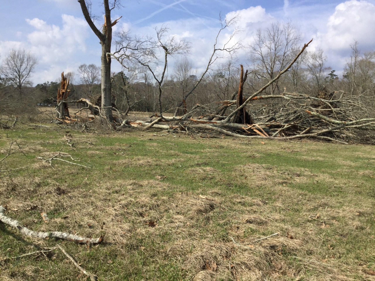
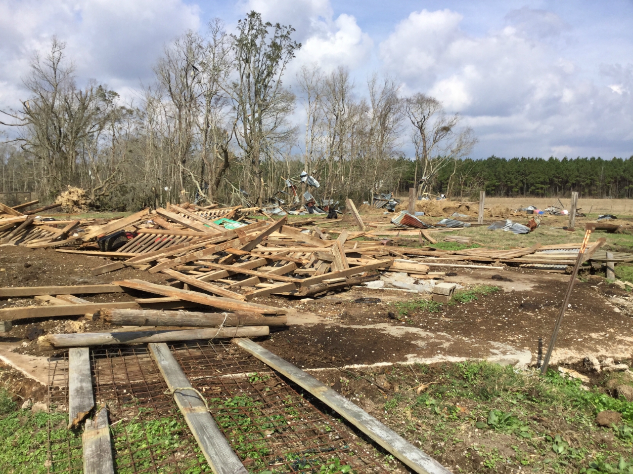
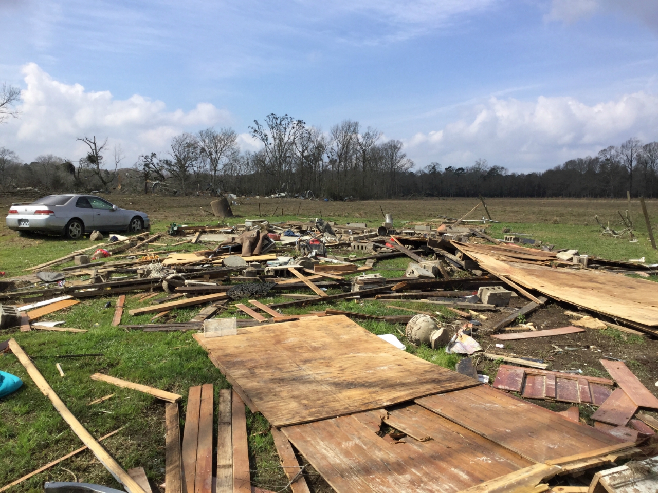
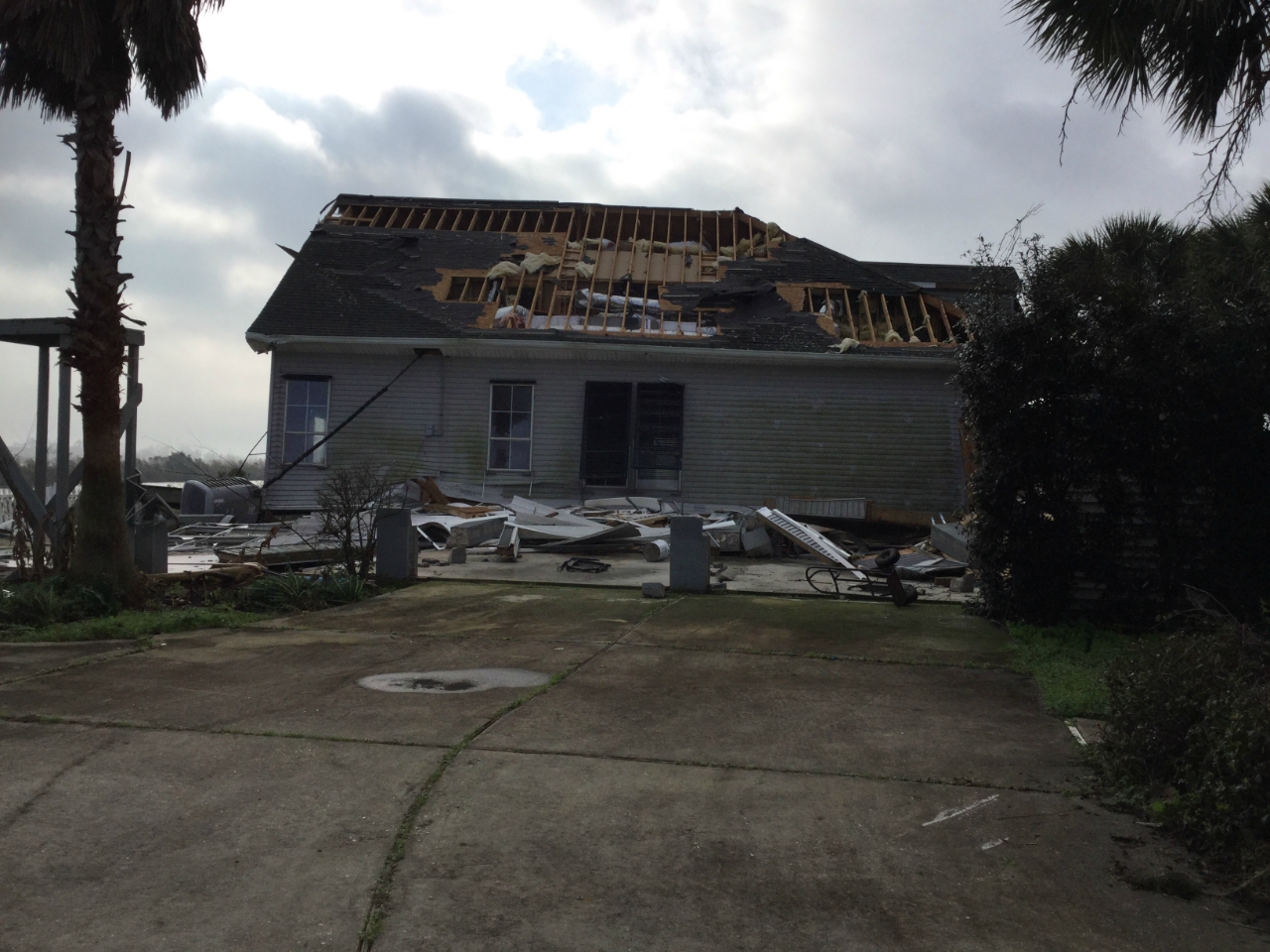
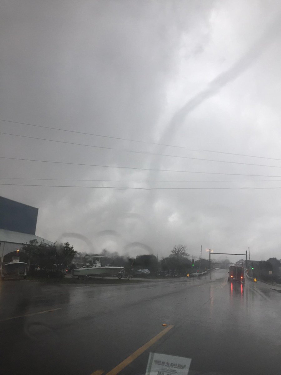
A National Weather Service Damage Assessment Team has surveyed the storm damage near Killian, crossing I-55 at mile marker 19, and near Madisonville, LA. It has been determined the damage was the result of a tornado. The tornado has been rated an EF-2 on the Enhanced Fujita Scale. Damage estimates were consistent with winds of 125 mph. The tornado touched down just off Carthage Bluff Rd where some siding was removed from a single family home and small branches were taken off of trees. The width of the tornado in the area was approximately 75 yards wide, and wind speeds were estimated to be around 80 mph. The tornado then proceeded just north of Carthage Bluff Rd. in a ENE direction, and widened to approximately 150 yards wide. Numerous hardwood trees were snapped and uprooted falling on a home, shed, and several vehicles. Wind speeds were estimated to be around 100 mph in this area. The tornado then widened considerably as it approached a bend in Carthage Bluff Rd around the intersection with Carthage Lane. A single wide mobile home lost a significant portion of the roof on Carthage Bluff Lane, numerous soft and hardwood trees were snapped or uprooted, and a single family home had the chimney collapse and some roofing material removed. The tornado had widened to approximately 350 yards wide at this point. Damage was consistent with a 100 mph EF-1 tornado in this area. The tornado then crossed a large field where several trees were snapped and uprooted. The tornado maintained the same width and intensity as it crossed the field. As the tornado approached a farmstead on Davidson Road, it maintained width, but increased in intensity to an EF-2 tornado with winds of around 115 mph as it destroyed three barns. A single family home stick built single family home was lifted off of an unsecured cinder block foundation and completely destroyed on Davidson Rd. Two people were seriously injured at this spot. Due to the house not being secured to the foundation, the winds were estimated to be around 120 mph in this location. A snapped telephone pole also supports this wind speed in this area. The tornado then crossed Davidson Rd. producing minor to moderate damage to a manufactured home and a single family home on a private lane. Numerous trees were also snapped and uprooted. The tornado remained at 350 yards wide in this area, and maintained EF-2 intensity with winds of around 120 mph. At this point, the tornado moved into a marshy wildlife refuge area with no road access. However, video of the large wedge tornado was taken as it moved across this marshland and then across Interstate 55 around mile marker 19. Due to the lack of access, an intensity rating cannot be given to the tornado as it moved through the marsh land, but an intensity of EF-1 with winds of 105 mph was given to the tornado as it moved across Interstate 55 and numerous trees were snapped and uprooted in this area. The tornado width had also increased to 500 yards at this point. The tornado then continued in a ENE direction across more open marsh land until it reached the Guste Island area of St. Tammany Parish and the Madisonville on the Lake Subdivision. The tornado had contracted back to a width of 350 yards in this area and maintained this width as it moved across both Chenier Rd. and Grand Port Louis Rd. The tornado produced EF-2 damage on Chenier Rd. where a house that was secured to concrete and rebar piers was moved off the foundation. Extensive roof damage was also noted to the house. Winds were estimated to be around 125 mph in this location. The tornado produced extensive tree damage on Grand Port Louis Rd. before dissipating just west of the city of Madisonville over open marsh. |
|
|
|
|
||||||||||||||||||