
Heavy rainfall and flooding concerns continue for portions of Texas into the lower Mississippi Valley. Severe thunderstorms are expected to redevelop across areas of western Texas later Saturday. Meanwhile, strong Pacific storm will move ashore this weekend. Increasing winds for many areas of the West and Southwest, heavy precipitation with snow for the higher terrain. Read More >
Overview
|
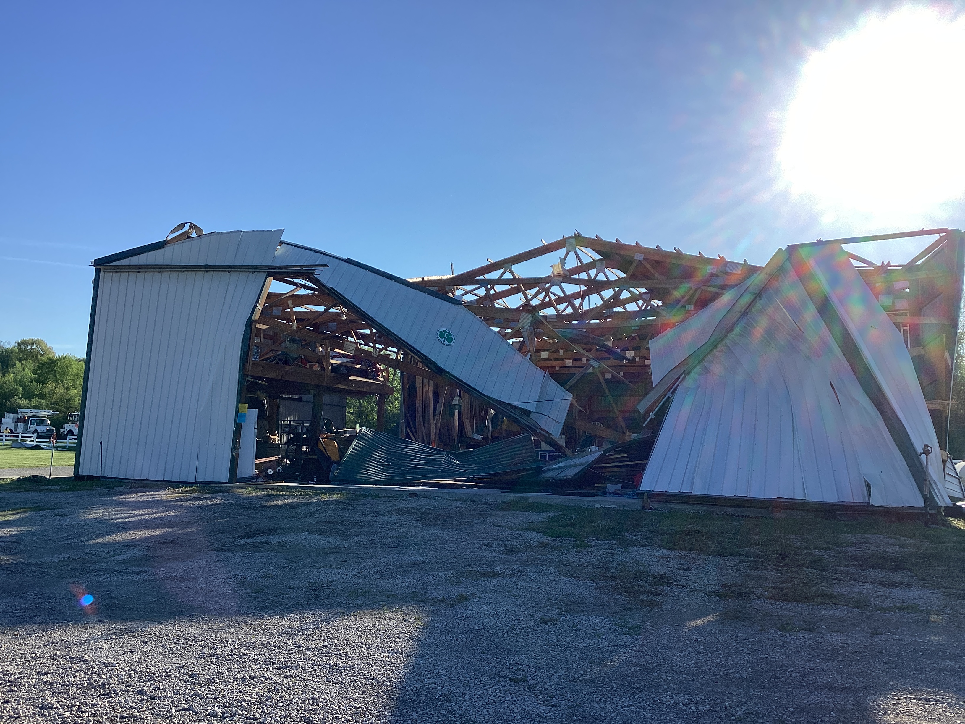
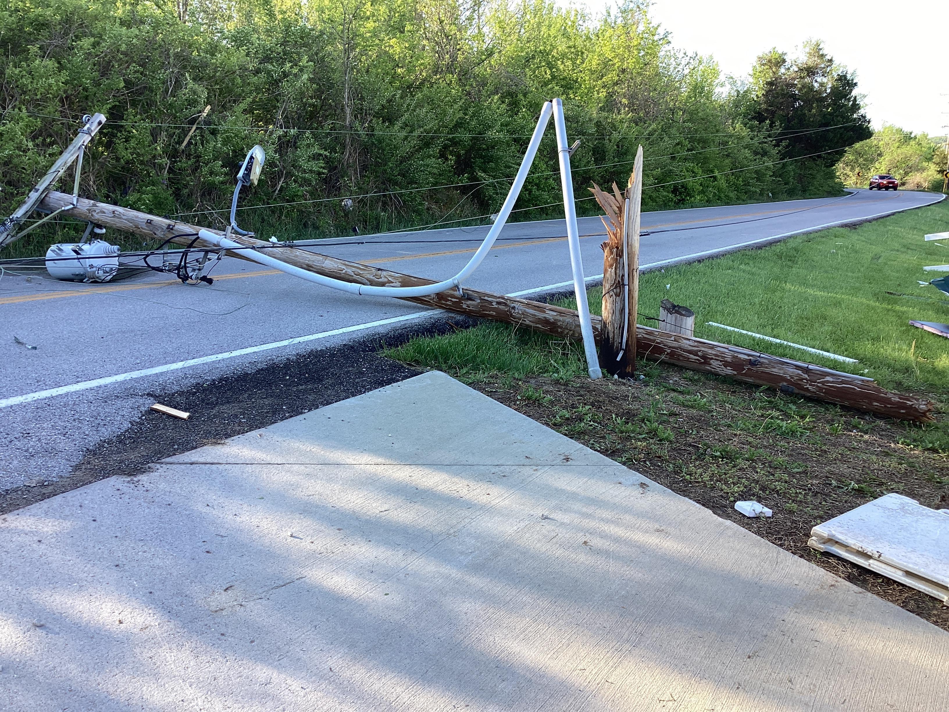
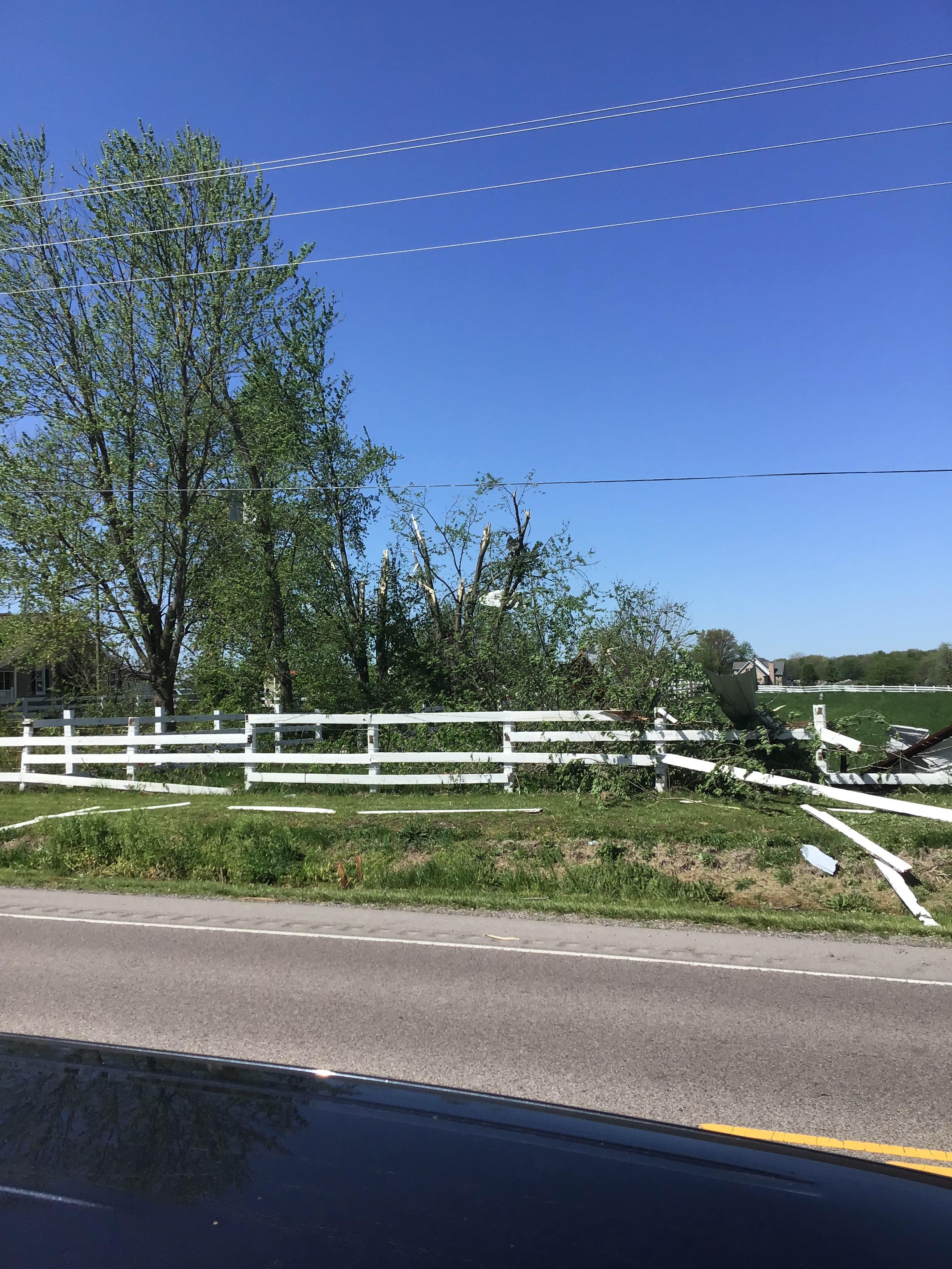
During the afternoon and evening of April 18, 2024, discrete supercell thunderstorms developed along a cold front moving through the bi-state area. These storms were initially mainly capable of producing large hail and damaging wind gusts, but become tornadic as additional thunderstorms formed along the front. Due to the additional thunderstorms, storm interaction increased, causing storms to congeal into a Quasi-Linear Convective System (QLCS) that impacted the St. Louis metro area and portions of southwestern Illinois. The QLCS was responsible for several tornadoes and instances of straight line wind damage in this part of the area. Fortunately, no injuries or fatalities were reported with these thunderstorms. |
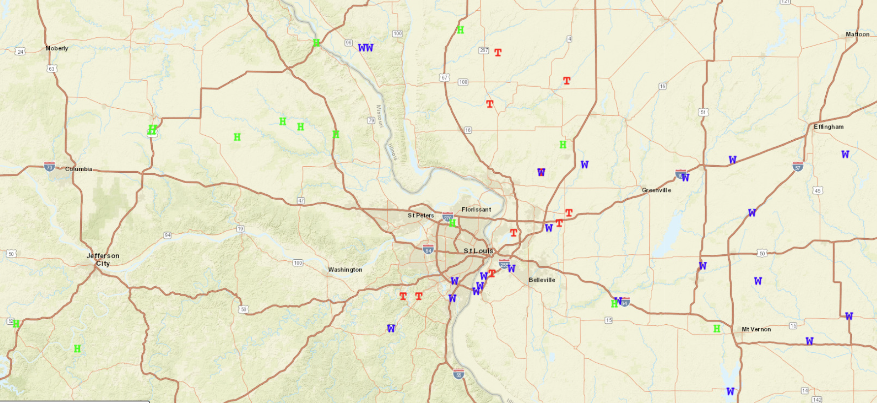
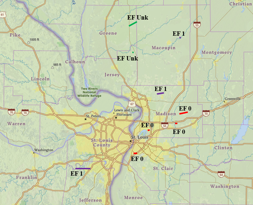 A map of the tornadoes surveyed as of April 20, 2024 |
Tornadoes:
|
Tornado - Pontoon Beach, IL
Track Map  
Downloadable KMZ File |
||||||||||||||||
|
Tornado - High Ridge, MO
Track Map 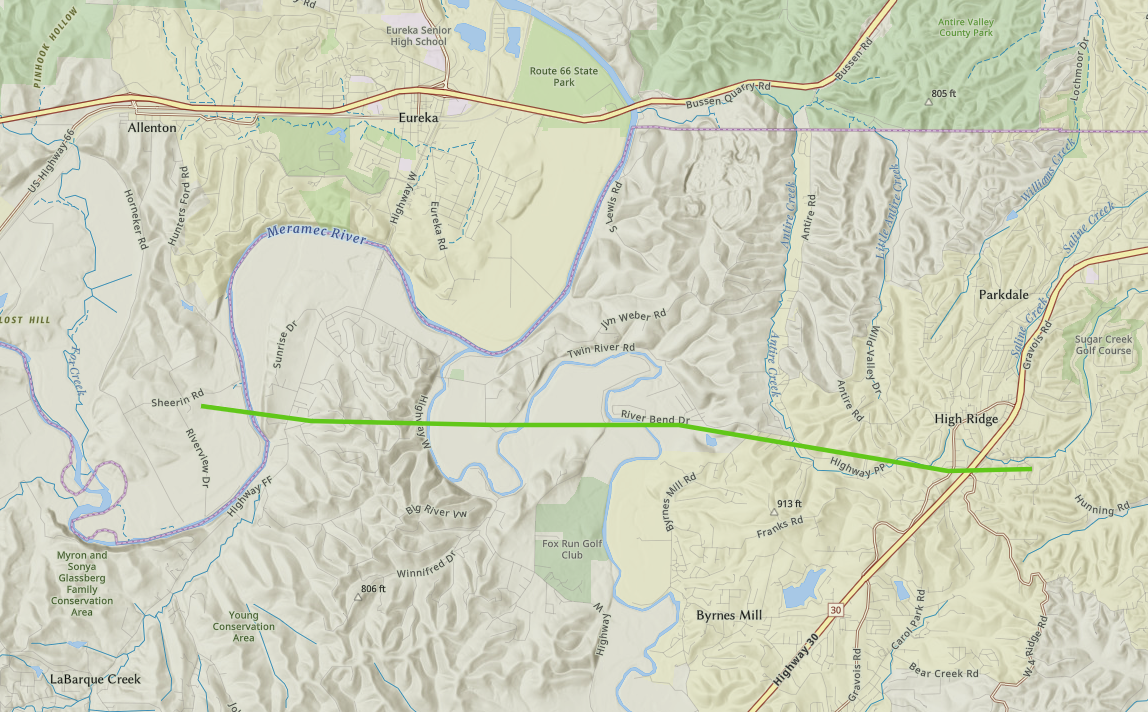
Downloadable KMZ File |
||||||||||||||||
|
Tornado - Prairietown, IL
Track Map 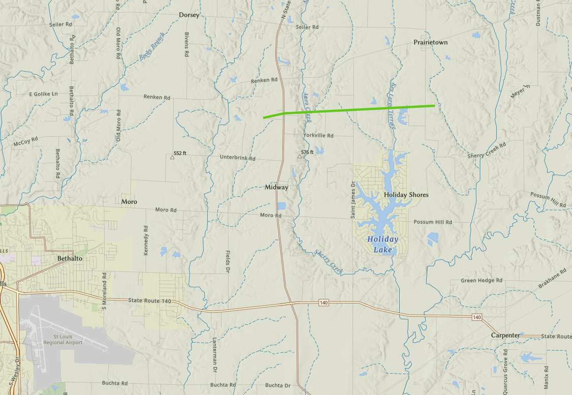
Downloadable KMZ File |
||||||||||||||||
|
Tornados - Marine, IL
Track Map 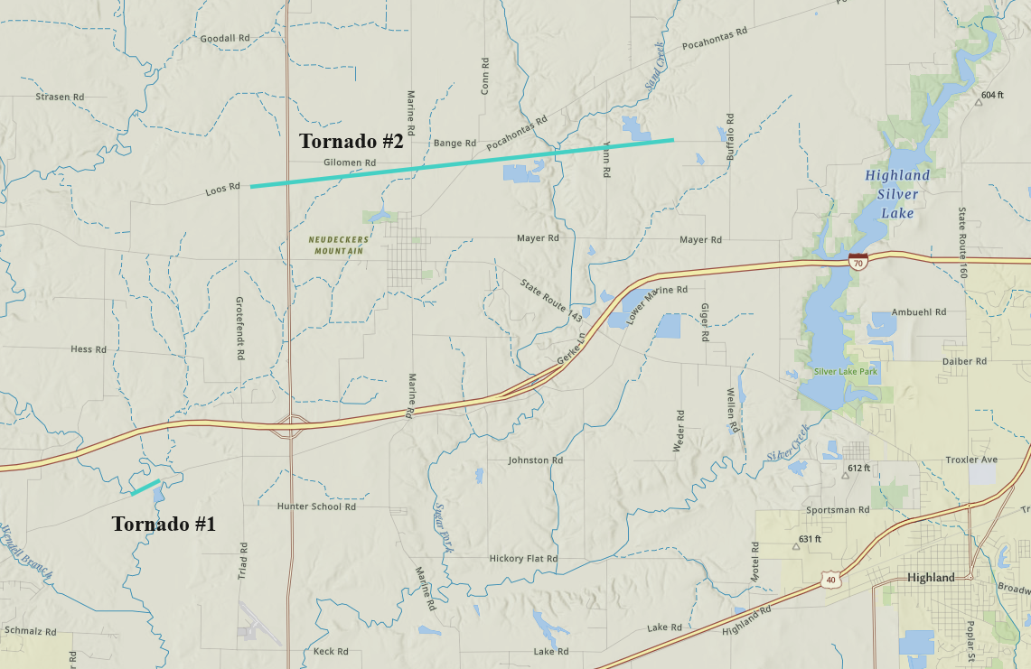
Downloadable KMZ File |
||||||||||||||||
|
Tornado - Cahokia, IL
Track Map 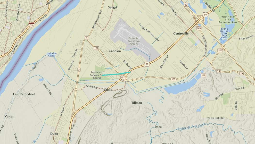
Downloadable KMZ File |
||||||||||||||||
|
Tornado - Standard City, IL
Track Map 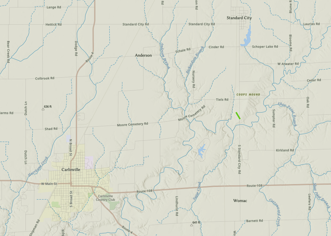
Downloadable KMZ File |
||||||||||||||||
|
Tornado - Athensville, IL
Track Map 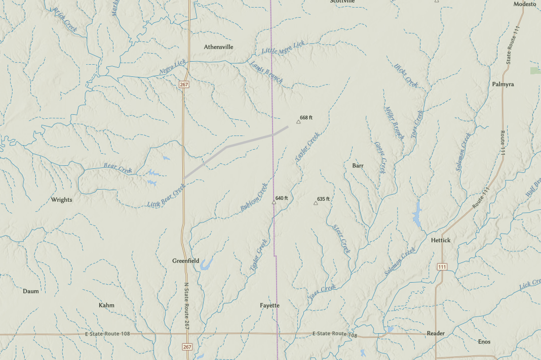
Downloadable KMZ File |
||||||||||||||||
|
Tornado - Kemper, IL
Track Map 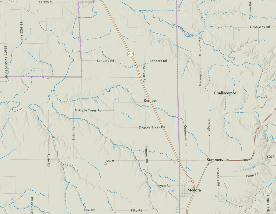
Downloadable KMZ File |
||||||||||||||||
The Enhanced Fujita (EF) Scale classifies tornadoes into the following categories:
| EF0 Weak 65-85 mph |
EF1 Moderate 86-110 mph |
EF2 Significant 111-135 mph |
EF3 Severe 136-165 mph |
EF4 Extreme 166-200 mph |
EF5 Catastrophic 200+ mph |
 |
|||||
Wind & Hail:
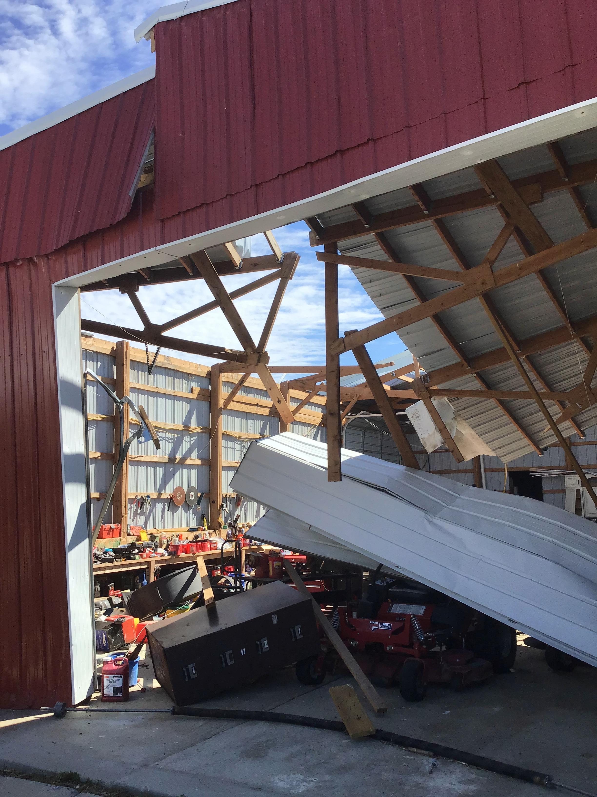
There were scattered damaging straight-line wind and large hail reports along with the tornadoes.
Wind
 |
 |
 |
 |
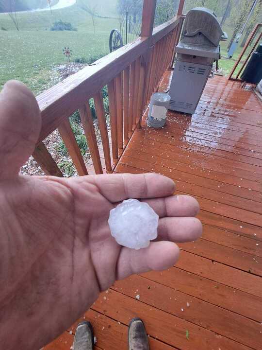
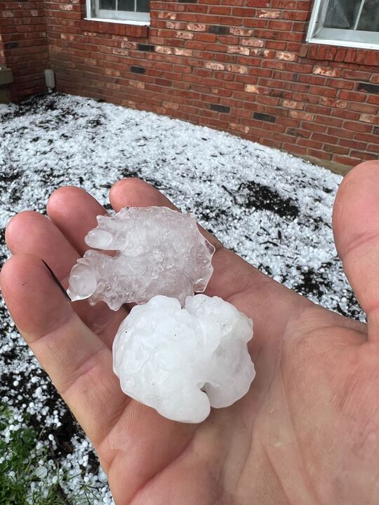
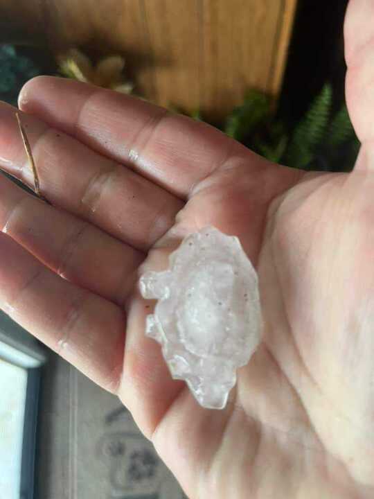
Hail
 |
 |
 |
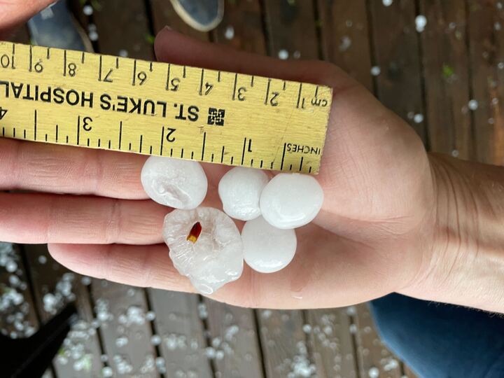 |
| Hail 5 miles south of Mexico MO | More large hail near Mexico | Large hail in Central MO | Large hail near Silex MO |
Photos
 |
 |
 |
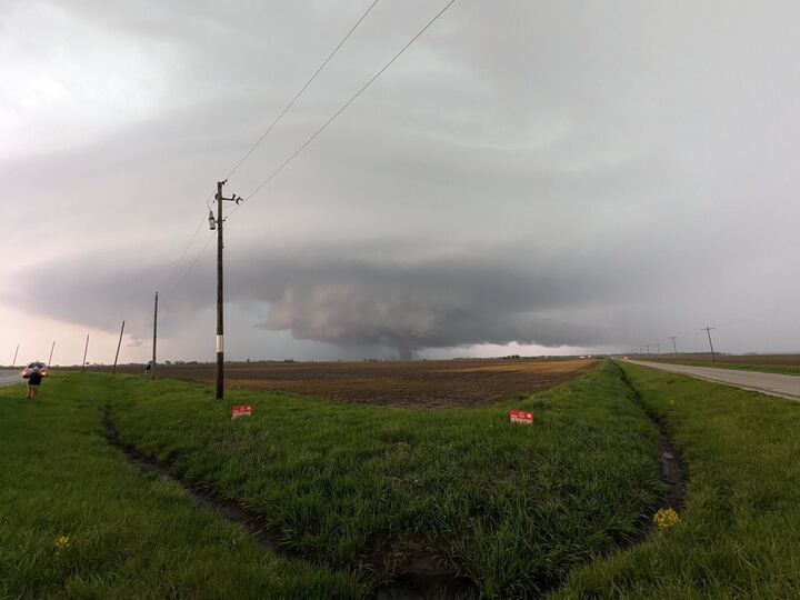 |
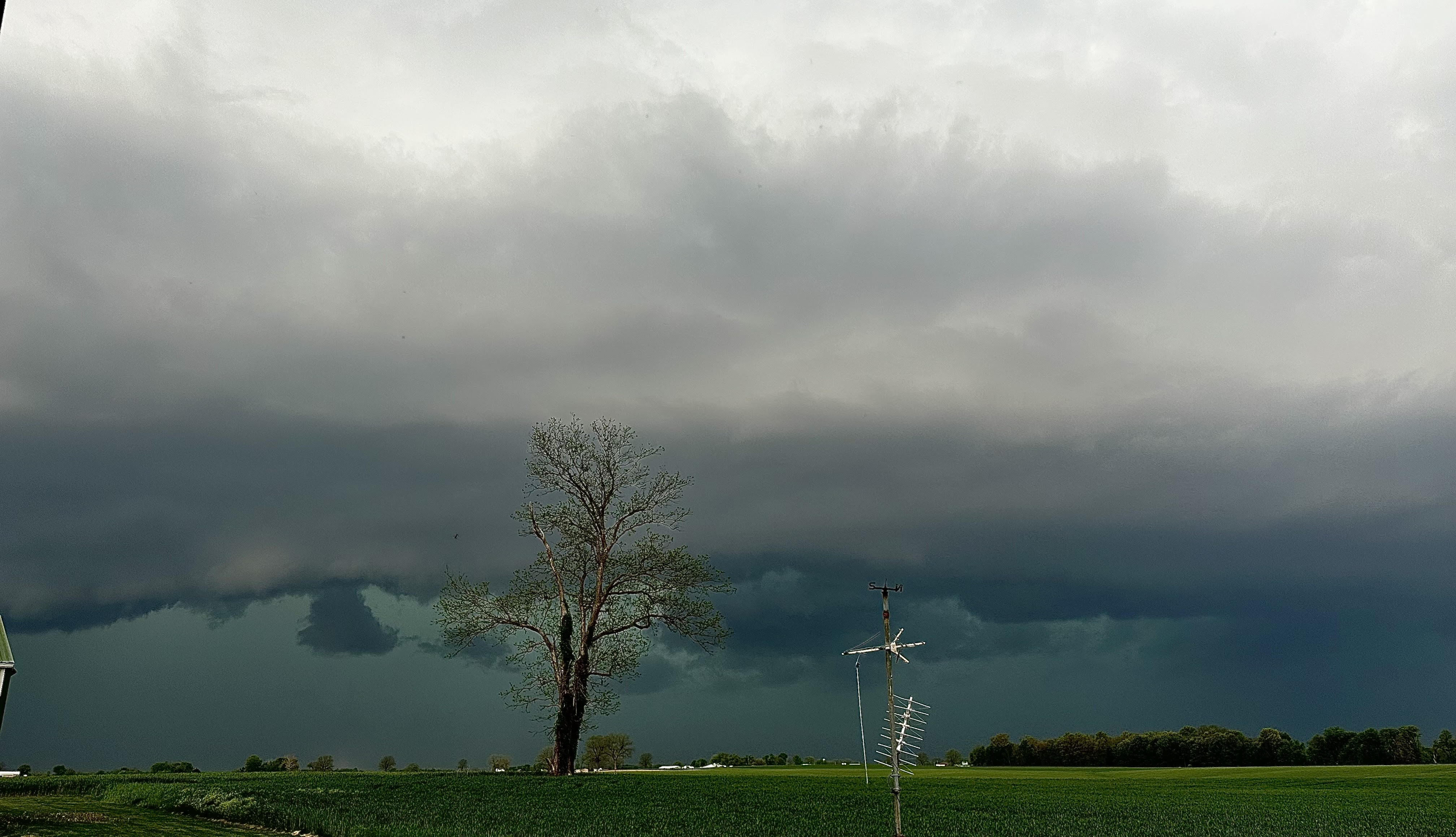
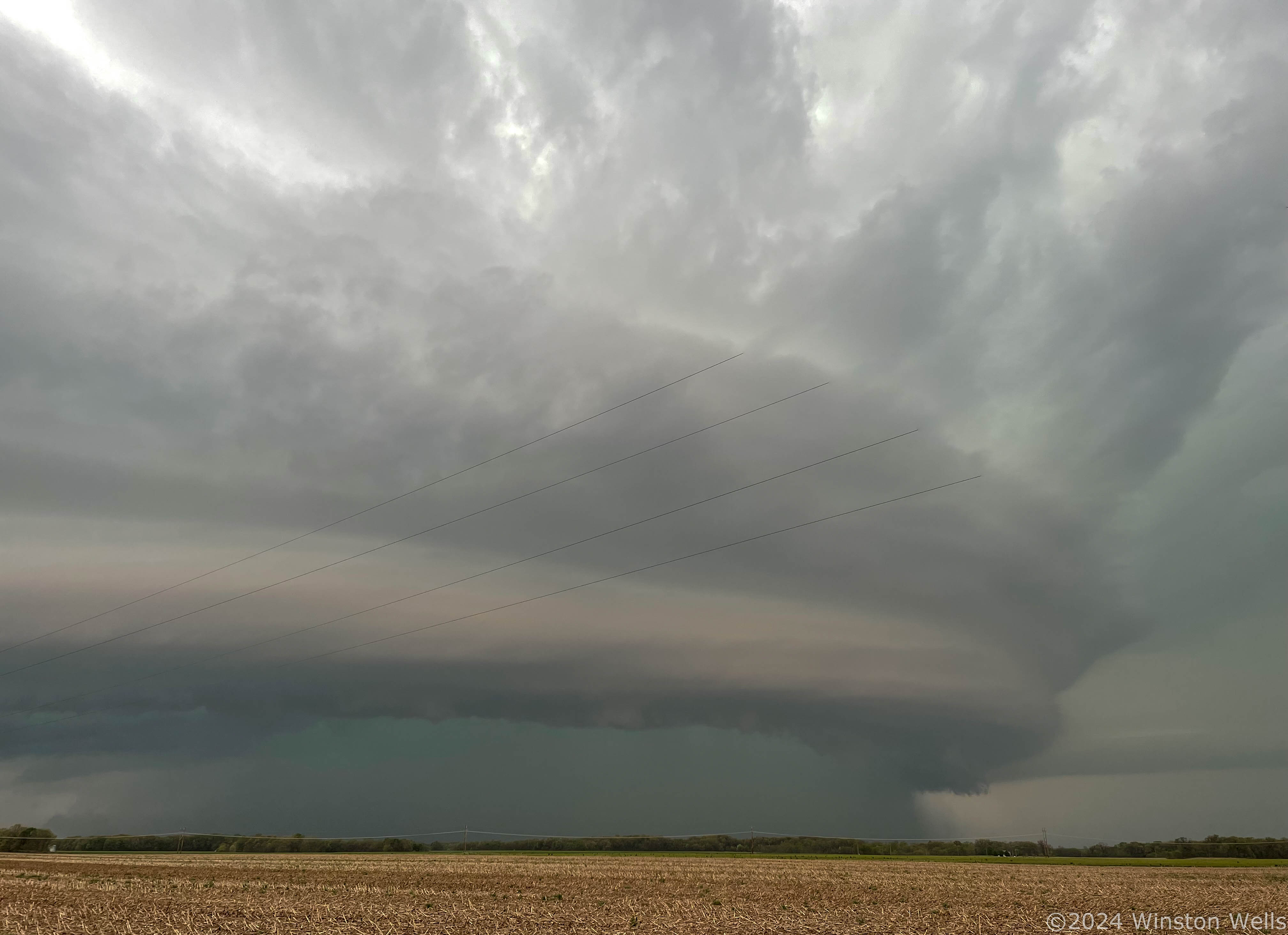
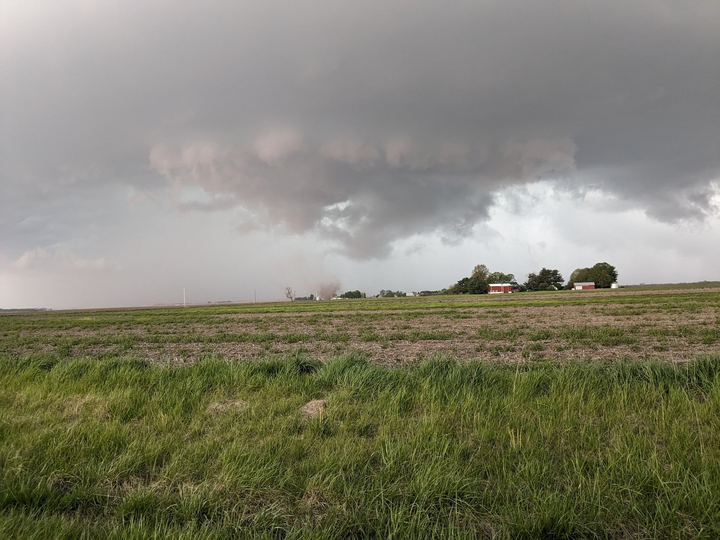
| Shelf Cloud near Hecker IL | Shelf Cloud near Hettick IL | Tornado near Athensville IL | Tornado near Athensville IL |
Radar
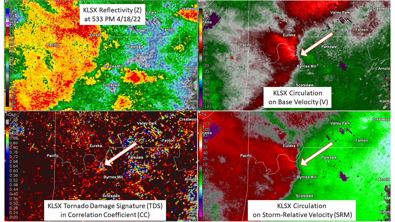
Tornado Damage Signatures on RADAR
 |
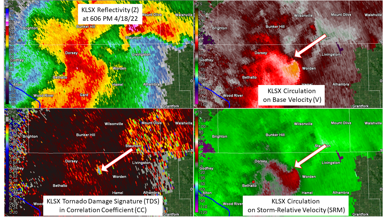 |
| Tornado Damage Signature on NWS St. Louis Doppler RADAR at 533 PM | Tornado Damage Signature on NWS St. Louis Doppler RADAR at 606 PM |
 |
Media use of NWS Web News Stories is encouraged! Please acknowledge the NWS as the source of any news information accessed from this site. |
|


 Weather Story
 Weather Map
 Local Radar
 Follow us on YouTube