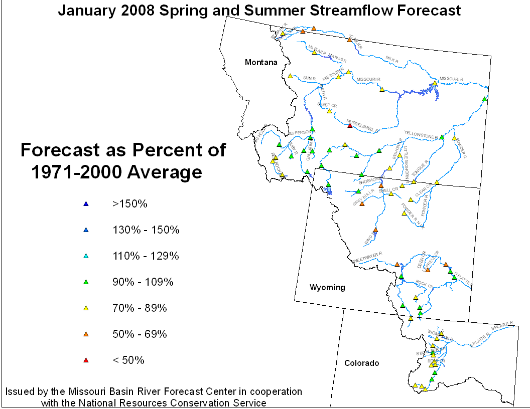
January 1, 2008 Spring and Summer Streamflow Forecasts
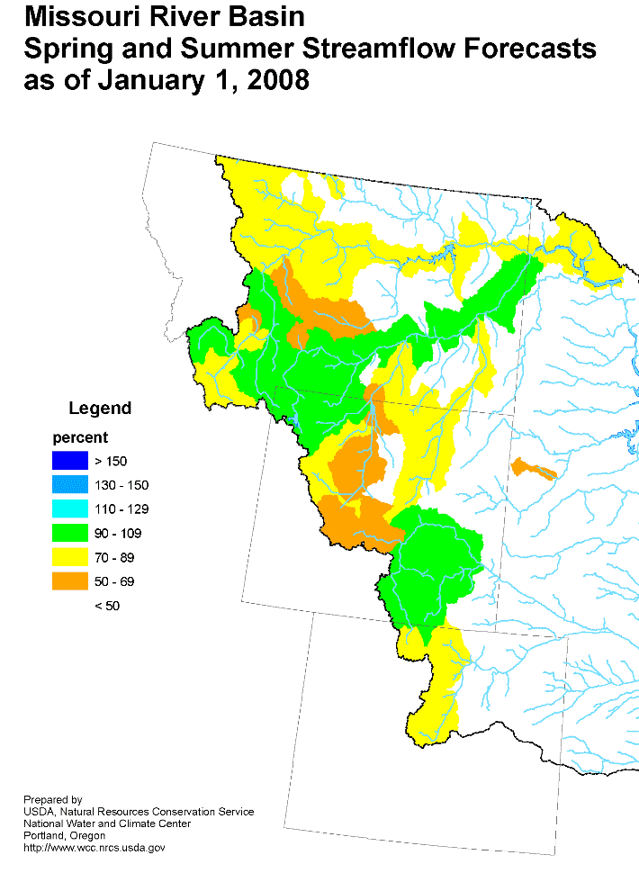

Missouri River Basin Streamflow Forecast Missouri River Basin Mountain Snowpack
Upper Missouri Basin
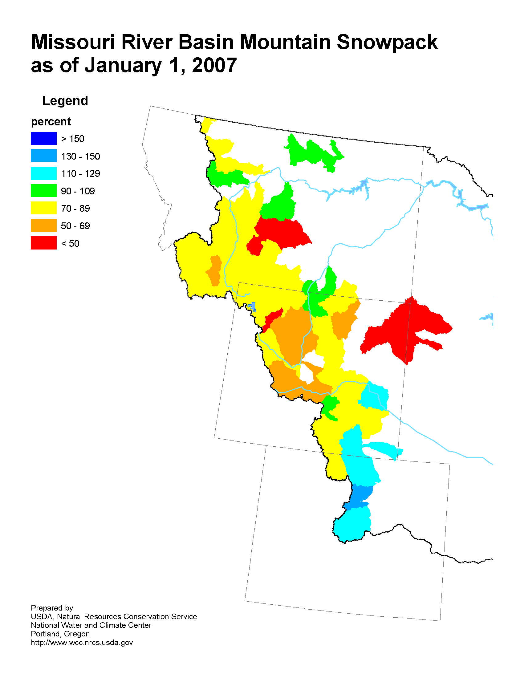
The high elevation snow pack in the Upper Missouri Basin as of
January 1 was mainly average to slightly below average. The snow
pack above Toston, Montana was 100 percent of average. The snow
pack between Toston and Fort Peck, Montana was 85 percent. The
snow pack in the St Mary and Milk river basins was 75 percent.
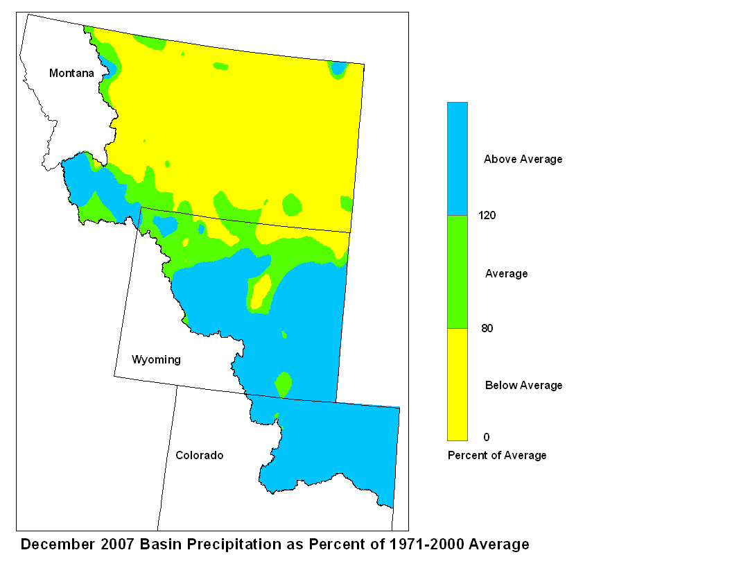
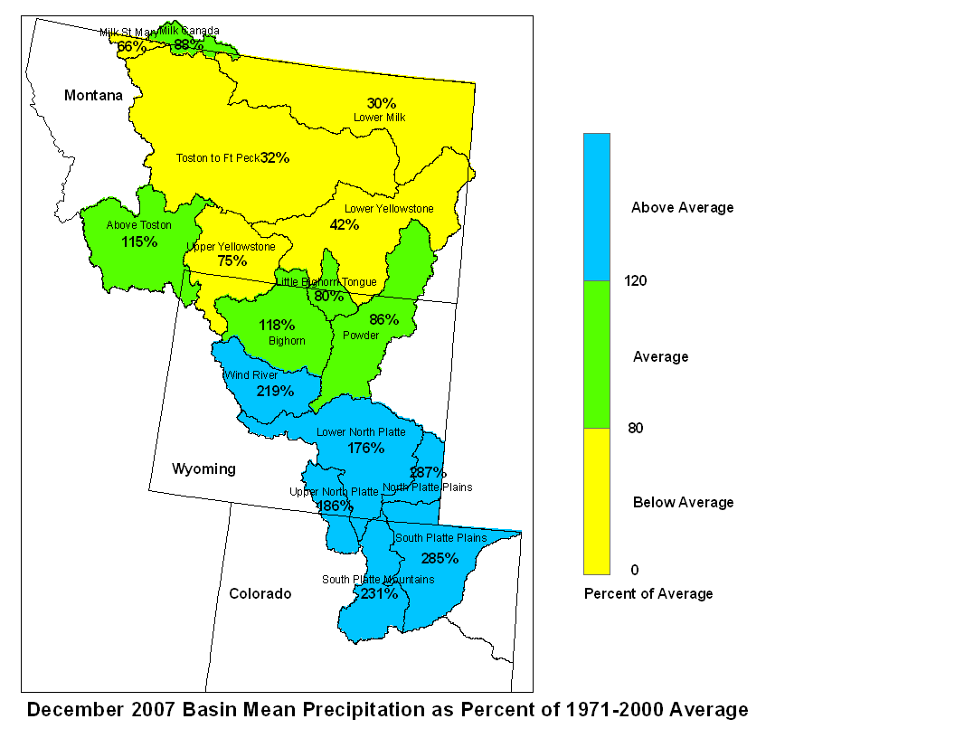
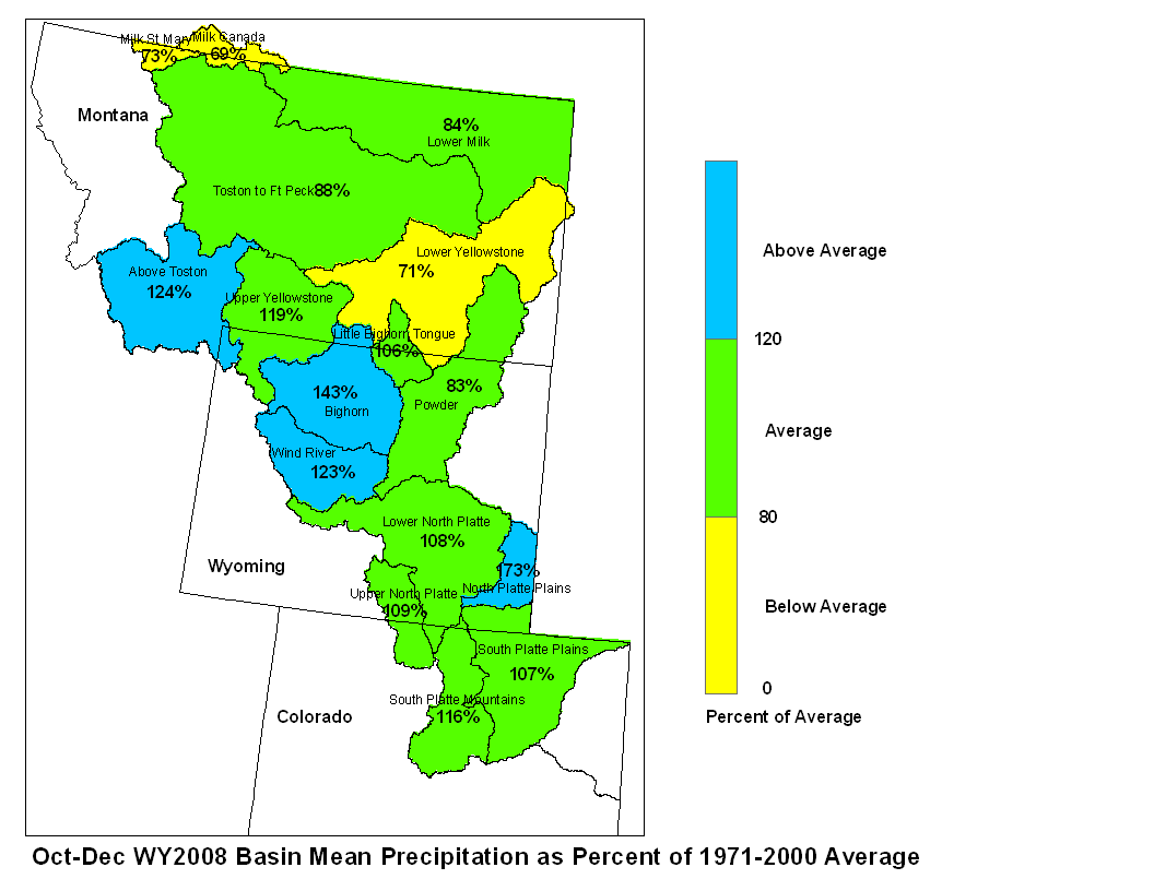
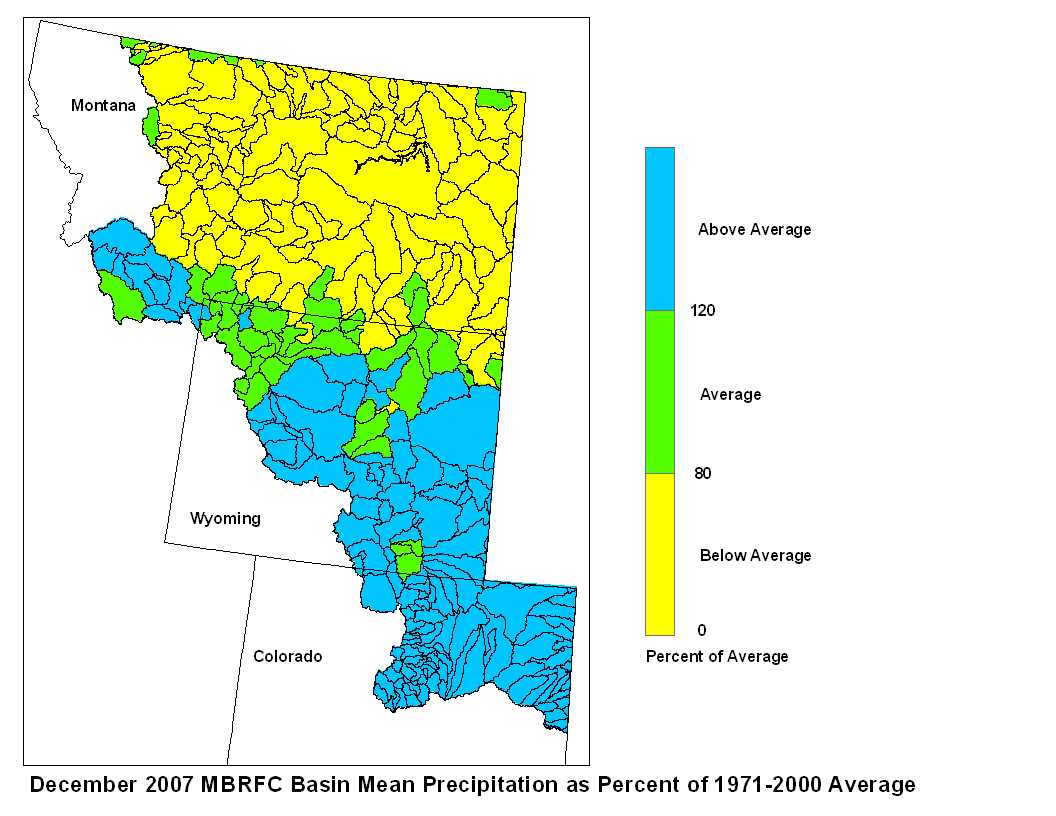
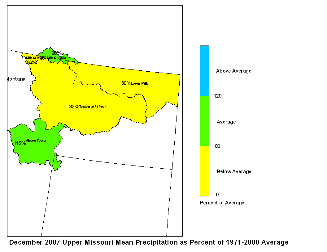
Fall precipitation across the Upper Missouri basin was mainly
below average with the exception of above Toston which was above
average. Basin precipitation summaries for the Missouri Basin
include: Milk St. Mary, 73 percent; Milk Canada, 69 percent;
Lower Milk, 84 percent; Above Toston, 124 percent; Toston to
Ft. Peck, 88 percent.


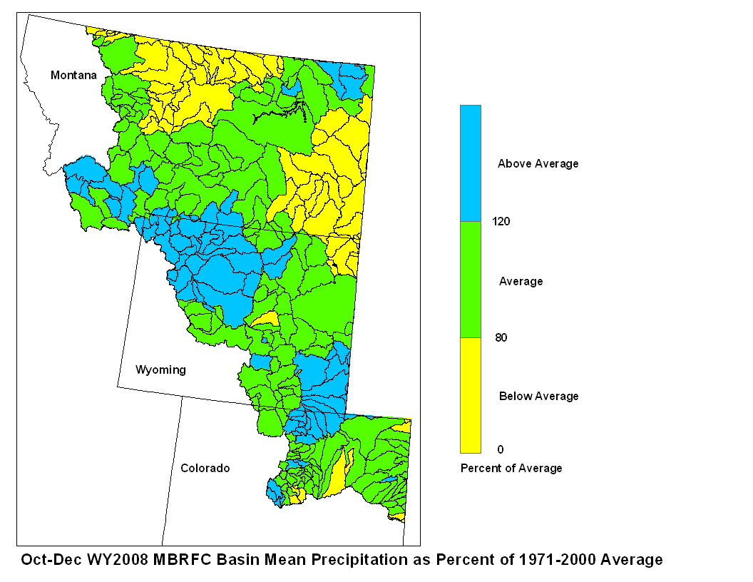
December 2007 Upper Missouri Mean Precip Oct-Dec WY2008 Upper Missouri Mean Precip
Stream flow in the Upper Missouri Basin is forecast to be below average
during the upcoming Spring and Summer.  The St. Mary River is forecast
to have 78 percent of average April-September flows.  Runoff is
expected to range around 85 percent of average for the Missouri Basin
above Fort Peck, Montana.  Forecasts for the Milk River Basin call for
around 50 percent of average Spring/Summer runoff.
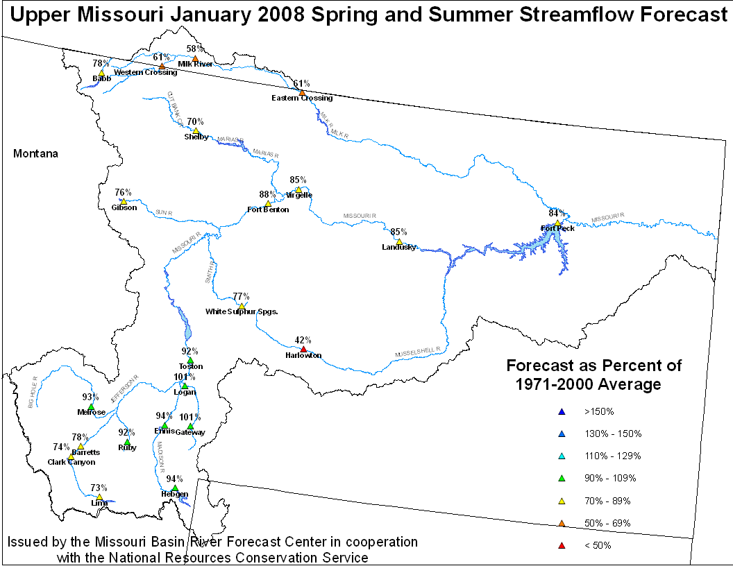
Upper Missouri January 1, 2007 Spring and Summer Streamflow Forecasts
Of the four major irrigation reservoirs in Montana: Lima Reservoir
had 56 percent average storage, Clark Canyon was holding 67 percent of
average water, Gibson Reservoir had 41 percent of average stored
water, and Fresno Reservoir had 65 percent of average stored water.
The major hydroelectric reservoirs in Montana (Canyon Ferry and
Fort Peck) had monthend storage in the average to below average
range; 87 and 57 percent of average water, respectively.
The U.S. Geological Survey long term gaging station, on the Marias
River near Shelby, Montana had an estimated 83 percent of average
runoff in December.
Yellowstone Basin
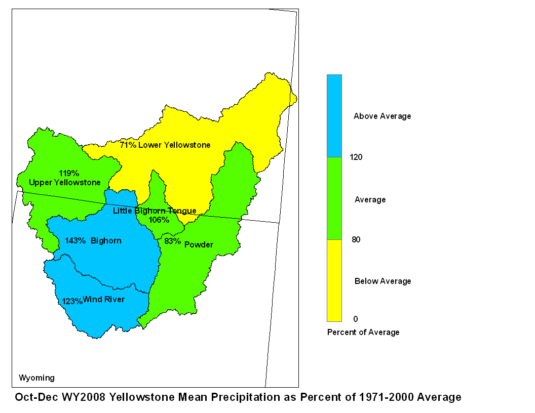
The high elevation snow pack in the Yellowstone Basin was about
average on January 1.  The snow pack in the Upper Yellowstone
Basin was 99 percent of average. The snow packs in the Wind,
Bighorn, and Shoshone Basins were 89, 92, and 91 percent of
average, respectively.  The snow packs in the Tongue and Powder
basins were 88 and 104 percent of average, respectively.

Precipitation during October through December ranged from above
average to below average.  The range was from 143 percent of average
in the Bighorn River Basin to 71 percent of average in the lower
Yellowstone River Basin.  The upper Yellowstone River Basin received
119 percent of average precipitation while the Wind River Basin
received 123 percent of average.  The Little Bighorn and Powder
River basins were in the average range.

Stream flow in the Yellowstone Basin is forecast to be average to
below average during the upcoming Spring and Summer.  Runoff at
Billings, Montana is expected to be 96 percent of average, with
a probable range between 70 and 122 percent of average.  Stream
flow for the Wind-Bighorn Basin above St. Xavier, Montana is
forecast to be 66 to 80 percent of average with a probable range
of 10 to 122 percent of average flow in sub-basins.  Flow in the
Tongue Basin is expected to be 73 to 77 percent of average with
a reasonably likely range of 38 to 118 percent of average flow.
Flows in the Powder River are expected to be about 80 percent of
average with a reasonably likely range of 37 to 139 percent of
average.
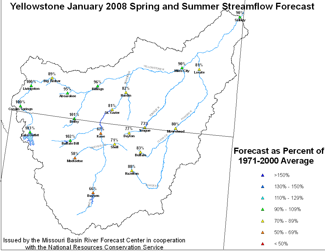
Yellowstone January 1, 2008 Spring and Summer Streamflow Forecasts
Month end storage was 61 percent of average at Boysen Reservoir in
Platte Basin
The high elevation snow pack in the Upper North Platte basin was
89 percent of average on January 1. The snow pack in the North
Platte Basin below Seminoe Reservoir was 85 percent of average.
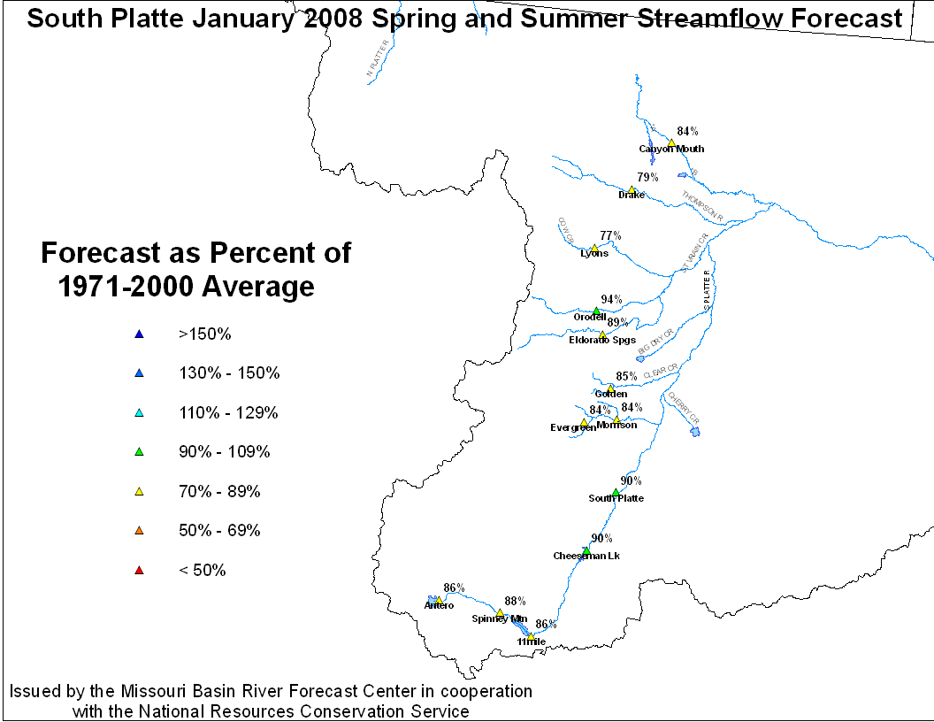
The snow pack in the South Platte Basin was 94 percent of average.
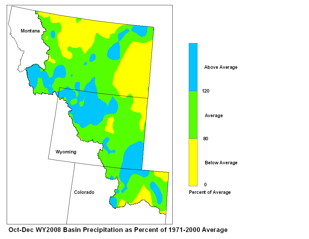
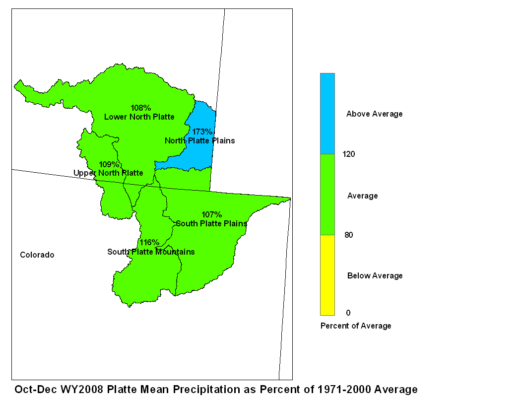
Fall precipitation across the Platte Basin was above average.
Fall precipitation in the North Platte Basin above Seminoe
Reservoir was 109 percent of average. In the North Platte Basin
between Seminoe Reservoir and Guernsy Reservoir precipitation
was 108 percent of average. The North Platte Basin below Guernsy
Reservoir had 173 percent of average fall precipitation. The high
elevations of the South Platte Basin had 116 percent of average
fall precipitation whereas the plains had 107 percent of average
October-December precipitation.
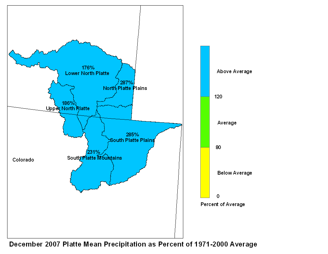

December 2007 Platte Mean Precip Oct-Dec WY2008 Platte Mean Precip
Stream flow in the Platte basin is forecast to range from below
average to above average during the upcoming spring and summer.
Runoff for streams above Seminoe Reservoir are expected to be about
87 to 100 percent of average.  Stream flows for the North  Platte
below Seminoe Reservoir are forecast to be 50 to 80 percent of
average, except for the Laramie River and little Laramie River and the
mainsteam of the North Platte river where runoff is forecast to be
from 90 to 108 percent of average. The South Platte Basin above South
Platte, Colorado can expect about 90 percent of average flow.
For the remainder of the South Platte Basin flows are expected to
be about 80 to 90 average.
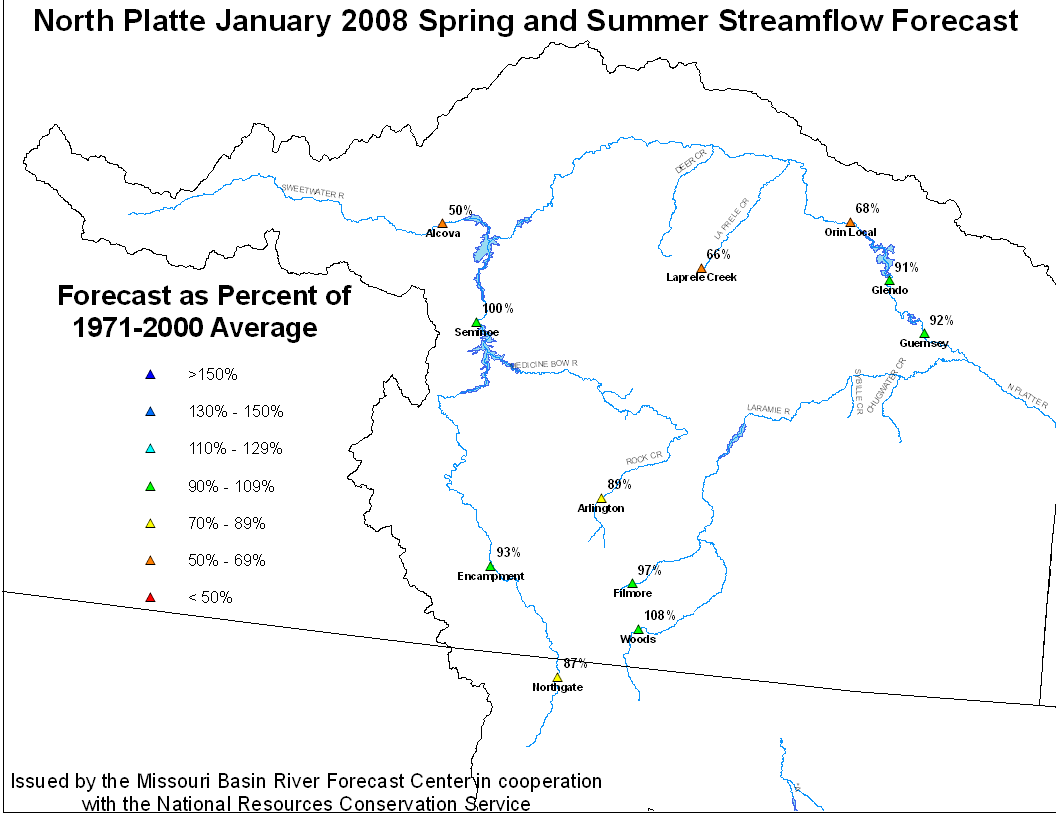
North Platte Streamflow Fcst South Platte Streamflow Fcst
Stored water in the North Platte Basin as of January 1 was 46 percent
of average. In the South Platte basin stored water was 89 percent of
average.

