|
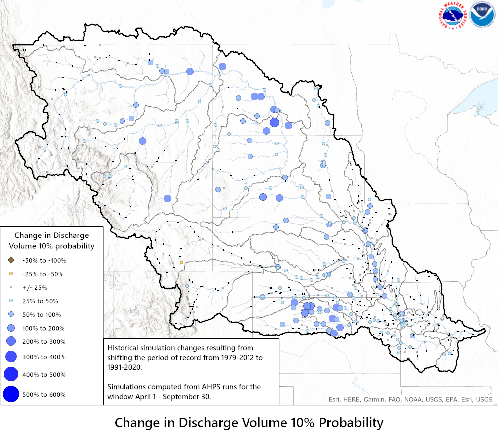
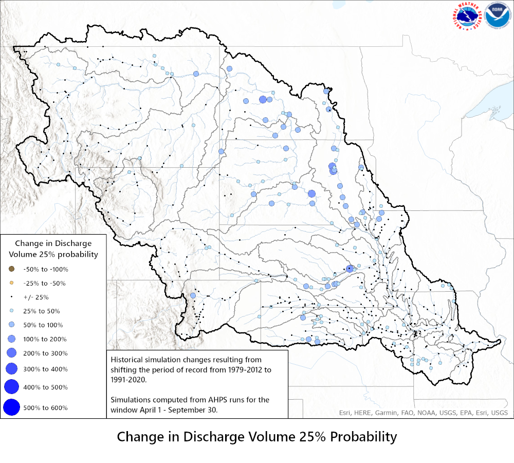
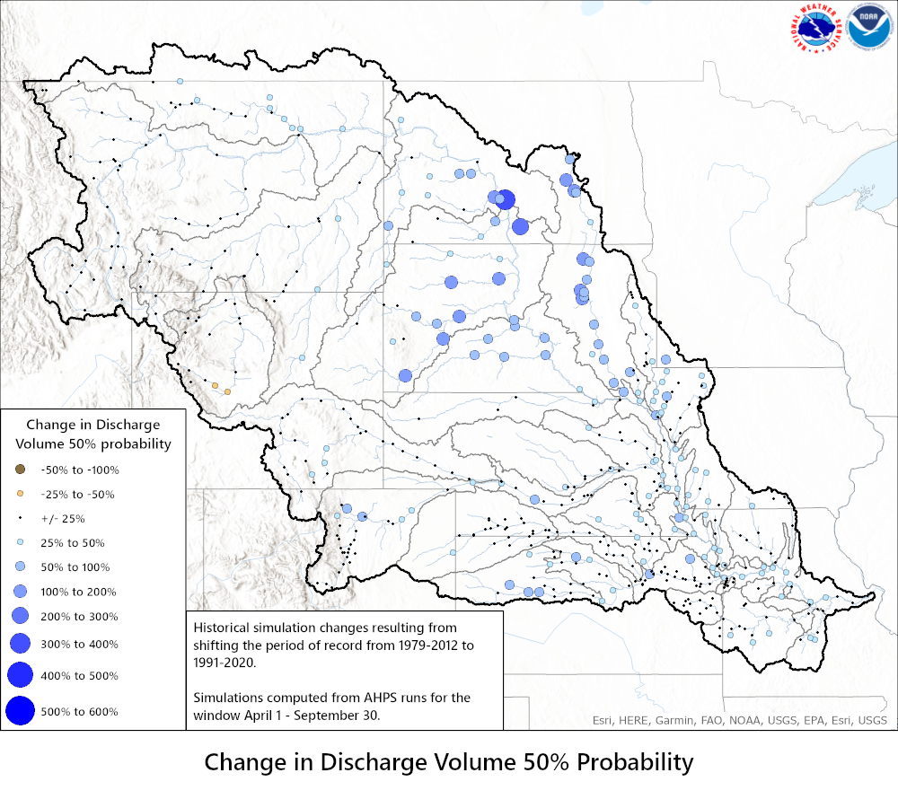
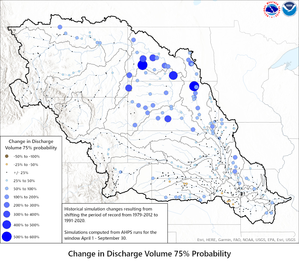
The historical simulation can be defined as the hydrologic model climatology that should reflect the historic range of possibilities. With the historical simulation, the hydrologic modeling system is executed one time for the years of interest. The computation begins using standard starting conditions for snow, soil and runoff conditions. The hydrologic models use only historical temperature and precipitation as the model inputs (forcings). Using those inputs, the hydrologic models are then executed continuously for the years of interest producing one continuous hydrograph of streamflow for those years. The peak flows for each year are selected for the period of interest (for example March 1 - May 30) and ranked to determine probabilities of exceedance illustrated on this webpage. Probabilities of exceedance can also be produced for other parameters such as volume or stage.
In this study the hydrologic models were executed using two different periods of record to compute the continuous hydrograph described above. The years 1979 through 2012 were the previous years that were used for the temperature and precipitation model inputs to produce the conditional simulations. The conditional simulations are used for the official AHPS probabilistic outlooks. For more information about conditional simulations see, https://www.weather.gov/ |
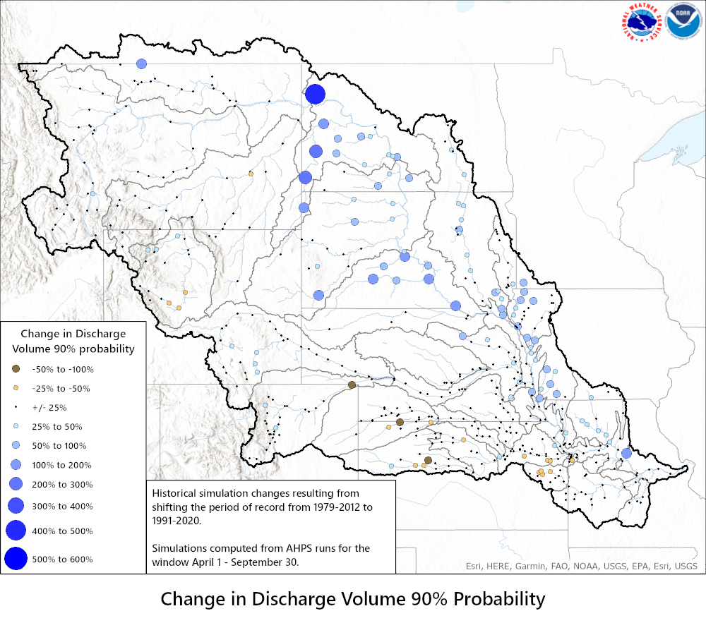
| Discharge Volume Change | ||
| 10% Probability | 25% Probability | 50% Probability |
 |
 |
 |
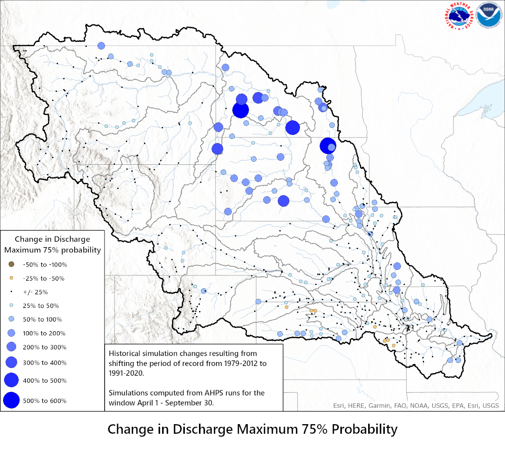
| 75% Probability | 90% Probability | |
 |
 |
|
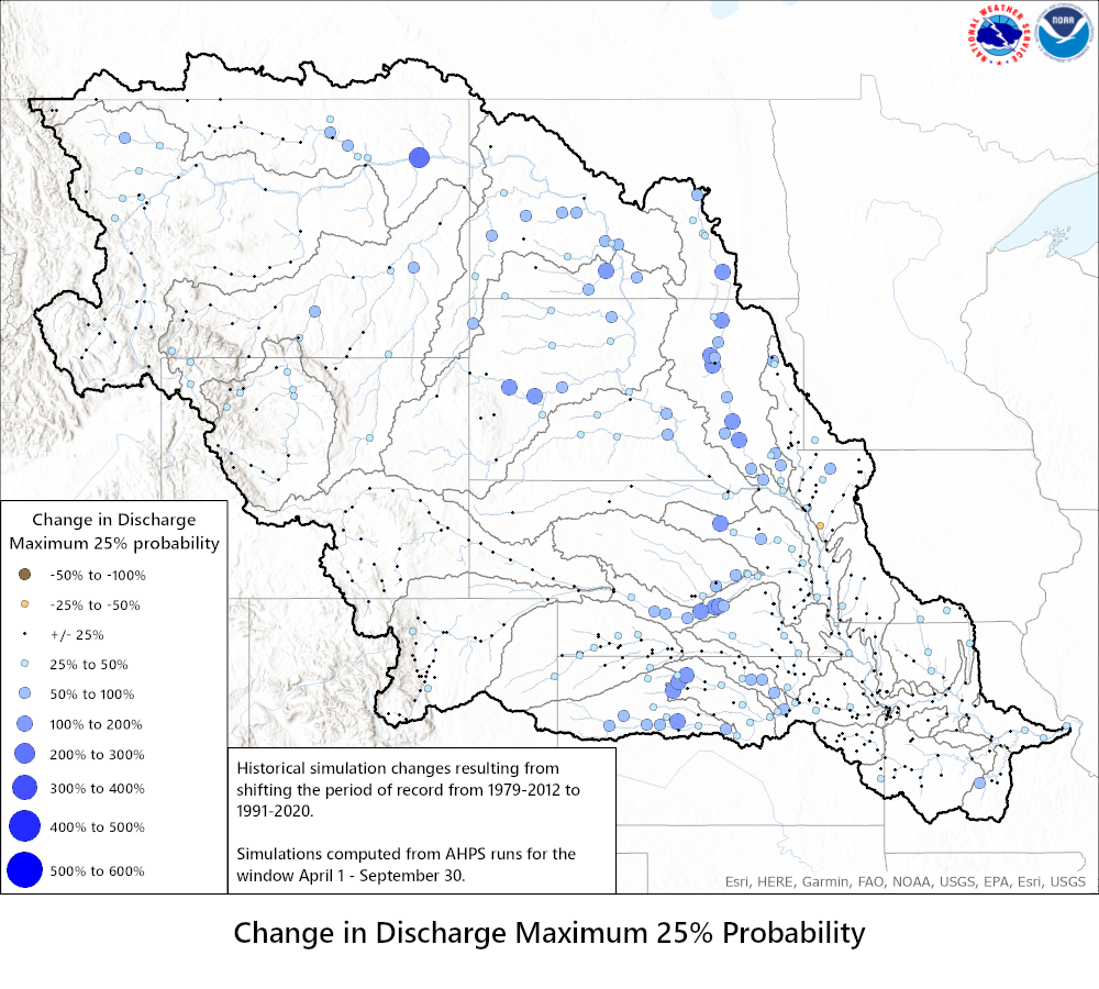
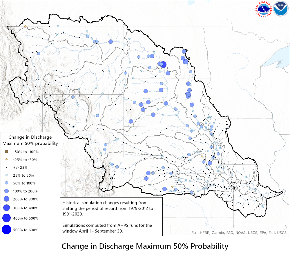
| Discharge Maximum Change | ||
| 10% Probability | 25% Probability | 50% Probability |
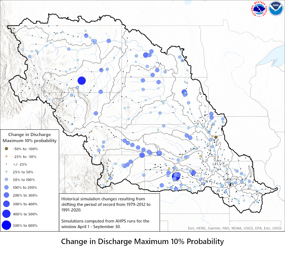 |
 |
 |
| 75% Probability | 90% Probability | |
 |
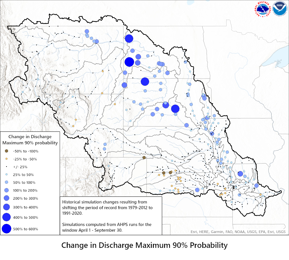 |
|
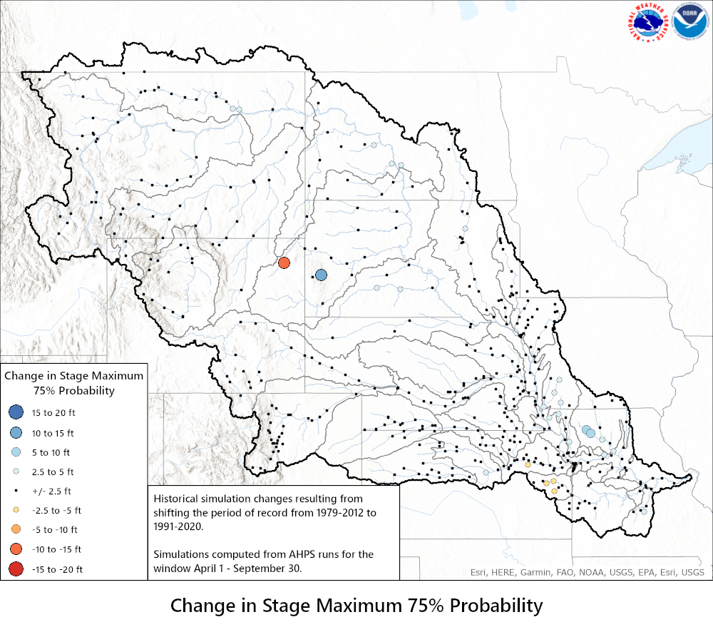
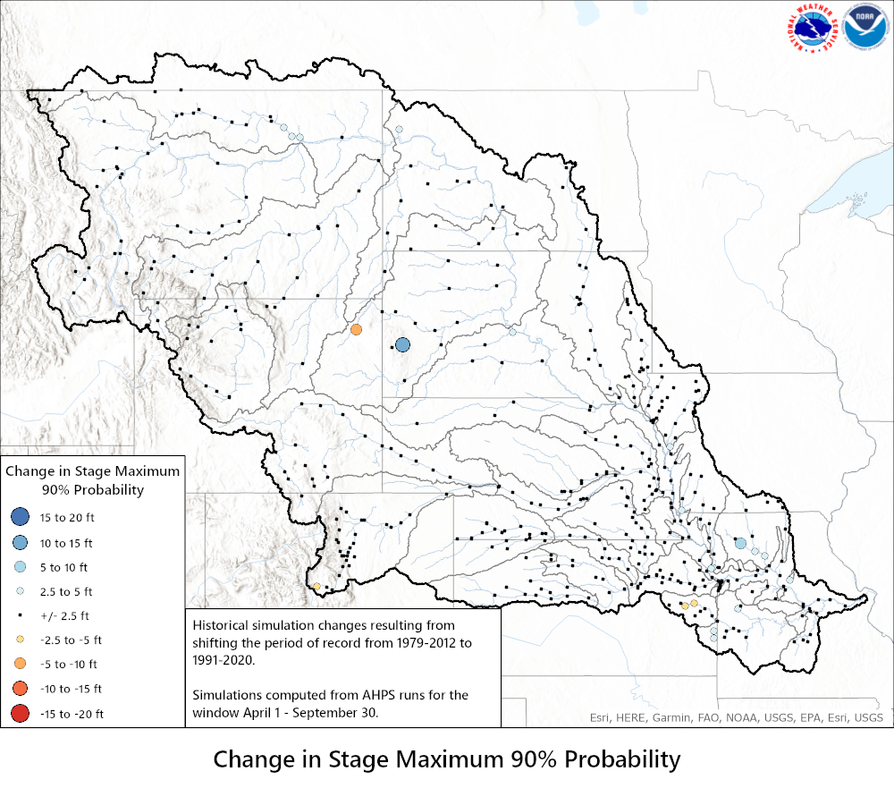
| Stage Maximum Change | ||
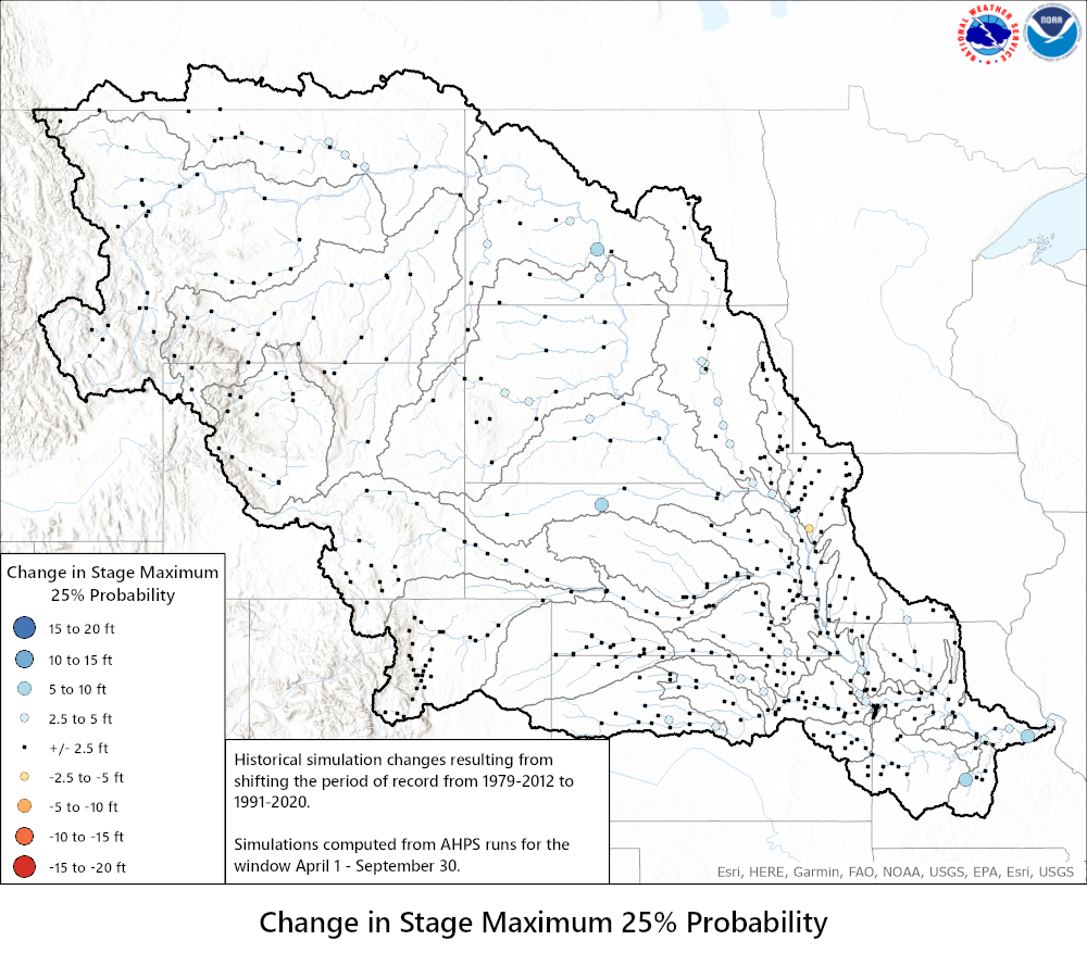
| 10% Probability | 25% Probability | 50% Probability |
 |
 |
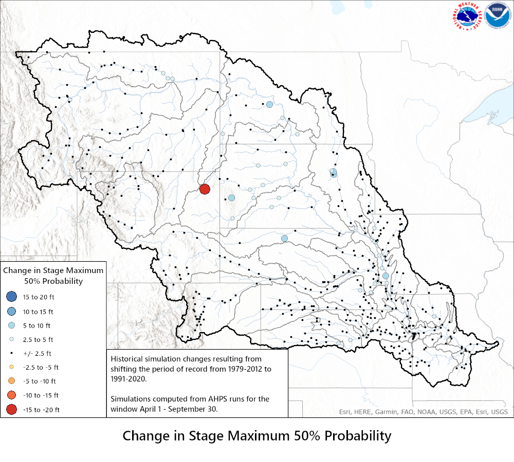 |
| 75% Probability | 90% Probability | |
 |
 |
|

