Overview
Update in the "Tornado" Tab BelowPrior to 2024, the state of Wisconsin had never seen a tornado in the month of February. On the evening of February 8th, 2024, a rare, impressive setup for severe weather came together across southern Wisconsin. As a dynamic low tracked northeast across the Upper Mississippi Valley, the warm sector spread across the state of Wisconsin. Within the warm sector, afternoon sunshine allowed surface- based instability to develop, ~500 J/Kg. Along with the increasing instability, the dynamic system brought a plethora of deep-layer and low-level shear. The impressive shear profiles led to concerns for the development of rotating storms that would be capable of producing all hazards - but especially large hail and a few tornadoes. Here are a few stats about this severe weather event, dating back to 1986. Prior to the evening of February 8th, 2024:
|
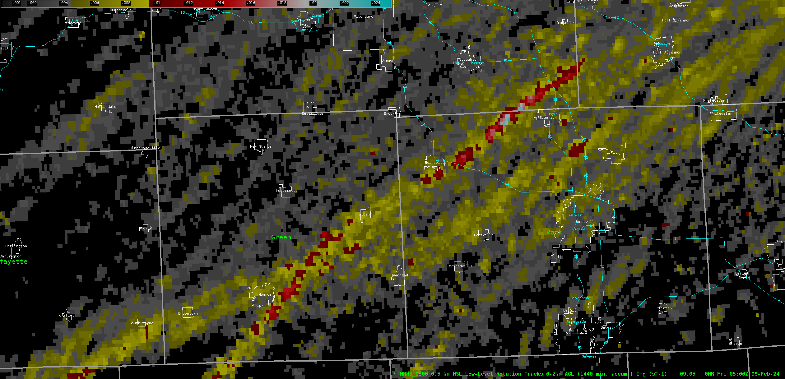
Radar Imagery of the Juda to Albany EF-1 and Evansville to Lake Koshkonong EF-2 tornadoes on February 8th, 2024. This radar imagery runs from 4:45pm to 6:18pm CST.
|
Tornadoes:
Update 2/14/2024:
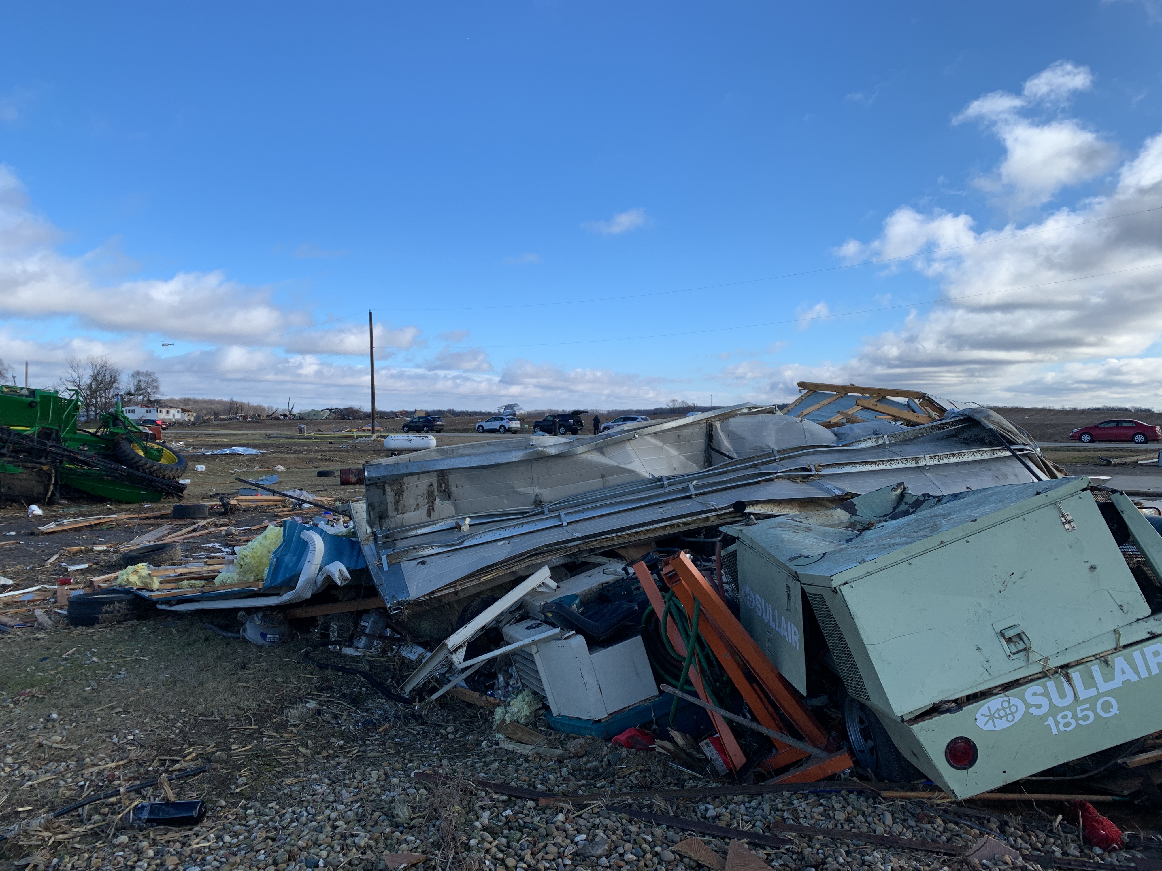
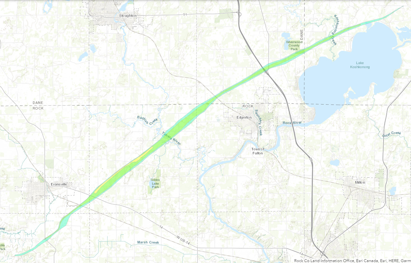
We`ve reviewed satellite/aerial data and made adjustments to the
path of the EF-2 tornado near Evansville. We also received a
report of damage at the beginning of the path and have extended
the start point further southwest. We also received information
about one injury that occurred east of Evansville to a motorist
which was pushed off the road by the tornado. They were
transported to the hospital with minor injuries. Based on the
damage survey and aerial imagery, we also have extended the peak
width of the tornado up to 750 yards which occurred in the
area east-northeast of Evansville at the time it was at its peak
strength.

We also have finalized that the tornado damage will be rated an
EF-2 for the second tornado after consulting with structural
engineers and meteorologists that confirmed that due to the lack
of steel and the age of the metal building system, that the winds
were likely 130 mph and firmly at EF-2 levels. Note that we`ve
bumped the estimated peak winds down on the Evansville to Lake
Koshkonong tornado to 130 mph to match what the structural
engineers recommended.

This will likely be the last update on the first two documented
tornadoes to occur in the month of February in Wisconsin going
back to 1950.
|
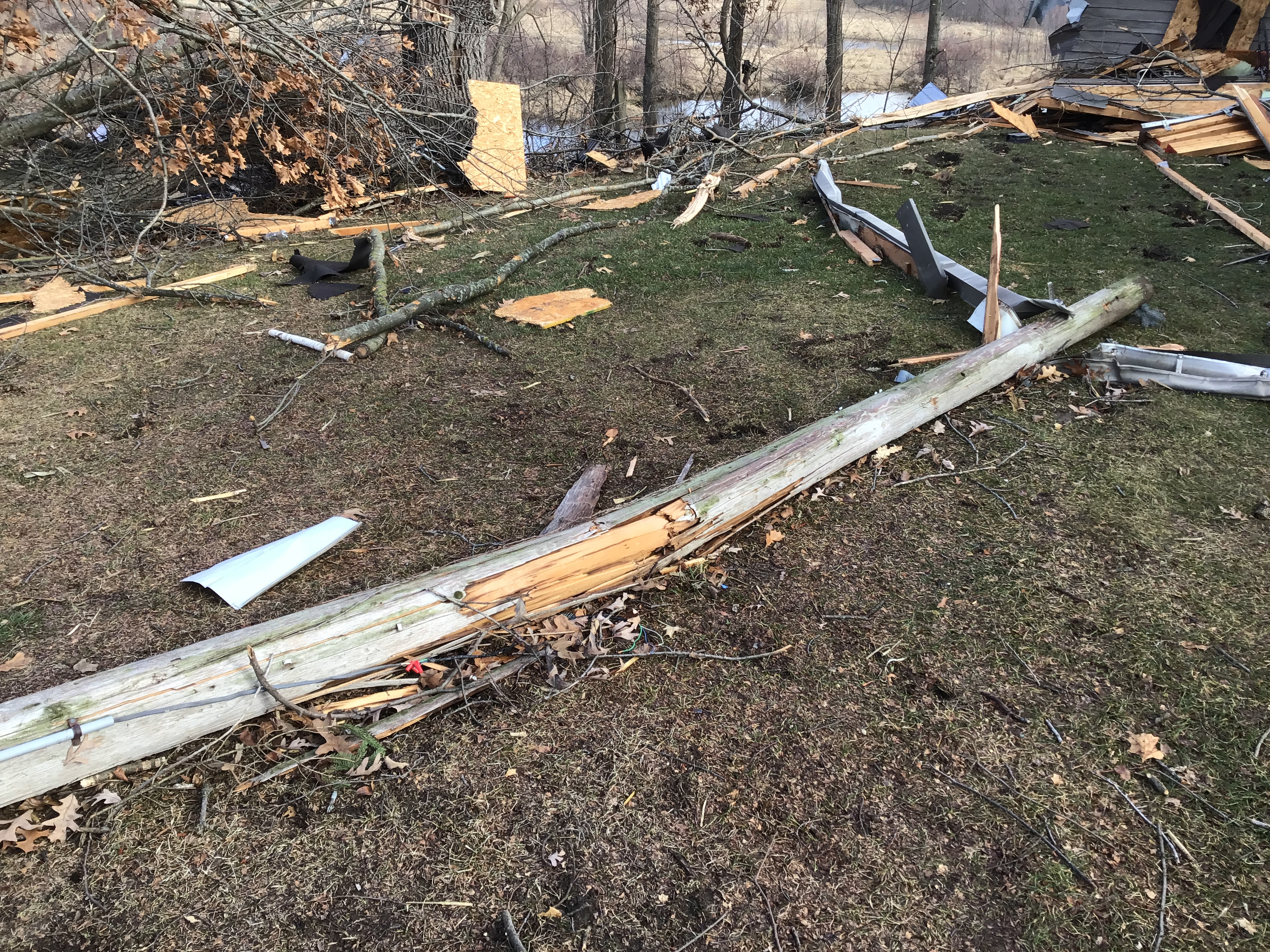
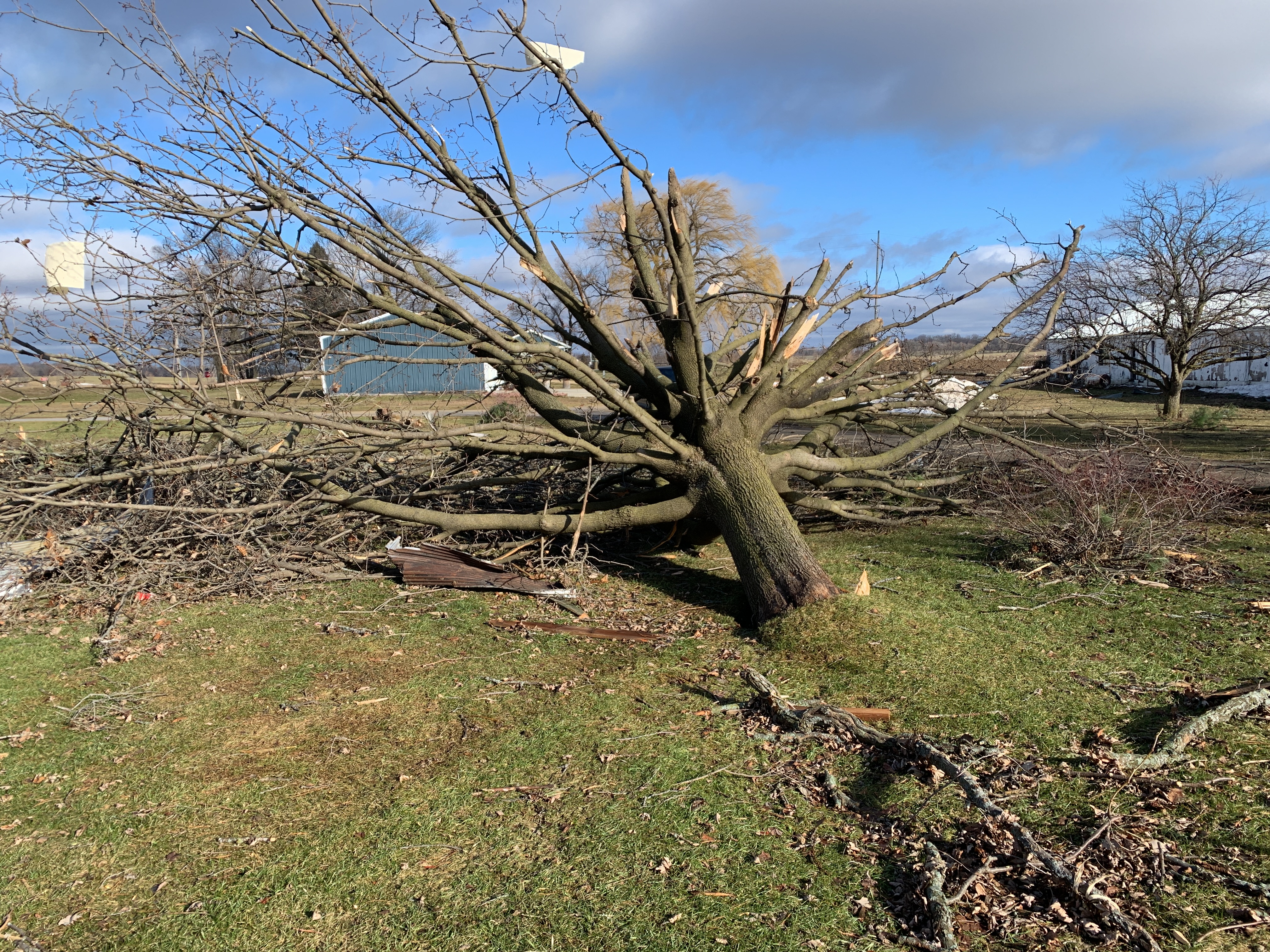
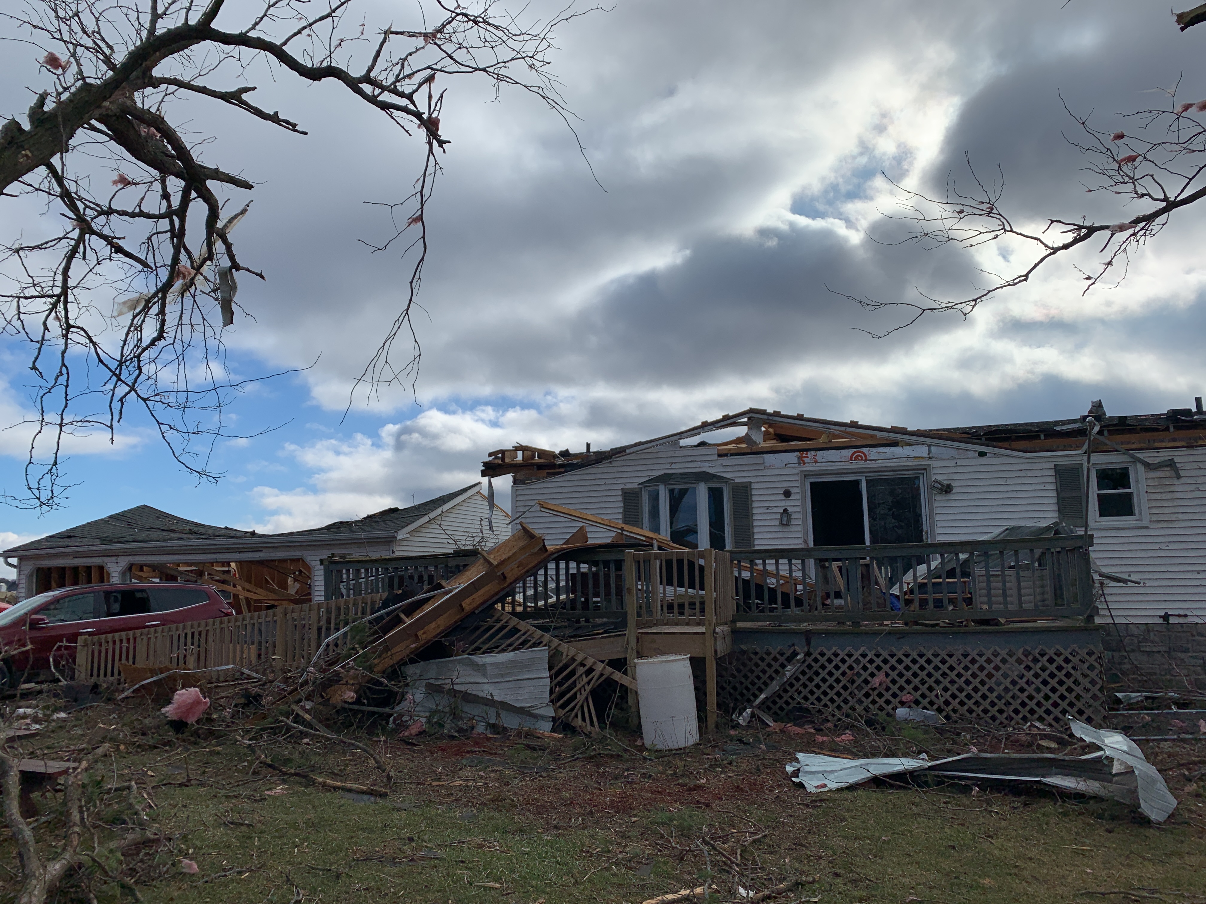
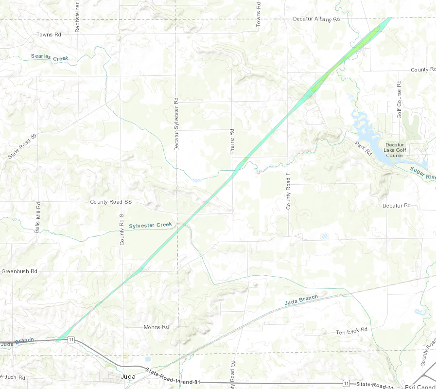
Tornado #1 - Juda to Albany
|
||||||||||||||||
|
Tornado #2- Evansville to Lake Koshkonong
|
||||||||||||||||
The Enhanced Fujita (EF) Scale classifies tornadoes into the following categories:
| EF0 Weak 65-85 mph |
EF1 Moderate 86-110 mph |
EF2 Significant 111-135 mph |
EF3 Severe 136-165 mph |
EF4 Extreme 166-200 mph |
EF5 Catastrophic 200+ mph |
 |
|||||
Storm Reports
For an interactive map for storm reports, visit the SPC Prototype Interactive Local Storm Reports Display.
For a written summary of storm reports, visit the Iowa State University's Iowa Environmental Mesonet archive of NWS Products.
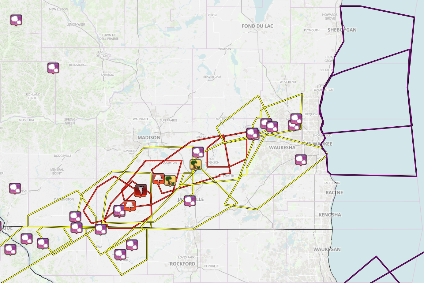 |
| National Weather Service Warnings and Reports. Tornado Warnings are in red, Severe Thunderstorm Warnings yellow, and Special Marine Warnings purple. |
 |
 |
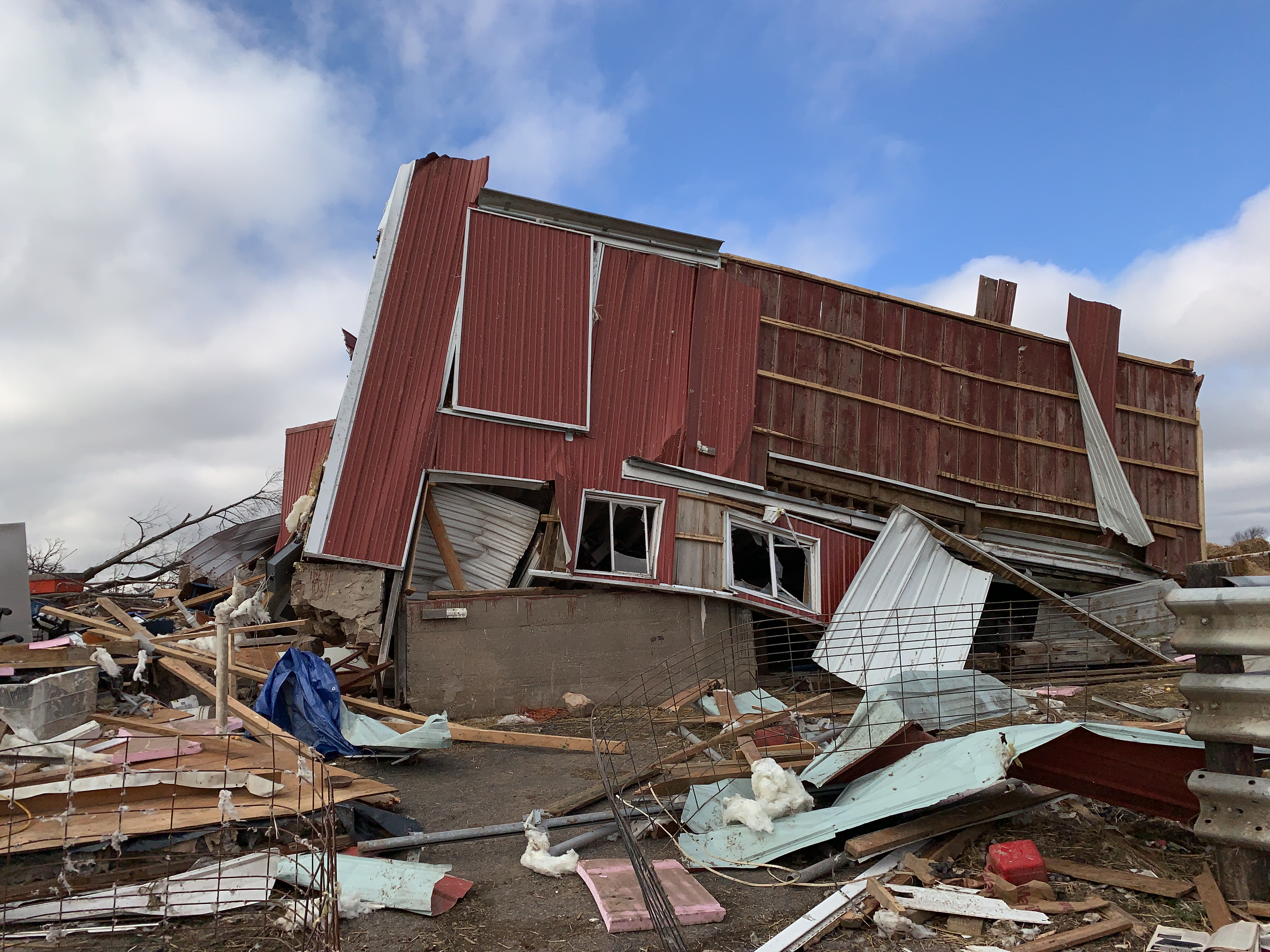 |
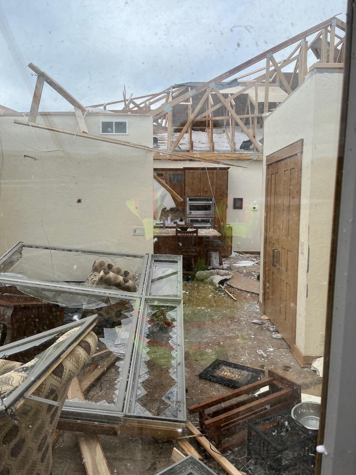
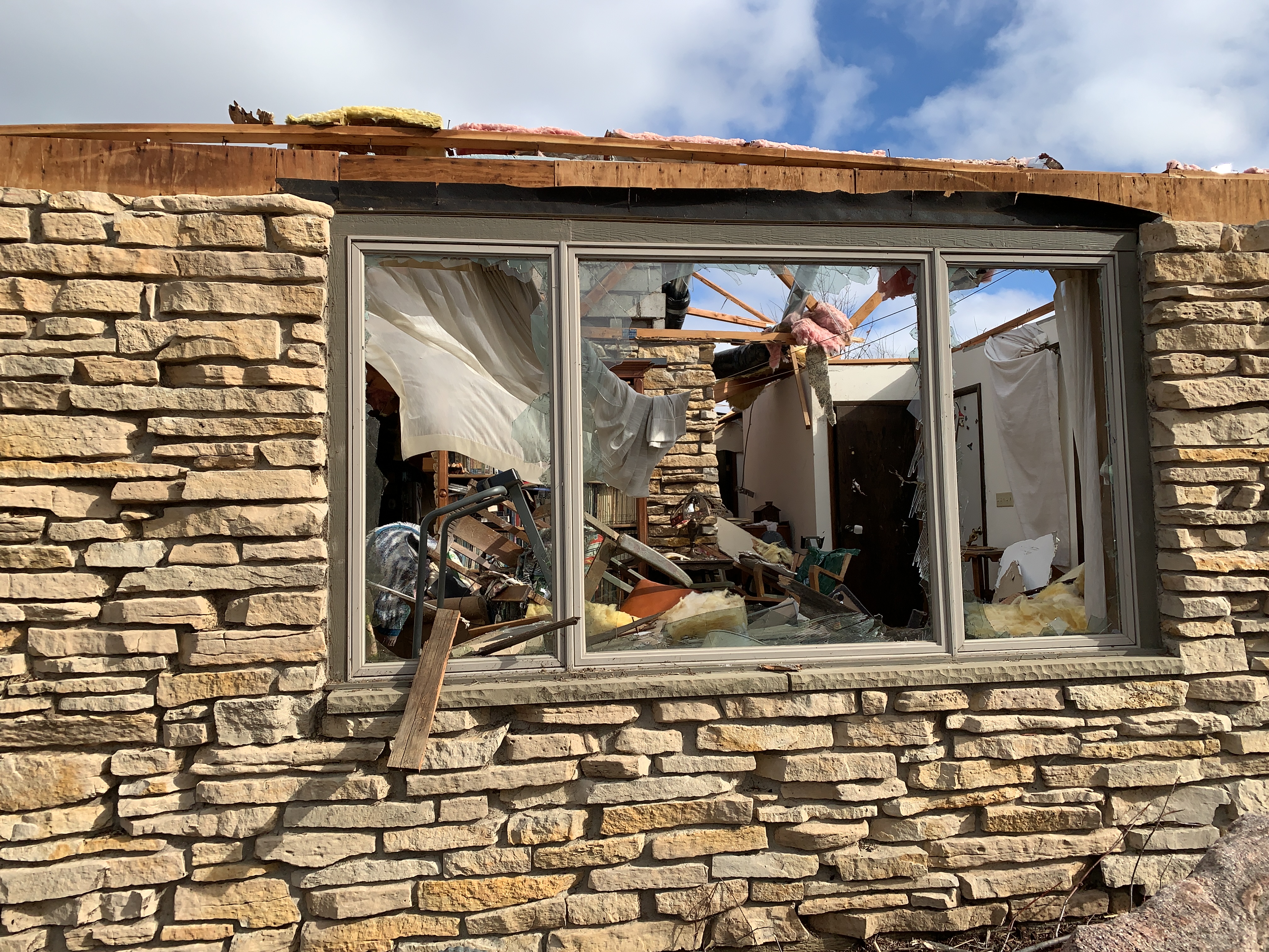
| Roof blown off house with extensive kitchen and living room damage. Evansville Area | Roof partially blown off house. Evansville Area | Barn tipped off its foundation. Evansville Area |
 |
 |
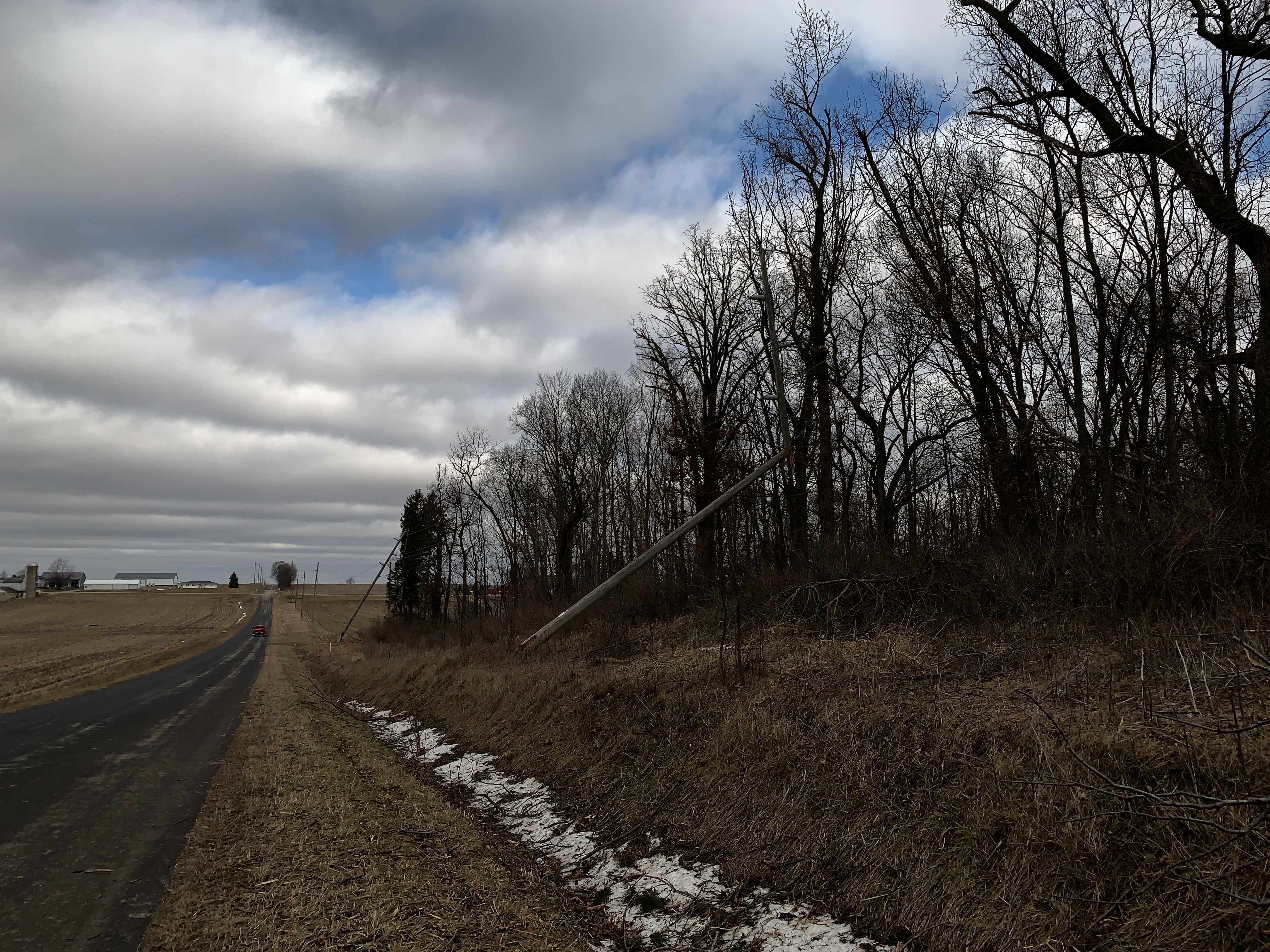 |
| Pole damage and yard debris. Evansville Area | Tree top snapped in middle of trunk and thrown. Evansville Area | Power Poles Leaning and Snapped Near Town of Porter, east of Evansville. Snow in the ditch. |
 |
 |
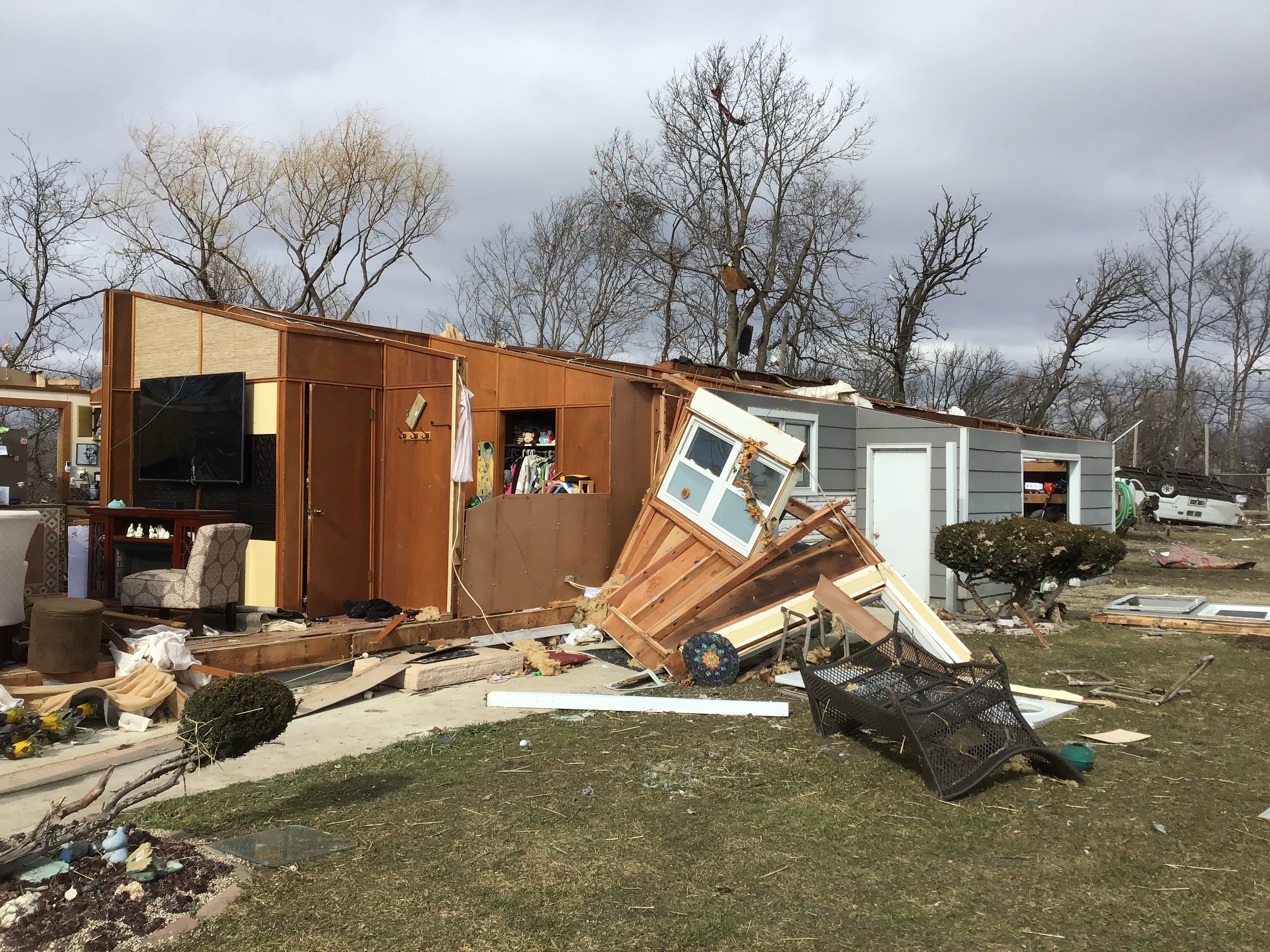 |
| Extensive damage to a farm. Evansville Area | Damage to home in Evansville Area. Yard debris. | Damage to home near Albany. Debris lofted into trees. Trailer rolled. |
Environment
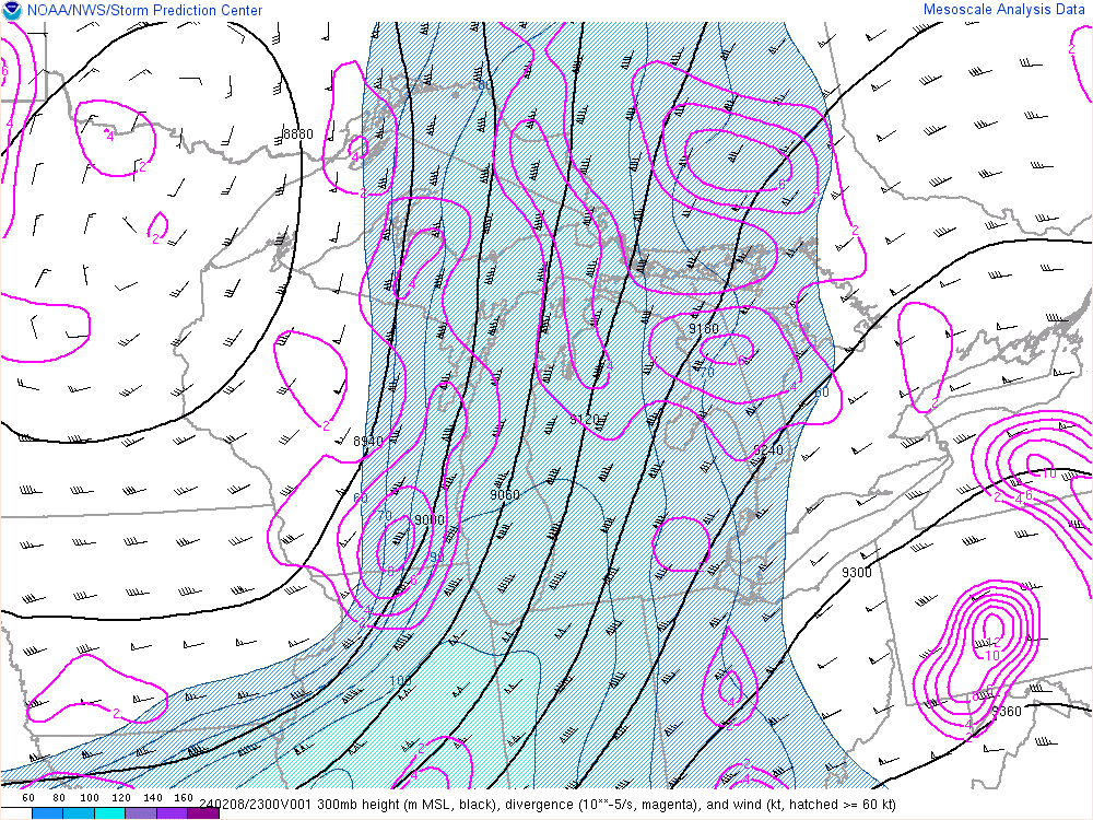
A 300 mb trough tracked from the Rocky Mountain West through the Northern Plains before swinging through the Upper Midwest Thursday, February 8th. Figure 3 shows the upper level jet over Wisconsin with the purple polygons highlighting the upper level divergence across southern Wisconsin. As the trough moved through, an upper level short wave rippled across the flow and added to the upper level divergence Thursday evening.
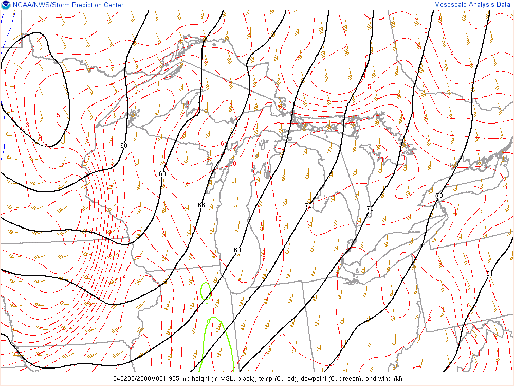
Looking lower in the atmosphere at 925 mb in Figure 2, you can see the impressive warm air advection and winds. Winds of 45 to 50 knots contributed to the warm and moist air surging northward that pushed dew points into the mid to upper 40s. These strong winds also hint at the amount of shear present during the afternoon and evening across southern Wisconsin.
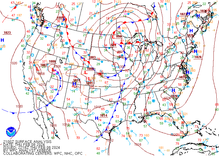
With upper level lift and impressive mid level moisture for this time of year, the pieces were lining up for some strong to severe thunderstorms. Looking at Figure 1, the surface low was to our northwest in the Northern Plains with a cold front draped across Minnesota and Iowa. As this cold front advanced east into Wisconsin, this was the surface forcing needed to initiate convection.
 |
 |
 |
| Figure 1: WPC Surface Map from around 2200Z. | Figure 2: 925mb - RAP Analysis from SPC around 2300Z. | Figure 3: 300mb RAP Analysis from SPC around 2300Z. |
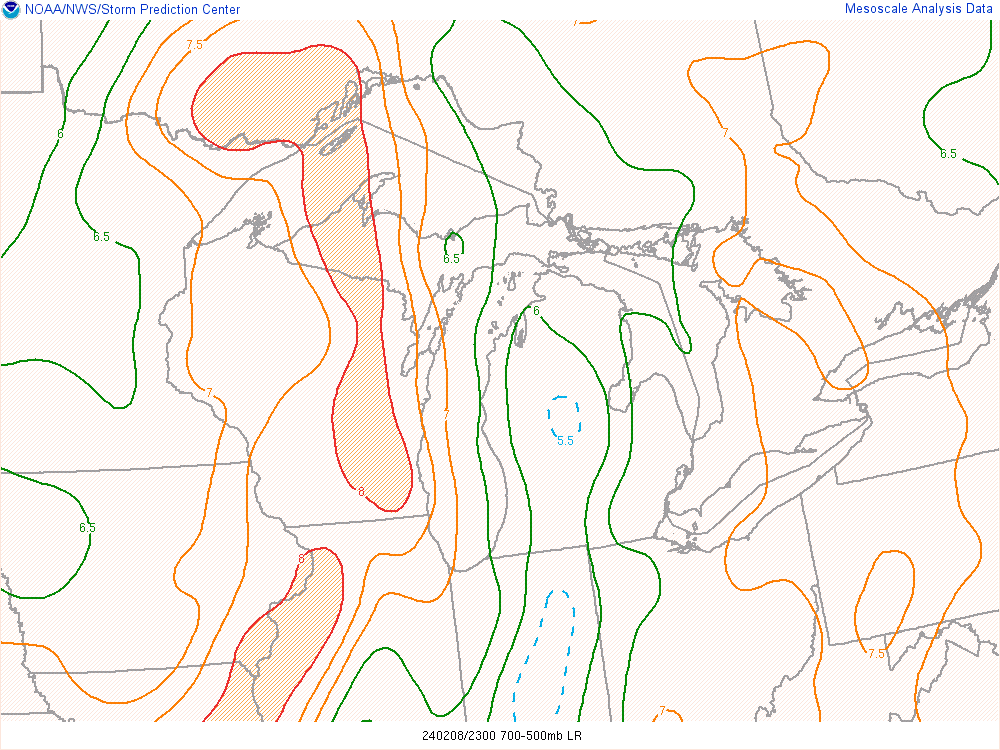
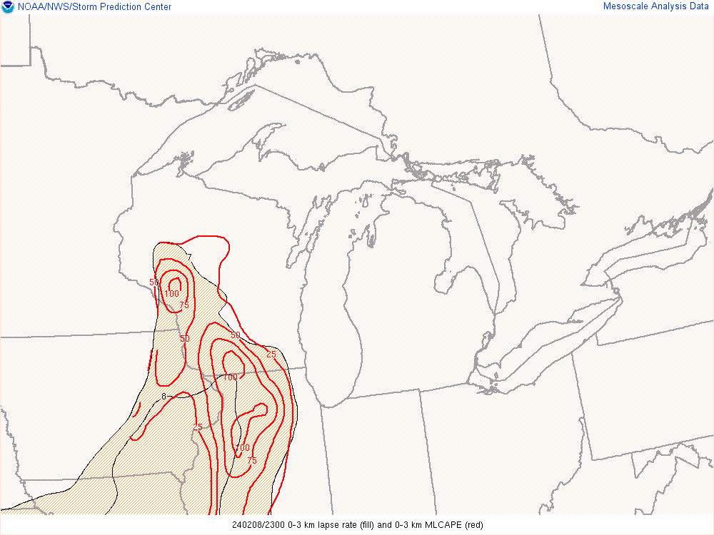
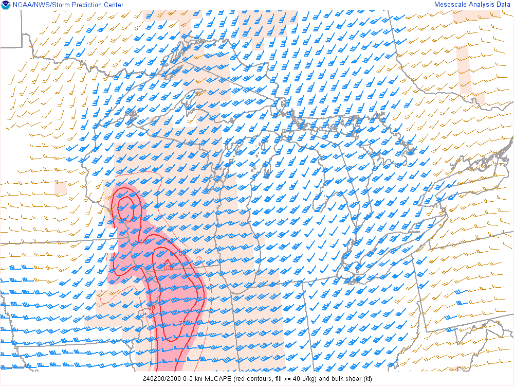
The severe potential really started to ramp up during the afternoon as skies cleared between the first round of storms along the warm front and second round along the cold front. As skies cleared, temperatures warmed and dew points increased, our near storm environment began to improve. Mid level lapse rates in Figure 4 quickly climbed to 8 degrees Celsius per kilometer which is impressive, especially for this time of year. Low level lapse rates and CAPE climbed as well with Figure 5 highlighting the area of low level lapse rates greater than 7 degrees Celsius per kilometer in the orange polygon and the 0-3 km MLCAPE values lined in red. When these values climbed, the concern for tornadoes grew across the state as surface-based convection became more likely. Shear was hinted at earlier with the strong 925 mb winds, but looking at Figure 6 confirms this with the 0-3 km MLCAPE and bulk shear. The MLCAPE is highlighted in the red contours/polygon and the bulk shear is shown in the wind barbs (vectors). Barbs (vectors) that are shaded blue are those that are over 30 kts, which is the minimum threshold that is looked at to identify an environment where severe thunderstorms can be sustained. Looking at the wind barbs you can see values of 40-50 knots across southern Wisconsin and Illinois.
 |
 |
 |
| Figure 4: Mid-level lapse rates - RAP Analysis from SPC around 2300Z. | Figure 5: Low-level lapse rates & 0-3km CAPE - RAP Analysis from SPC around 2300Z. | Figure 6: 0-3km MLCAPE (color shaded) and 0-3km Bulk Shear - RAP Analysis from SPC around 2300Z. |
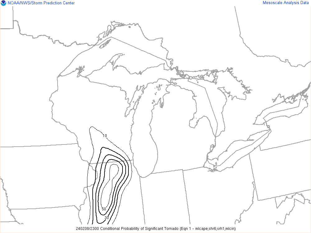
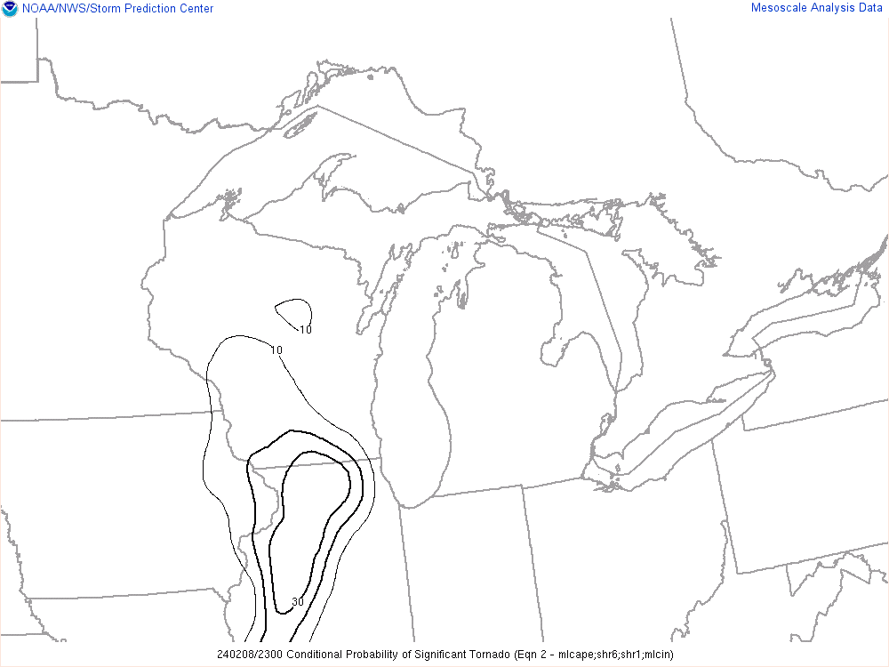
With all of the ingredients for severe thunderstorms coming together, it is no surprise that tornado parameters started to increase across Illinois and Wisconsin. Given the direction and speed shear present in both states, any storm that started to rotate had to be watched carefully. Figures 7 through 9 highlight the conditional probability of a significant tornado and convective inhibition.
 |
 |
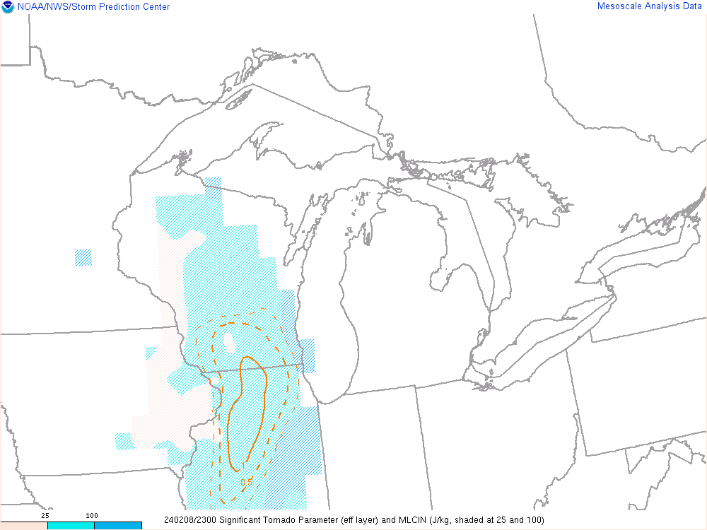 |
| Figure 7: Conditional Probability of a Significant Tornado Equation 1 - RAP Analysis from SPC around 2300Z | Figure 8: Conditional Probability of a Significant Tornado Equation 2 - RAP Analysis from SPC around 2300Z | Figure 9: Signification Tornado Parameter and SBCIN (color shaded) - RAP Analysis from SPC around 2300Z |
 |
Media use of NWS Web News Stories is encouraged! Please acknowledge the NWS as the source of any news information accessed from this site. |
|


 Follow us on YouTube