
New Year Brings Ice and Snow to
southeast Mississippi & southwest Alabama
January 1, 2002
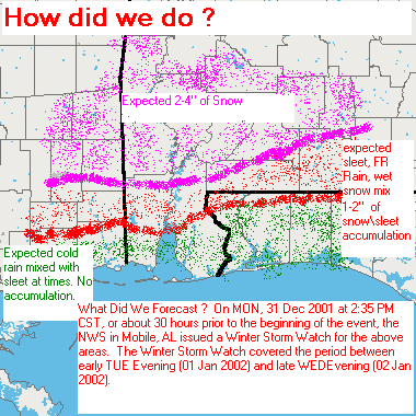
As a developing surface low pressure system moved slowly across the southern Gulf of Mexico during the late evening of January 1st, a rain and sleet mix changed to snow over inland portions of our area, while a mixture of rain, sleet and freezing rain fell over coastal counties of Alabama. A cold rain fell over the northwest Florida panhandle overnight.
Ending at 8am on January 2nd, National Weather Service Cooperative observer reports along with numerous emergency management and law enforcement agencies reported that snow fell roughly north of a line from Wiggins, MS to Deer Park, AL to Chrysler, AL and then to Evergreen and Luverne, AL.
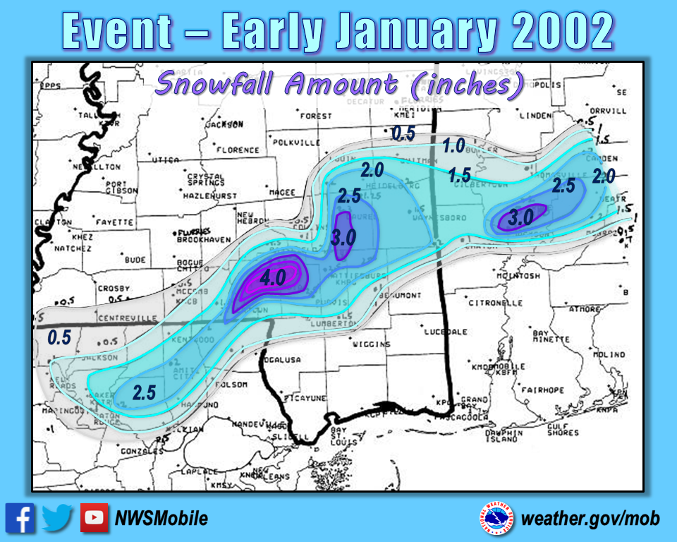
Snow Reports:
Southeast Mississippi
| Location | Amount (inches) |
| Beaumont | 1 |
| State Line | 2 |
| Waynesboro | 1-2 |
| Northern Perry County | 2-3 |
| Southern Perry County | 1-2 |
Southwest Alabama
| Location | Amount (inches) |
| Andalusia | None |
| Butler | 1 |
| Camden | 2 |
| Chatom | 1 |
| Chilton (near Grove Hill) | 2 |
| Evergreen | Trace |
| Greenville | 1.5 |
| Highland Home | 2 |
| Jackson | 3 |
| Luverne | 1/4 |
| Peterman | 2 |
| Thomasville | 1 |
| Whatley | 3 |
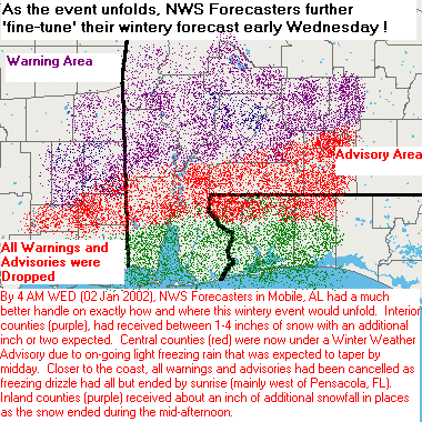
Additionally, rain and sleet fell overnight south of the above mentioned snowfall line. By sunrise, the precipitation had changed to a mixture of light freezing rain and freezing drizzle. The southern extent of the significant icing appears to have been from a line from Saucier, MS to west Mobile, AL to Brewton, AL to Andalusia, AL.
Mixed Precipitation Reports:
Southeast Mississippi
| Location | Amount (inches) |
| Northern Stone and George Counties | 1/10 -1/4 inch of sleet and freezing rain with a dusting of snow on rooftops |
| Southern Stone and George Counties | > 1/4 inch of sleet and freezing rain with dusting of snow on rooftops |
Southwest Alabama
| Location | Amount (inches) |
| Bates Field, Mobile | approx. 1/10 inch freezing rain |
| Seven Hills | approx. 1/10 inch freezing rain |
| Mount Vernon | 1/10 to 1/4 inch sleet and freezing rain |
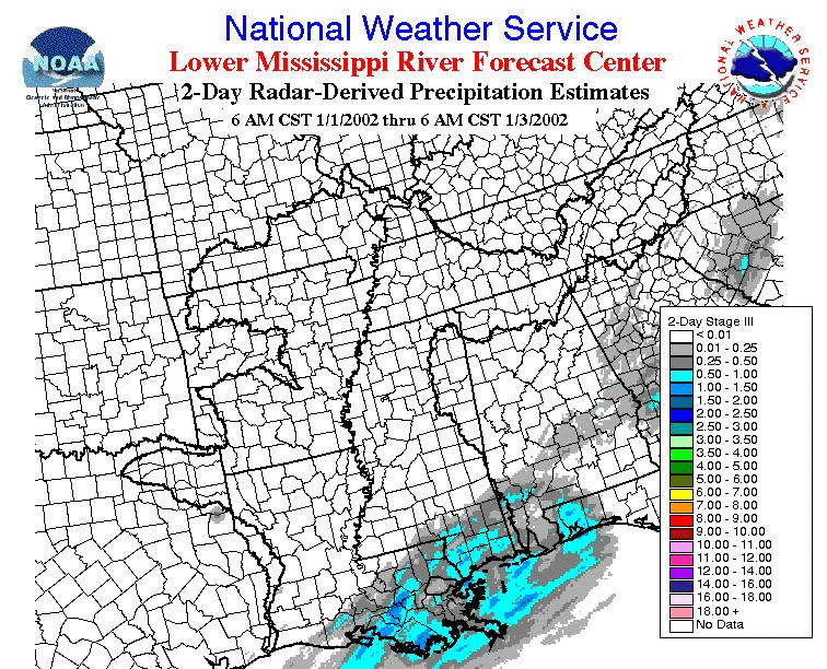
Radar Derived Precipitation Totals: January 1-3, 2002
 |
 |
|
 |
Acknowledgements: Page initially created by Jeff Medlin (Meteorologist In Charge) and Alan Campbell (Forecaster). Page updated by Morgan Barry (Forecaster).
LAST UPDATED: October 2016


 Follow us on YouTube