INTRODUCTION
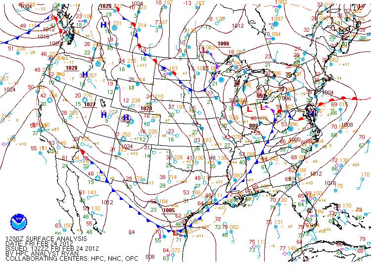
During the mid-morning hours of 24 February 2012, a line of severe thunderstorms suddenly erupted along a fast moving cold front as it began to move across southeastern Mississippi and into southwestern Alabama. Some of these thunderstorms became severe locally, and one of those, produced straight-line wind damage that heavily damaged the roof of Harper Headstart School near Jackson, Alabama. Warning forecasters were able to provide 12 minutes of lead time before the severe thunderstorm struck. Students were able to take proper action to protect themselves upon timely receipt of the warning by school administrators. Metal fencing surrounding the structure was flattened and the school also lost electrical power due to a transformer catching on fire. Winds were estimated as high as 90 mph in association with this severe thunderstorm. Scattered reports of straight-line wind damage and severe hail occurred elsewhere in association with this event to include: (1) Dog Brown Road in northeastern Greene County, MS and (2) along I-65 and other portions of Butler and Crenshaw counties in Alabama. Figure 1 shows damage reports on a national scale (courtesy NWS Storm Prediction Center) while Figure 2 shows damage reports and warnings issued regionally (courtesy Iowa State). No tornadoes occurred in association with this event.
|
|
|
|
EVENT EVOLUTION
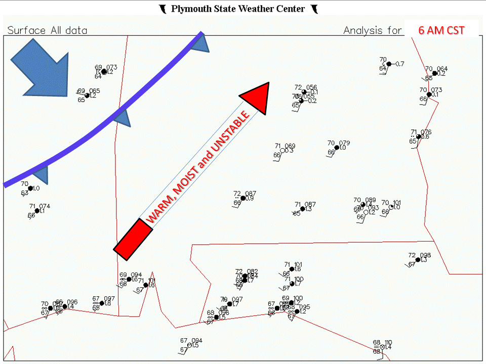 Fig 4a |
|
|
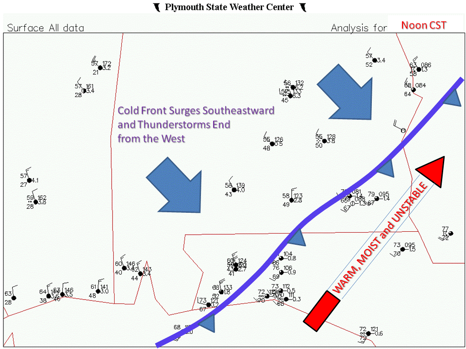
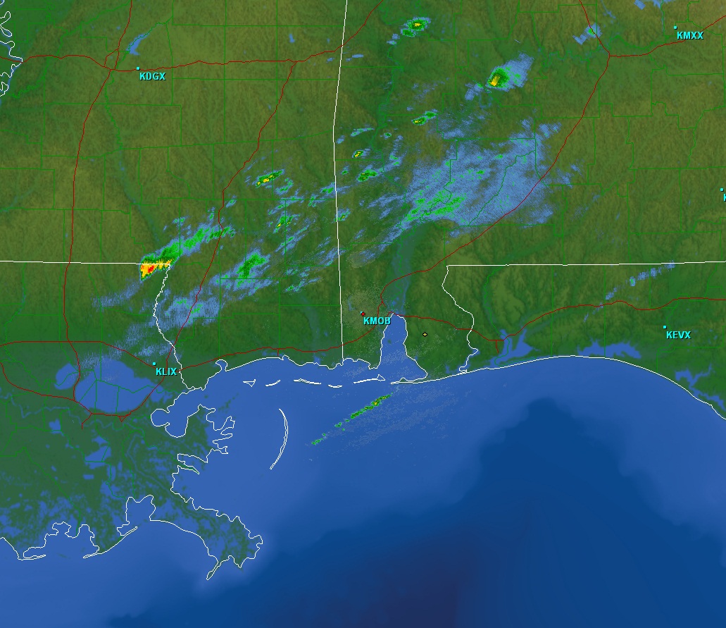
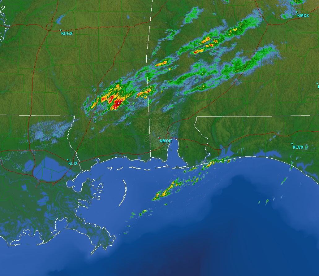
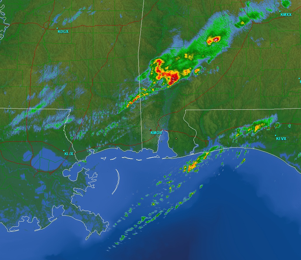
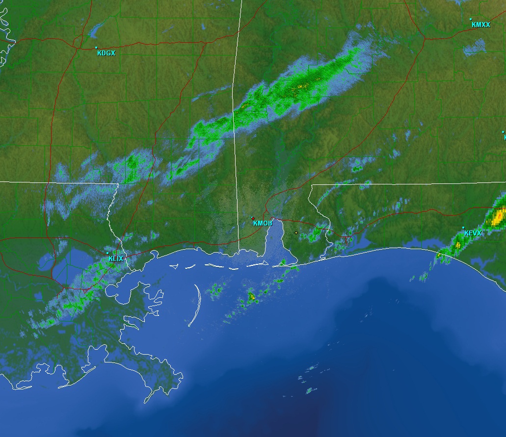
Although not shown, the atmosphere on that day was characterized by adequate instability and vertical wind shear to support severe thunderstorm formation. Figure 3 shows a large scale depiction of surface conditions valid at 6 AM CST – prior to the formation of the line of thunderstorms. Figures 4a-c show cold front locations every three hours at 6 AM-, 9 AM and Noon CST, respectively. Note the warm moist air ahead of the cold front and the cooler and much drier air behind it. As one can see in the image series, the cold front moved quickly and the surge that occurred between 9 AM and Noon CST was most closely located with where the line of thunderstorms formed and also where stronger cells along the line produced severe weather (see the inset in Fig. 4b). An hourly radar reflectivity time series from the event beginning to end is shown in Figures 5a-f. Note that Figure 5c matches the same image of the location of the cold front shown in Figure 4b.
|
|
|
|
|
|
|
Figure 6a-b shows radar reflectivity (leftmost image) and base velocity (rightmost image). One case see dry air punching downward whose leading edge is marked by the dashed black line and the arrow. The damaging 90 mph winds were punching into the rear of the severe thunderstorm as it moved off to the east. Although not shown, radar reflectivity data above this elevation show a clear cut “doughnut hole” from ~4500-16,000 feet AGL with higher velocities in the middle.
 Fig 6a-b |
PRODUCTS AND SERVICES
The NWS in Mobile, AL began mentioning the possibility of this event two days in advance in their Graphicasts and Hazardous Weather Outlook Products. About 36 hours before the event, forecasters began to slow down the event occurrence, or, push it later in time as it became clear the upper system would move farther north and the southeastward progression of the low level cold front would be halted (i.e., actually pushing it into 6 AM to Noon time frame versus the midnight to 6 AM time frame). The later passage of the cold front allowed for more instability to be present during the daylight hours when it moved through. The average lead time for all warned severe thunderstorms was about 26 minutes with a 12 minute lead time for the Harper Headstart severe thunderstorm in Jackson, Alabama. The NWS in Mobile, AL continued sending special updates via email and conducted two Special Webinars with its Emergency Managers two days prior to the event, alerting them to the fact that severe thunderstorms were possible. No tornadoes occurred in association with this event.
ACKNOWLEDGEMENTS
This web page was produced by Jeffrey Medlin (Science and Operations Officer) and Ray Ball (Information Technology Officer).


 Follow us on YouTube