
A strong atmospheric river moving into northern California later Tuesday will bring a threat for moderate to heavy rainfall and flooding, gusty to high winds, and mountain snows for parts of the Northwest U.S. through at least Wednesday. Gusty winds and isolated rain and snow showers will continue in the Northeast U.S. Tuesday behind a cold front. Read More >
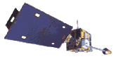
There are three main types of satellite images available:
VISIBLE
INFRARED
WATER VAPOR
VISIBLE IMAGERY: Visible satellite pictures can only be viewed during the day, since clouds reflect the light from the sun. On these images, clouds show up as white, the ground is normally grey, and water is dark. In winter, snow-covered ground will be white, which can make distinguishing clouds more difficult. To help differentiate between clouds and snow, looping pictures can be helpful; clouds will move while the snow won't. Snow-covered ground can also be identified by looking for terrain features, such as rivers or lakes. Rivers will remain dark in the imagery as long as they are not frozen. If the rivers are not visible, they are probably covered with clouds. Visible imagery is also very useful for seeing thunderstorm clouds building. Satellite will see the developing thunderstorms in their earliest stages, before they are detected on radar.
INFRARED IMAGERY: Infrared satellite pictures show clouds in both day and night. Instead of using sunlight to reflect off of clouds, the clouds are identified by satellite sensors that measure heat radiating off of them. The sensors also measure heat radiating off the surface of the earth. Clouds will be colder than land and water, so they are easily identified. Infrared imagery is useful for determining thunderstorm intensity. Strong to severe thunderstorms will normally have very cold tops. Infrared imagery can also be used for identifying fog and low clouds. The fog product combines two different infrared channels to see fog and low clouds at night, which show up as dark areas on the imagery.
WATER VAPOR IMAGERY: Water vapor satellite pictures indicate how much moisture is present in the upper atmosphere (approximately from 15,000 ft to 30,000 ft). The highest humidities will be the whitest areas while dry regions will be dark. Water vapor imagery is useful for indicating where heavy rain is possible. Thunderstorms can also erupt under the high moisture plumes.


 Local Radar
 Huntsville Radar
 Regional Satellite
 Graphical Forecast
 Weather Map