
Critical fire weather conditions, severe thunderstorms capable of producing severe wind gusts, large hail, strong tornadoes and heavy rainfall remain on tap for the central U.S. this evening. Flash flooding is also possible for portions of the Plains and Mississippi Valley. Very large hail up to 3 inches in diameter will be possible this evening across western Kansas. Read More >
| Overview | |||||||||||||||||||||||
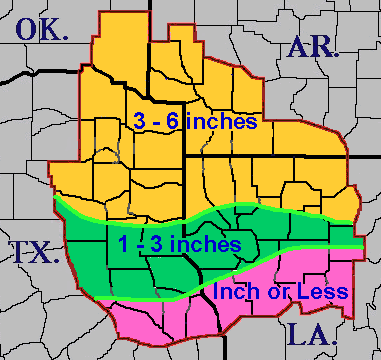
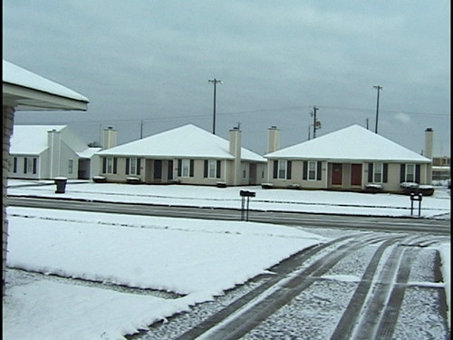
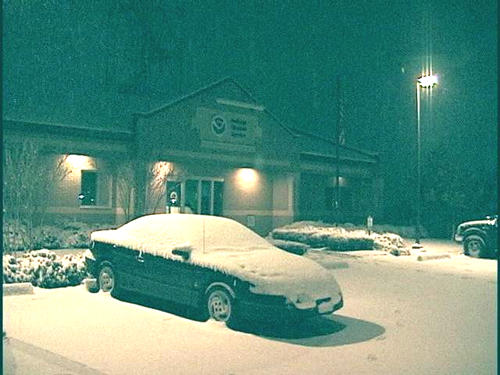
| The third in a series of winter storms in December affected the region on New Year's Eve 2000, which coincided with a major college football game game between Texas A&M and Mississippi State. The primary difference with this storm compared to previous events was that the bulk of the precipitation fell as snow instead of sleet and freezing rain. Snowfall amounts varied from a dusting to an inch over the Toledo Bend Country and Central Louisiana, to as much as 3 to 6 inches generally north of Interstate 20. A few locations in Southwest Arkansas recorded totals near 7 inches. Shreveport Regional Airport officially recorded 2.2 inches of snowfall, which was the highest daily total snowfall in Shreveport since February 1, 1985, when 4.4 inches of snowfall was recorded. | |||||||||||||||||||||||
|
About 30 minutes before kickoff, snow blew into Shreveport with strong wind whipping from one end zone to the other. The game started with the synthetic grass field a mix of green and white. By the second quarter, the turf was blanketed by snow. Plows were used during timeouts to make the goal lines, end lines, and hash marks visible. As the snow fell throughout the game, at times, it came down so hard that it made watching the game like looking through television static. Many of the 36,974 fans at Independence Stadium left at halftime. "There might have been a different football game under normal conditions, but our team just never gave up," said Mississippi State Coach Jackie Sherrill, who held the same post at Texas A&M from 1982-88. "I was surprised both teams scored as many points as we did in the snow." Mississippi State won the game in overtime, 43-41. |
|||||||||||||||||||||||
|
Graphics
Photos
|
|||||||||||||||||||||||
| Back to Top | |||||||||||||||||||||||


 Follow us on YouTube