
Critical fire weather conditions, severe thunderstorms capable of producing severe wind gusts, large hail, strong tornadoes and heavy rainfall remain on tap for the central U.S. this evening. Flash flooding is also possible for portions of the Plains and Mississippi Valley. Very large hail up to 3 inches in diameter will be possible this evening across western Kansas. Read More >
| Overview | |||||||||
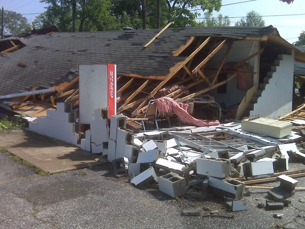
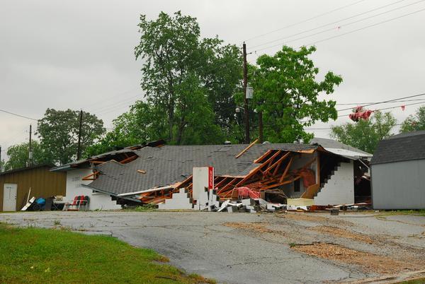
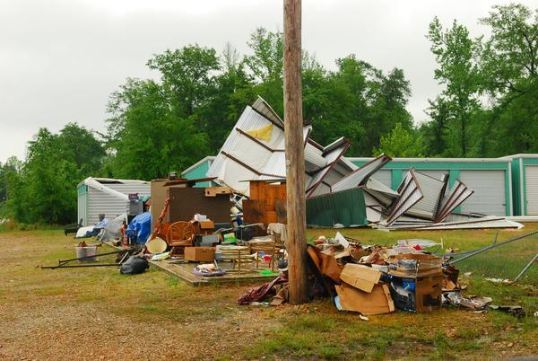
| A storm survey was conducted for damage that occurred in Dierks, AR, as well as other locations, due to severe thunderstorms that moved through that area. The survey team concluded that an EF1 tornado occurred in Dierks. Below are photos of some of the storm damage that was sent to the National Weather Service in Shreveport by local residents. | |||||||||
| Photos | |||||||||
|
|||||||||
|
|||||||||
|
|
|||||||||


 Follow us on YouTube