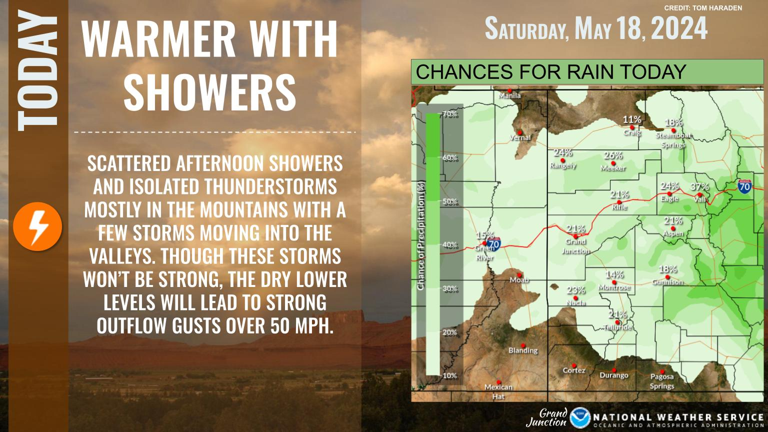
Expect significant changes in the weather over the next few days. Today will be fairly placid for most areas with warmer than normal temperatures. However, a weak disturbance is expected to bring scattered showers and isolated thunderstorms to the central and southern Colorado mountains. On Sunday it gets windy as a strong spring storm moves over the Great Basin. A High Wind Watch remains in effect for much of eastern Utah and the westernmost counties of Colorado from Sunday morning through Sunday evening. The storm pushes eastward across the region Sunday night bringing widespread showers and a few thunderstorms. An influx of colder air will bring snow levels to mountain bases in the north with light accumulations possible across the northwest Plateau. Active weather is expected to persist during the remainder of the week along with colder than normal temperatures.


 Follow us on YouTube