|
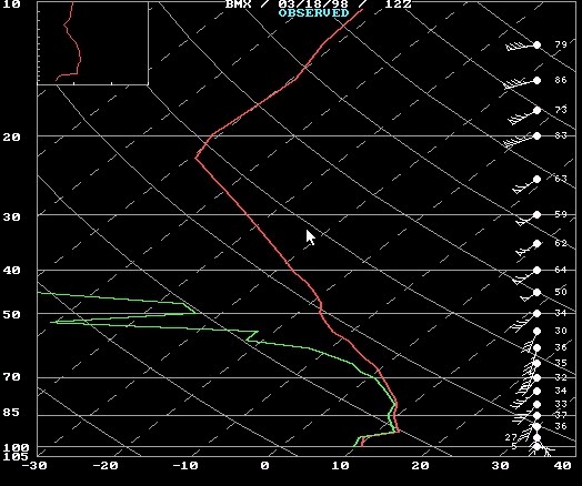
A rather strong cold-air wedge event occurred over eastern Alabama and northern Georgia from March 17th through March 19th, 1998. In Alabama, the leading edge of the cooler air is commonly refered to as a "back-door" cold front, as the front arrives from the east, rather than from the west. During a wedge event, a shallow cold air mass spills southward along the east side of the Appalachian Mountains and fans out as it reaches the foothills of Georgia and Alabama. By the time the relatively colder air reaches Alabama, it may only be a few thousand feet thick, as seen in the Birmingham (BMX) sounding (below). As with arctic air masses which occasionally sweep rapidly southward along the front range of the Rocky Mountians, the shallow nature of these air masses can evade temperature forecasting equations based on certain atmospheric models. The current Eta Model has grid spacing of 32 km in the horizontal and 45 levels in the vertical. However, numerical temperature guidance still relies on the NGM model. While the NGM temperature forecasting schemes are very good, they rely on a model which does not have the vertical resolution found in the Eta model, especially in the lowest few kilometers above the earth's surface.
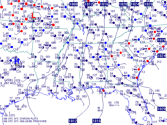
The surface map below was during the peak of the wedge event. Surface temperatures across northern Georgia were in the lower 40s while middle 60s were observed in western Alabama.
|


 Follow us on YouTube