NWS Birmingham, Alabama
Weather Forecast Office
Analysis and Comments on a March 1998 Wedge Event
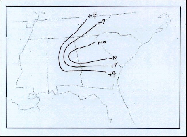
Numerical guidance maximum temperature forecast errors were rather large during the wedge event. The following stations were used in the analysis: Birmingham, Huntsville, Anniston, Montgomery, Atlanta, Athens, Columbus(GA), and Chattanooga. Observed maximum temperatures on March 17th, were subtracted from FWC MOS forecast temperatures, beginning with the 12Z cycle on March 15th (top left), and ending with 00Z cycle on March 17th (bottom right). Suprisingly, MOS forecasts did not improve as the forecast cycle approached the 17th.
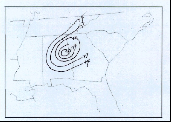
 4th period forecast highs minus observed highs. |
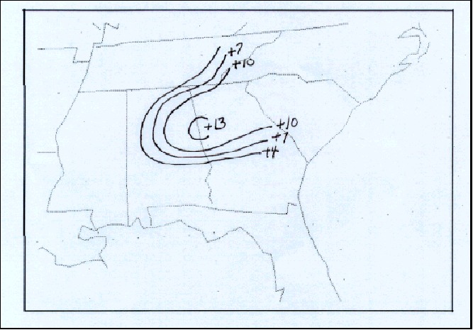
 3rd period forecast highs minus observed highs. |
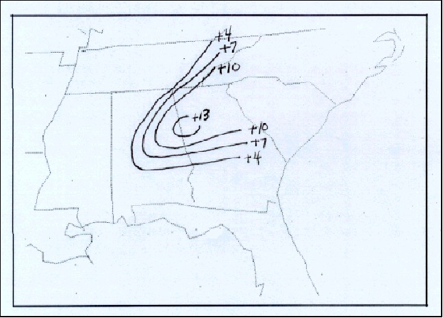
 2nd period forecast highs minus observed highs. |
 1st period forecast highs minus observed highs. |
References
Bell, G.D., and L.F. Bosart, 1998: Appalachian Cold-Air Damming. Monthly Weather Review, 116, 137-161.
| Page 1 | Page 2 | Page 3 | Page 4 | Page 5 | Page 6 |
Current Hazards
National Outlooks
Tropical
Local Storm Reports
Public Information Statement
Graphical Hazardous Weather Outlook
Current Conditions
Rivers and Lakes
Regional Weather Roundup
Regional Highs/Lows/Rainfall
Drought Monitor
Forecasts
Aviation Weather
Graphical Forecasts
Forecast Discussion
Air Quality
Fire Weather
Climate and Past Weather
Past Events
Storm Data
Tornado Database
Daily Rainfall Plots
Local Climate Data
Tropical Cyclone Reports
Warnings and Other Products
Tornado Warnings
Severe Thunderstorm Warnings
Flash Flood Warnings
Winter Weather Warnings
Special Weather Statements
Non-Precipitation Warnings
Flood/River Flood Warnings
Productos en Español
Conciencia y Preparación
Previsión de 7 DÃas
Weather Safety
Severe Safety w/ ASL
NOAA Weather Radio
All-Hazards Awareness Booklet
Severe Weather Preparedness
Severe Safety Rules
Tornado Safety Rules
Awareness Weeks
Severe Weather
Hurricane Preparedness
Summer Safety Campaign
Winter Weather
US Dept of Commerce
National Oceanic and Atmospheric Administration
National Weather Service
NWS Birmingham, Alabama
465 Weathervane Road
Calera, AL 35040
205-664-3010
Comments? Questions? Please Contact Us.

