
Dangerous heat will expand from the Gulf Coast into the Southern Plains and Desert Southwest through week's end. Additional extreme heat impacting the Pacific Northwest will shift to the northern Plains by the weekend. Tropical Storm Bertha is expected to continue to impact portions of the northwestern Gulf Coast from south central Louisiana to the upper Texas coast today. Read More >
Grand Rapids, MI
Weather Forecast Office
Overview
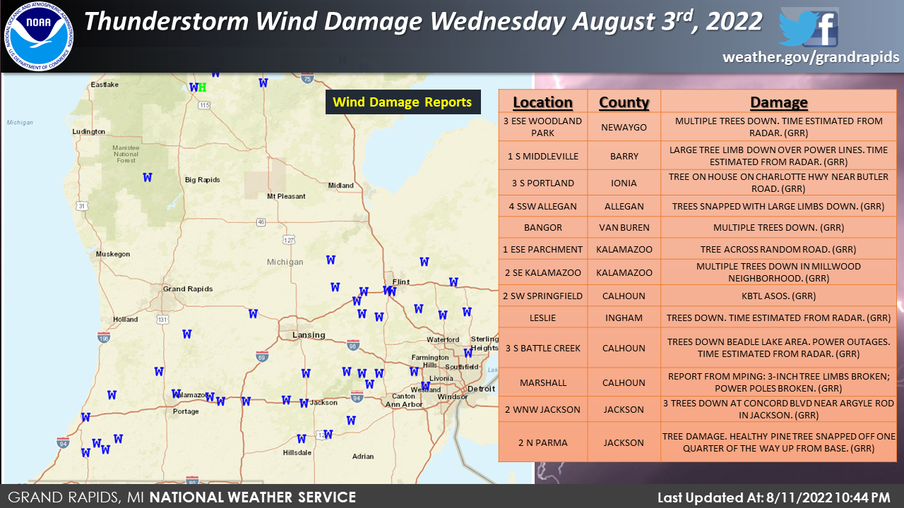
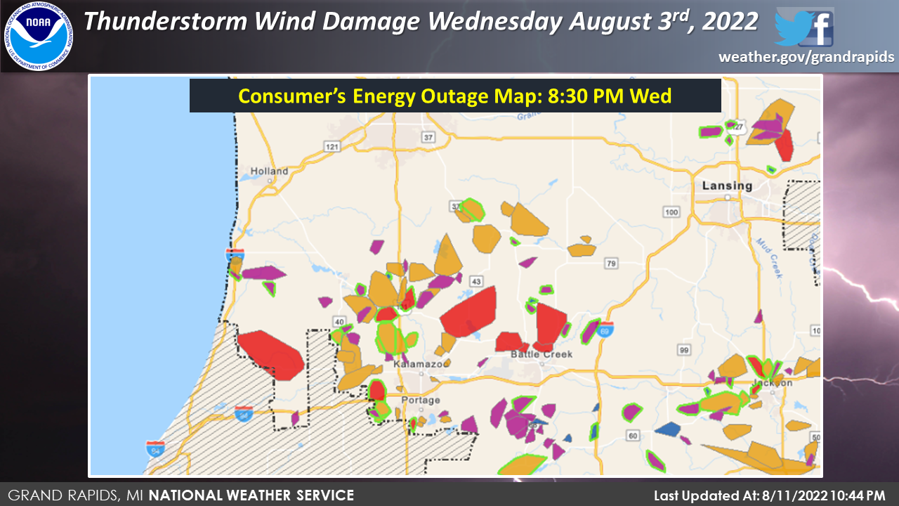
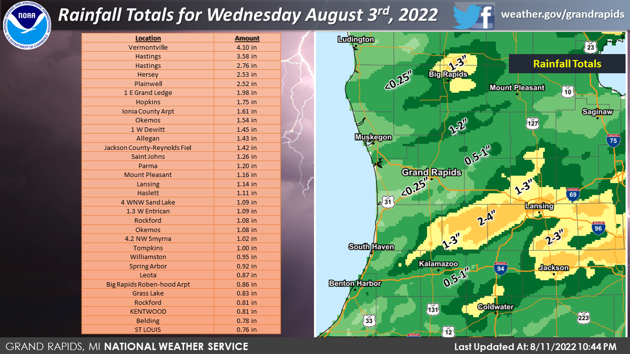
Through the afternoon and early evening of August 3rd, 2022 A storm system that had multiple lines of convection moved through southern Lower Michigan. This system was primarily a wind threat with reports of over 160,000 homes without power. Showers and storms did form along a boundary which caused over 4 inches of rainfall. That caused localized flooding in a few locations.
Wind & Power Outages:
Wind
Power Outages
Radar
Radar Reflectivity and doppler winds with related warnings
Warnings and Radar Reflectivity until 4:10 pm
Warnings and Doppler Wind Speed until 4:10 pm
Warnings and Radar Reflectivity from 4:35 pm until 7:00 pm
Warnings and Doppler Velocity from 4:35 pm till 7:00 pm
Rain Reports
 |
Media use of NWS Web News Stories is encouraged! Please acknowledge the NWS as the source of any news information accessed from this site. |
|
US Dept of Commerce
National Oceanic and Atmospheric Administration
National Weather Service
Grand Rapids, MI
4899 Tim Dougherty Drive SE
Grand Rapids, MI 49512-4034
616-949-0643
Comments? Questions? Please Contact Us.

