
Dangerous heat will expand from the Gulf Coast into the Southern Plains and Desert Southwest through week's end. Additional extreme heat impacting the Pacific Northwest will shift to the northern Plains by the weekend. Tropical Storm Bertha is expected to continue to impact portions of the northern Gulf Coast from the western Florida Panhandle to southeastern Louisiana through tonight. Read More >
Overview
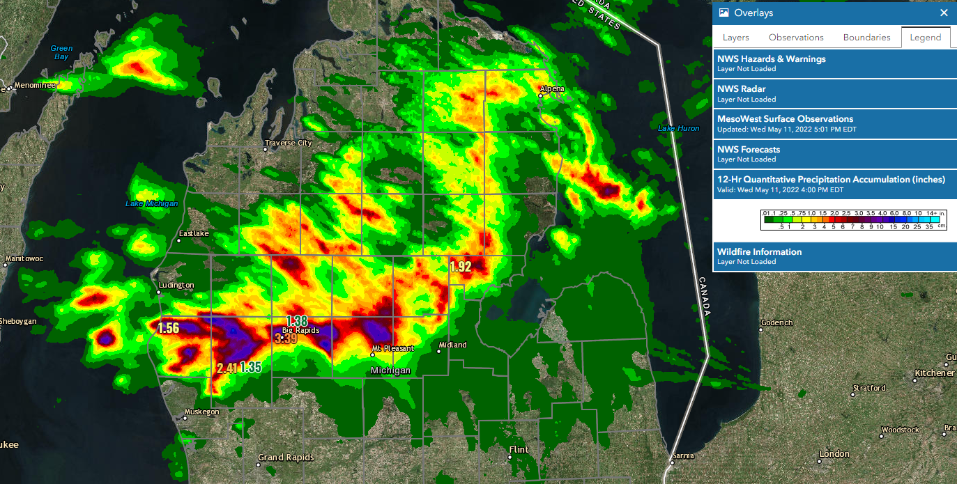
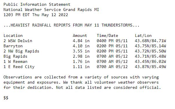
Backbuilding and training thunderstorms with substantial rainfall rates resulted in localized flooding across Central Lower Michigan. Upwards of 3-4 inches fell across parts of Isabella, Mecosta, Newaygo, and Osceola Counties, resulting in substantial flooding in localized spots. Preliminary flooding damage estimates reported by County Emergency Management were up to $100K in Isabella County due primarily to road damage, and up to $1 Million in Big Rapids due to roads and infrastructure.
Photos & Video
|
|
| __ | Flooding impacts areas in and surrounding Big Rapids. If you come across a flooded street, do not drive through it! Turn around, don't drown! |
| Video courtesy of Isabella County Emergency Management. | Video courtsey of Isabella County Emergency Management. | Video courtsey of Isabella County Emergency Management. |
Radar
| Thunderstorms continued to backbuild and train across parts of Central Lower Michigan resulting in prolonged heavy downpours. Rainfall rates reached up to 3 inches per hour, with areas reporting up to 3-5 inches within 1-2 hours. |
Rain and Hail Reports
Several pockets of significant rainfall rates resulted in 1 hour rainfall totals up to 3-4 inches across Isabella, Mecosta, Newaygo and Oceana Counties.
.PNG)
 |
Media use of NWS Web News Stories is encouraged! Please acknowledge the NWS as the source of any news information accessed from this site. |
|

