
Dangerous heat will expand from the Gulf Coast into the Southern Plains and Desert Southwest through week's end. Additional extreme heat impacting the Pacific Northwest will shift to the northern Plains by the weekend. Tropical Storm Bertha is expected to continue to impact portions of the northern Gulf Coast from the western Florida Panhandle to southeastern Louisiana through tonight. Read More >
Overview
|
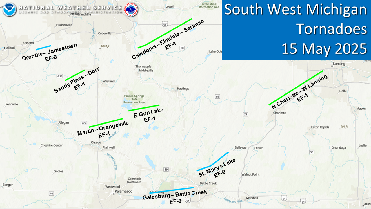
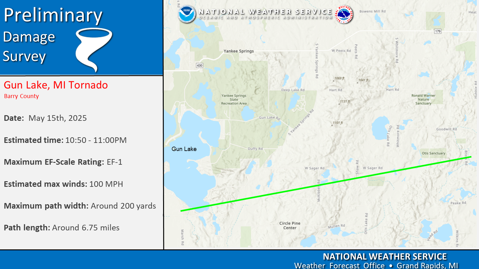
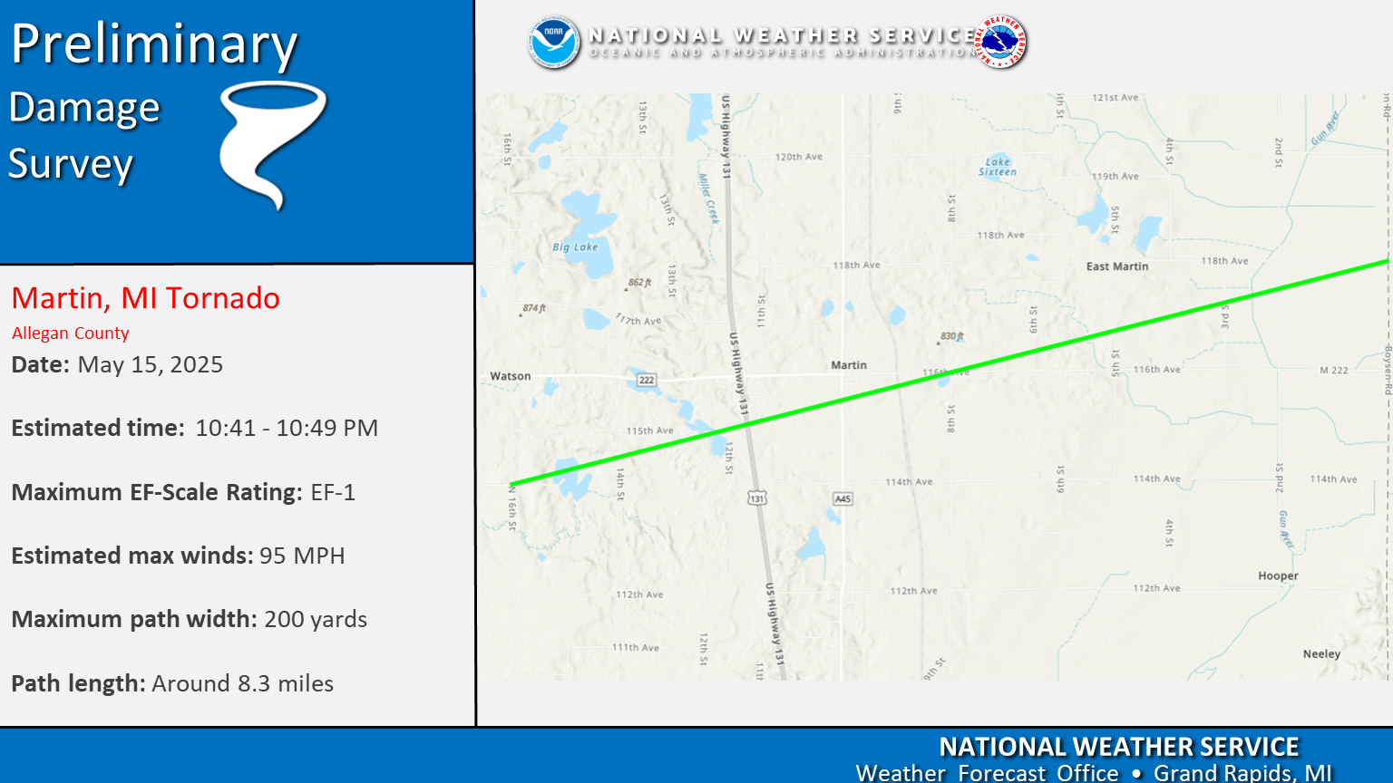
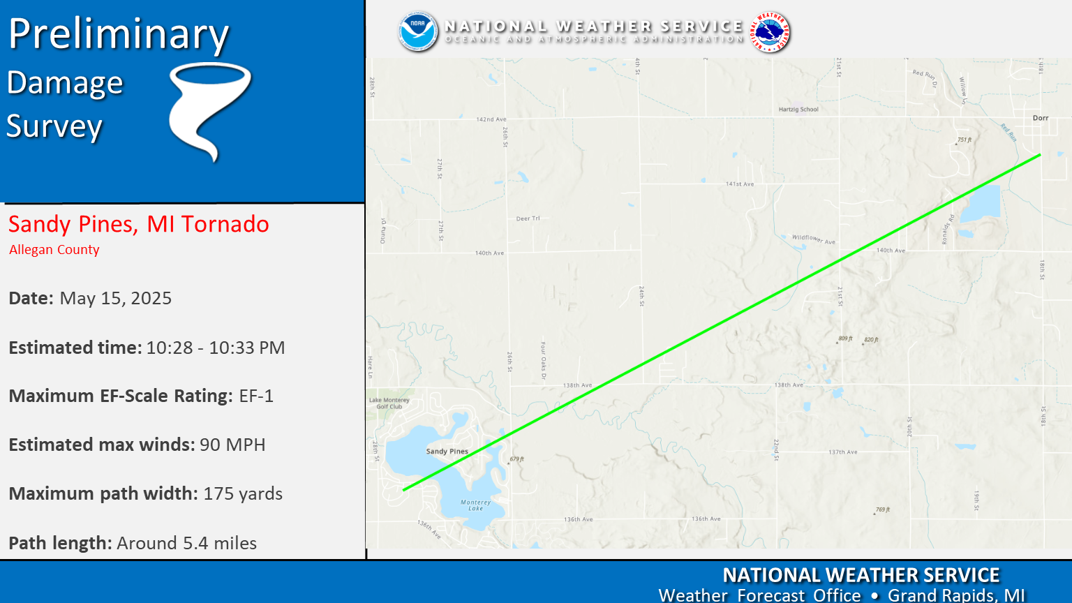
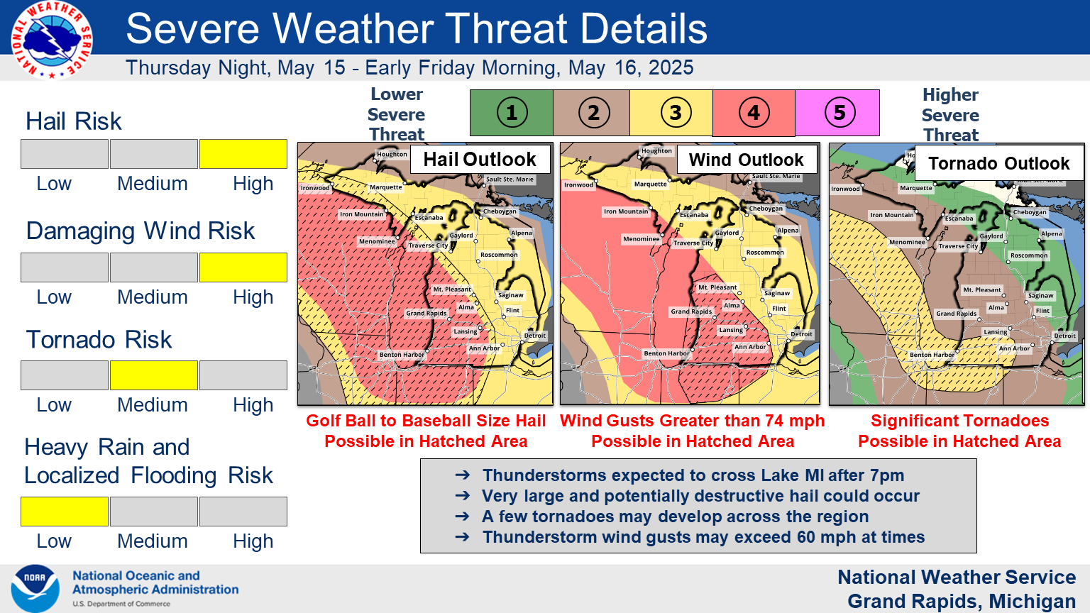
On the evening of May 15th, 2025 a severe weather system moved across Southern Lower Michigan. That system brought widespread damaging winds and 11 tornadoes across Lower Michigan. Eight of those tornadoes occurred in southwest and southcentral Michigan. Thankfully there were no injuries or fatalities directly related to the storm damage. |
Tornadoes
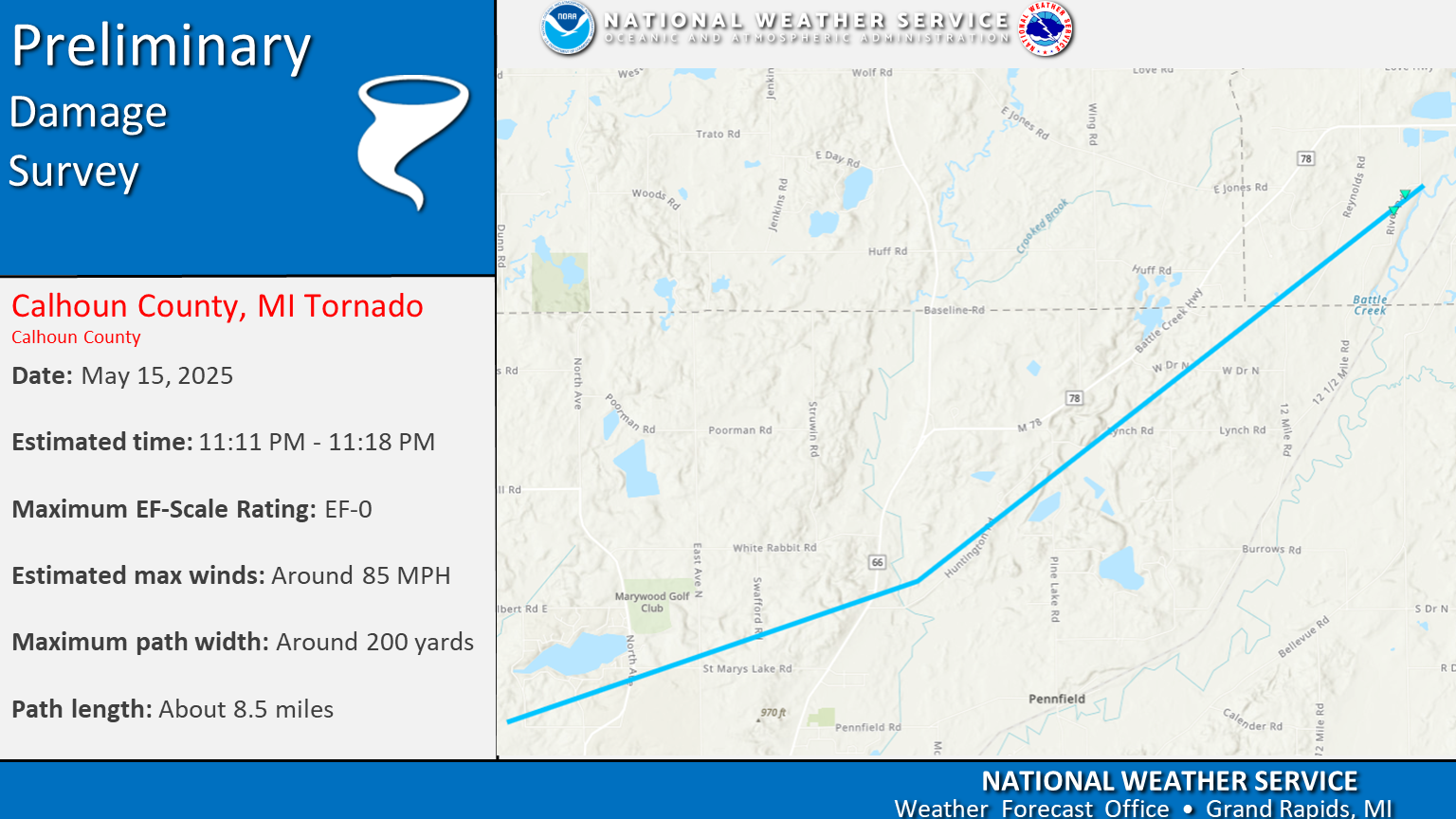
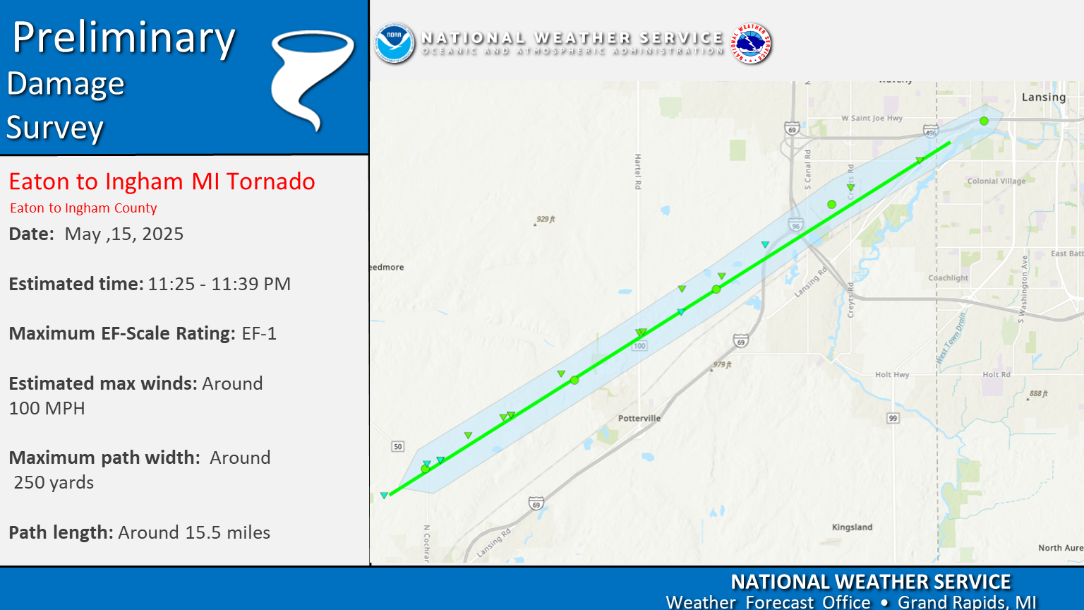
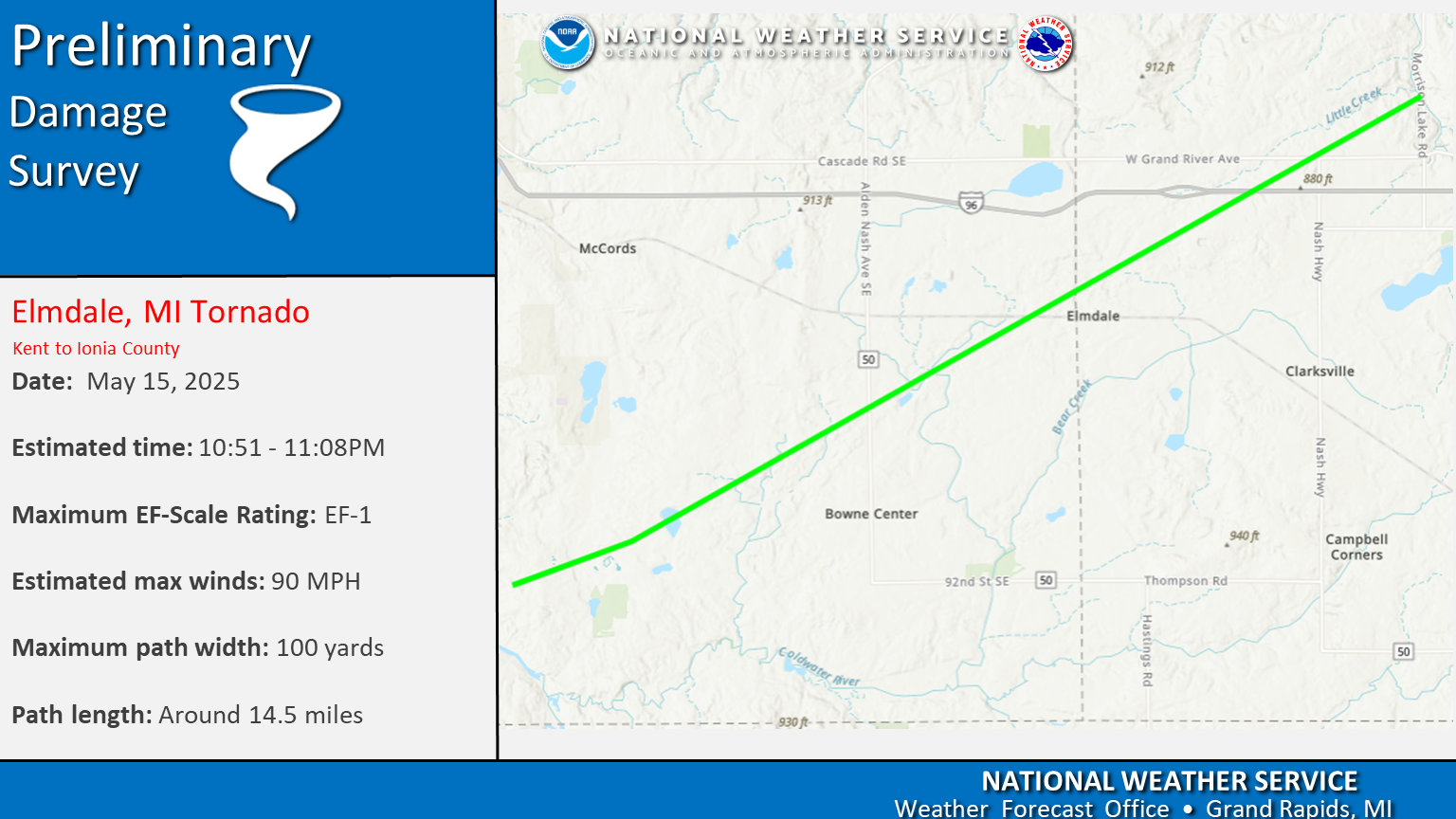
Select a tornado from the table to zoom into the track and view more information. The default table view is limited to 8 tracks, but can be scrolled by a mouse wheel or dynamically expanded. Additionally, the table can fill the entire window by clicking the small circular expanding arrow icon at the very top right of the table and returned to its original size by clicking the button again. The side information panel that opens over the map can be closed using the "X" on the upper right corner of the pop-up. Zoom into the map and click damage points to see detailed information and pictures from the surveys.

The Enhanced Fujita (EF) Scale classifies tornadoes into the following categories:
| EF0 Weak 65-85 mph |
EF1 Moderate 86-110 mph |
EF2 Significant 111-135 mph |
EF3 Severe 136-165 mph |
EF4 Extreme 166-200 mph |
EF5 Catastrophic 200+ mph |
 |
|||||
| Tornadoes that fail to impact any ratable structures on the EF-Scale are rated EF-Unknown (EF-U) | |||||
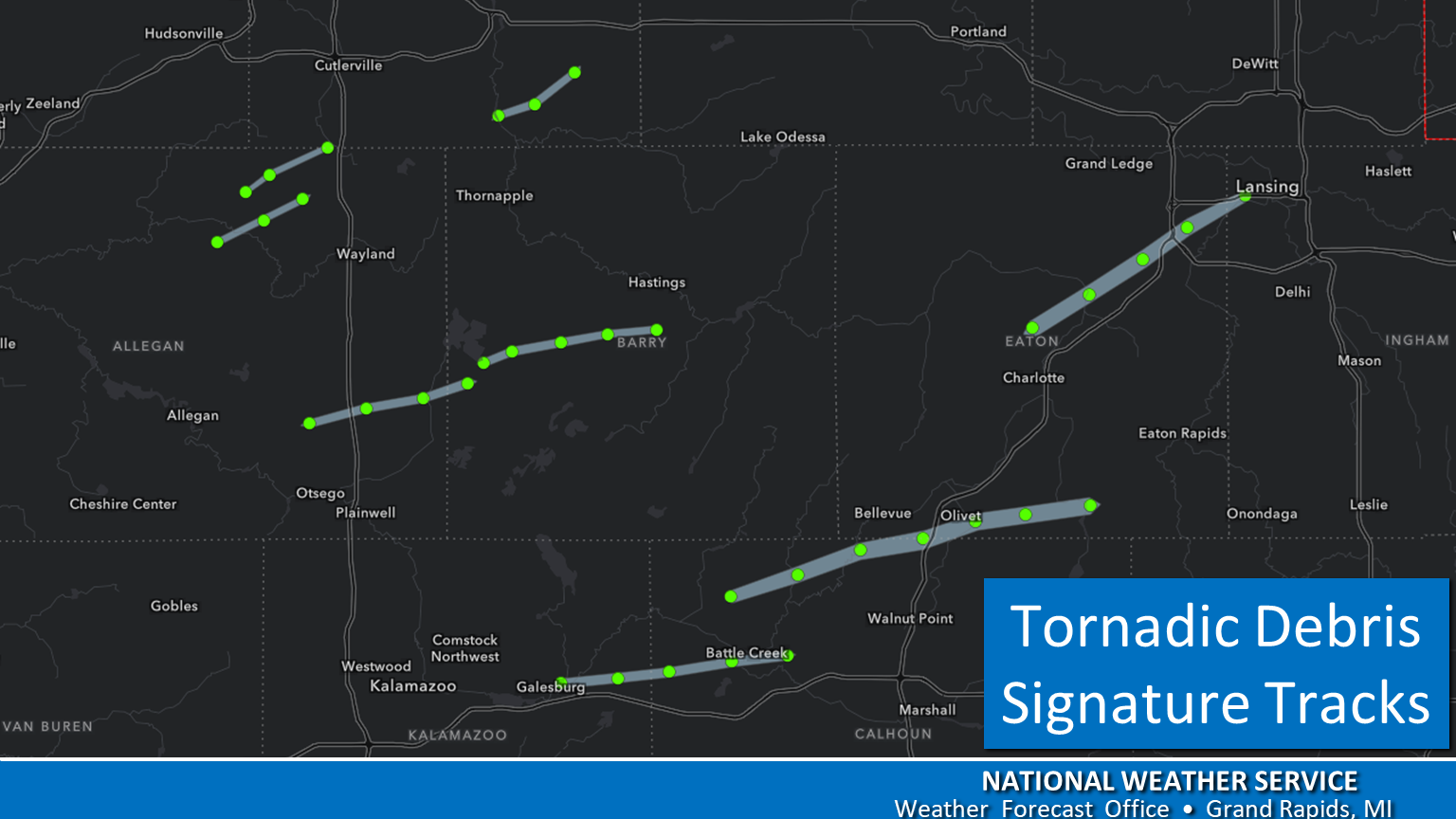
Tornado Tracks
 |
 |
 |
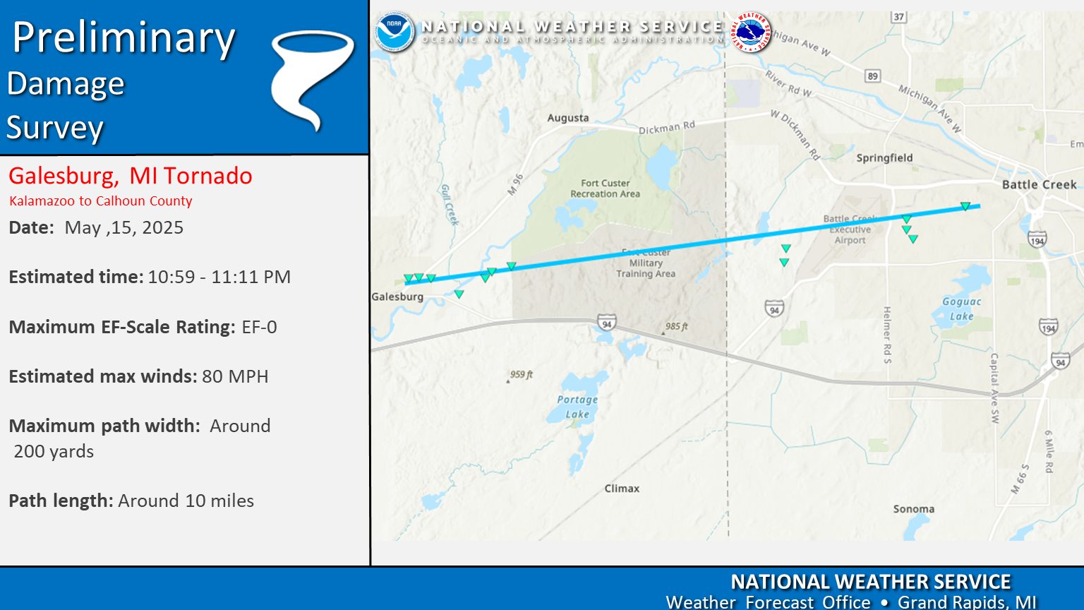 |
| St. Mary's Lake | N Charlotte - W Lansing | Caledonia - Elmdale - Saranac | Galesburg - Battle Creek |
 |
 |
 |
 |
| Gun Lake | Martin - Orangeville | Sandy Pines - Dorr | Drenthe -Jamestown |
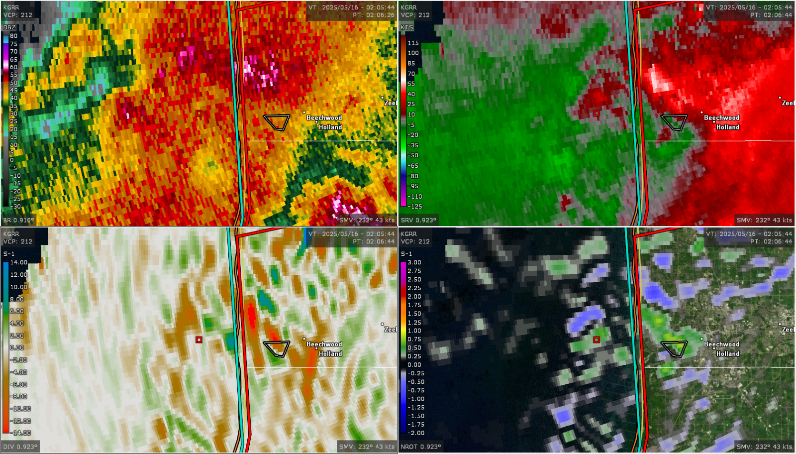
Radar
Radar Reflectivity
Radar Velocity
Radar Storm Relative Velocity
>
 |
 |
 |
 |
| Tornadic Debris Signature | 4 Panel showing Strong tornadic signature moving onshore at 9:59PM | 4 Panel showing Tornadic signature as of 10:06 PM | 4 Panel with Reflectivity, Storm Relative Velocity, Correlation Coefficient and NROT |
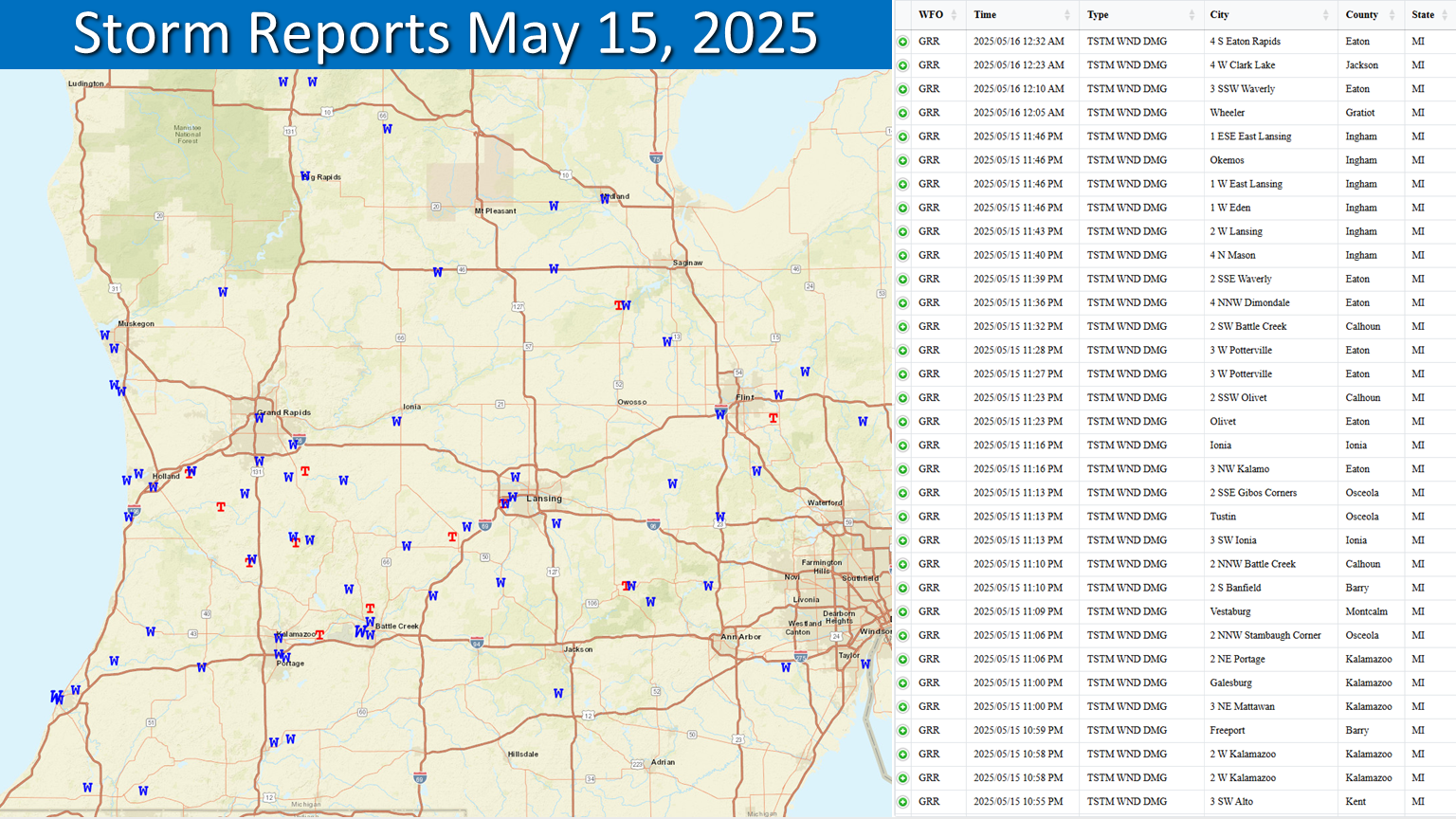
Wind Reports
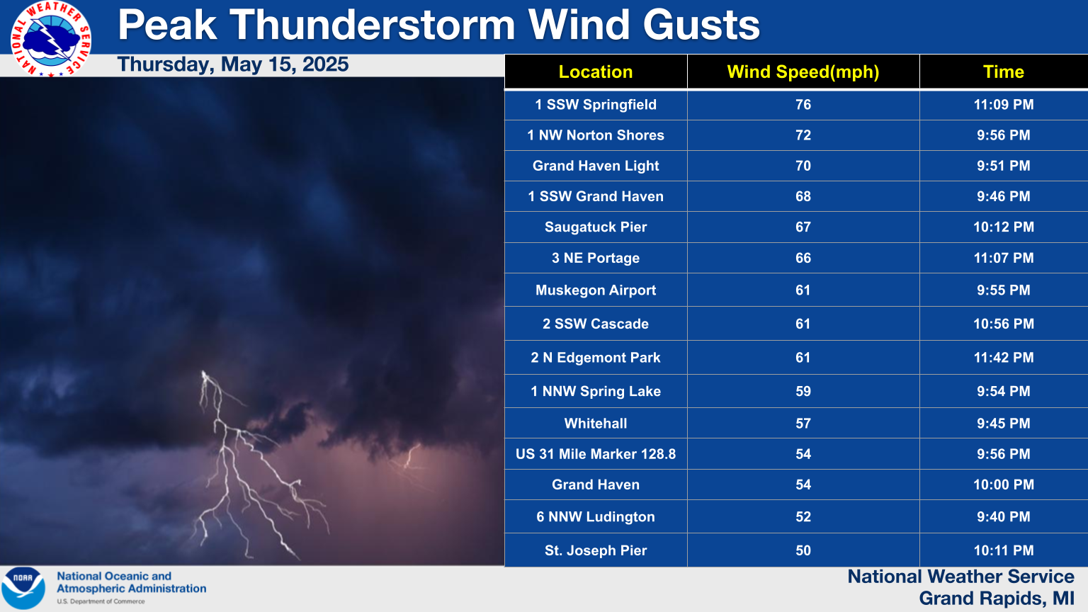
Observations are collected from a variety of sources with varying equipment and exposures. We thank all volunteer weather observers for their dedication. Not all data listed are considered official.
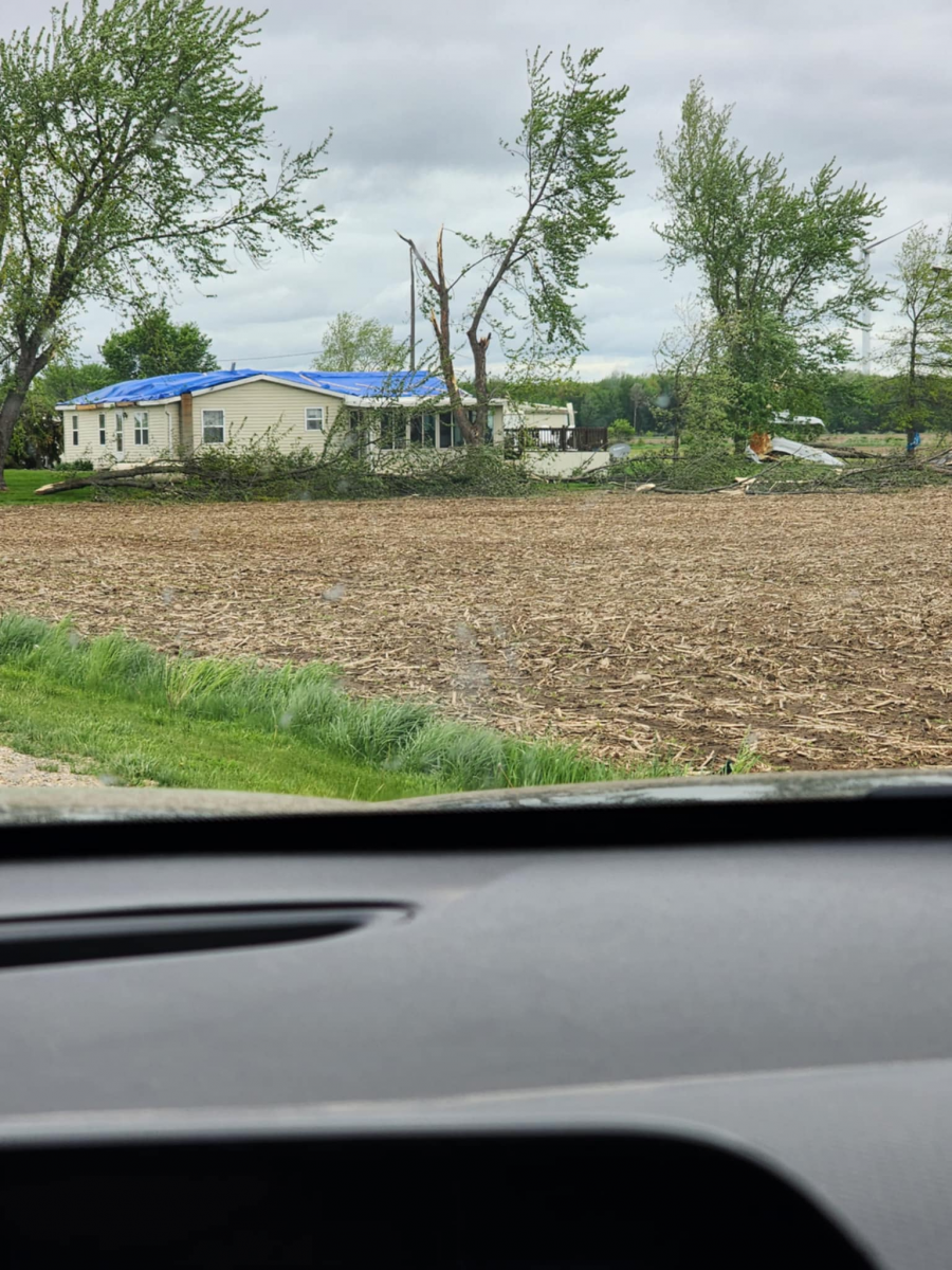
Photos & Video
Damage Photos
 |
 |
 |
 |
| Eaton County (NWS Employee) |
Gratiot County (NWS Employee) |
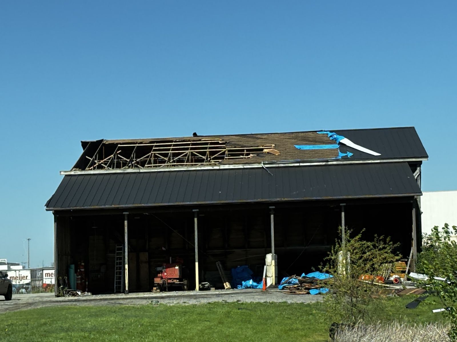
Damaged Outbuilding (NWS) |
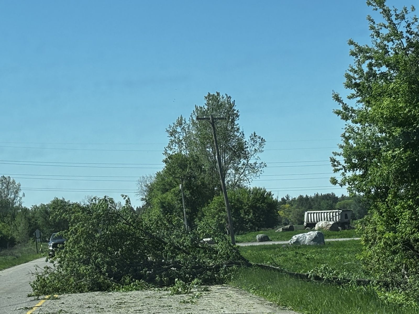
Trees on roads Ingham county (NWS Employee) |
Damage Photos
 |
 |
 |
 |
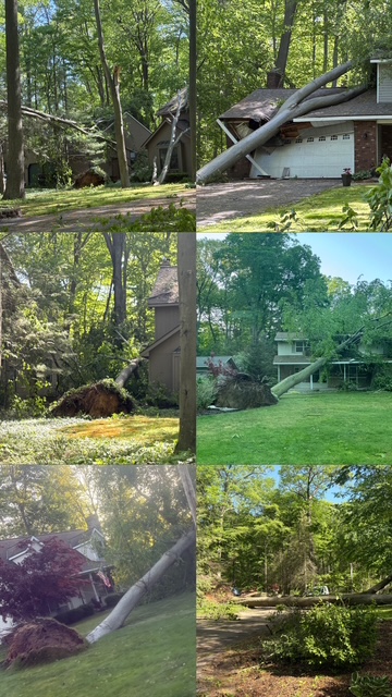
| Wakazoo Woods (Ottawa County EM) |
Wakazoo Woods (MLive) |
Collapsed Barn, Charlotte (NWS) |
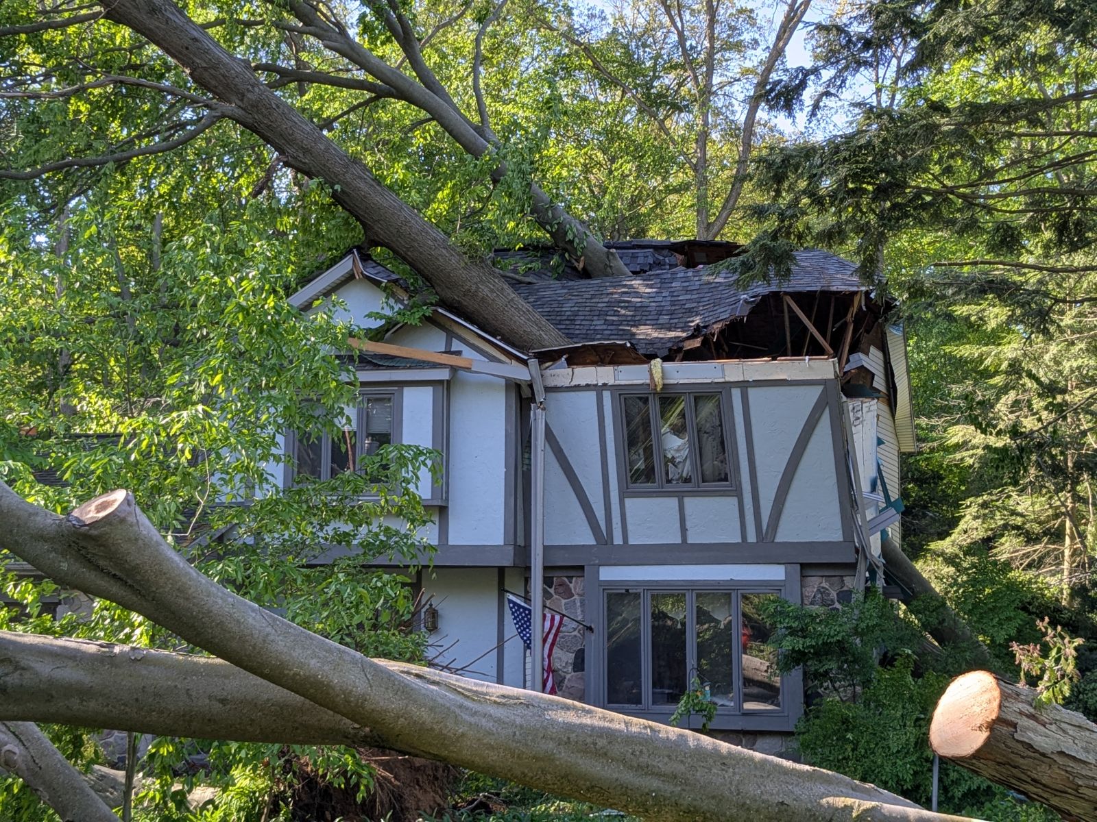
Tree on House Wakazoo Woods (Holland Sentinal) |
Storm Reports
Wide Spread Damage Across the region as a bowing line with embedded thunderstorms brought damaging winds and tornadoes across southern Lower Michigan.
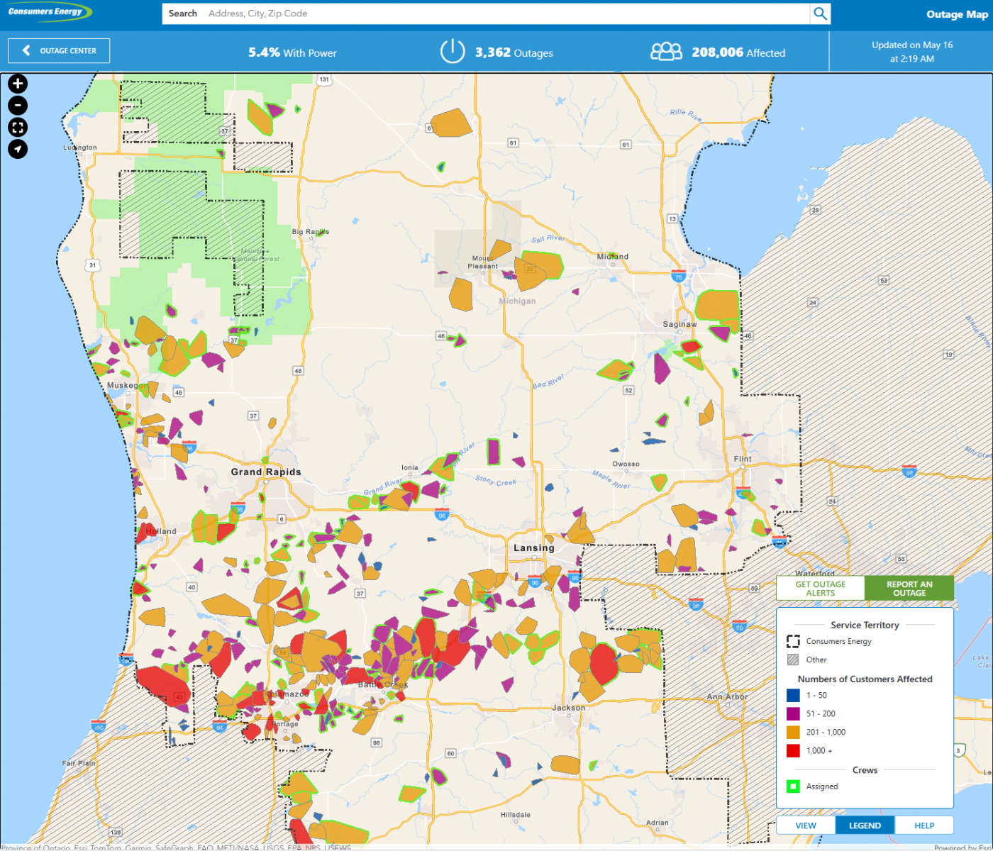
Consumers Power Energy Map
Environment
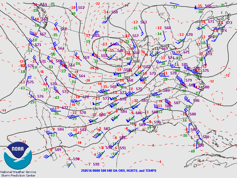
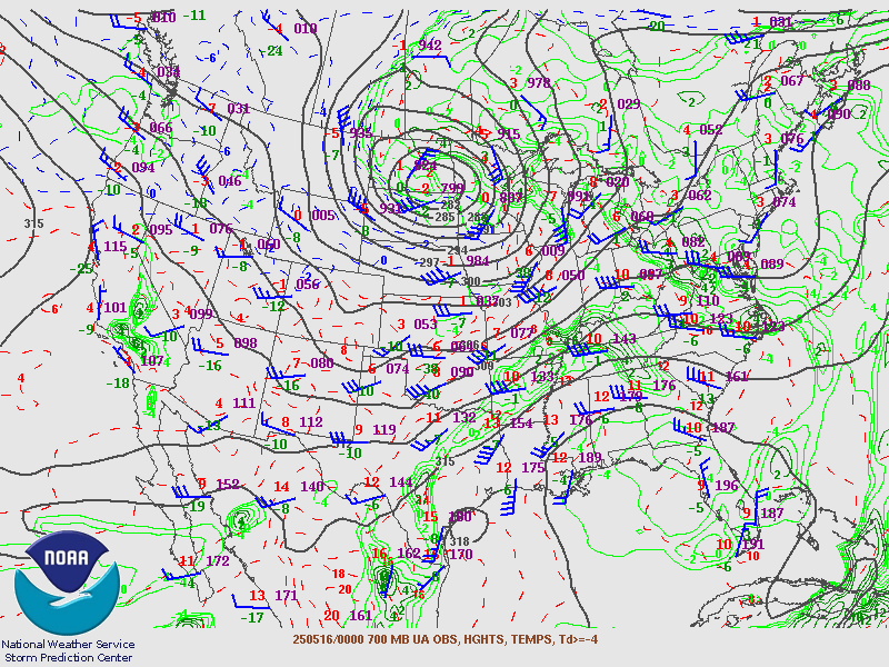
Upper Air Data
 |
 |
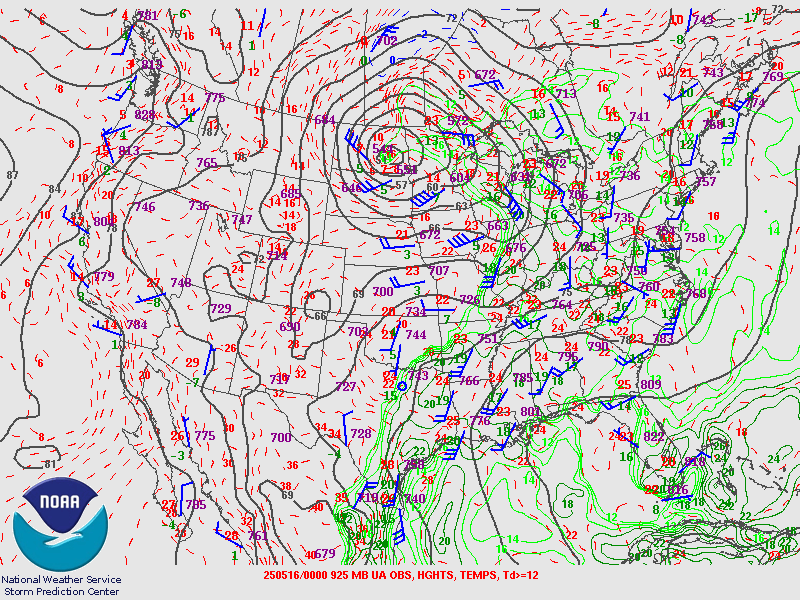 |
| 500 MB at 8 PM 15 May 2025 | 700 mb at 8 PM 15 May 2025 | 925 MB at 8 PM 15 May 2025 |
Near-storm environment summary.
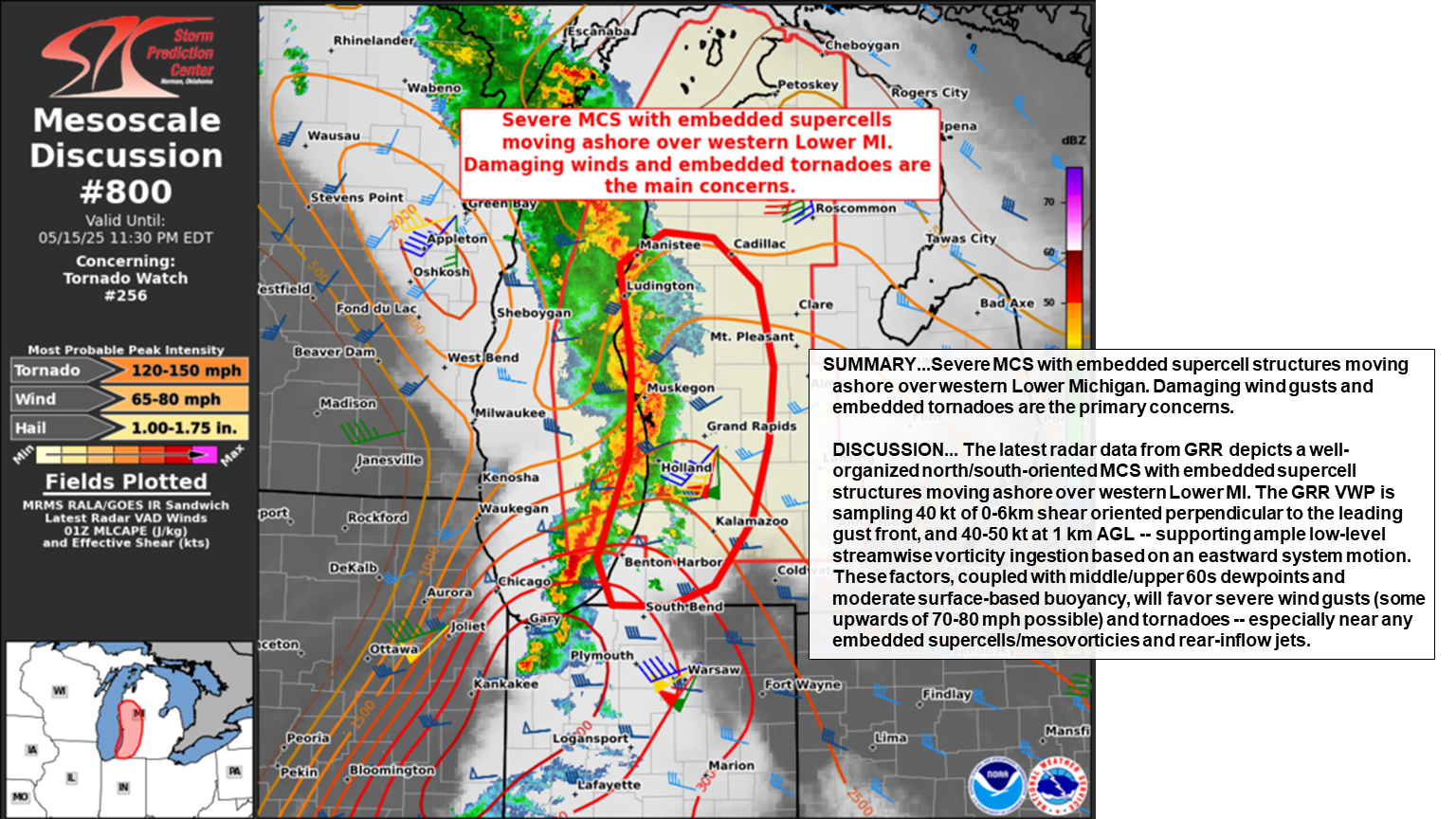 |
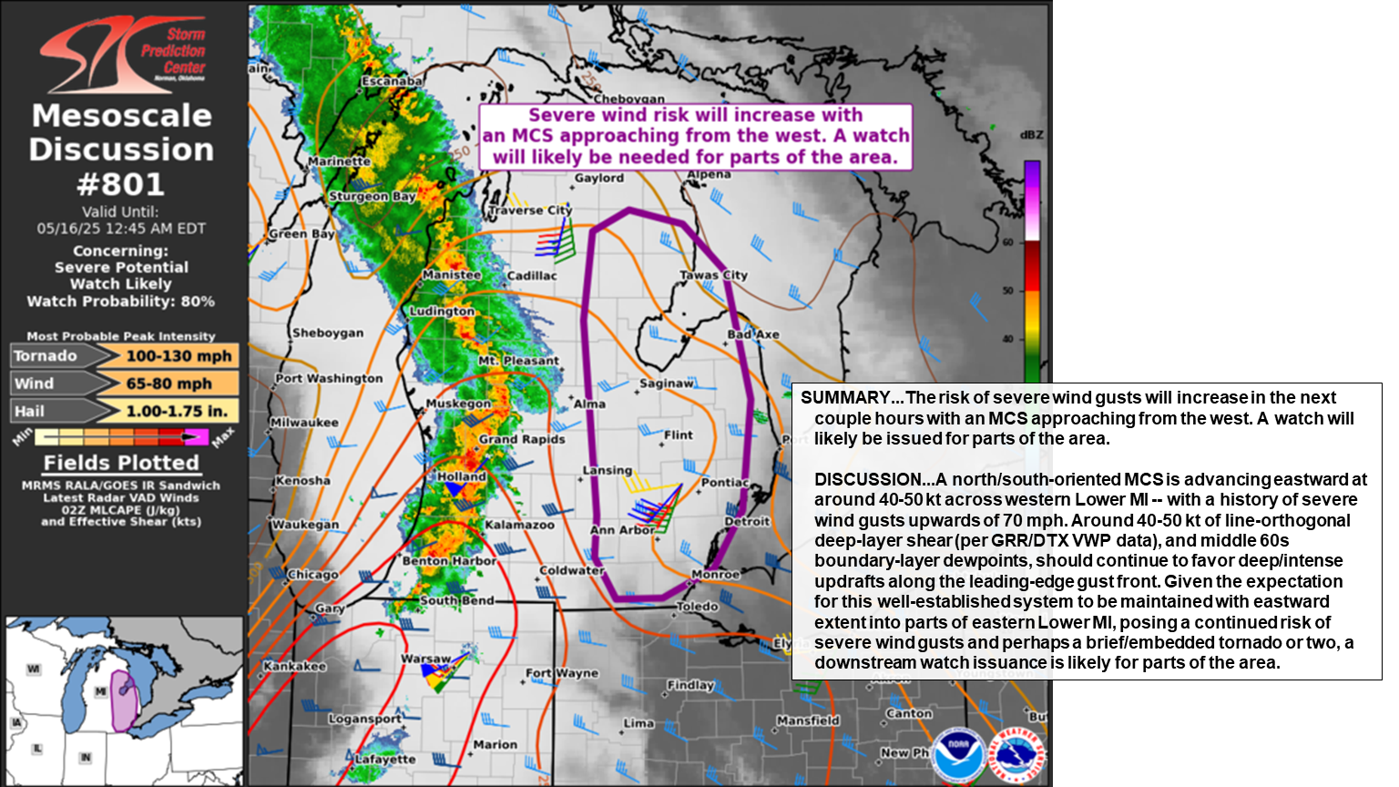 |
.gif) |
| Mesoscale Discussion #800 Valid 15 May 2025 11:30 PM | Mesoscale Discussion #801 Valid 16 May 12:45 AM | NWS Detroit Upper Air Skew-T 15 May 2025 at 8 PM |
Storm Prediction Center Analysis.
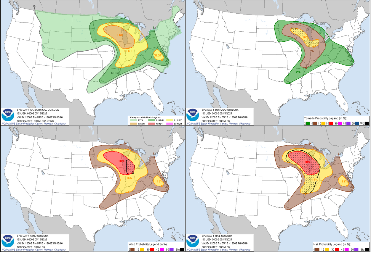 |
 |
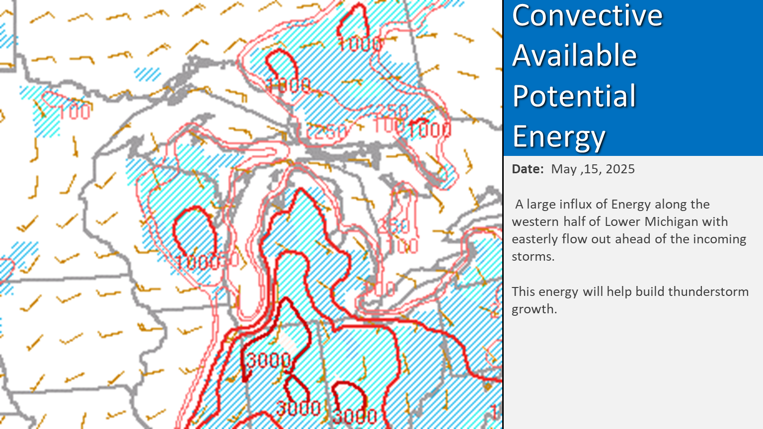 |
| Day 1 Outlook Storm Prediction Center | Severe Weather Threats | CAPE as of 15May2025 9 PM |
 |
Media use of NWS Web News Stories is encouraged! Please acknowledge the NWS as the source of any news information accessed from this site. |
|

