Dangerous heat will expand from the Gulf Coast into the Southern Plains and Desert Southwest through week's end. Additional extreme heat impacting the Pacific Northwest will shift to the northern Plains by the weekend. Tropical Storm Bertha is expected to continue to impact portions of the northwestern Gulf Coast from south central Louisiana to the upper Texas coast today. Read More >
August 29, 2019 Severe Weather Summary
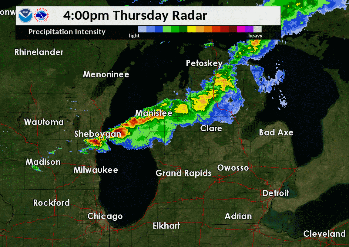 |
| Radar reflectivity loop from 5:00 PM 8/29/2019 to 12:00 AM 8/30/2019 showing strong to severe storms moving across Lower Michigan. |
During the evening hours of August 29th, 2019, strong to severe storms moved across Lower Michigan and produced:
Check out the tabs below for more information.
Hail:
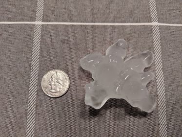
While small (e.g. <1") hail was observed with several storms, one was particularly strong and produced hailstones ranging in size from golf- to tennis-ball (1.75 - 2.5") in a swath from northern Muskegon county through southwestern Newaygo and into northern Kent counties. Similar to the storm that produced baseball size hail in Battle Creek earlier this summer, the thunderstorm responsible for the large hail on August 29th was a supercell, or a storm with a rotating updraft. Typically storms must have a rotating updraft to produce such large hail.
.gif) |
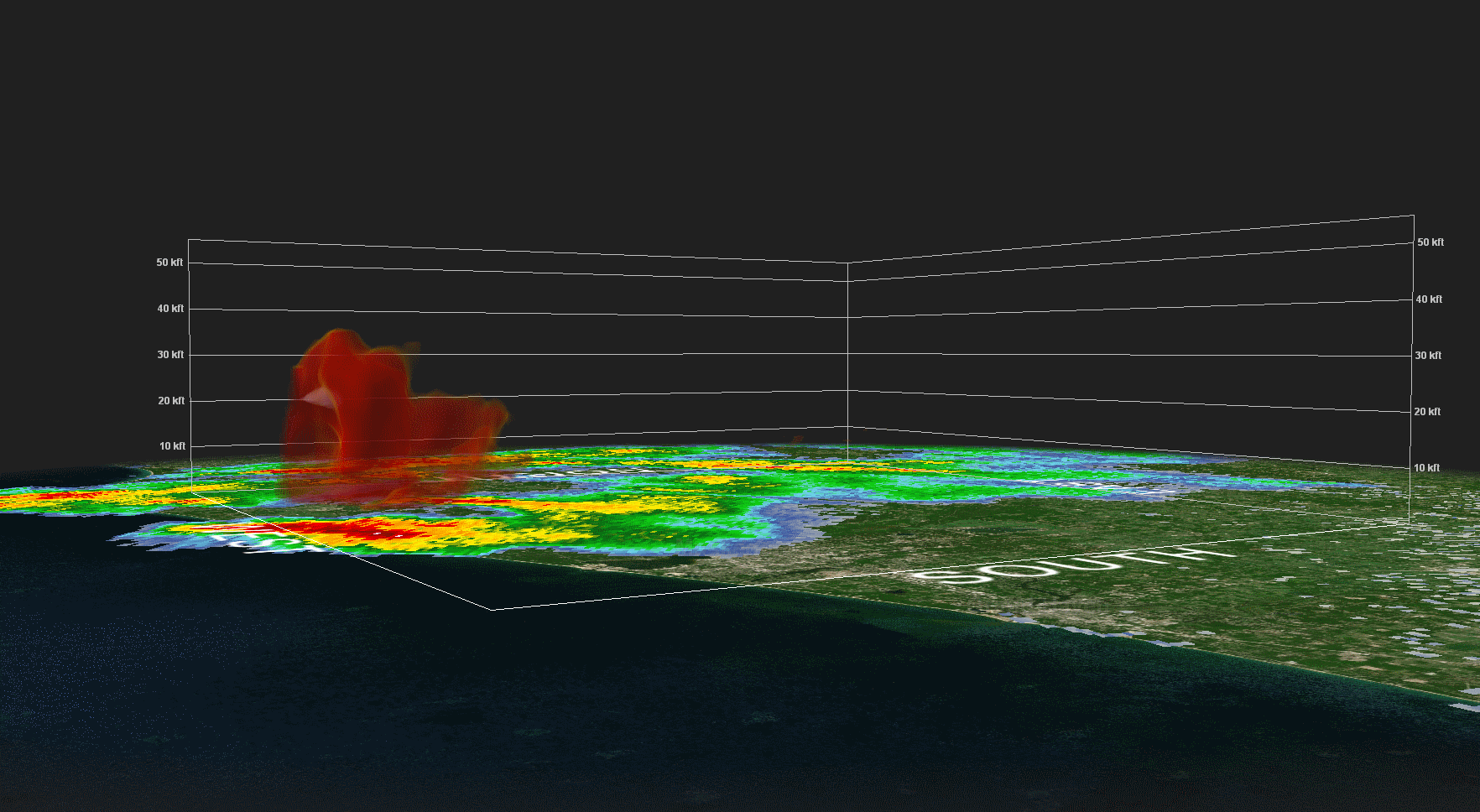 |
| Lowest-scan radar reflectivity from KGRR (Grand Rapids) from 4:40 to 5:16 PM EST. The pink and purple areas are regions of large hail. | Composite "3-D" radar reflectivity from KGRR (Grand Rapids) from 4:40 to 5:16 PM EST. Notice how the pink and purple areas sink toward the ground--that's the large hail in the storm falling! |
 |
 |
| Large hail that fell near Fremont - Photo courtesy of Tyler Green, relayed via WZZM TV | Large hail that fell near Twin Lake - Photo courtesy of Jennifer Hull, relayed via WZZM TV |
Radar and Damage Surveys:
Several areas of enhanced wind damage were reported prompting an NWS Damage Survey. Two areas were surveyed--near Grant, MI in Newaygo County and near Leslie, MI in Ingham county.
Grant, MI -- Newaygo County
Winds estimated between 55 to 70 mph downed several trees mainly between Mason Drive and Spruce Avenue, north of East 120th street. All trees were laid down from west to east, indicating that the winds were not rotating and hence not tornadic in nature. A carport was pushed west to east and a boat was also tipped over. Given the presentation of the damage and radar data, the damage was likely caused by an intense channel of winds along the periphery of the updraft known as the rear-flank downdraft, which is a common area of severe winds in supercell thunderstorms.
|
Lowest-scan radar reflectivity from KGRR (Grand Rapids) from 6:30 - 6:45 PM EST. |
Lowest-scan radial velocity from KGRR (Grand Rapids) from 6:30 - 6:45 PM EST. |
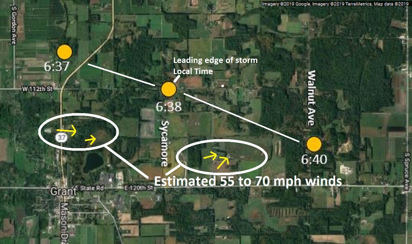 |
| Regional map of NWS Damage Survey results conducted near Grant, MI. (Click on the image to zoom). |
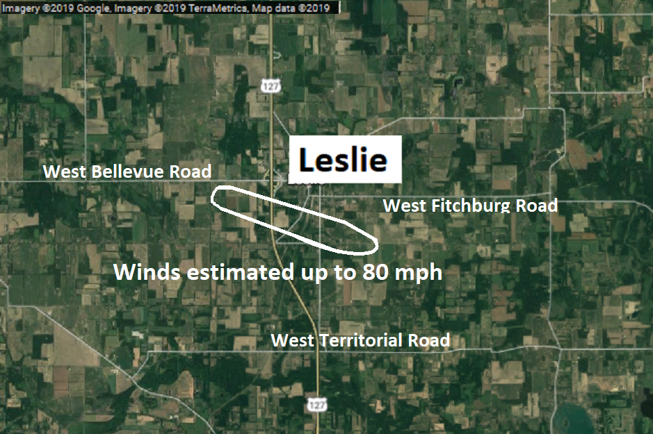
Leslie, MI -- Ingham County
Winds estimated between 70 and 80 mph caused a 3 to 4 mile swath of downed trees and damage to outbuildings. The damage started near Blackmore Road and continued east southeast across US-127 toward Jackson Road. Again, most of the damage was oriented in one direction with radar data supporting a downburst that was non-tornadic in nature. In the radar data, note how a bowing segment emerges and accelerates eastward coincident with where the damage was reported. Oftentimes such surges lead to damaging winds, as was indeed the case with this event.
|
|
|||
| Lowest-scan radar reflectivity from KGRR (Grand Rapids) from 10:50 to 11:05 PM EST. | Lowest-scan radial velocity from KGRR (Grand Rapids) from 10:50 to 11:05 PM EST. |
|
|
| Regional map of NWS Damage Survey results conducted near Leslie, MI. (Click on the image to zoom). |
Even while we found no evidence of tornadoes at least in western Lower Michigan, the majority of strong to violent tornadoes are produced by supercells. Thankfully, conditions were not quite right for tornadoes during the event, though there were several reports of low-level rotation with the storms especially near Grant.
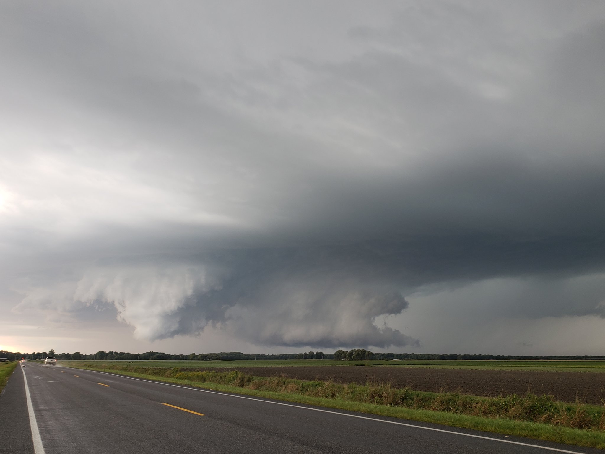 |
| Picture of a rotating wall cloud near Grant - Courtesy of Cameron Nixon |
Damage Reports:
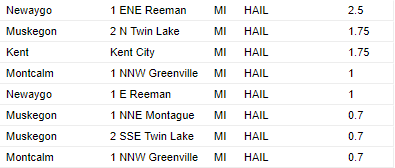
There were several reports of large hail up to 1+ inches, particularly across Muskegon, Newaygo, northern Kent, and Montcalm Counties, with the highest report up to 2.5 inches in Newaygo County. Meanwhile, several reports of downed trees and other types of thunderstorm wind damage were received across West Michigan due to strong thunderstorm wind gusts. In addition to hail and strong winds, torrential rain resulted in rain totals up to 1-2 inches.
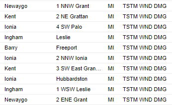
Here are lists of damage reports (click on each to enlarge):
| Heavy Rainfall Reports | Hail reports | Damaging Wind Reports |
.PNG) |
 |
 |
Additional Photos:
The storms were quite photogenic especially considering the time of day (e.g. sunset). Check out all the great photos posted on our social media pages -- thank you everyone who shared them with us!
 |
 |
| Taken near Hudsonville - Courtesy of Andrea Honor | Taken in Isabella County -- Courtesy of Tim Wolff |
 |
 |
| Taken near Mount Pleasant - Courtesy of Tony Fairchild | Courtesy of MikeTerpstra |
 |
| The storms as seen from a plane (so cool!) - courtesy of Jessica Bloom. |
Thank you everyone who shared your photos with us!
 |
Media use of NWS Web News Stories is encouraged! Please acknowledge the NWS as the source of any news information accessed from this site. |
|