Dangerous heat will expand from the Gulf Coast into the Southern Plains and Desert Southwest through week's end. Additional extreme heat impacting the Pacific Northwest will shift to the northern Plains by the weekend. Tropical Storm Bertha is expected to continue to impact portions of the northern Gulf Coast from the western Florida Panhandle to southeastern Louisiana through tonight. Read More >
Overview
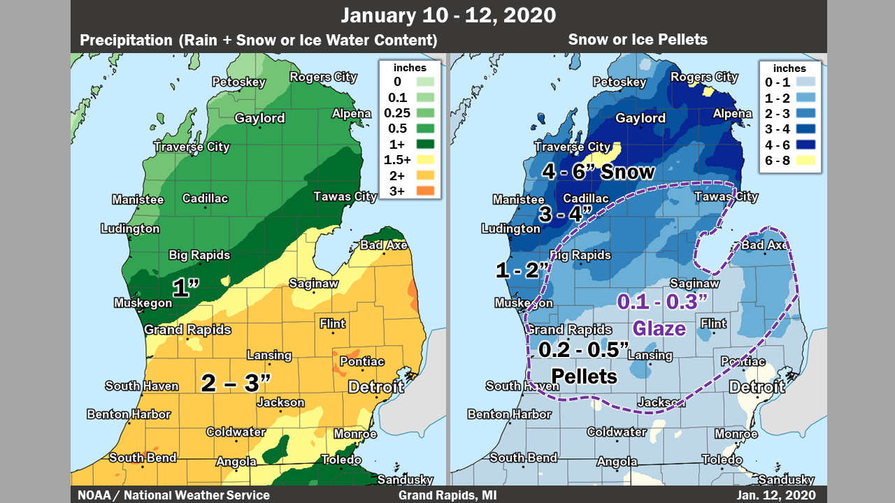
A strong and very wet storm system arrived Friday night with rain overspreading the area. This rain was heavy for areas near and south of I-96, where 2-3 inches of rain fell. Daily rainfall records for January 11th were set at Grand Rapids, Muskegon, Lansing, and Kalamazoo. Colder air came in from the north on Saturday, changing precipitation over from rain, to a mixture of sleet and freezing rain.
Freezing rain and sleet continued into Saturday evening, before changing over to snowfall across the area, then ending overnight.
Ice amounts ranged from a trace toward Ludington to the northwest and I-94 to the south, and between 0.1 and 0.3 inches for the most part elsewhere. Snow amounts ranged from a couple of tenths across I-94, to as much as 3-4 inches toward Ludington and Baldwin.
Below is a map of the precipitation amounts, pictures of the flooding and ice from around the area, and radar loops during the event.
|
Total Rainfall Map Snowfall Map with Ice Amounts Overlaid |
NWS Grand Rapids (NWS) |
|
Photo Courtesy of Amy Hovey - Lowell, MI |
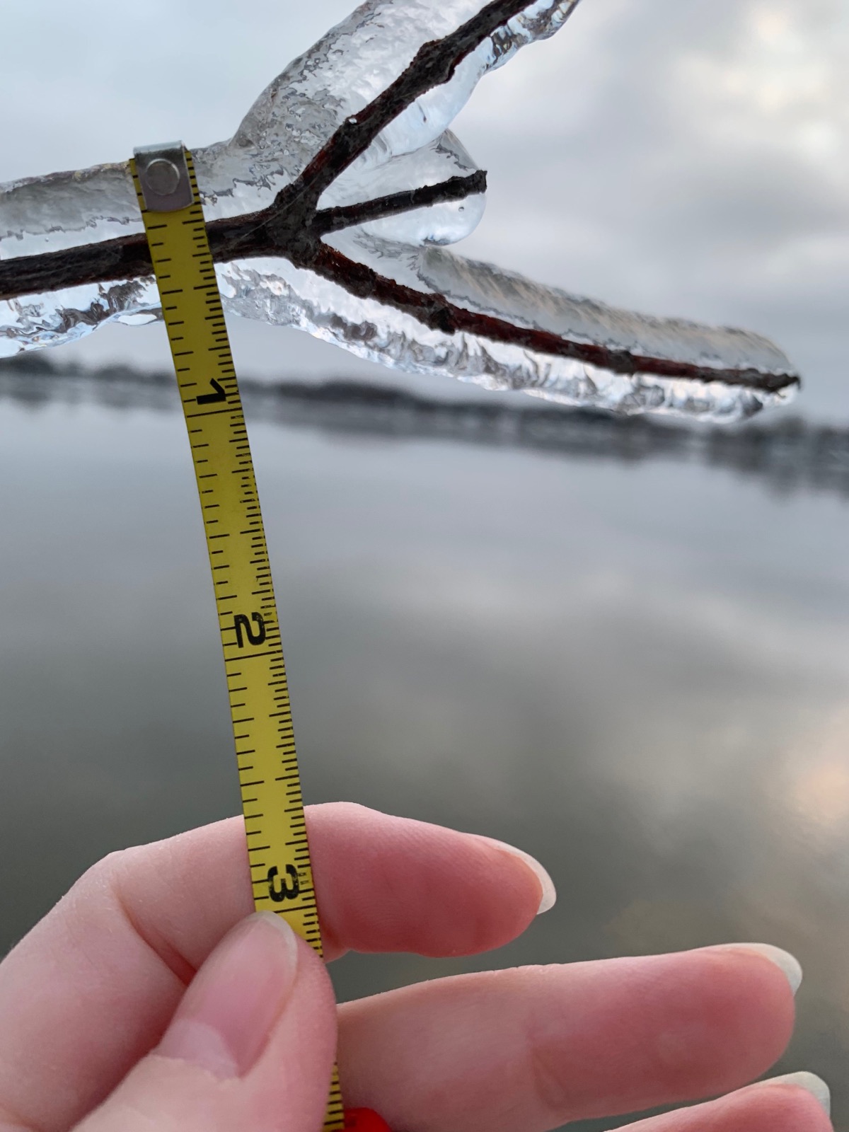
Photo Courtesy of Victoria Lee - Delton, MI |
Saranac, MI (NWS) |
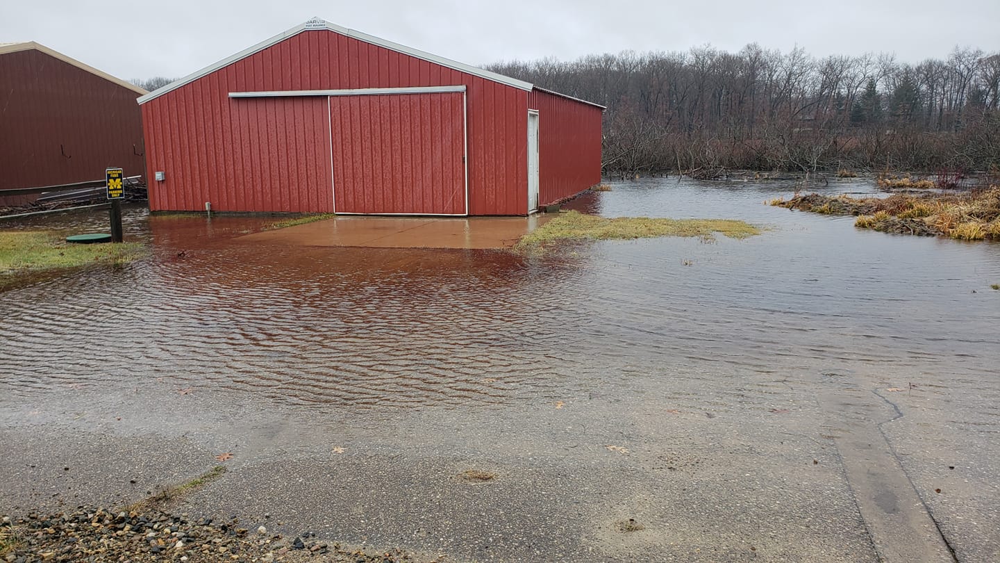
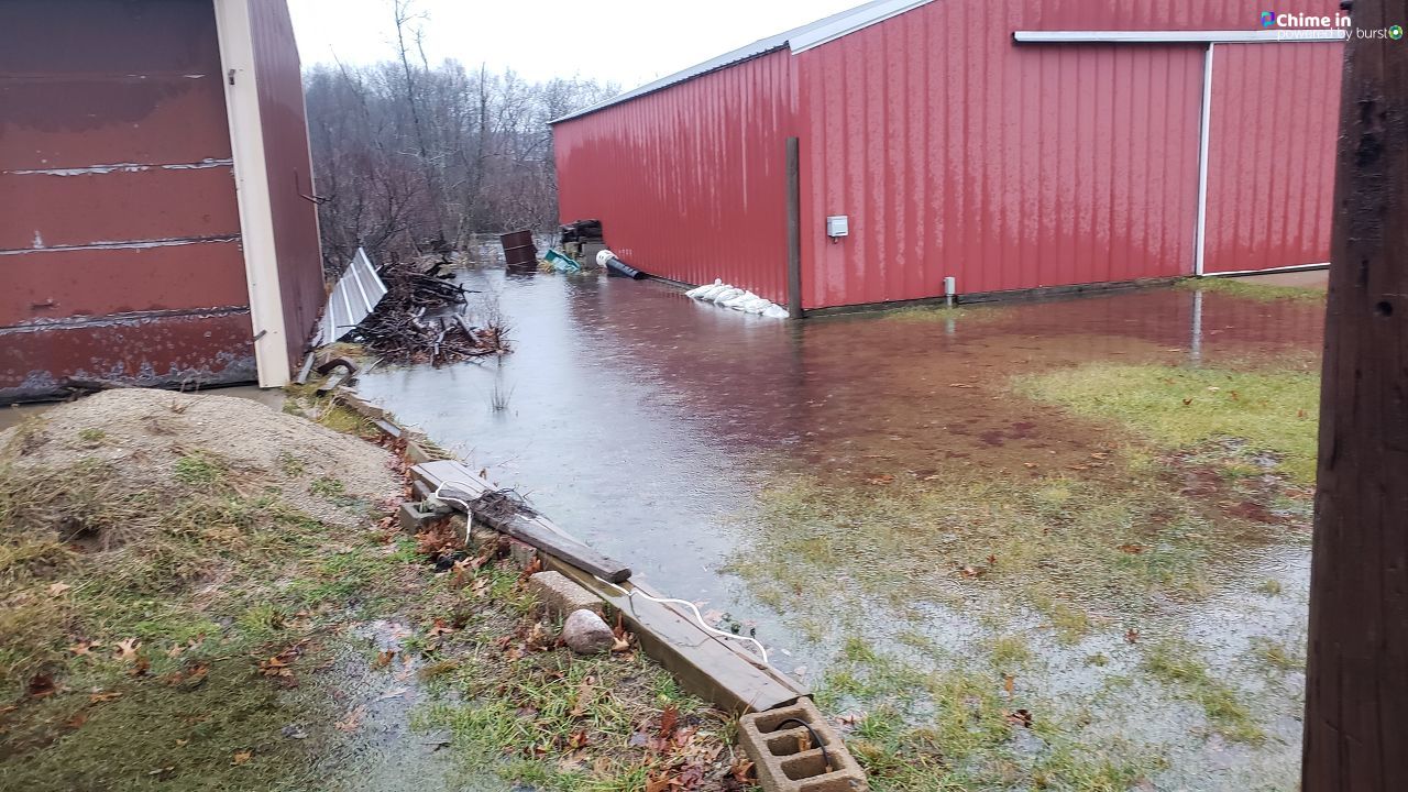
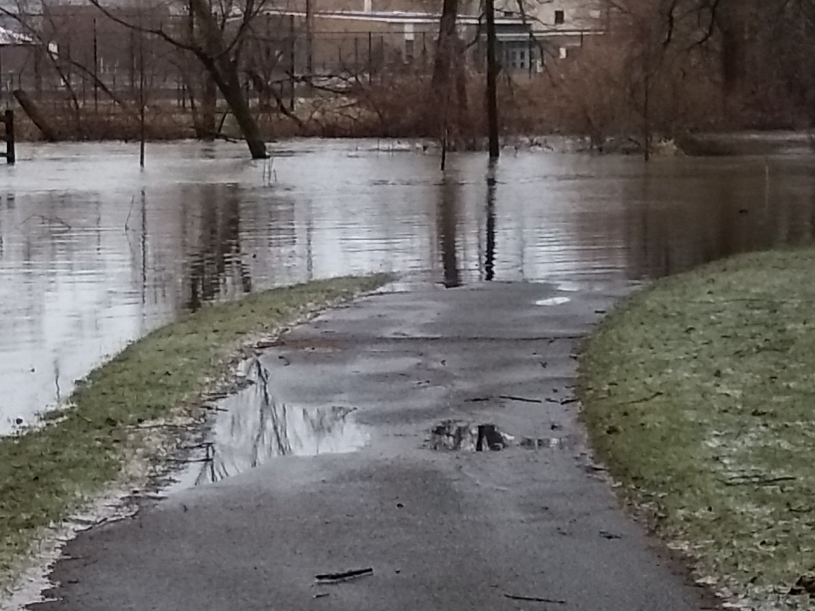
Flooding
Photos
 |
 |
 |
.4.png) |
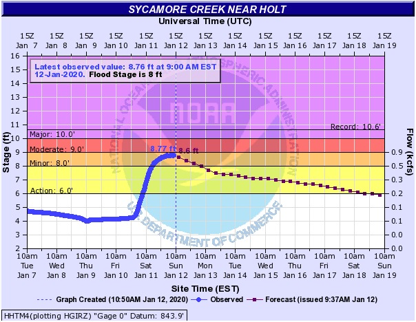
| Photo Courtesy of Victoria Lee - Delton, MI | Wedgewood Park in Grandville, MI | Levels on Sycamore Creek near Holt, MI | Levels on the Grand River near Comstock Park, MI |
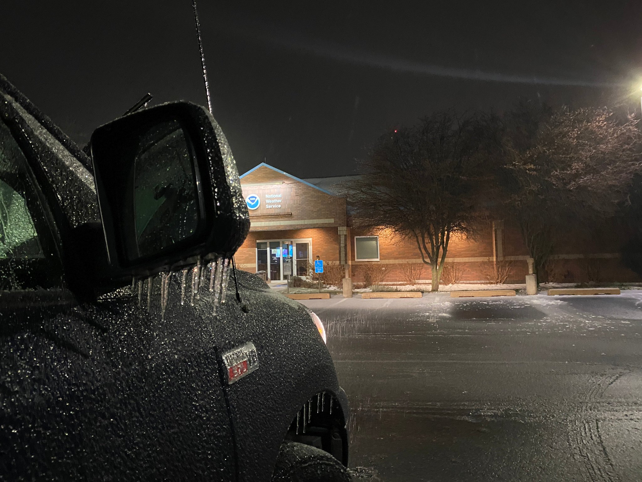
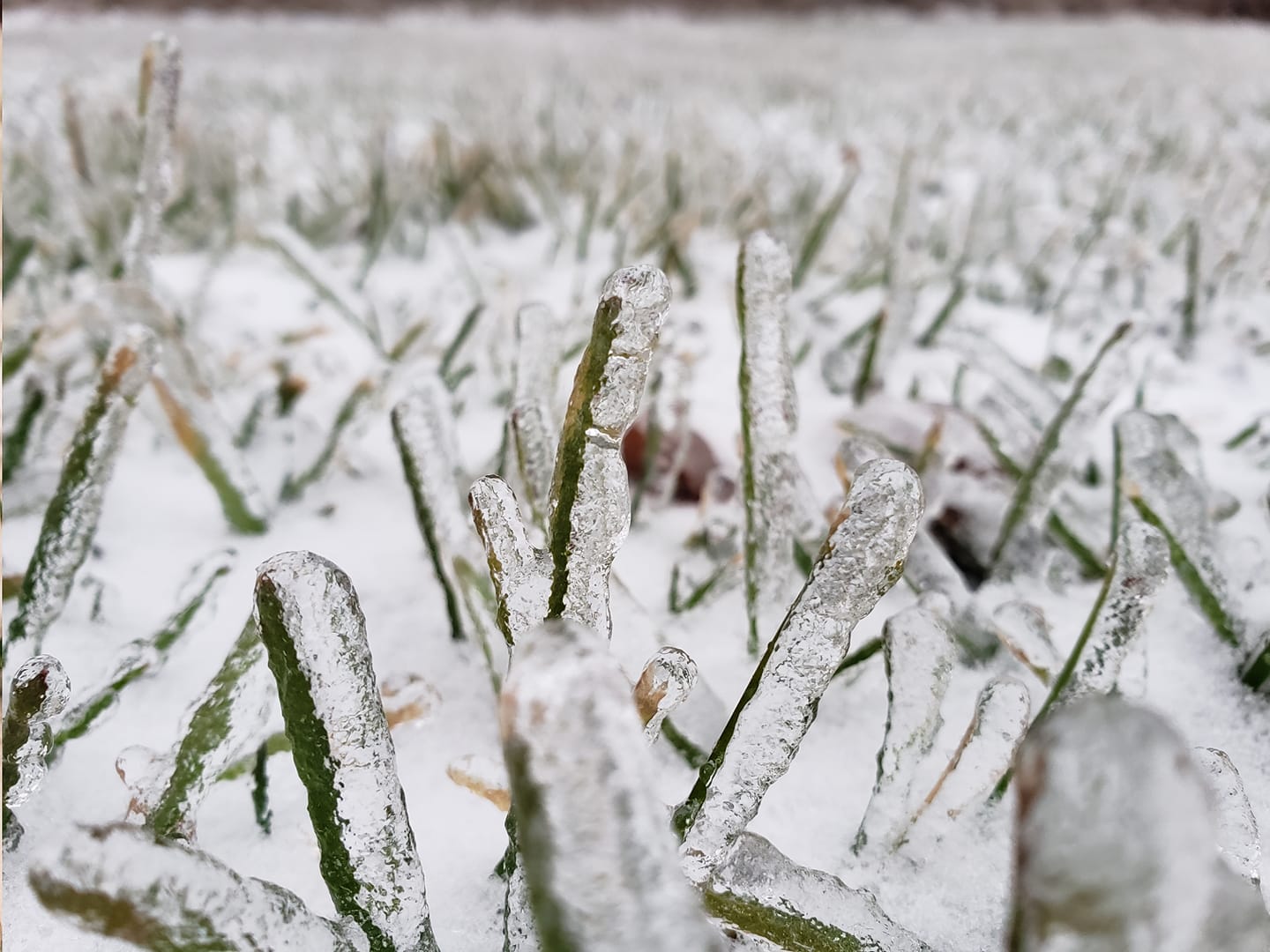
Snow/Ice
 |
 |
 |
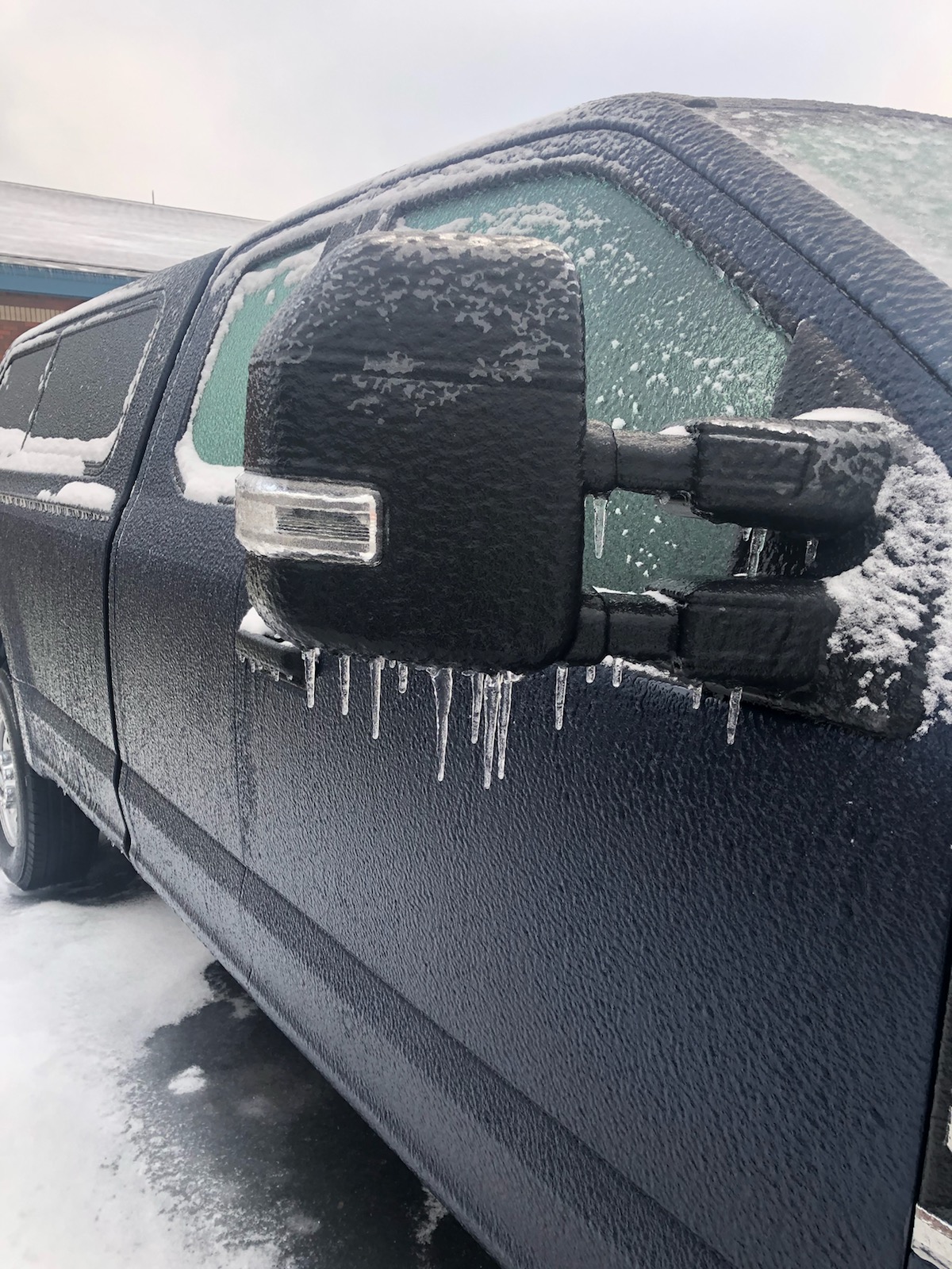 |
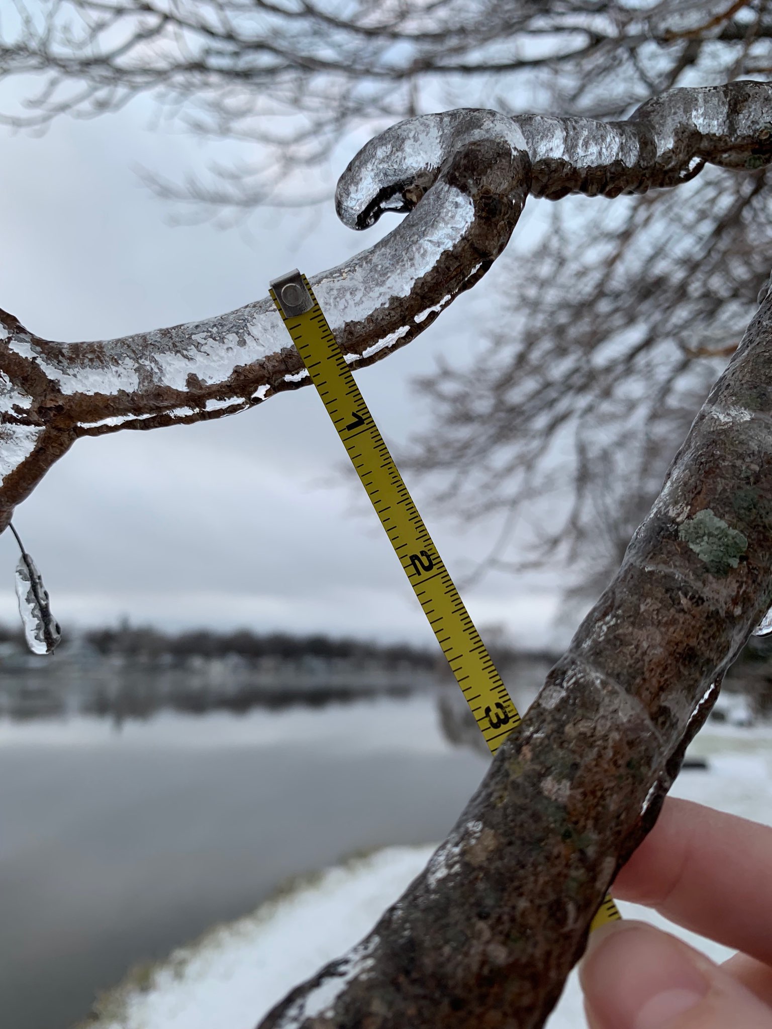
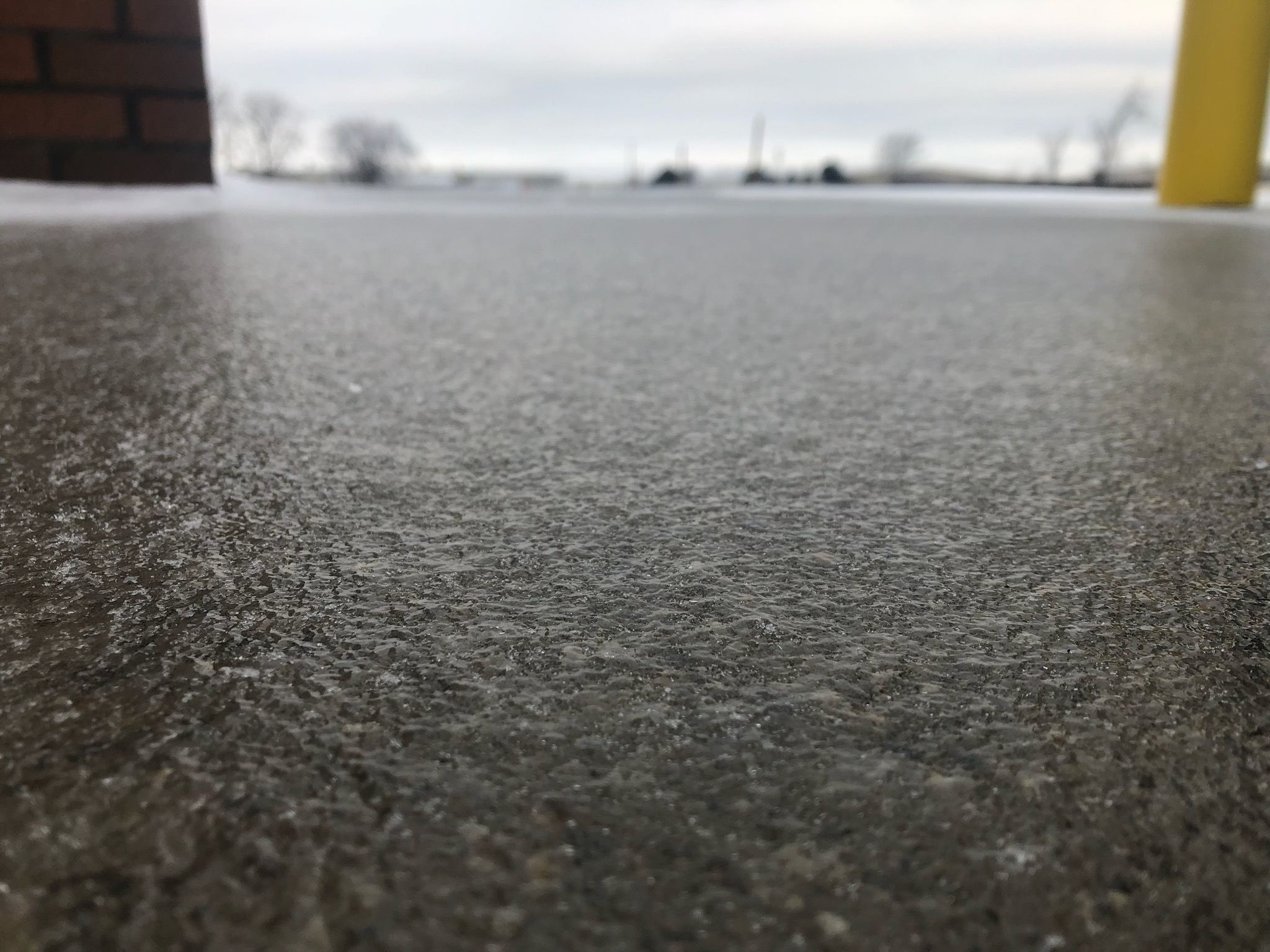
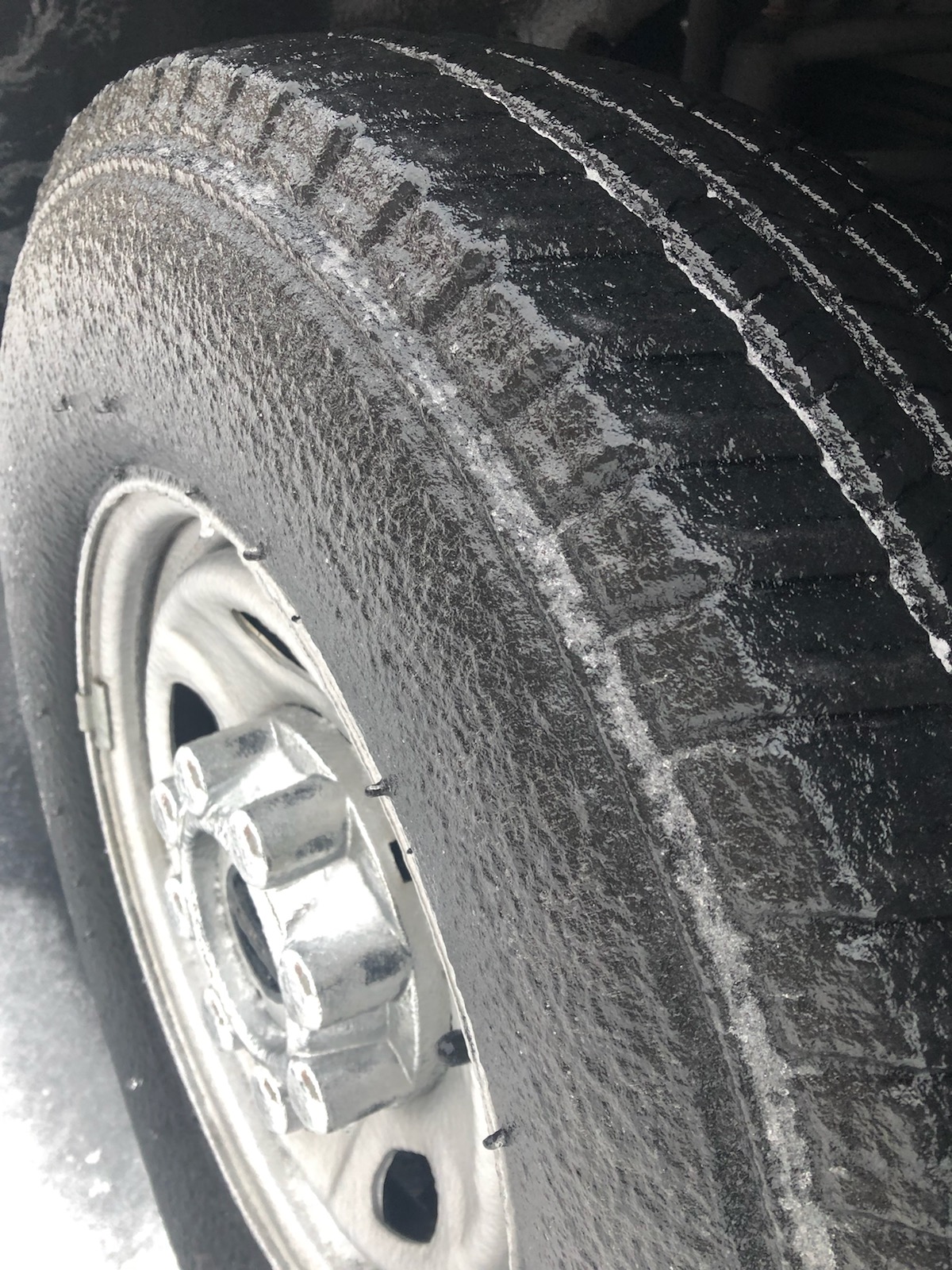
| Ice encasing trees in Saranac, MI | Icy sheath covering sidewalks in Grand Rapids, MI | Ice encasing a tire in Grand Rapids, MI | Ice completely coating on a truck in Grand Rapids, MI |
.PNG)
ASOS Reported Freezing Rain (Inches)
| GRR - Grand Rapids | 0.16 |
| LAN - Lansing | 0.04 |
| MKG - Muskegon | 0.17 |
| BIV - Holland | 0.28 |
| BTL - Battle Creek | 0.09 |
| JXN - Jackson | 0.08 |
Radar
|
January 10-11, 2020 - 10 pm to 4 am Overnight Radar |
January 11, 2020 - 4 am to 10 am Morning Radar |
January 11, 2020 - 10 am to 4 pm Afternoon Radar |
|
January 11, 2020 - 4 pm to 10 pm Evening Radar |
January 11-12, 2020 - 10 pm to 4 am Overnight Radar |
 |
Media use of NWS Web News Stories is encouraged! Please acknowledge the NWS as the source of any news information accessed from this site. |
|