Dangerous heat will expand from the Gulf Coast into the Southern Plains and Desert Southwest through week's end. Additional extreme heat impacting the Pacific Northwest will shift to the northern Plains by the weekend. Tropical Storm Bertha is expected to continue to impact portions of the northern Gulf Coast from the western Florida Panhandle to southeastern Louisiana through tonight. Read More >
Grand Rapids, MI
Weather Forecast Office
Overview
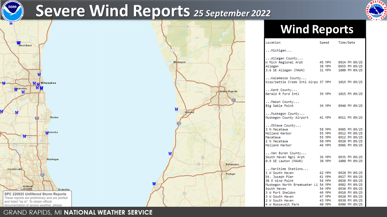
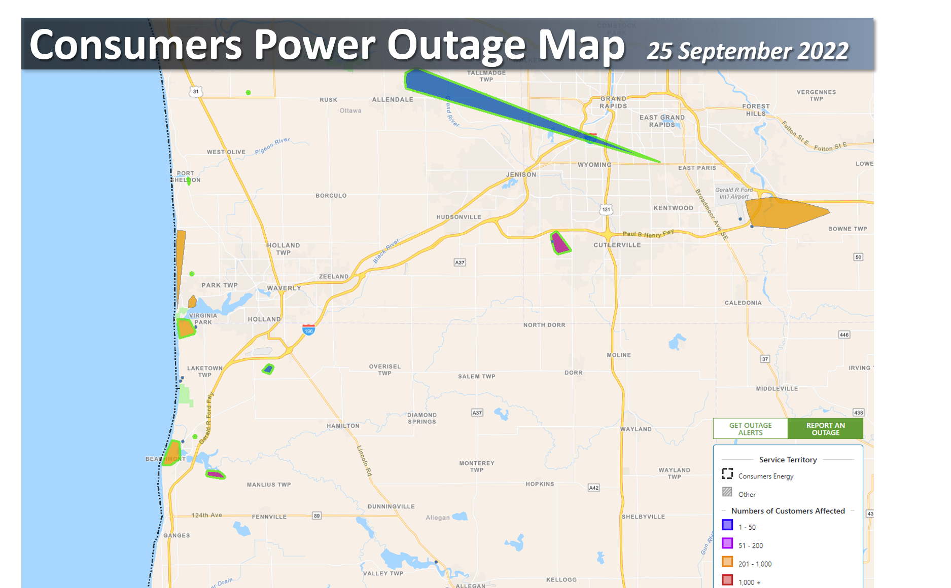
A large upper level low moving through the Upper Great Lakes region brought a finger of the northern jet streak through the region that coupled with a low level jet filtered through the warm air over the lake and caused damaging winds along the lakeshore. Buoys and observations stations in and along Lake Michigan had wind reports upwards of 62 mph. This caused power outages along the lakeshore and just inland as the storms moved souteasterly through southwest Michigan.
 |
Media use of NWS Web News Stories is encouraged! Please acknowledge the NWS as the source of any news information accessed from this site. |
|
US Dept of Commerce
National Oceanic and Atmospheric Administration
National Weather Service
Grand Rapids, MI
4899 Tim Dougherty Drive SE
Grand Rapids, MI 49512-4034
616-949-0643
Comments? Questions? Please Contact Us.