Overview
|
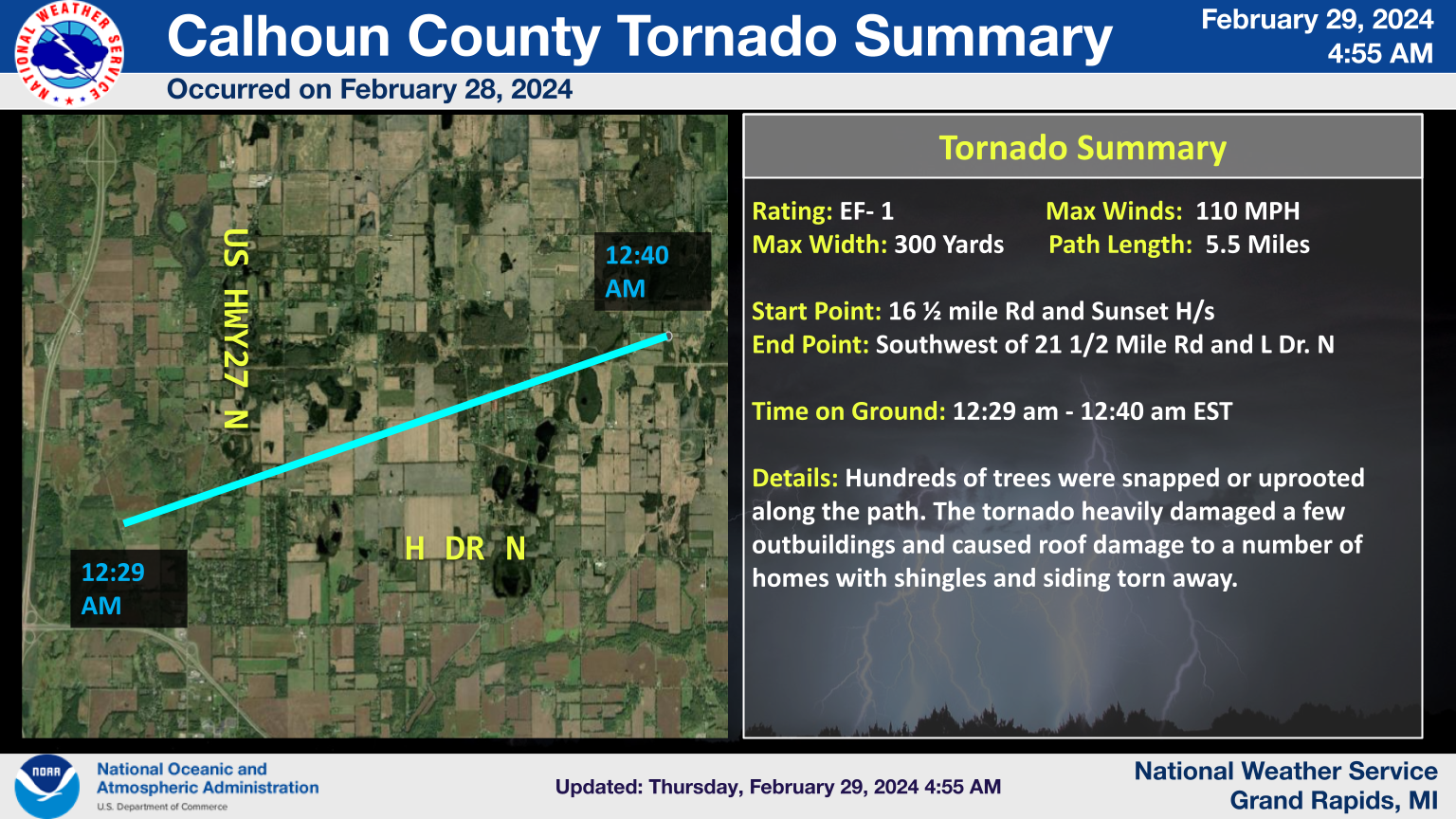
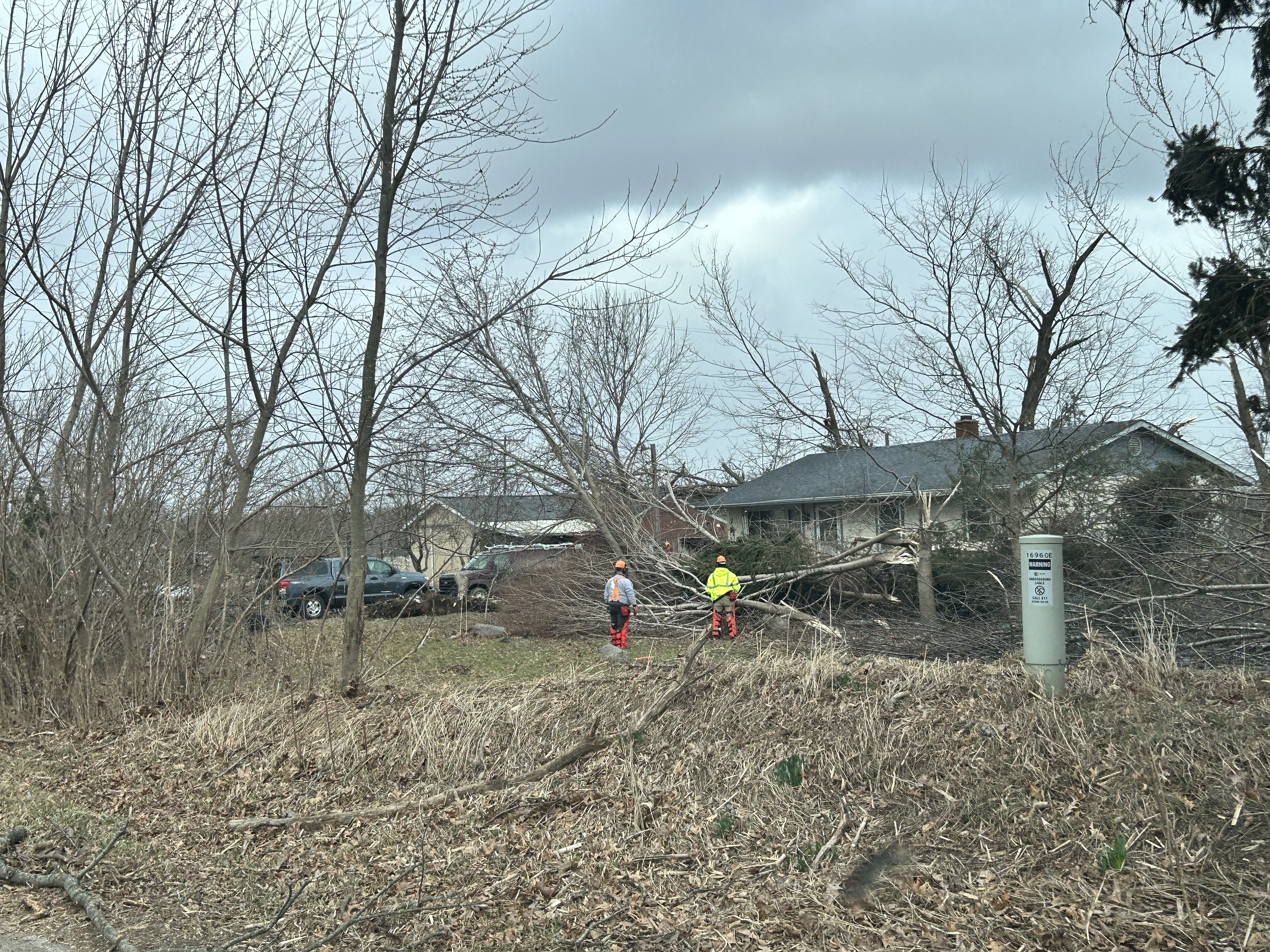
February 27, 2024 will be remembered as an exceedingly warm day followed by rapid changes at night. Deep southerly flow brought massive warm air advection that broke Maximum high temperatures across the lower Michigan. In Grand Rapids, it was over 70 degrees for the first time on record. Surface dew points surged into the 50s. So a warm moist air mass over the region was more like a late April day then a late February one. A large synoptic system moving in from the west brought strong atmospheric lift to the area. The deep layer shear in Southwest Lower Michigan was well over 40 knots. With strong deep layer shear (that is, changing wind speed and/or direction with respect to height above the ground)and moderate instability (see this page for an explanation of instability), the region was ripe for severe weather. A line of severe thunderstorms entered the area from the south with several supercell thunderstorms (see the bottom of this page for a description of supercells) out ahead of the line. One long lived supercell with a persistent mesocyclone caused damage along the I-94 corridor which included an EF-1 Tornado near Marshall Michigan. Along with this supercell a line of storms brought upwards of 2.4 inch hail across Lower Michigan to areas south of I-96. This storm system continued eastward and caused an EF-2 tornado in Grand Blanc Michigan. For more information on that storm go to NWS Detroit |
|
 |
 |
 |
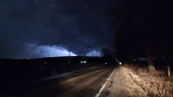
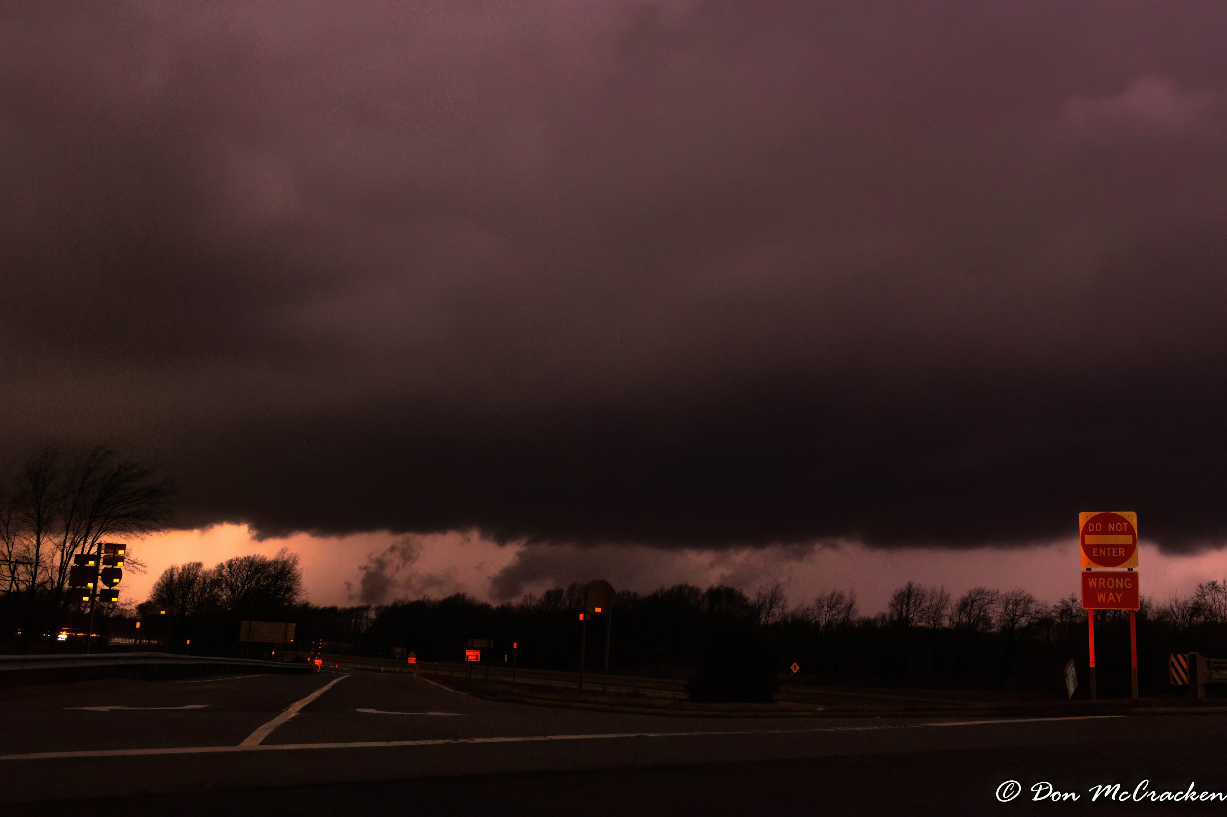
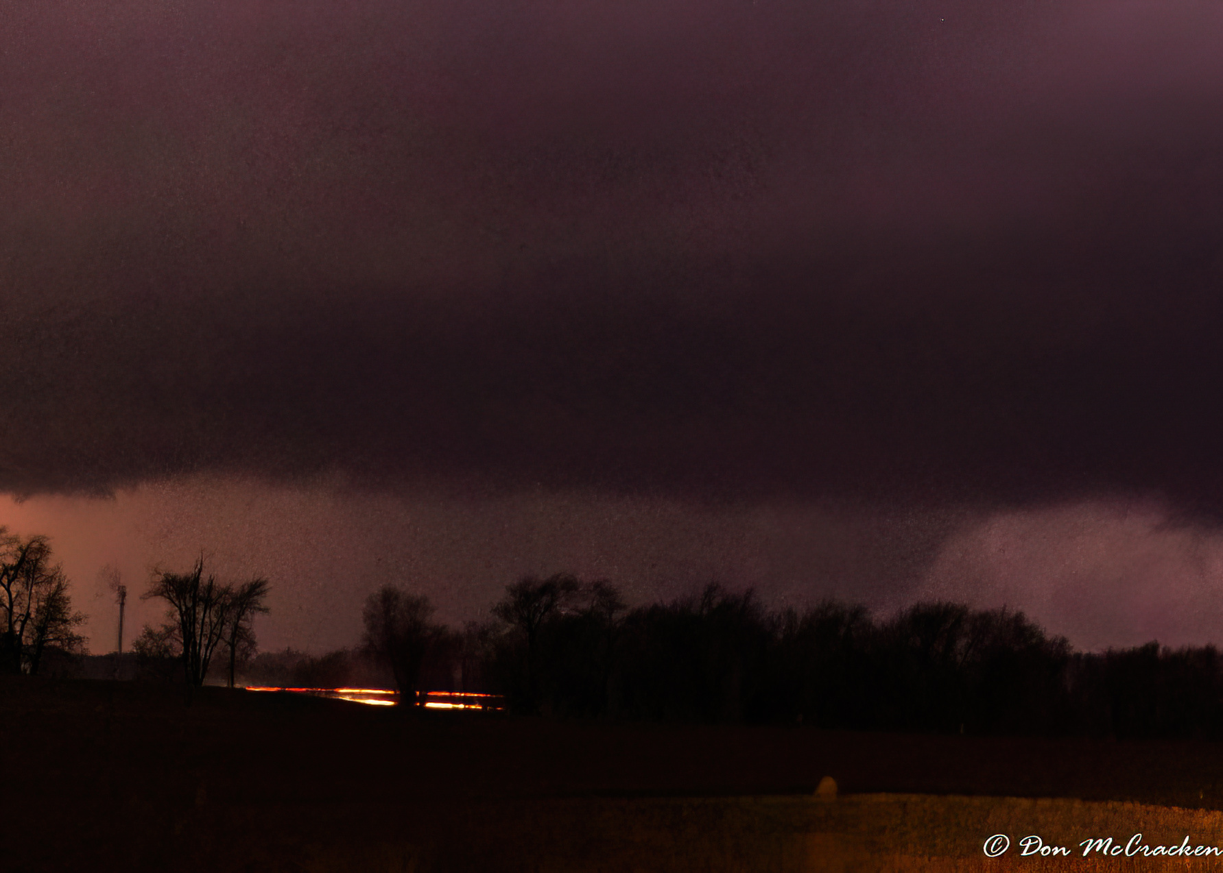
| Marshall Tornado: Photo Credit: Don McCracken | Marshall Tornado: Photo Credit: Don McCracken | 2.4 inch large hail Battle Creek Photo Credit: Katie Nickolaou |
Tornadoes:
|
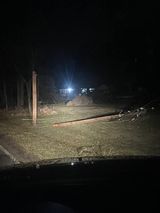
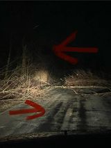
Tornado - Area north of Marshall
|
||||||||||||||||
The Enhanced Fujita (EF) Scale classifies tornadoes into the following categories:
| EF0 Weak 65-85 mph |
EF1 Moderate 86-110 mph |
EF2 Significant 111-135 mph |
EF3 Severe 136-165 mph |
EF4 Extreme 166-200 mph |
EF5 Catastrophic 200+ mph |
 |
|||||
Wind & Hail:
Wind
Besides the Marshall Tornado the long lived supercell brought damaging winds across southern Lower Michigan to areas near Decatur, Lawton and near Marengo, Michigan
 |
 |
 |
 |
| Power Pole snapped North of Marengo Photo credit: Kyle Piers |
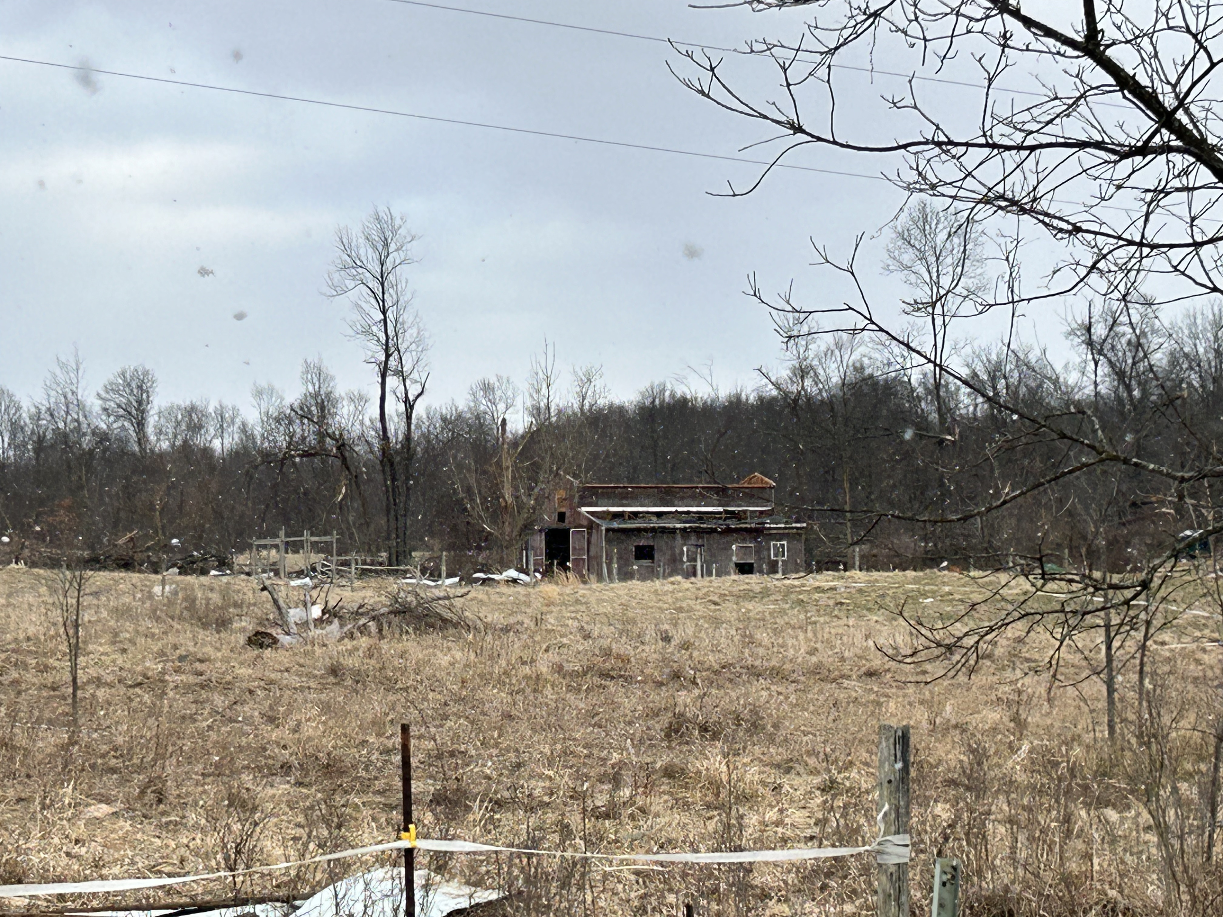
Downed tree on Structure Lawton of CR669 Photo Credit: Elizabeth Fouth |
Downed trees Lawton CR669 Photo Credit: Elizabeth Fouth |
Tree Damage Calhoun County Photo credit: Kyle Piers |
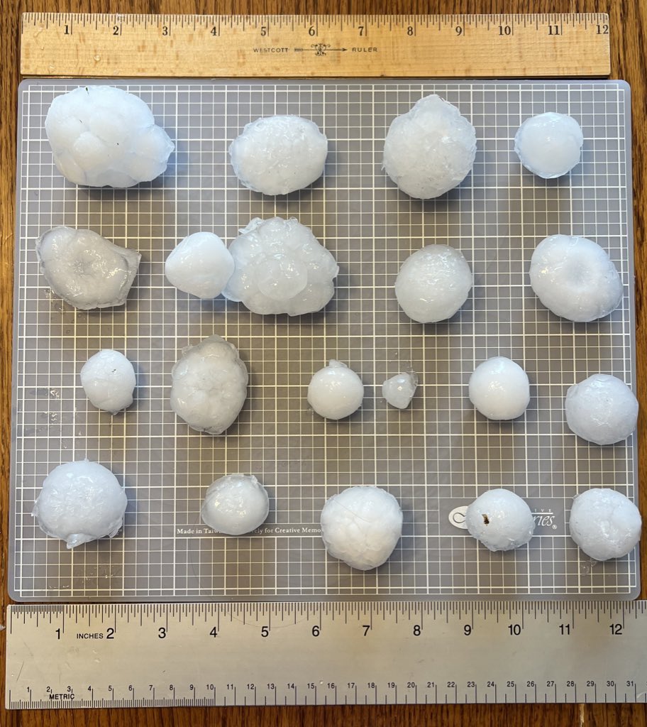
Hail
Large Hail occurred in the line of severe storms especially in the long lived supercell that caused the tornado in Calhoun County The largest hail was 2.4 inches
 |
 |
 |
.jpg) |
| Large Hail Lakeview Photo Credit: Lisa D |
Large Hail Emmett Township Photo Credit: Chenee Robertson |
Various Hail Battle Creek Photo Credit: Katie Nickolaou |
Large Hail Scotts, MI Photo Credit: James Cooper |
Record Temperatures
Warm air advection out ahead of the approaching weather system caused record high temperature across southern Michigan. Some of these record temperatures broke 70 degrees which in Grand Rapids had never been recorded in February before. Below is a graphic an table showing maximum temperatures from across the region.
.png)
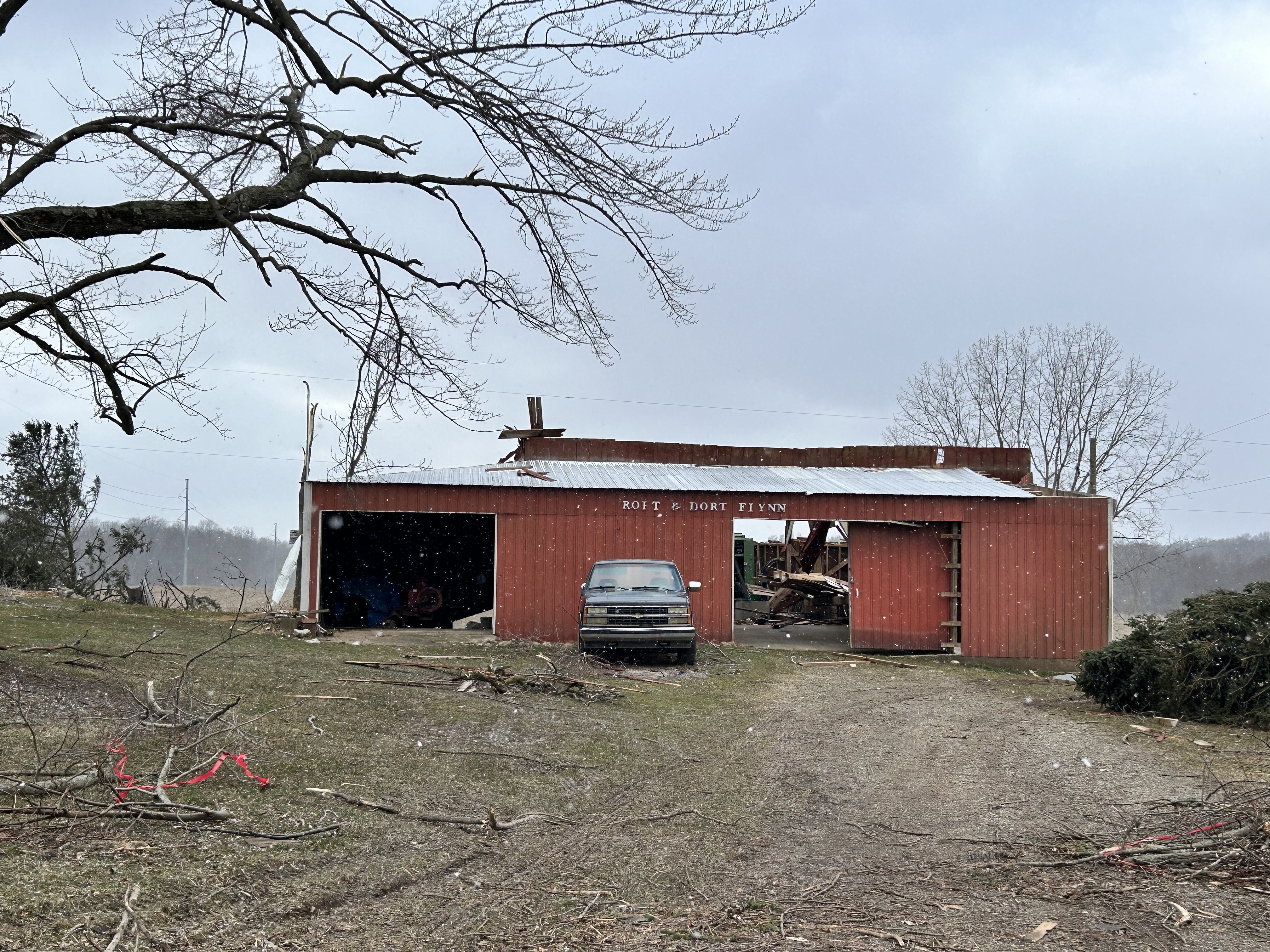
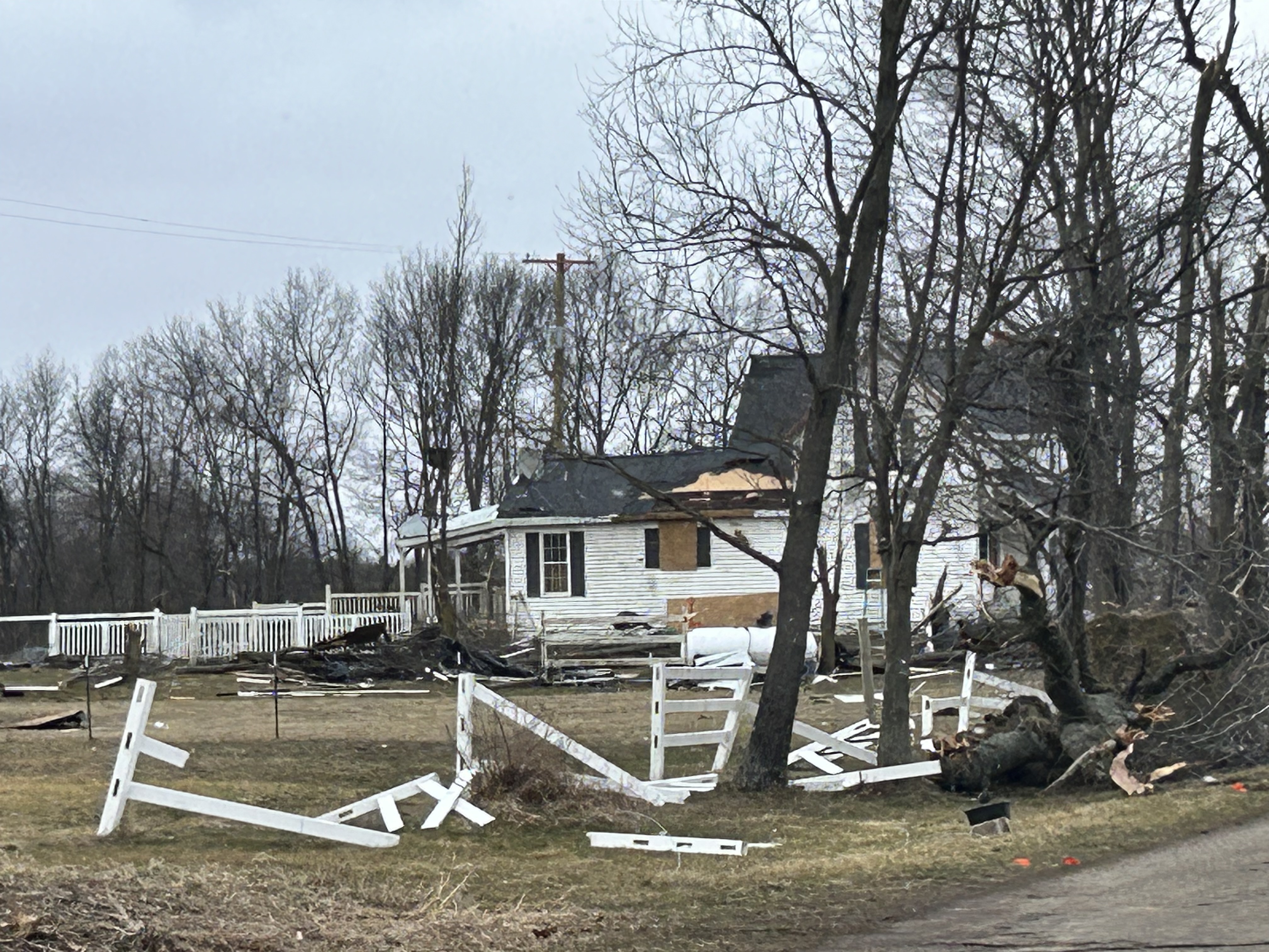
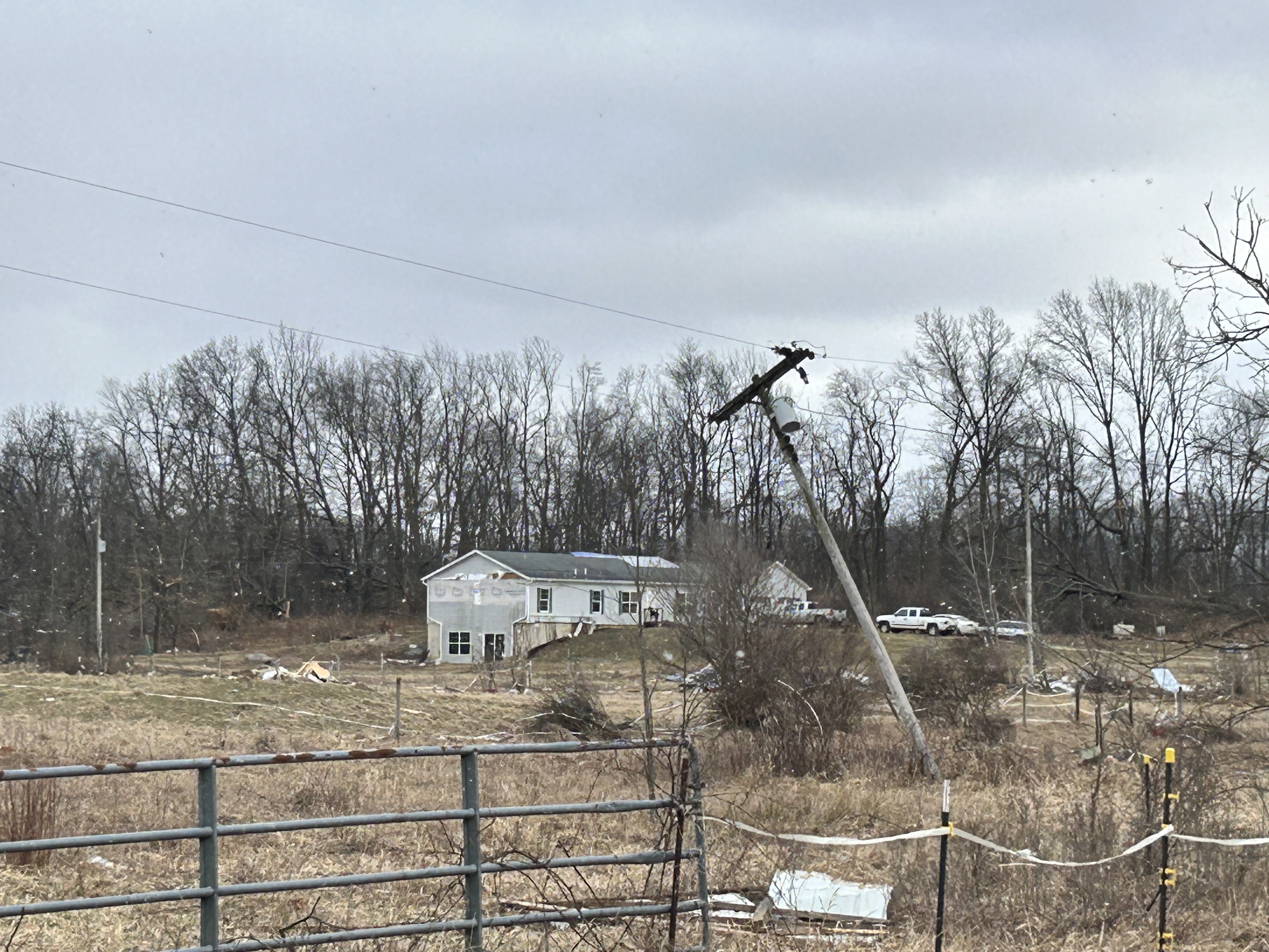
Photos & Video
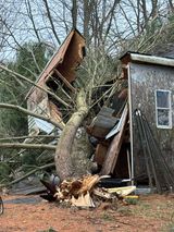
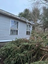
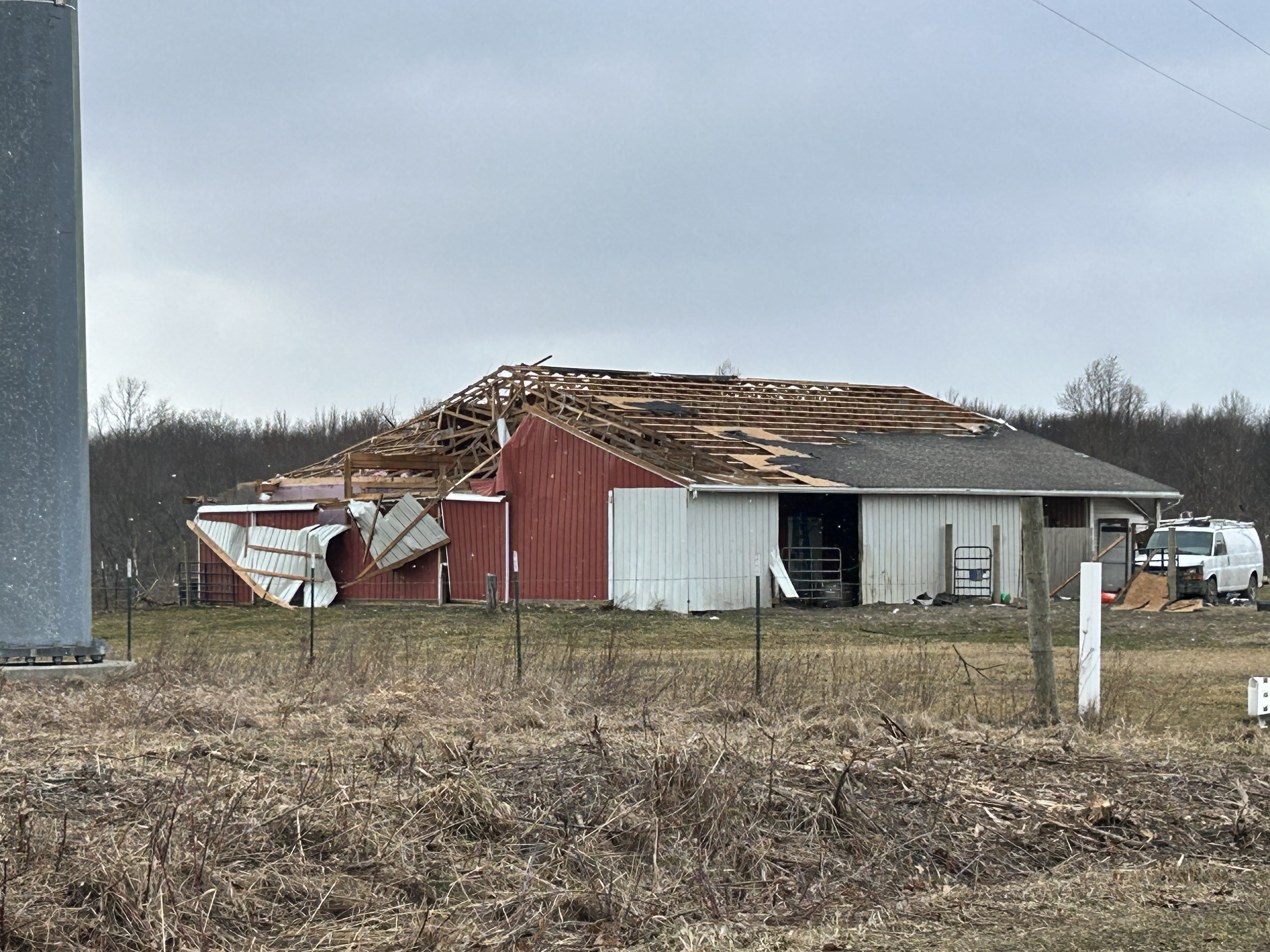
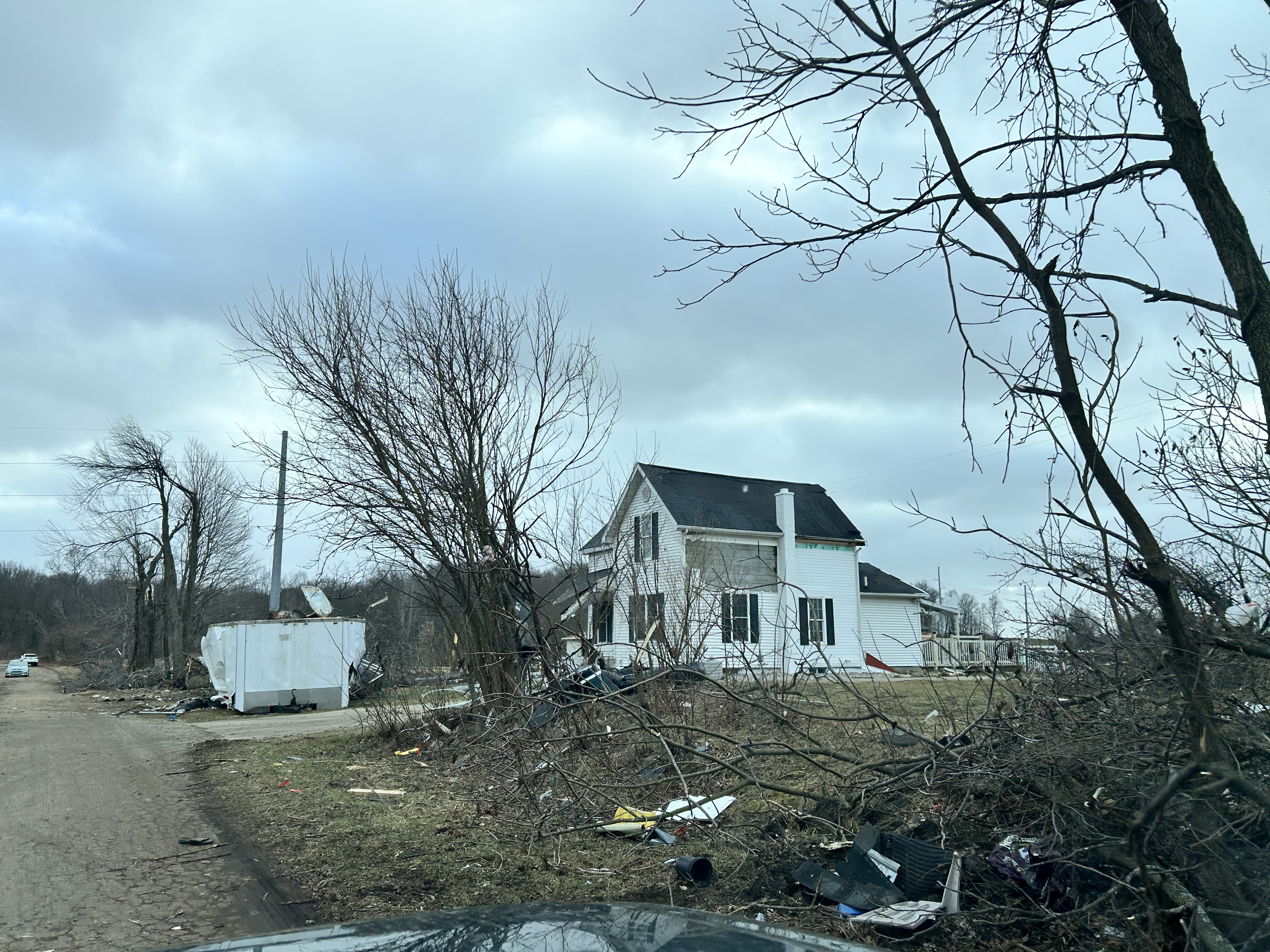
Here are damage photos from the Marshall Tornado
 |
 |
 |
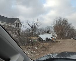 |
| Damage to outbuilding Photo Credit: Kim Scholten |
Damage to House Photo Credit: Kim Scholten |
Downed Trees Photo Credit: Kim Scholten |
Utility Trailer Photo Credit: Kim Scholten |
 |
 |
 |
 |
| Damage to Barn Photo Credit: Kim Scholten |
Damage to House Photo Credit: Kim Scholten |
Siding off house Photo Credit: Kim Scholten |
Roof off Barn Photo Credit: Kim Scholten |
Radar
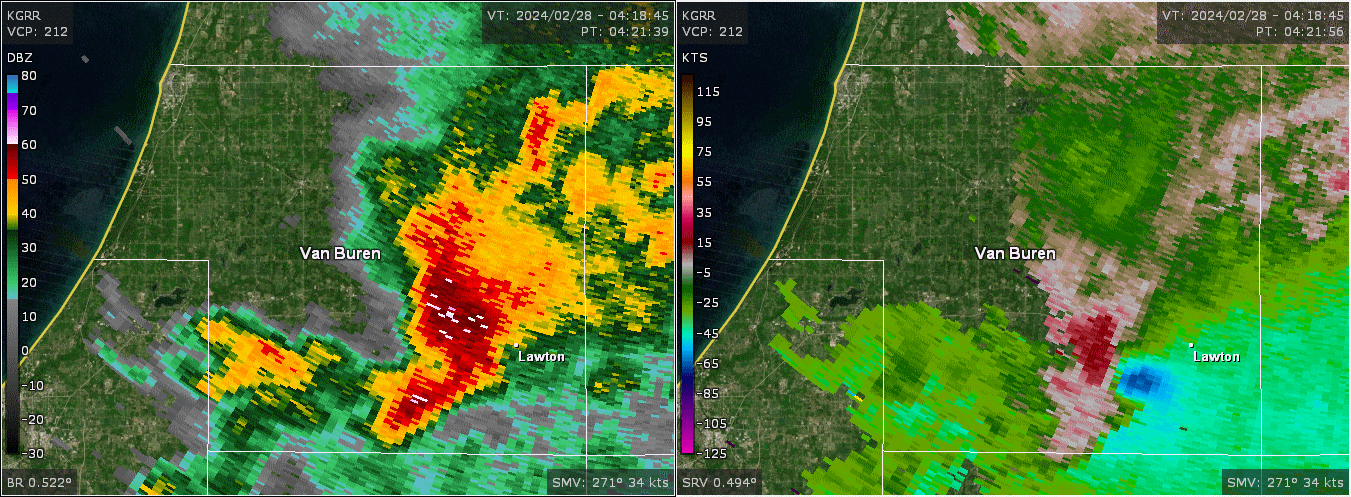
Radar Reflectivity
Only wind damage was reported southwest of Lawton in spite of there being a circulation.
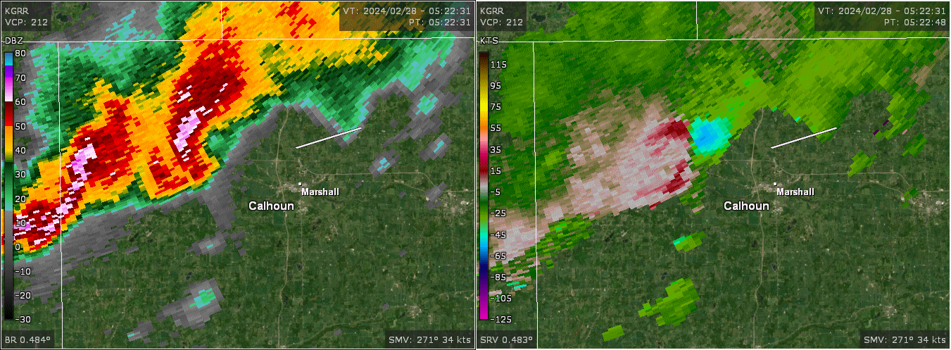
Here is the circulation that did produce a tornado near Marshall. It is common for the damage to occur on the southern edge of where the radar "sees" the circulation. Note how similar looking circulations can produce very different results!
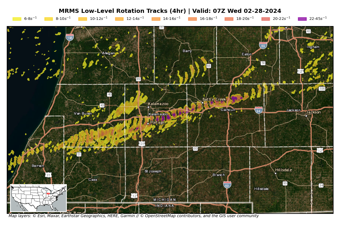
The image below shows the track of where storm rotation was strongest as storms moved eastward between 10 PM EST February 27 and 2 AM EST February 28.
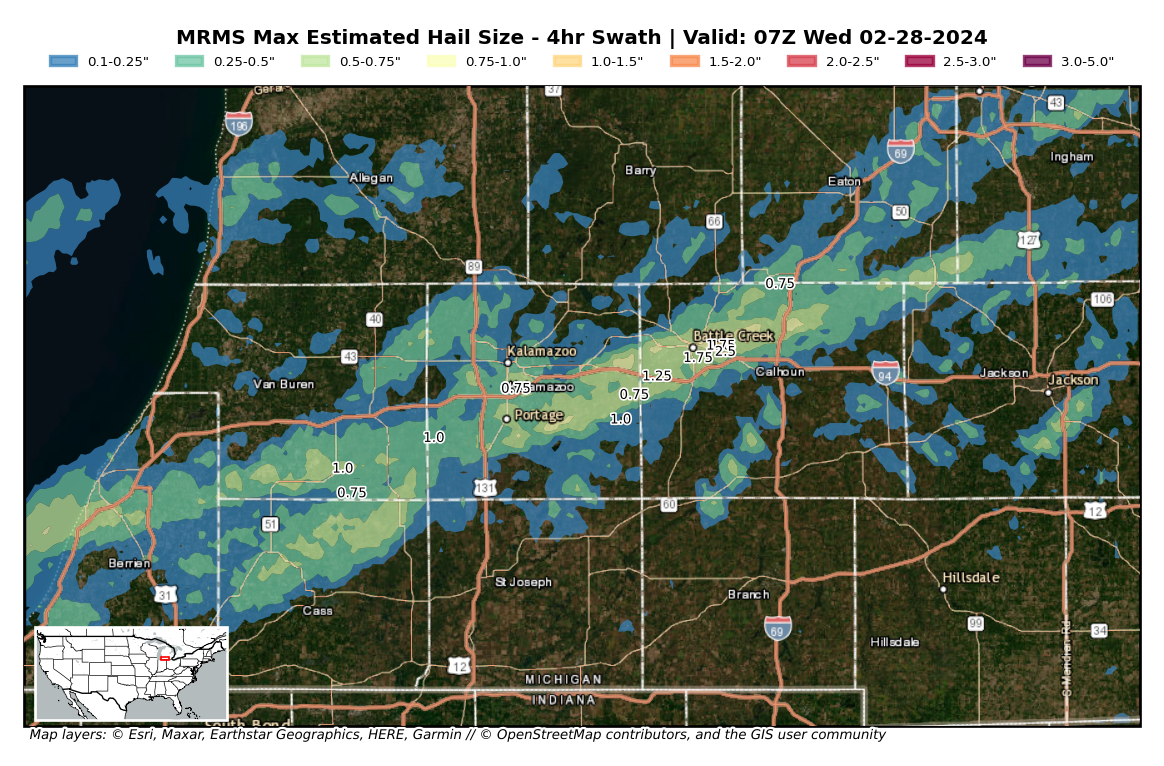
This image below shows estimated hail size (and reported hail) as storms moved eastward between 10 PM EST February 27 and 2 AM EST February 28.
Storm Reports
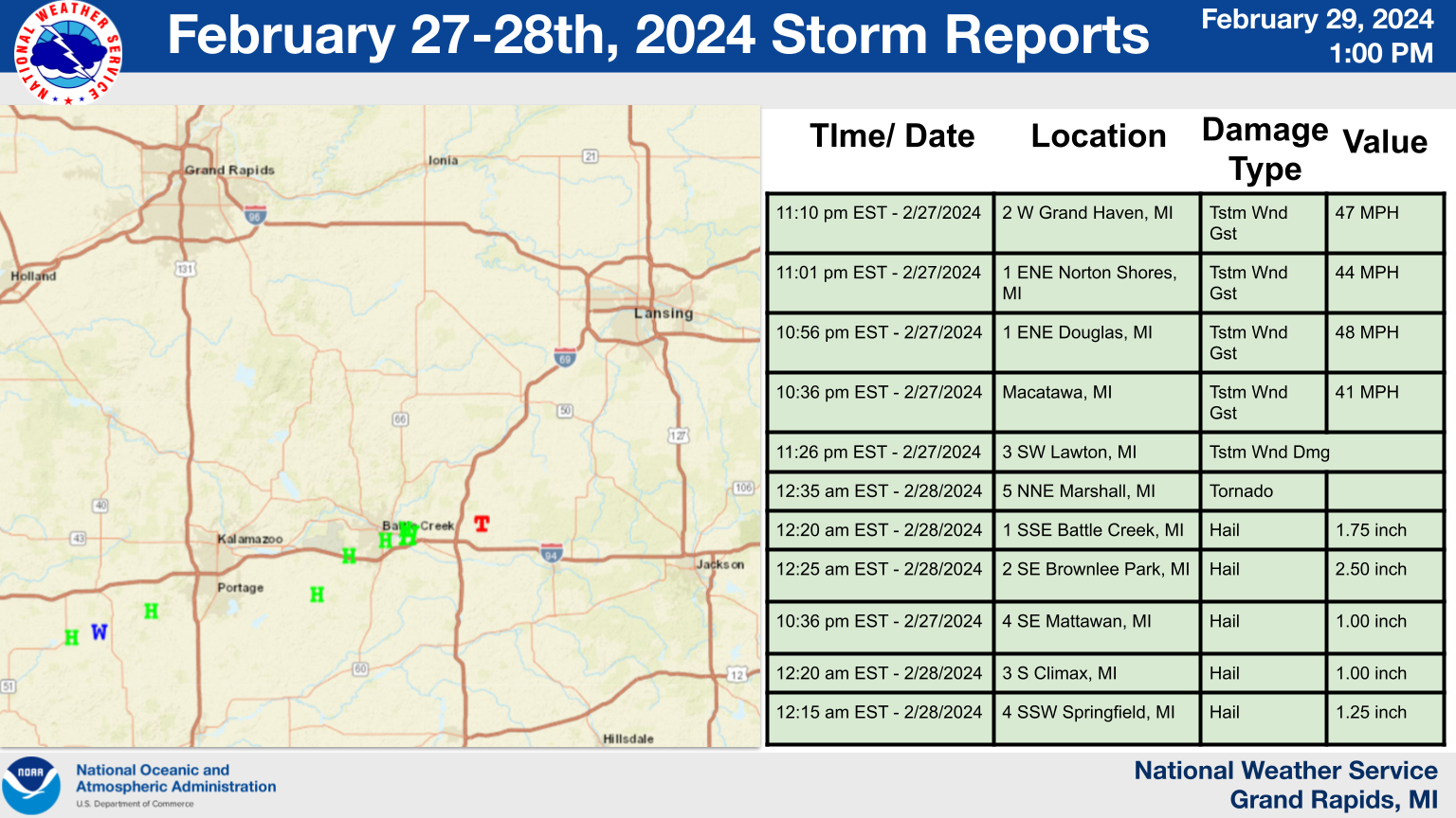
For more information go to: SPC February 27th, 2024 Damage reports
Preliminary Local Storm Report
National Weather Service Grand Rapids MI
542 PM EST Wed Feb 28 2024

..TIME...   ...EVENT...      ...CITY LOCATION...     ...LAT.LON...
..DATE...   ....MAG....      ..COUNTY LOCATION..ST.. ...SOURCE....
            ..REMARKS..

1101 PM     Non-Tstm Wnd Gst 1 ENE Douglas           42.65N 86.19W
02/27/2024  M48 MPH          Allegan            MI   Mesonet

            Mesonet station MC148 I-196 Mile Marker
            38.1.

1201 AM     Non-Tstm Wnd Gst 2 NNE Alto              42.88N 85.37W
02/28/2024  M41 MPH          Kent               MI   Mesonet

            Mesonet station MC150 I-96 Mile Marker 52.2.

0215 AM     Non-Tstm Wnd Gst 2 ENE Ludington         43.97N 86.40W
02/28/2024  M43 MPH          Mason              MI   AWOS

            AWOS station KLDM Ludington Mason County
            Arpt.

0220 AM     Non-Tstm Wnd Gst 4 WNW Roosevelt Park    43.23N 86.34W
02/28/2024  M54 MPH          Muskegon           MI   Mesonet

            Mesonet station MKGM4 Muskegon Pier.

0251 AM     Non-Tstm Wnd Gst 2 W New Era             43.56N 86.39W
02/28/2024  M42 MPH          Oceana             MI   Mesonet

            Mesonet station MC160 US 31 Mile Marker
            140.7.

0300 AM     Non-Tstm Wnd Gst Mears                   43.68N 86.41W
02/28/2024  M41 MPH          Oceana             MI   Mesonet

            Mesonet station MIMEA Mears (MAWN).

0448 AM     Non-Tstm Wnd Gst Macatawa                42.77N 86.20W
02/28/2024  M47 MPH          Ottawa             MI   Buoy

            Buoy station HLNM4 Holland Harbor.

0635 AM     Non-Tstm Wnd Gst 1 S Little Point Sable  43.62N 86.54W
02/28/2024  M40 MPH          Oceana             MI   Mesonet

            Mesonet station DVI00019 Shelby.

0658 AM     Non-Tstm Wnd Gst 2 WNW Jackson           42.26N 84.44W
02/28/2024  M48 MPH          Jackson            MI   Mesonet

            Mesonet station CW5542 Jackson.

0700 AM     Non-Tstm Wnd Gst 5 SW Whitehall          43.37N 86.42W
02/28/2024  M50 MPH          Muskegon           MI   Mesonet

            Mesonet station DW2963 Whitehall.

0720 AM     Non-Tstm Wnd Gst 1 ENE Norton Shores     43.17N 86.23W
02/28/2024  M49 MPH          Muskegon           MI   ASOS

            ASOS station KMKG Muskegon County Airport.

0720 AM     Non-Tstm Wnd Gst 2 W Grand Haven         43.06N 86.26W
02/28/2024  M55 MPH          LMZ846             MI   Mesonet

            Mesonet station XGHL Grand Haven Light.

0736 AM     Non-Tstm Wnd Gst 2 S Holland             42.75N 86.10W
02/28/2024  M49 MPH          Allegan            MI   ASOS

            ASOS station KBIV W Mich Regional Arpt.

0831 AM     Non-Tstm Wnd Gst 1 SW Portland           42.86N 84.91W
02/28/2024  M40 MPH          Ionia              MI   Mesonet

            Mesonet station MC149 I-96 Mile Marker 76.0.

0841 AM     Non-Tstm Wnd Gst 2 WSW Butternut         43.18N 84.96W
02/28/2024  M43 MPH          Montcalm           MI   Mesonet

            Mesonet station MC146 M-57 Mile Marker 32.0.

0841 AM     Non-Tstm Wnd Gst 3 NNE Edgemont Park     42.78N 84.58W
02/28/2024  M44 MPH          Clinton            MI   ASOS

            ASOS station KLAN Lansing.

0851 AM     Non-Tstm Wnd Gst 3 ENE Sandstone         42.27N 84.47W
02/28/2024  M45 MPH          Jackson            MI   ASOS

            ASOS station KJXN Jackson County-Reynolds
            Field Airport.

0910 AM     Non-Tstm Wnd Gst 1 W South Haven         42.40N 86.29W
02/28/2024  M48 MPH          LMZ844             MI   Mesonet

            Mesonet station SVNM4 South Haven.

0951 AM     Non-Tstm Wnd Gst 2 W Hesperia            43.57N 86.07W
02/28/2024  M40 MPH          Oceana             MI   Mesonet

            Mesonet station MC147 M-20 Mile Marker 16.6.

1006 AM     Non-Tstm Wnd Gst 1 SSE Springfield       42.32N 85.23W
02/28/2024  M44 MPH          Calhoun            MI   ASOS

            ASOS station KBTL Battle Creek Executive
            Airport.

1011 AM     Non-Tstm Wnd Gst 3 SE Lawrence           42.19N 86.01W
02/28/2024  M47 MPH          Van Buren          MI   Mesonet

            Mesonet station MC163 I-94 Mile Marker 53.8.

1018 AM     Non-Tstm Wnd Gst 17 W Keeler             42.12N 86.49W
02/28/2024  M44 MPH          LMZ844             MI   Mesonet

            Mesonet station XSTJ St. Joseph Pier.

1018 AM     Non-Tstm Wnd Gst 1 N Saint Joseph        42.12N 86.49W
02/28/2024  M44 MPH          LMZ844             MI   Mesonet

            Mesonet station XSTJ St. Joseph Pier.

1025 AM     Non-Tstm Wnd Gst 1 E Lawton              42.17N 85.82W
02/28/2024  M41 MPH          Van Buren          MI   Mesonet

            Mesonet station EW6899 Lawton.

1031 AM     Non-Tstm Wnd Gst 2 SW Big Rapids         43.69N 85.52W
02/28/2024  M41 MPH          Mecosta            MI   Mesonet

            Mesonet station MC143 US-131 Mile Marker
            138.7.

1044 AM     Non-Tstm Wnd Gst 2 SSW Cascade           42.88N 85.52W
02/28/2024  M46 MPH          Kent               MI   ASOS

            ASOS station KGRR Gerald R Ford Intl.

1055 AM     Non-Tstm Wnd Gst 16 W Keeler             42.13N 86.47W
02/28/2024  M42 MPH          LMZ844             MI   Mesonet

            Mesonet station DVI11762 Saint Joseph.

1055 AM     Non-Tstm Wnd Gst 2 WNW Benton Harbor     42.13N 86.47W
02/28/2024  M42 MPH          LMZ844             MI   Mesonet

            Mesonet station DVI11762 Saint Joseph.

1056 AM     Non-Tstm Wnd Gst 5 N Blanchard           43.60N 85.09W
02/28/2024  M43 MPH          Isabella           MI   Mesonet

            Mesonet station MC118 B-3 M-20 At Costabella
            Ave.

1100 AM     Non-Tstm Wnd Gst 1 ESE Lawton            42.16N 85.83W
02/28/2024  M40 MPH          Van Buren          MI   Mesonet

            Mesonet station MILAW 0.9 SE Lawton (MAWN).

1121 AM     Non-Tstm Wnd Gst 2 SSW Holland           42.75N 86.12W
02/28/2024  M42 MPH          Allegan            MI   Mesonet

            Mesonet station MC097 US-31 Mile Marker 47.0
            Holland.

1131 AM     Non-Tstm Wnd Gst 1 S Hudsonville         42.85N 85.86W
02/28/2024  M40 MPH          Ottawa             MI   Mesonet

            Mesonet station MC156 I-196 Mile Marker
            62.3.

1141 AM     Non-Tstm Wnd Gst 2 E Zeeland             42.81N 85.98W
02/28/2024  M43 MPH          Ottawa             MI   Mesonet

            Mesonet station MC155 I-196 Mile Marker
            55.5.

1141 AM     Non-Tstm Wnd Gst 1 N Dutton              42.85N 85.58W
02/28/2024  M41 MPH          Kent               MI   Mesonet

            Mesonet station MC154 M-6 Mile Marker 12.7.

1230 PM     Non-Tstm Wnd Gst 1 SE Grandville         42.90N 85.74W
02/28/2024  M40 MPH          Kent               MI   Mesonet

            Mesonet station DW6683 Grandville.

0115 PM     Non-Tstm Wnd Gst 2 SE Mason              42.57N 84.42W
02/28/2024  M40 MPH          Ingham             MI   AWOS

            AWOS station KTEW Mason Jewett Arpt.

0226 PM     Non-Tstm Wnd Gst 3 NE Portage            42.23N 85.55W
02/28/2024  M45 MPH          Kalamazoo          MI   ASOS

            ASOS station KAZO Kalamazoo/BC Intl Airport.
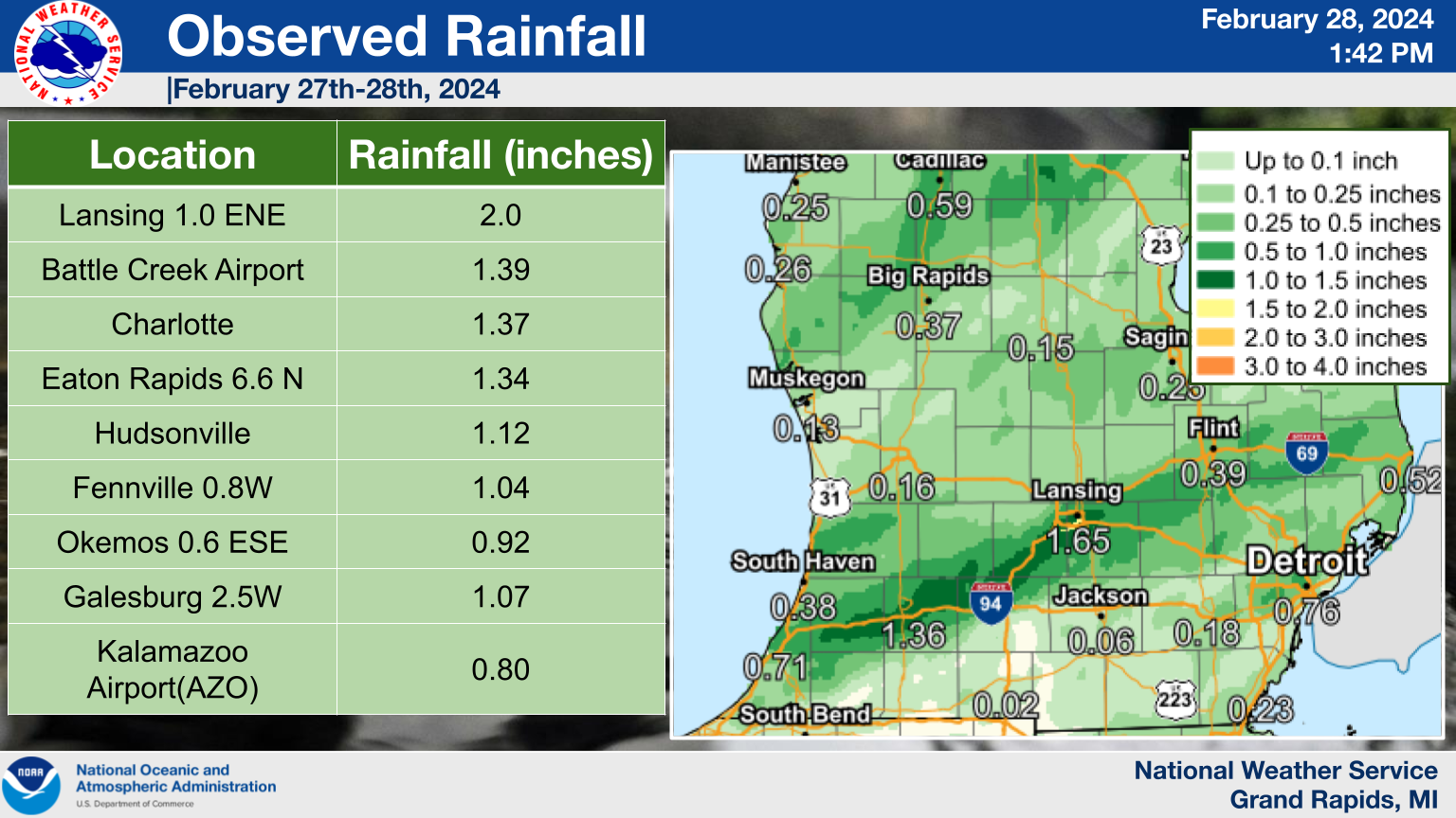
Rain Reports
 |
Media use of NWS Web News Stories is encouraged! Please acknowledge the NWS as the source of any news information accessed from this site. |
|