
A heat wave over the Southwest will intensify this week, peaking and expanding into the Intermountain West and northern High Plains this weekend. Critical to extremely critical fire weather conditions are forecast from the Northwest and the northern Great Basin this weekend. Particularly Dangerous Situation Red Flag Warnings have been issued. Read More >
Overview
|
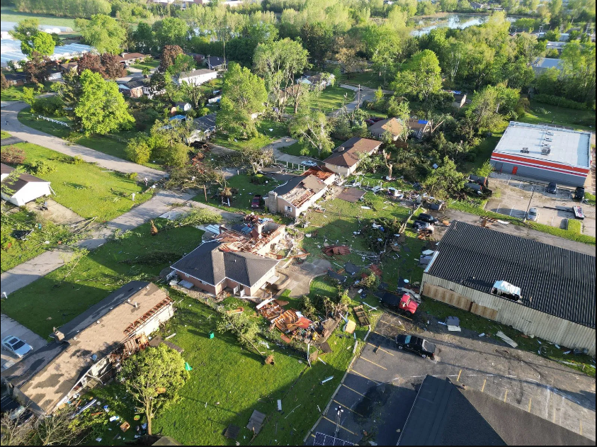
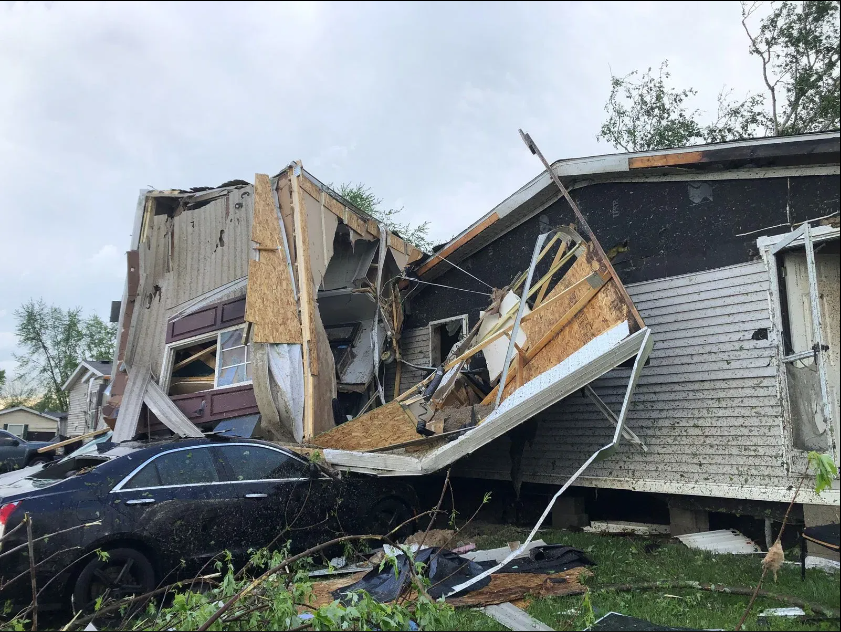
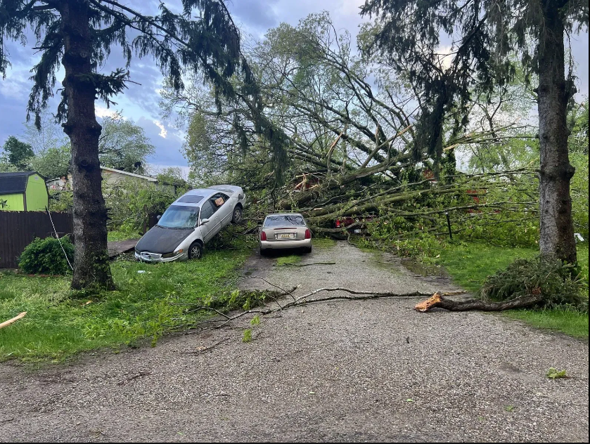
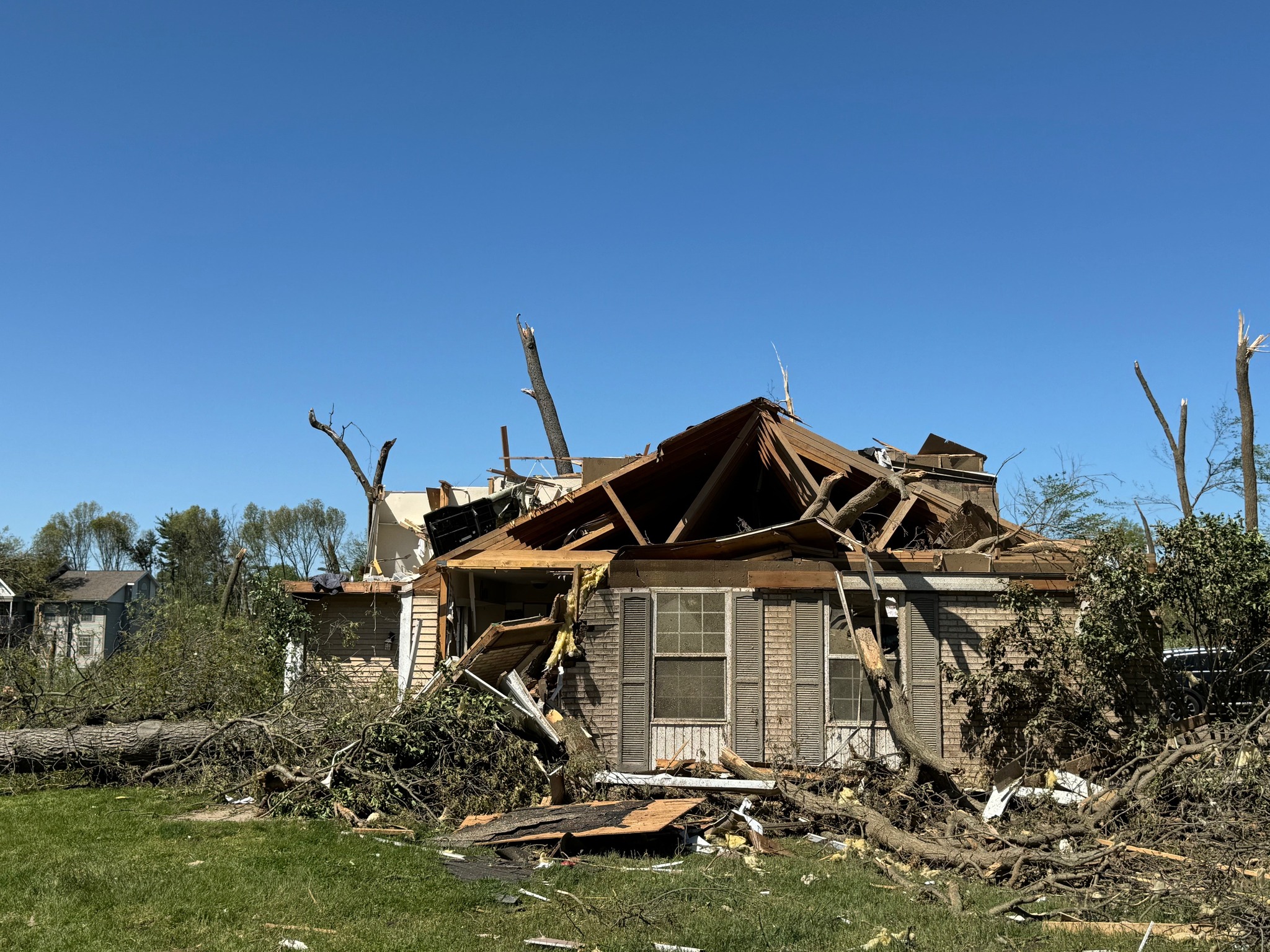
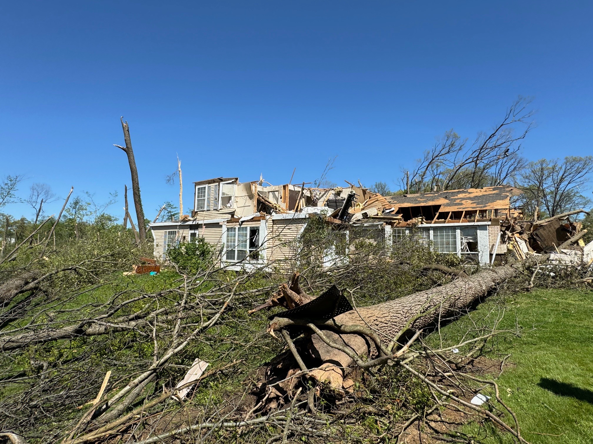
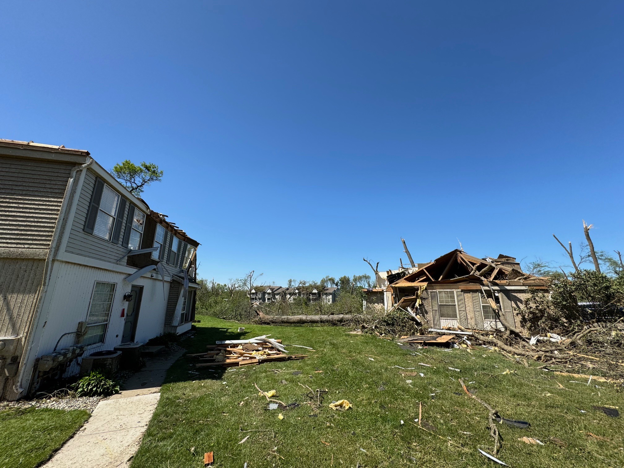
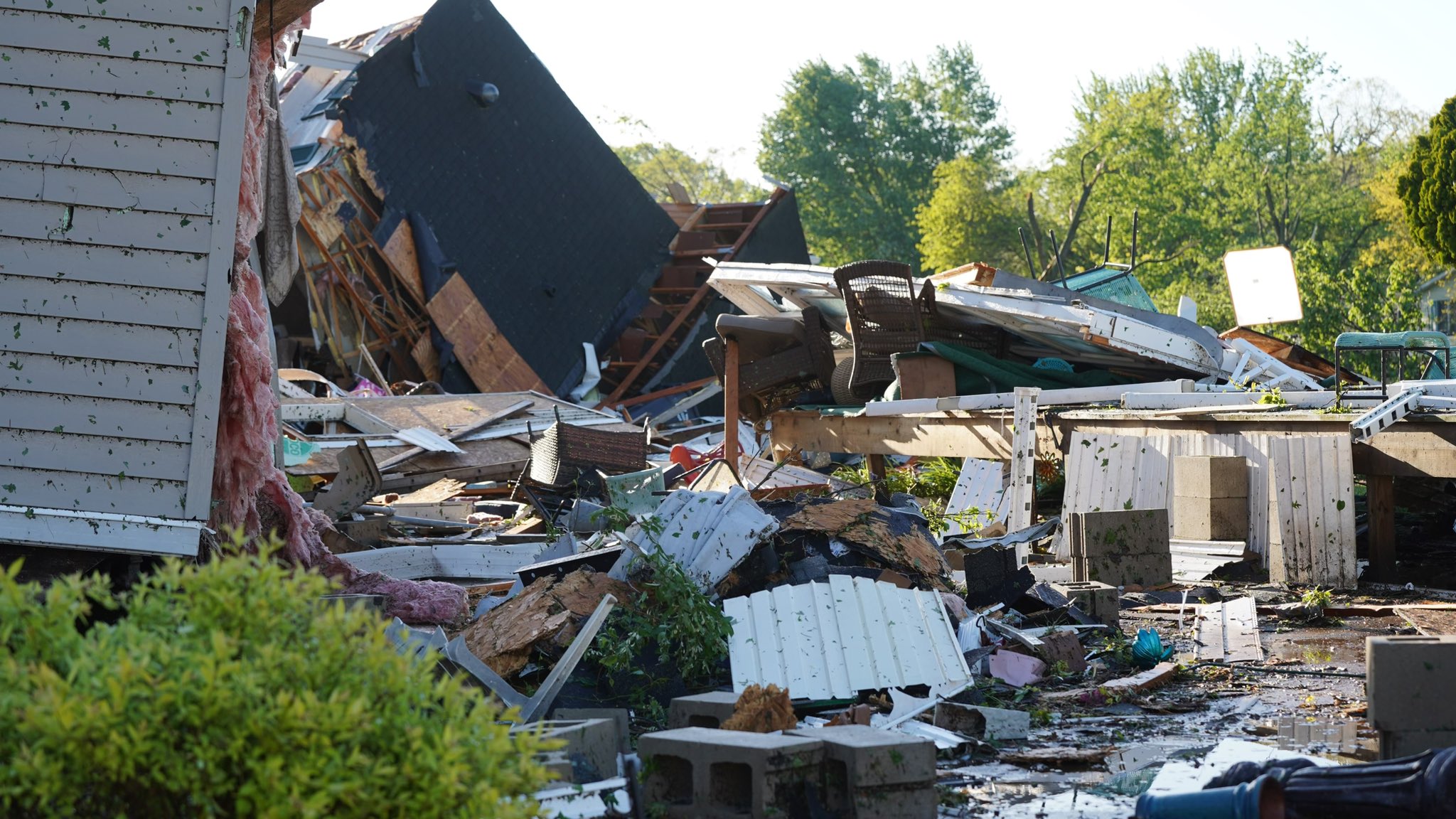
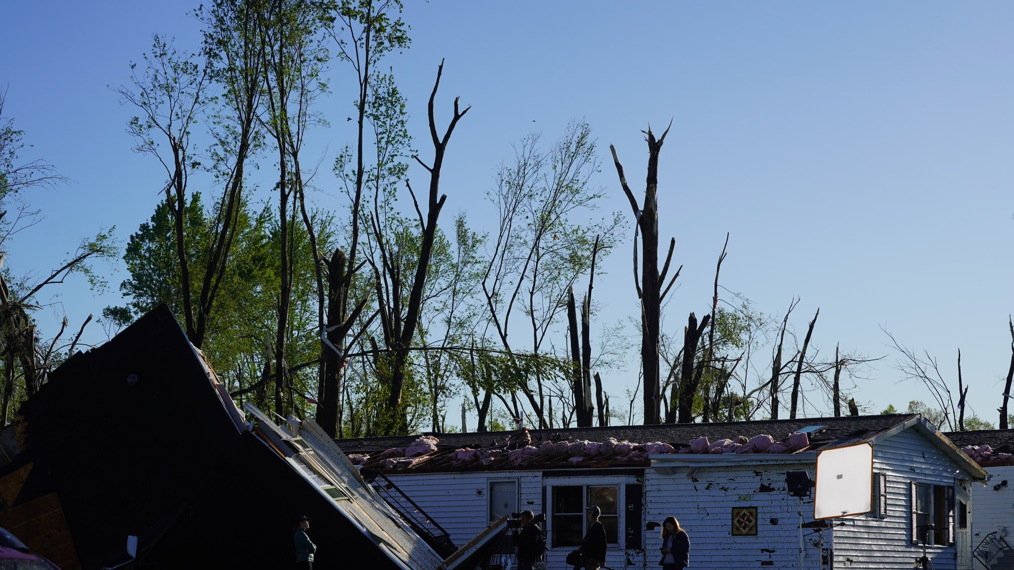
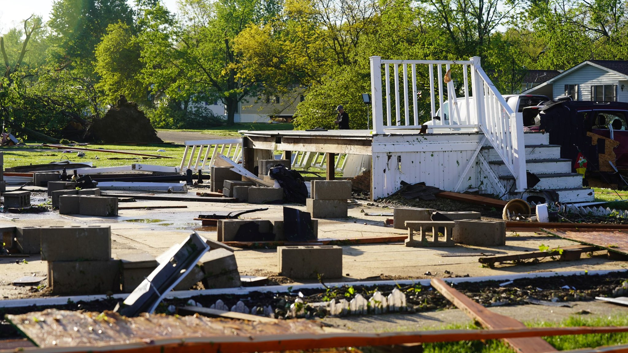
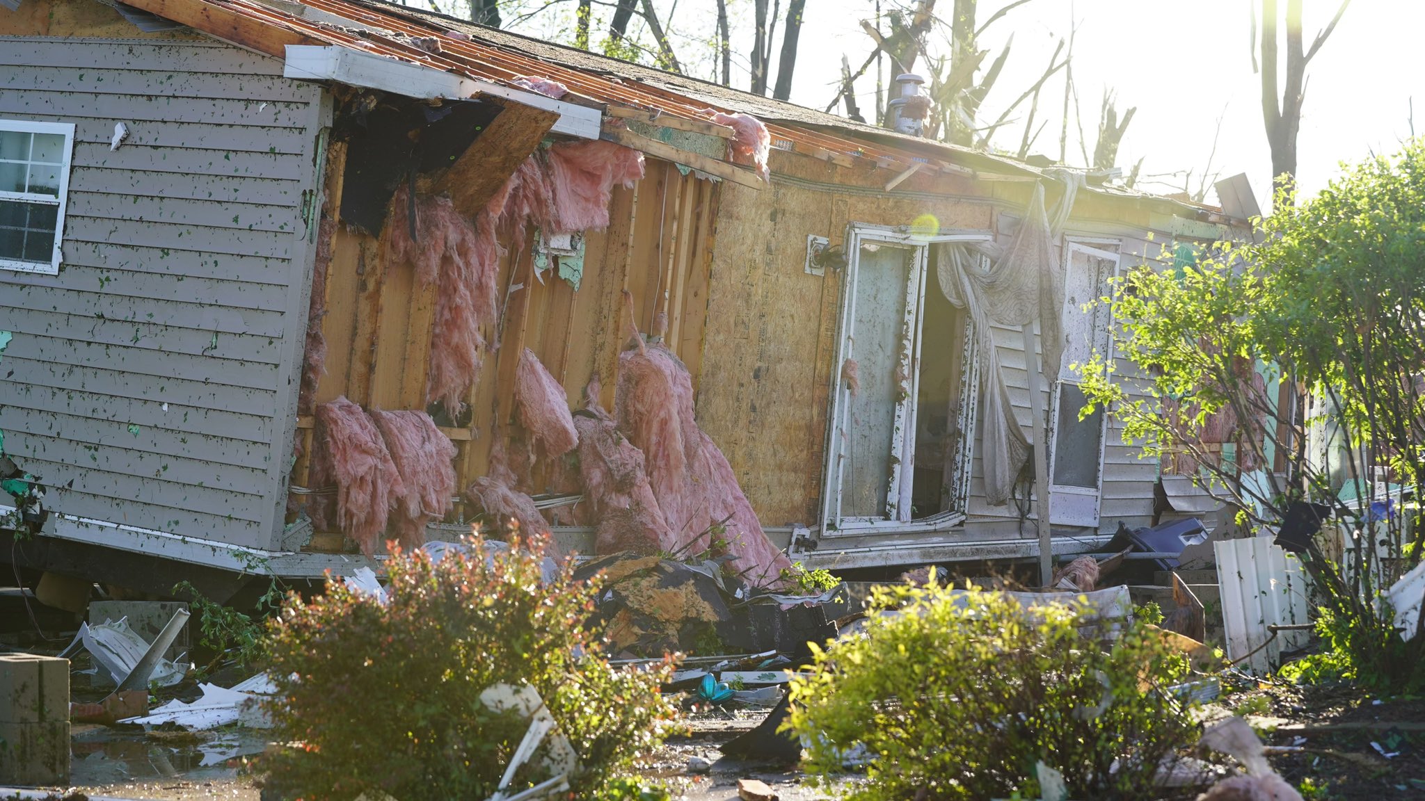
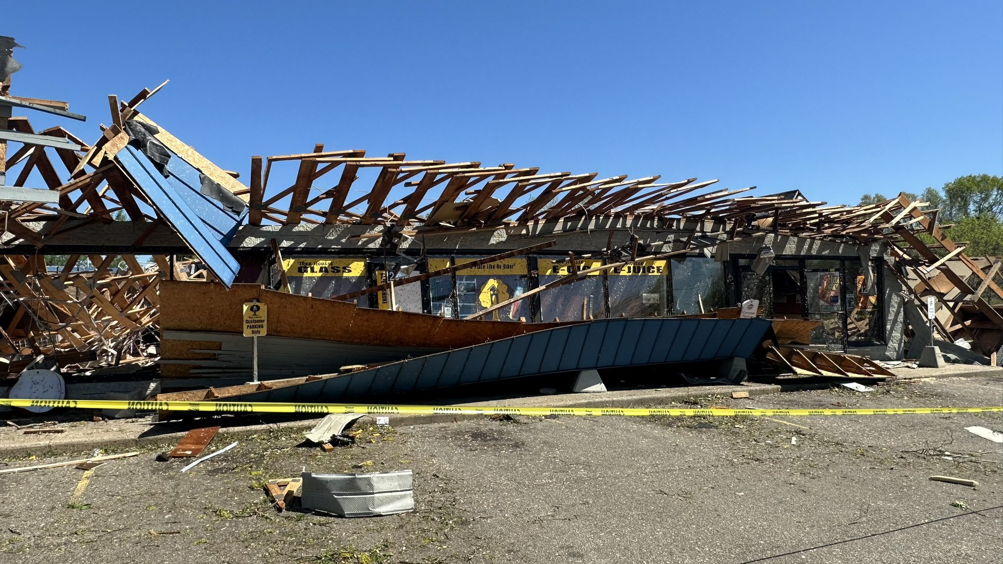
Numerous thunderstorms developed across southern Lower Michigan during the evening of May 7, 2024. Many thunderstorm cells exhibited some rotation, and a couple of strongly rotating storms produced tornadoes during parts of their life cycle. One of the tornadoes cut a path across the city of Portage and in portions of adjacent townships in Kalamazoo County. Large hail also fell from some of the storms in southern Michigan, in some cases up to 4 inches in diameter. Information about the Portage tornado is below. Information about other tornadoes in southern Michigan is available from NWS Northern Indiana. |
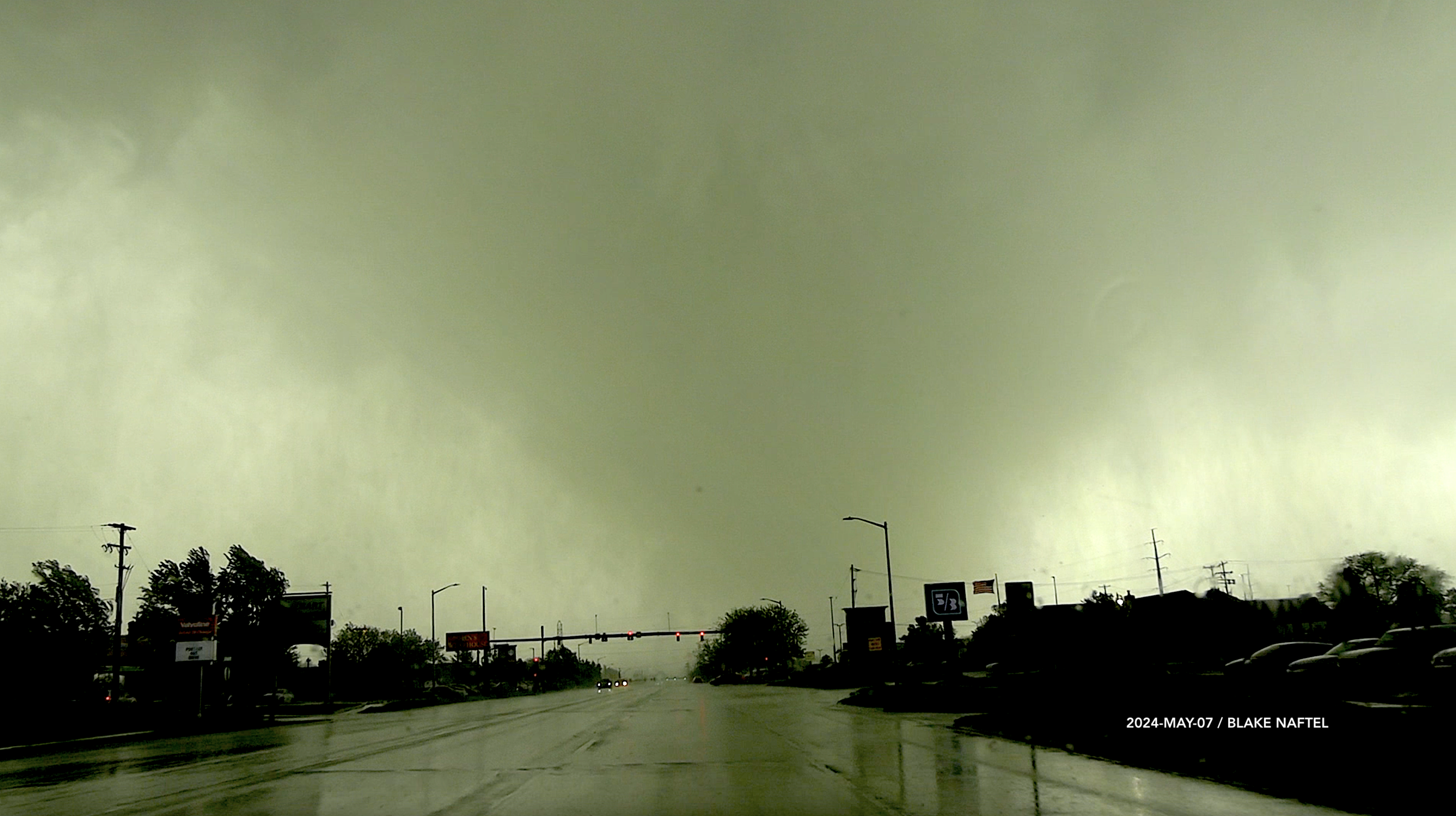 Portage Tornado, Photo Courtesy of Blake Naftel |
Tornadoes
|
Tornado - Portage, MI
Track Map 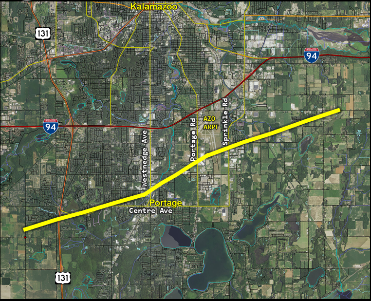 
Downloadable KMZ File (available soon) |
||||||||||||||||
|
||||||||||||||||
The Enhanced Fujita (EF) Scale classifies tornadoes into the following categories:
| EF0 Weak 65-85 mph |
EF1 Moderate 86-110 mph |
EF2 Significant 111-135 mph |
EF3 Severe 136-165 mph |
EF4 Extreme 166-200 mph |
EF5 Catastrophic 200+ mph |
 |
|||||
Photos & Video
Ariel footage of tornado damage suffered on the evening of May 7, 2024. Video Credit: Michigan State Police
 |
 |
 |
 |
| Portage Area Damage (Jake Taylor/WWMT) |
Portage Area Damage (Jake Taylor/WWMT) |
Portage Area Damage (Diana Rice/WWMT) |
Portage Area Damage (Alleisha Baker/WWMT) |
 |
 |
 |
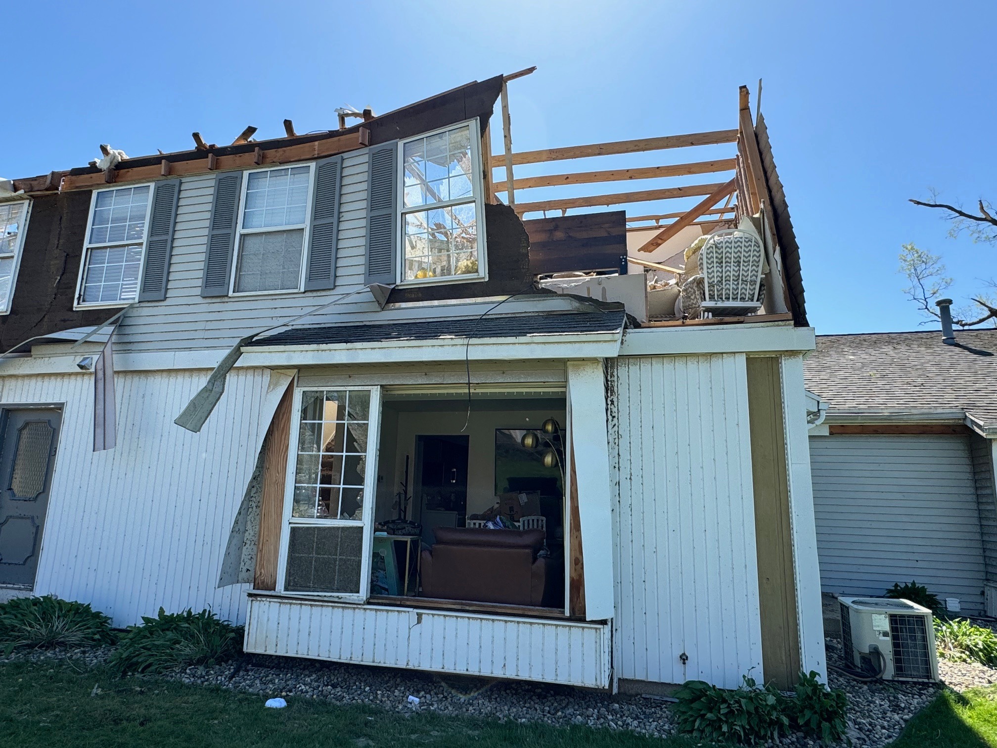 |
| Damage at Timbercreek Townhomes in Portage (WOODTV) | Damage at Timbercreek Townhomes in Portage (WOODTV) | Damage at Timbercreek Townhomes in Portage (WOODTV) | Damage at Timbercreek Townhomes in Portage (WOODTV) |
 |
 |
 |
 |
| Portage Area Damage (Samantha Jacques/WZZM) |
Portage Area Damage (Samantha Jacques/WZZM) |
Portage Area Damage (Samantha Jacques/WZZM) |
Portage Area Damage (Samantha Jacques/WZZM) |
 |
| Strip Mall Along West Centre Ave in Portage (WOODTV) |
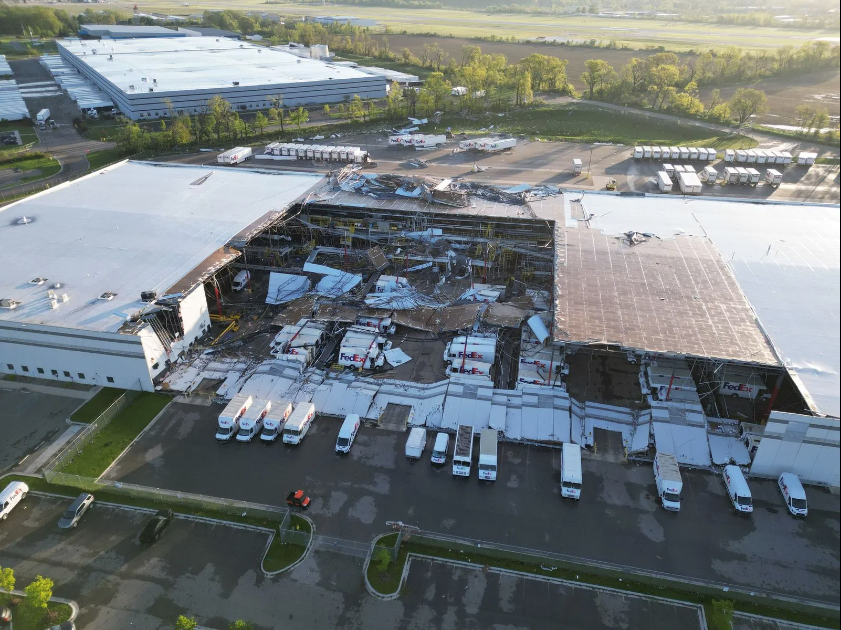
"A large and destructive tornado developed just before 6 p.m. ET in Southern Kalamazoo County within Texas Township and tracked east/northeast along Center Street into Portage, Michigan. The tornado caused structural damage to a FedEx building and other homes and businesses within the path as it tracked just south of the Kalamazoo-Battle Creek International Airport Tuesday evening. The primary video view of the tornado is looking south from Westnedge Avenue south of the Crossroads Mall and Target store in Portage, Michigan as the tornado tracked east."
Video Credit: Blake Naftel
Radar
| Base reflectivity from 5:32pm to 7:32 pm. Portage tornado is denoted in the green line. | Multi-Radar Multi-Sensor 30 minute rotation tracks from 6:00pm to 6:50pm. |
.PNG) |
.PNG) |
.PNG) |
.PNG) |
| 5:48pm | 5:55pm | 6:01pm | 6:08pm |
.PNG) |
.PNG) |
.PNG) |
.PNG) |
| 6:11pm | 6:14pm | 6:17pm | 6:20pm |
Storm Reports
..TIME...   ...EVENT...      ...CITY LOCATION...     ...LAT.LON...
..DATE...   ....MAG....      ..COUNTY LOCATION..ST.. ...SOURCE....
            ..REMARKS..

0532 PM     Tstm Wnd Dmg     2 S Decatur             42.08N 85.97W
05/07/2024                   Van Buren          MI   Storm Chaser

            Chaser provided photos of several trees
            uprooted and snapped just south of Decatur.
            Time is estimated by radar.

0542 PM     Hail             6 ESE Decatur           42.07N 85.86W
05/07/2024  E0.75 Inch       Van Buren          MI   Trained Spotter

            Time estimated from radar.

0555 PM     Tornado          4 WSW Portage           42.19N 85.67W
05/07/2024                   Kalamazoo          MI   NWS Storm Survey

            The EF2 tornado touched down near the
            intersection of South 10th Street and West R
            Avenue and traveled east/northeast for
            around 11 miles until it lifted north of
            East N Avenue just west of 31st Street. Many
            homes, including two mobile home parks, were
            severely damaged. A number of businesses had
            significant damage. Hundreds of trees were
            snapped or uprooted. A large section of the
            roof of an industrial warehouse also
            collapsed near the Kalamazoo/Battle Creek
            International Airport. Total number of
            injuries unknown.

0555 PM     Tstm Wnd Dmg     4 W Portage             42.19N 85.67W
05/07/2024                   Kalamazoo          MI   NWS Employee

            Large trees down, power lines down, shingles
            scattered around. Possible tornado. Time
            estimated based on radar.

0600 PM     Tornado          2 W Portage             42.20N 85.64W
05/07/2024                   Kalamazoo          MI   Official NWS Obs

            Radar confirmed tornado. Time estimated via
            radar.

0601 PM     Hail             2 NW Portage            42.22N 85.62W
05/07/2024  M2.00 Inch       Kalamazoo          MI   Public


0614 PM     Tstm Wnd Dmg     Tekonsha                42.09N 84.99W
05/07/2024                   Calhoun            MI   Fire Dept/Rescue

            Numerous trees and wires down in Tekonsha.
            Time is estimated via radar.

0623 PM     Hail             4 WNW Montague          43.44N 86.44W
05/07/2024  E0.88 Inch       Muskegon           MI   Trained Spotter


0630 PM     Hail             1 N Rothbury            43.52N 86.35W
05/07/2024  E1.00 Inch       Oceana             MI   Public

            Report from mPING: Quarter (1.00 in.).
 |
Media use of NWS Web News Stories is encouraged! Please acknowledge the NWS as the source of any news information accessed from this site. |
|

