NWS Grand Rapids Climate Blog
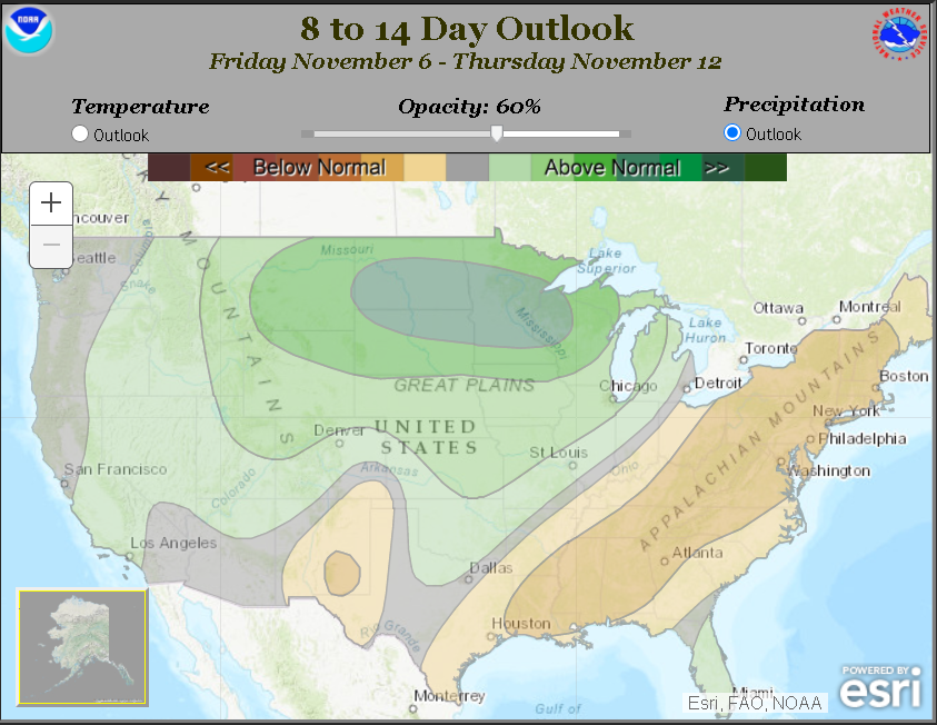
For example, we will take a look at our Climate Prediction Center's 8 to 14 Day Outlook for temperature and precipitation:
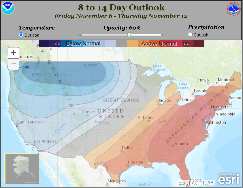
Odds are tilted toward warmer than normal temperatures to start the second week of November, likely returning to
near normal conditions by the middle of November. For precipitation, odds are tilted toward a wetter pattern developing
during the second week of November as compared to the first week. No significant snow is foreseen across
Southwestern and Central Lower Michigan through mid November.
What are some of the long-range indicators we look at to determine what the weather may be like more than a week
from now?
- Arctic Oscillation
- North American Oscillation
- Madden-Julian Oscillation
- Pacific/North American Pattern
- Analogs (matching current patterns to past similar patterns and determining their outcomes)
- Trends (average over 30 years)
Meteorologists understand how the different oscillations and patterns are measured. We can look at how these indicators
are projected to change and what that typically means for weather patterns in the Great Lakes. For example, it is well
known that when the Arctic Oscillation turns strongly negative, we would expect colder air to move into the Great Lakes
region, increasing the odds of below normal temperatures as well as the possibility for lake effect snow (depending
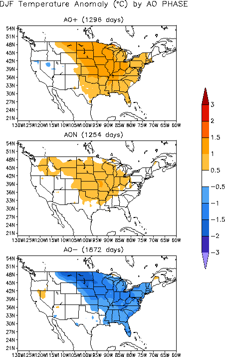
on wind direction). Here are some figures, based on years of research data, that show the typical temperature patterns
that develop when the Arctic Oscillation is positive, neutral, and negative respectively:
Notice that, on average, the Great Lakes don't tend to tap into colder air until the Arctic Oscillation turns negative
(listed as "AO-"). What makes forecasting challenging (and fun) is that one indicator, like the Arctic Oscillation,
could be overruled by a stronger signal from a different indicator. It is akin to being in the midst of an El Niño pattern,
which may normally produce warmer than normal temperatures across the Great Lakes, but shorter term changes
in the pattern from one or more of the oscillations or other indicators bring colder conditions to the region. This is
why we have to take a look at many different things.
Check back later for more blog updates throughout the winter!