Dangerous heat will expand from the Gulf Coast into the Southern Plains and Desert Southwest through week's end. Additional extreme heat impacting the Pacific Northwest will shift to the northern Plains by the weekend. Tropical Storm Bertha is expected to continue to impact portions of the northern Gulf Coast from the western Florida Panhandle to southeastern Louisiana through tonight. Read More >
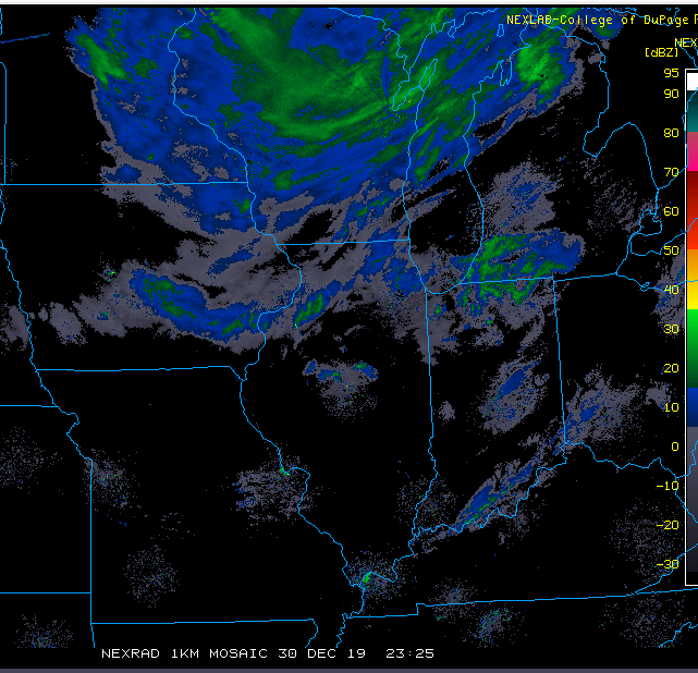
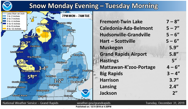
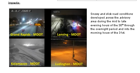
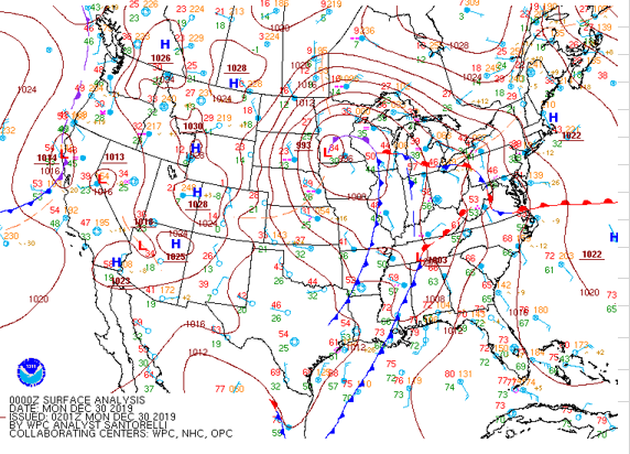
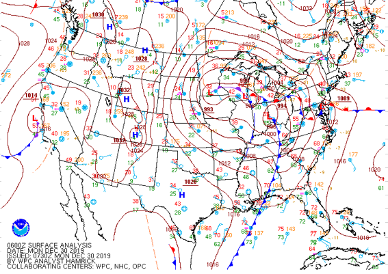
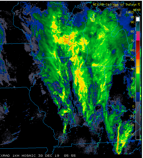
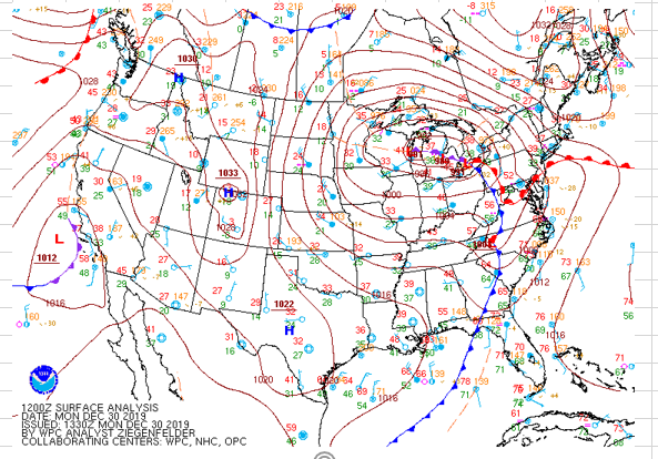
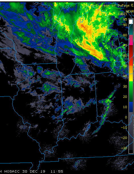
A deeply occluded surface storm, which tracked nearly due north from the Ohio River Valley on Sunday December 29, then moved into Michigan on the 30th during the morning hours. As the deep surface low tracked north toward northern Lake Michigan it, in combination with an equally deep upper level system brought in enough cold air to turn the rain that was falling to lake enhanced snow showers by late afternoon. Snow was aided considerably by moisture enhancement from Lake Michigan. Since the storm was fairly deep, 989 mb at 2 pm on the 30th, in combination with the 1033 mb high over Colorado, caused gusty southwest winds that gusted to near 40 mph at times Monday evening into Tuesday morning. The combination of snow and blowing snow caused hazardous travel conditions to develop from the late evening hours of the 30th into the 31st.

.PNG)