
Wildfire smoke will push into the Midwest, worsening air quality. A frontal system brings severe storms from the Northern Plains to the Mid‑Atlantic the next few days. Heavy Gulf Coast rain is possible as Tropical Depression Two has formed, while monsoonal storms persist in the Southwest with heavy rainfall. Hazardous heat expands from the Plains into the Lower Mississippi Valley. Read More >
Grand Rapids, MI
Weather Forecast Office
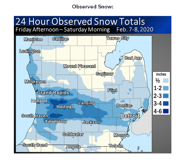
Strong areas of 1000-850 mb convergence combined with an upper level disturbance and moisture from Lake Michigan to bring a brief convective burst of heavy snow near to south of I-96 during the mid to late afternoon hours of the 7th of February 2020. Another upper air disturbance and stronger 1000-850 mb convergence brought a swath of heavy snow near to south of I-96 overnight, with up to 4 to 5 inches of snow reported at Byron Center.

US Dept of Commerce
National Oceanic and Atmospheric Administration
National Weather Service
Grand Rapids, MI
4899 Tim Dougherty Drive SE
Grand Rapids, MI 49512-4034
616-949-0643
Comments? Questions? Please Contact Us.

